Filters: Tags: Cody (X)
31 results (71ms)|
Filters
Date Range
Extensions Types Contacts
Categories Tag Types Tag Schemes |
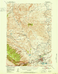
USGS Historical Quadrangle in GeoPDF.
USGS Historical Quadrangle in GeoPDF.

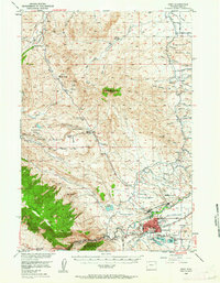
USGS Historical Quadrangle in GeoPDF.
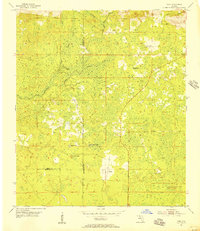
USGS Historical Quadrangle in GeoPDF.
Mule deer within the Upper Shoshone herd make a number of significant, long-distance migrations west into the core of the Greater Yellowstone Ecosystem. The longest is a 133-mile (214-km) migration that originates at the mouth of the South Fork of the Shoshone River near Buffalo Bill Reservoir and ends at Jenny Lake in Grand Teton National Park. Deer in the Upper Shoshone herd winter in the lower-elevation sagebrush valleys of the South Fork Shoshone River and North Fork of the Shoshone River. Each spring, an estimated 6,700 deer head west into the high-elevation, mountainous country of the Absaroka Range and then into Yellowstone National Park or Grand Teton National Park. These challenging journeys, an average...
Categories: Data;
Types: Downloadable,
Map Service,
OGC WFS Layer,
OGC WMS Layer,
Shapefile;
Tags: Cody,
United States,
Wyoming,
animal behavior,
migration (organisms),
This data set contains imagery from the National Agriculture Imagery Program (NAIP). The NAIP program is administered by USDA FSA and has been established to support two main FSA strategic goals centered on agricultural production. These are, increase stewardship of America's natural resources while enhancing the environment, and to ensure commodities are procured and distributed effectively and efficiently to increase food security. The NAIP program supports these goals by acquiring and providing ortho imagery that has been collected during the agricultural growing season in the U.S. The NAIP ortho imagery is tailored to meet FSA requirements and is a fundamental tool used to support FSA farm and conservation programs....
This data set contains imagery from the National Agriculture Imagery Program (NAIP). The NAIP program is administered by USDA FSA and has been established to support two main FSA strategic goals centered on agricultural production. These are, increase stewardship of America's natural resources while enhancing the environment, and to ensure commodities are procured and distributed effectively and efficiently to increase food security. The NAIP program supports these goals by acquiring and providing ortho imagery that has been collected during the agricultural growing season in the U.S. The NAIP ortho imagery is tailored to meet FSA requirements and is a fundamental tool used to support FSA farm and conservation programs....
USGS Historical Quadrangle in GeoPDF.
USGS Historical Quadrangle in GeoPDF.
Mule deer within the Clarks Fork herd make a number of significant westward long-distance migrations. These migrations originate north of Cody, near Heart Mountain and along the foothills of Absaroka Front. There, deer winter in the lower elevation sagebrush valleys, and in spring an estimated 2,700 deer head west into the high elevation mountain valleys of the Absaroka Range and Yellowstone National Park. This herd summers along the Lamar River, Cache Creek, and the Clarks Fork of the Yellowstone. The longest migration is 68 miles and ends just north of Yellowstone Lake along the Yellowstone River in the Hayden Valley. These challenging journeys, an average of 38 miles long, cross rugged terrain and steep mountain...
Categories: Data;
Types: Downloadable,
Map Service,
OGC WFS Layer,
OGC WMS Layer,
Shapefile;
Tags: Cody,
United States,
Wyoming,
animal behavior,
migration (organisms),
The Carter Mountain pronghorn herd contains approximately 7,000 animals—half which migrate 10–60 mi (16–97 km) west from common winter ranges in the Bighorn Basin to summer ranges near the Absaroka Range (fig. 29). During this migration, pronghorn must cross U.S. Highway 14 and Wyoming Highway 120. Most pronghorn summer in ranges west of Wyoming Highway 120 along the Greybull River, but some individuals summer in the South Fork Shoshone River drainage. A segment of the population gains nearly 6,000 ft (1,829 m) in elevation to summer on the high plateaus of the Absaroka Range and upper Greybull River and spend the summer months at 10,000–11,000 ft (3,048–3,353 m) above sea level in alpine meadows they share with...
Categories: Data;
Types: Downloadable,
Map Service,
OGC WFS Layer,
OGC WMS Layer,
Shapefile;
Tags: Cody,
United States,
Wyoming,
animal behavior,
biota,
USGS Historical Quadrangle in GeoPDF.
This data set contains imagery from the National Agriculture Imagery Program (NAIP). The NAIP program is administered by USDA FSA and has been established to support two main FSA strategic goals centered on agricultural production. These are, increase stewardship of America's natural resources while enhancing the environment, and to ensure commodities are procured and distributed effectively and efficiently to increase food security. The NAIP program supports these goals by acquiring and providing ortho imagery that has been collected during the agricultural growing season in the U.S. The NAIP ortho imagery is tailored to meet FSA requirements and is a fundamental tool used to support FSA farm and conservation programs....
This data set represents easements in the BLM Cody Field Office area.
This data set contains imagery from the National Agriculture Imagery Program (NAIP). The NAIP program is administered by USDA FSA and has been established to support two main FSA strategic goals centered on agricultural production. These are, increase stewardship of America's natural resources while enhancing the environment, and to ensure commodities are procured and distributed effectively and efficiently to increase food security. The NAIP program supports these goals by acquiring and providing ortho imagery that has been collected during the agricultural growing season in the U.S. The NAIP ortho imagery is tailored to meet FSA requirements and is a fundamental tool used to support FSA farm and conservation programs....
This data set contains imagery from the National Agriculture Imagery Program (NAIP). The NAIP program is administered by USDA FSA and has been established to support two main FSA strategic goals centered on agricultural production. These are, increase stewardship of America's natural resources while enhancing the environment, and to ensure commodities are procured and distributed effectively and efficiently to increase food security. The NAIP program supports these goals by acquiring and providing ortho imagery that has been collected during the agricultural growing season in the U.S. The NAIP ortho imagery is tailored to meet FSA requirements and is a fundamental tool used to support FSA farm and conservation programs....
USGS Historical Quadrangle in GeoPDF.
This data set contains imagery from the National Agriculture Imagery Program (NAIP). The NAIP program is administered by USDA FSA and has been established to support two main FSA strategic goals centered on agricultural production. These are, increase stewardship of America's natural resources while enhancing the environment, and to ensure commodities are procured and distributed effectively and efficiently to increase food security. The NAIP program supports these goals by acquiring and providing ortho imagery that has been collected during the agricultural growing season in the U.S. The NAIP ortho imagery is tailored to meet FSA requirements and is a fundamental tool used to support FSA farm and conservation programs....
USGS Historical Quadrangle in GeoPDF.
USGS Historical Quadrangle in GeoPDF.
|

|
