Filters: Tags: Colorado (X) > Date Range: {"choice":"year"} (X)
1,512 results (93ms)|
Filters
Date Types (for Date Range)
Types Contacts
Categories Tag Types
|
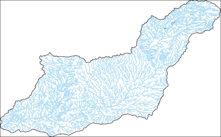
The National Hydrography Dataset (NHD) is a feature-based database that interconnects and uniquely identifies the stream segments or reaches that make up the nation's surface water drainage system. NHD data was originally developed at 1:100,000-scale and exists at that scale for the whole country. This high-resolution NHD, generally developed at 1:24,000/1:12,000 scale, adds detail to the original 1:100,000-scale NHD. (Data for Alaska, Puerto Rico and the Virgin Islands was developed at high-resolution, not 1:100,000 scale.) Local resolution NHD is being developed where partners and data exist. The NHD contains reach codes for networked features, flow direction, names, and centerline representations for areal water...
Layers of geospatial data include contours, boundaries, land cover, hydrography, roads, transportation, geographic names, structures, and other selected map features.
Layers of geospatial data include contours, boundaries, land cover, hydrography, roads, transportation, geographic names, structures, and other selected map features.
Layers of geospatial data include contours, boundaries, land cover, hydrography, roads, transportation, geographic names, structures, and other selected map features.
Layers of geospatial data include contours, boundaries, land cover, hydrography, roads, transportation, geographic names, structures, and other selected map features.
The Colorado Plateau structural province features long monoclinal flexures between uplifts and basins that are the major lines of deformation within and marginal to the Plateau. These folds are named, well-known, and have been described as part of several previous tectonic syntheses of the Colorado Plateau (Kelley, 1955; Davis, 1978; 1999). However, no digital data have ever been created that locate these folds in digital map space. This digital dataset compiles mapped locations of monoclinal folds from several geologic maps from the Colorado Plateau, most released only in “paper”, non-vector format. Fold names and their general map trace were guided by regional-scale maps that synthesize the tectonic elements of...
This data release documents proposed updates to geologic inputs (faults) for the upcoming 2023 National Seismic Hazard Model (NSHM). This version (1.0) conveys differences between 2014 NSHM fault sources and those recently released in the earthquake geology inputs for the U.S. National Seismic Hazard Model (NSHM) 2023, version 1.0 data release by Hatem et al. (2021). A notable difference between the 2014 and 2023 datasets is that slip rates are provided at points for 2023 instead of generalized along the entire fault section length as in 2014; consequently, slip rates are not provided for fault sections in the draft 2023 dataset. Geospatial data (shapefile, kml and geojson) are provided in this data release with...
Categories: Data;
Types: Downloadable,
Map Service,
OGC WFS Layer,
OGC WMS Layer,
Shapefile;
Tags: Arizona,
California,
Colorado,
Idaho,
Nevada,
The GNLCC Multi-dimensional Synthesis is a synthesis of existing information in four categories to promote a common understanding of situation, existing information and information gaps, as well as providing an index of programmatic, resource and other climate and landscape related information for GNLCC. The synthesis includes: the GNLCC Resource Directory (organizations and initiatives); climate and ecological response (what does existing and projected climate information say and what are expected ecological effects); and monitoring (who is monitoring what).FY2011Objectives:Provide a Framework from which to organize the various monitoring and evaluation efforts. Included are key monitoring and evaluation questions...
Categories: Data,
Project;
Types: Map Service,
OGC WFS Layer,
OGC WMS Layer,
OGC WMS Service;
Tags: Alberta,
British Columbia,
CO-2,
CO-3,
CO-3,
We propose a collaborative project with the USGS, Wyoming State Climate Office, USFWS, USFS, and the NPS whereby we will assemble and maintain long-term records of climate from key stations in and around the Great Northern LCC and subject these records to a rigorous series of QA/QC procedures. Where appropriate we will use best available practices to infill missing data, and we will develop station histories (e.g., details of station moves, instrumentation changes, etc.) as a context for interpreting these records. We will then rigorously analyze patterns of long-term (50-100 years) variability and trends in these datasets, and provide summaries designed to meet the needs of non-climate specialists working in the...
Categories: Data,
Project;
Types: Map Service,
OGC WFS Layer,
OGC WMS Layer,
OGC WMS Service;
Tags: Alberta,
British Columbia,
CO-2,
CO-3,
CO-3,
WGFD has a quantity of GPS-based animal movement data available for processing. In order to fully integrate this data into existing statewide migration route data layers and/or to use it to develop modeled migration corridor data layers, it must be reviewed, organized appropriately, analyzed, modeled and finally structured to allow seamless integration. The objective of this proposal is to review and examine the data, organize it meaningfully, and present it initially in combination with existing migration routes in order to represent generalized big game migration corridors across the landscapes of Wyoming. This is anticipated as a “first look” product, and serve as a basis for future work to more fully analyze...
Categories: Data,
Project;
Types: Map Service,
OGC WFS Layer,
OGC WMS Layer,
OGC WMS Service;
Tags: 2010,
2012,
CO-2,
CO-3,
CO-3,
The High Plains aquifer extends from approximately 32 to 44 degrees north latitude and 96 degrees 30 minutes to 106 degrees west longitude. The aquifer underlies about 175,000 square miles in parts of Colorado, Kansas, Nebraska, New Mexico, Oklahoma, South Dakota, Texas, and Wyoming. This digital dataset consists of a raster of water-level changes for the High Plains aquifer, predevelopment (about 1950) to 2019. It was created using water-level measurements from 2,741 wells measured in both the predevelopment period (about 1950) and in 2019, the latest available static water level measured in 2015 to 2018 from 71 wells in New Mexico and using other published information on water-level change in areas with few water-level...
Across the country, public land managers make hundreds of decisions each year that influence landscapes and ecosystems within the lands they manage. Many of these decisions involve vegetation manipulations known as land treatments. Land treatments include activities such as removal or alteration of plant biomass, seeding burned areas, and herbicide applications. Data on these land treatments historically have been stored at local offices and gathering information across large spatial areas was difficult. These valuable data needed to be centralized and stored for Federal agencies involved in land treatments because these data are useful to land managers for policy and management and to scientists for developing...
Probability map of Cheatgrass occurrence in relation to vegetation, abiotic, and anthropogenic features. These data were released prior to the October 1, 2016 effective date for the USGS’s policy dictating the review, approval, and release of scientific data as referenced in USGS Survey Manual Chapter 502.8 Fundamental Science Practices: Review and Approval of Scientific Data for Release.
Probability map of green-tailed towhee occurrence in relation to vegetation, abiotic, and anthropogenic features. These data were released prior to the October 1, 2016 effective date for the USGS’s policy dictating the review, approval, and release of scientific data as referenced in USGS Survey Manual Chapter 502.8 Fundamental Science Practices: Review and Approval of Scientific Data for Release.
Probability map of Halogeton occurrence in relation to vegetation, abiotic, and anthropogenic features. These data were released prior to the October 1, 2016 effective date for the USGS’s policy dictating the review, approval, and release of scientific data as referenced in USGS Survey Manual Chapter 502.8 Fundamental Science Practices: Review and Approval of Scientific Data for Release.
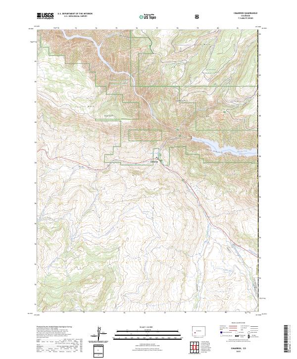
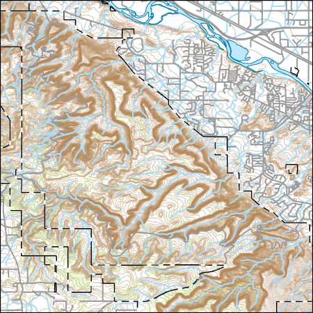
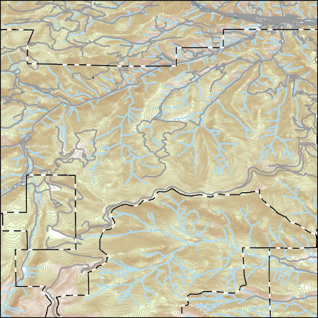
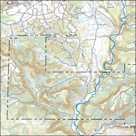
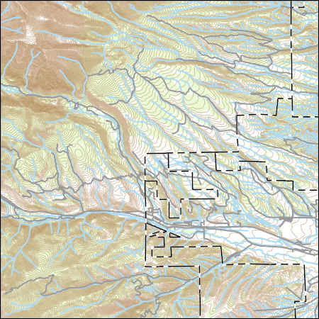
Layered geospatial PDF 7.5 Minute Quadrangle Map. Layers of geospatial data include orthoimagery, roads, grids, geographic names, elevation contours, hydrography, and other selected map features. This map is derived from GIS (geospatial information system) data. It represents a repackaging of GIS data in traditional map form, not creation of new information. The geospatial data in this map are from selected National Map data holdings and other government sources.

The Watershed Boundary Dataset (WBD) is a comprehensive aggregated collection of hydrologic unit data consistent with the national criteria for delineation and resolution. It defines the areal extent of surface water drainage to a point except in coastal or lake front areas where there could be multiple outlets as stated by the "Federal Standards and Procedures for the National Watershed Boundary Dataset (WBD)" "Standard" (https://pubs.usgs.gov/tm/11/a3/). Watershed boundaries are determined solely upon science-based hydrologic principles, not favoring any administrative boundaries or special projects, nor particular program or agency. This dataset represents the hydrologic unit boundaries to the 12-digit (6th level)...
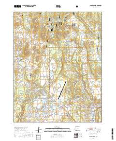
Layered geospatial PDF 7.5 Minute Quadrangle Map. Layers of geospatial data include orthoimagery, roads, grids, geographic names, elevation contours, hydrography, and other selected map features. This map is derived from GIS (geospatial information system) data. It represents a repackaging of GIS data in traditional map form, not creation of new information. The geospatial data in this map are from selected National Map data holdings and other government sources.
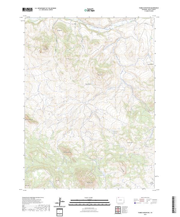
Layered geospatial PDF 7.5 Minute Quadrangle Map. Layers of geospatial data include orthoimagery, roads, grids, geographic names, elevation contours, hydrography, and other selected map features. This map is derived from GIS (geospatial information system) data. It represents a repackaging of GIS data in traditional map form, not creation of new information. The geospatial data in this map are from selected National Map data holdings and other government sources.
Petroleum within unconventional source-rock reservoirs is hosted in organic matter and mineral pore space as well as in voids and microfractures. Recent work has shown that for source-rock reservoirs in the dry gas window, significant portions of methane (CH4), the main component of petroleum at elevated maturities, can be stored within fine organic matter porosity. However, within reservoirs at lower thermal maturities (e.g., peak oil or wet-gas conditions), the distribution and behavior of CH4 and the higher alkanes that comprise gas condensates across pore sizes is unclear, especially for fine pores with diameters <50 nm. Understanding CH4 within these settings provides insight for petroleum generation, movement,...
Categories: Data;
Tags: Colorado,
Contrast Matching,
Denver-Julesburg Basin,
Energy Resources,
Gas Condensate,
|

|
