Filters: Tags: Continental (X)
12 results (30ms)|
Filters
Date Range
Extensions Types Contacts
Categories Tag Types Tag Schemes |
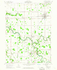
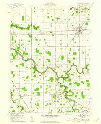
USGS Historical Quadrangle in GeoPDF.
Increasing the proportion of power derived from renewable energy sources is becoming an increasingly important part of many countries's strategies to achieve reductions in greenhouse gas emissions. However, renewable energy investments can often have external costs and benefits, which need to be taken into account if socially optimal investments are to be made. This paper attempts to estimate the magnitude of these external costs and benefits for the case of renewable technologies in Scotland, a country which has set particularly ambitious targets for expanding renewable energy. The external effects we consider are those on landscape quality, wildlife and air quality. We also consider the welfare implications of...
Categories: Publication;
Types: Citation;
Tags: Implications,
Vegetation,
boreal,
communities,
continental,
This data set contains imagery from the National Agriculture Imagery Program (NAIP). The NAIP program is administered by USDA FSA and has been established to support two main FSA strategic goals centered on agricultural production. These are, increase stewardship of America's natural resources while enhancing the environment, and to ensure commodities are procured and distributed effectively and efficiently to increase food security. The NAIP program supports these goals by acquiring and providing ortho imagery that has been collected during the agricultural growing season in the U.S. The NAIP ortho imagery is tailored to meet FSA requirements and is a fundamental tool used to support FSA farm and conservation programs....
This data set contains imagery from the National Agriculture Imagery Program (NAIP). The NAIP program is administered by USDA FSA and has been established to support two main FSA strategic goals centered on agricultural production. These are, increase stewardship of America's natural resources while enhancing the environment, and to ensure commodities are procured and distributed effectively and efficiently to increase food security. The NAIP program supports these goals by acquiring and providing ortho imagery that has been collected during the agricultural growing season in the U.S. The NAIP ortho imagery is tailored to meet FSA requirements and is a fundamental tool used to support FSA farm and conservation programs....
Increasing the proportion of power derived from renewable energy sources is becoming an increasingly important part of many countries's strategies to achieve reductions in greenhouse gas emissions. However, renewable energy investments can often have external costs and benefits, which need to be taken into account if socially optimal investments are to be made. This paper attempts to estimate the magnitude of these external costs and benefits for the case of renewable technologies in Scotland, a country which has set particularly ambitious targets for expanding renewable energy. The external effects we consider are those on landscape quality, wildlife and air quality. We also consider the welfare implications of...
Categories: Publication;
Types: Citation;
Tags: Implications,
Vegetation,
boreal,
communities,
continental,
This data set contains imagery from the National Agriculture Imagery Program (NAIP). The NAIP program is administered by USDA FSA and has been established to support two main FSA strategic goals centered on agricultural production. These are, increase stewardship of America's natural resources while enhancing the environment, and to ensure commodities are procured and distributed effectively and efficiently to increase food security. The NAIP program supports these goals by acquiring and providing ortho imagery that has been collected during the agricultural growing season in the U.S. The NAIP ortho imagery is tailored to meet FSA requirements and is a fundamental tool used to support FSA farm and conservation programs....
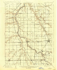
USGS Historical Quadrangle in GeoPDF.
This data set contains imagery from the National Agriculture Imagery Program (NAIP). The NAIP program is administered by USDA FSA and has been established to support two main FSA strategic goals centered on agricultural production. These are, increase stewardship of America's natural resources while enhancing the environment, and to ensure commodities are procured and distributed effectively and efficiently to increase food security. The NAIP program supports these goals by acquiring and providing ortho imagery that has been collected during the agricultural growing season in the U.S. The NAIP ortho imagery is tailored to meet FSA requirements and is a fundamental tool used to support FSA farm and conservation programs....
Data represents segments of the National Wild and Scenic River System. This is a national dataset that was clipped by WyGISC to the Wyoming Boundaries, additionally a web link to additional river data was included
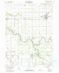
USGS Historical Quadrangle in GeoPDF.
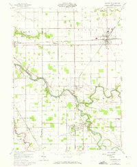
USGS Historical Quadrangle in GeoPDF.
USGS Historical Quadrangle in GeoPDF.
|

|
