Filters: Tags: Copper Mountain (X)
139 results (121ms)|
Filters
Date Range
Types Contacts
Categories Tag Types Tag Schemes |
Parked haul trucks at the Morenci mine.
This data set contains imagery from the National Agriculture Imagery Program (NAIP). The NAIP program is administered by USDA FSA and has been established to support two main FSA strategic goals centered on agricultural production. These are, increase stewardship of America's natural resources while enhancing the environment, and to ensure commodities are procured and distributed effectively and efficiently to increase food security. The NAIP program supports these goals by acquiring and providing ortho imagery that has been collected during the agricultural growing season in the U.S. The NAIP ortho imagery is tailored to meet FSA requirements and is a fundamental tool used to support FSA farm and conservation programs....
ADMMR map collection: Skip Loading Device, Number 6 Shaft, Morenci Branch; 1 in. to 2 feet; 21 x 14 in.
Categories: Data;
Tags: Abrasive, Garnet Andra,
Arizona,
Arizona Central,
Bon Ton,
Calcium, Limestone,
This data set contains imagery from the National Agriculture Imagery Program (NAIP). The NAIP program is administered by USDA FSA and has been established to support two main FSA strategic goals centered on agricultural production. These are, increase stewardship of America's natural resources while enhancing the environment, and to ensure commodities are procured and distributed effectively and efficiently to increase food security. The NAIP program supports these goals by acquiring and providing ortho imagery that has been collected during the agricultural growing season in the U.S. The NAIP ortho imagery is tailored to meet FSA requirements and is a fundamental tool used to support FSA farm and conservation programs....
This data set contains imagery from the National Agriculture Imagery Program (NAIP). The NAIP program is administered by USDA FSA and has been established to support two main FSA strategic goals centered on agricultural production. These are, increase stewardship of America's natural resources while enhancing the environment, and to ensure commodities are procured and distributed effectively and efficiently to increase food security. The NAIP program supports these goals by acquiring and providing ortho imagery that has been collected during the agricultural growing season in the U.S. The NAIP ortho imagery is tailored to meet FSA requirements and is a fundamental tool used to support FSA farm and conservation programs....
Heinrichs Geoexploration Co. Maps: BYU-Morenci Area Claim and Topo Field Map; 1 in. to 500 feet; 31 x 33 in.
Categories: Data;
Tags: Abrasive, Garnet Andra,
Arizona,
Arizona Central,
Bon Ton,
Calcium, Limestone,
Heinrichs Geoexploration Co. Maps: Essex-Morenci; 1 in. to 400 feet; 18 x 20 in.
ADMMR map collection: Clifton-Morenci District Map; 22 x 14 in.
Categories: Data;
Tags: Abrasive, Garnet Andra,
Arizona,
Arizona Central,
Bon Ton,
Calcium, Limestone,
A conveyor and primary surge dump at the Morenic mine, with tanks on the right.
A rig for drilling blast holes on the right and a loaded haul truck on the left.
A view of the town of Morenci, Arizona.
ADMMR map collection: Rail Haulage at Morenci Mine; 19 x 26 in.
Categories: Data;
Tags: Abrasive, Garnet Andra,
Arizona,
Arizona Central,
Bon Ton,
Calcium, Limestone,
Heinrichs Geoexploration Co. Maps: Copper King Mountain-Colorado Gulch Area, Banner Mining Company, District Mining Claims; 1 in. to 400 feet; 23 x 28 in.
A view of the town of Morenci, Arizona showing a theater, shopping center, and some automobiles.
The Metcalf Mill with tailings thickeners in the foreground.
The Stargo Canyon leach field at Morenci.
This data set contains imagery from the National Agriculture Imagery Program (NAIP). The NAIP program is administered by USDA FSA and has been established to support two main FSA strategic goals centered on agricultural production. These are, increase stewardship of America's natural resources while enhancing the environment, and to ensure commodities are procured and distributed effectively and efficiently to increase food security. The NAIP program supports these goals by acquiring and providing ortho imagery that has been collected during the agricultural growing season in the U.S. The NAIP ortho imagery is tailored to meet FSA requirements and is a fundamental tool used to support FSA farm and conservation programs....
An aerial view of the SX pant at the Morenci mine.
Two men working with cathodes at the Morenci SE plant.
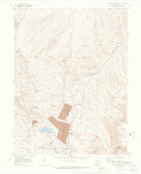
USGS Historical Quadrangle in GeoPDF.
|

|
