Filters: Tags: Cripple Creek South (X)
17 results (41ms)|
Filters
Date Range
Types Contacts
Categories Tag Types Tag Schemes |
This data set contains imagery from the National Agriculture Imagery Program (NAIP). The NAIP program is administered by USDA FSA and has been established to support two main FSA strategic goals centered on agricultural production. These are, increase stewardship of America's natural resources while enhancing the environment, and to ensure commodities are procured and distributed effectively and efficiently to increase food security. The NAIP program supports these goals by acquiring and providing ortho imagery that has been collected during the agricultural growing season in the U.S. The NAIP ortho imagery is tailored to meet FSA requirements and is a fundamental tool used to support FSA farm and conservation programs....
This data set contains imagery from the National Agriculture Imagery Program (NAIP). The NAIP program is administered by USDA FSA and has been established to support two main FSA strategic goals centered on agricultural production. These are, increase stewardship of America's natural resources while enhancing the environment, and to ensure commodities are procured and distributed effectively and efficiently to increase food security. The NAIP program supports these goals by acquiring and providing ortho imagery that has been collected during the agricultural growing season in the U.S. The NAIP ortho imagery is tailored to meet FSA requirements and is a fundamental tool used to support FSA farm and conservation programs....
This data set contains imagery from the National Agriculture Imagery Program (NAIP). The NAIP program is administered by USDA FSA and has been established to support two main FSA strategic goals centered on agricultural production. These are, increase stewardship of America's natural resources while enhancing the environment, and to ensure commodities are procured and distributed effectively and efficiently to increase food security. The NAIP program supports these goals by acquiring and providing ortho imagery that has been collected during the agricultural growing season in the U.S. The NAIP ortho imagery is tailored to meet FSA requirements and is a fundamental tool used to support FSA farm and conservation programs....
HySpex by NEO (HySpex) VNIR-1800 and SWIR-384 imaging spectrometer radiance data were acquired on September 14, 2017 at the Cresson Pit of the Cripple Creek & Victor mine in Cripple Creek, Colorado. ASD FieldSpecⓇ NG data were collected on September 13 and 14, 2017 at two calibration sites within the Cresson Pit imaged with the HySpex imaging spectrometers. The HySpex VNIR-1800 imaging spectrometer is a push broom type instrument that utilizes 1800 pixels to collect 186 channels of spectral data in the region of 400 to 1000 nanometers (nm). The spectral sampling interval of the HySpex VNIR-1800 is 3.26 nm with a 17° field of view (Norsk Elektro Optikk AS, 2016b). The HySpex SWIR-384 imagining spectrometer is a push...
Categories: Data;
Tags: Big Bull Mountain,
Colorado,
Cripple Creek,
Cripple Creek District Mine,
Cripple Creek North,
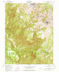
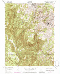
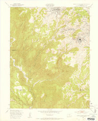
USGS Historical Quadrangle in GeoPDF.
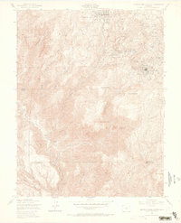
USGS Historical Quadrangle in GeoPDF.
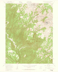
USGS Historical Quadrangle in GeoPDF.
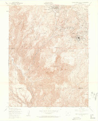
USGS Historical Quadrangle in GeoPDF.
USGS Historical Quadrangle in GeoPDF.
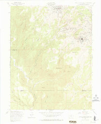
USGS Historical Quadrangle in GeoPDF.
USGS Historical Quadrangle in GeoPDF.
HySpex by NEO (HySpex) VNIR-1800 and SWIR-384 imaging spectrometer radiance data were acquired on September 14, 2017 at the Cresson Pit of the Cripple Creek & Victor mine in Cripple Creek, Colorado. ASD FieldSpecⓇ NG data were collected on September 13 and 14, 2017 at two calibration sites within the Cresson Pit imaged with the HySpex imaging spectrometers. The HySpex VNIR-1800 imaging spectrometer is a push broom type instrument that utilizes 1800 pixels to collect 186 channels of spectral data in the region of 400 to 1000 nanometer (nm). The spectral sampling interval of the HySpex VNIR-1800 is 3.26 nm with a 17° field of view (Norsk Elektro Optikk AS, 2016b). The HySpex SWIR-384 imagining spectrometer is a push...
This data set contains imagery from the National Agriculture Imagery Program (NAIP). The NAIP program is administered by USDA FSA and has been established to support two main FSA strategic goals centered on agricultural production. These are, increase stewardship of America's natural resources while enhancing the environment, and to ensure commodities are procured and distributed effectively and efficiently to increase food security. The NAIP program supports these goals by acquiring and providing ortho imagery that has been collected during the agricultural growing season in the U.S. The NAIP ortho imagery is tailored to meet FSA requirements and is a fundamental tool used to support FSA farm and conservation programs....
HySpex by NEO (HySpex) VNIR-1800 and SWIR-384 imaging spectrometer radiance data were acquired on September 14, 2017 at the Cresson Pit of the Cripple Creek & Victor mine in Cripple Creek, Colorado. ASD FieldSpecⓇ NG data were collected on September 13 and 14, 2017 at two calibration sites within the Cresson Pit imaged with the HySpex imaging spectrometers. The HySpex VNIR-1800 imaging spectrometer is a push broom type instrument that utilizes 1800 pixels to collect 186 channels of spectral data in the region of 400 to 1000 nanometers (nm). The spectral sampling interval of the HySpex VNIR-1800 is 3.26 nm with a 17° field of view (Norsk Elektro Optikk AS, 2016b). The HySpex SWIR-384 imagining spectrometer is a push...
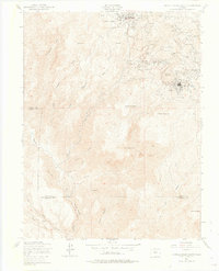
USGS Historical Quadrangle in GeoPDF.

USGS Historical Quadrangle in GeoPDF.
HySpex by NEO (HySpex) VNIR-1800 and SWIR-384 imaging spectrometer radiance data were acquired on September 14, 2017 at the Cresson Pit of the Cripple Creek & Victor mine in Cripple Creek, Colorado. ASD FieldSpecⓇ NG data were collected on September 13 and 14, 2017 at two calibration sites within the Cresson Pit imaged with the HySpex imaging spectrometers. The HySpex VNIR-1800 imaging spectrometer is a push broom type instrument that utilizes 1800 pixels to collect 186 channels of spectral data in the region of 400 to 1000 nanometers (nm). The spectral sampling interval of the HySpex VNIR-1800 is 3.26 nm with a 17° field of view (Norsk Elektro Optikk AS, 2016b). The HySpex SWIR-384 imagining spectrometer is a push...
Categories: Data;
Tags: Big Bull Mountain,
Colorado,
Cripple Creek,
Cripple Creek District Mine,
Cripple Creek North,
|

|
