Filters: Tags: Cropland (X)
43 results (86ms)|
Filters
Contacts
(Less)
|
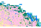
This dataset contains generalized landcover data for the Prairie Farm Rehabilitation Administration (PFRA) determined agricultural extent of Manitoba and Saskatchewan. This dataset was subset into two shapefiles. The other half of this dataset covers PFRA agricultural areas of Alberta and British Columbia. The Landcover Generalization process was undertaken to solve rendering problems of the original vectorized landcover data due to its unwieldy/overwhelming size. LANDSAT 7 imagery used in the process was collected during the WGTPP. This landcover imagery has a 30 meter resolution and is stored in over 1,100 vectorized 1:50,000 map sheet tiles. The data requires over seven gigabytes of disc space. If the user wishes...

The USDA, NASS Cropland Data Layer (CDL) is a raster, geo-referenced, crop-specific land cover data layer with a ground resolution of 56 meters. The CDL is produced using satellite imagery from the Indian Remote Sensing RESOURCESAT-1 (IRS-P6) Advanced Wide Field Sensor (AWiFS) collected during the current growing season. Some Cropland Data Layer states used Landsat 5 TM and/or Landsat 7 ETM+ satellite imagery to supplement the classification. Ancillary classification inputs include: the United States Geological Survey (USGS) National Elevation Dataset (NED), the USGS National Land Cover Dataset 2001 (NLCD 2001), and the National Aeronautics and Space Administration (NASA) Moderate Resolution Imaging Spectroradiometer...

The USDA, NASS Cropland Data Layer (CDL) is a raster, geo-referenced, crop-specific land cover data layer. The 2010 CDL has a ground resolution of 30 meters. The CDL is produced using satellite imagery from the Landsat 5 TM sensor, Landsat 7 ETM+ sensor, and the Indian Remote Sensing RESOURCESAT-1 (IRS-P6) Advanced Wide Field Sensor (AWiFS) collected during the current growing season.Some CDL states used additional satellite imagery and ancillary inputs to supplement and improve the classification. These additional sources can include the United States Geological Survey (USGS) National Elevation Dataset (NED), the USGS National Land Cover Dataset 2001 (NLCD 2001), and the National Aeronautics and Space Administration...
This tabular data set represents the percent of land cover classes from the 2014 Crop land Data Layer compiled for two spatial components of the NHDPlus version 2 data suite (NHDPlusv2) for the conterminous United States; 1) individual reach catchments and 2) reach catchments accumulated upstream through the river network. This dataset can be linked to the NHDPlus version 2 data suite by the unique identifier COMID. The source data is the "2014 Crop Land Data Layer" produced by the United States Department of Agriculture (USDA) National Agricultural Statistics Service (NASS, 2015). Reach catchment information characterizes data at the local scale. Reach catchments accumulated upstream through the river network characterizes...
Categories: Data;
Types: Citation;
Tags: CDL,
Catchment,
Conterminous United States,
Crop Land Data Layer,
CropScape,
The dataset summarizes total area (km2) and proportion of Central Valley waterbird habitat, summed across individual waterbird habitats (i.e., wetland and cropland types), that was available for each of 17 projected scenarios. The dataset also includes relatively recent (year 2005) area of existing habitat (i.e., “existing area”) for comparison with areas based on scenarios. Analysis was conducted for the projection period including water-years 2006–2099 (water-year defined as October-December and January–September of the following year). Because habitat areas vary through the season with timing of crop harvest and flooding of wetlands and post-harvested fields, annual areas and proportions represent summation...
Categories: Data;
Tags: Central Valley of California,
climate change,
cropland,
habitat,
urbanization,
This dataset consists of a series of rasters covering the conterminous United States. Each raster is a one kilometer (km) grid for 18 selected Census of Agriculture statistics mapped to land use pixels for the time period 1950 to 2012. A supplemental set of 9 statistics mapped at the entire county level are also provided as 1-km rasters. The rasters are posted as ArcGIS grids. The statistics represent values for crops, livestock, irrigation, fertilizer, and manure usage. Most statistics are mapped for all 14 Census of Agriculture reporting years in that time frame: 1950, 1954, 1959, 1964, 1969, 1974, 1978, 1982, 1987, 1992, 1997, 2002, 2007, and 2012.
Categories: Data;
Types: Citation;
Tags: Census of Agriculture,
Conterminous U.S.,
Cropland,
Crops,
Dasymetric mapping,
America’s remaining grassland in the Prairie Pothole Region (PPR) is at risk of being lost to crop production. When crop prices are high, like the historically high corn prices that the U.S. experienced between 2008 and 2014, the risk of grassland conversion is even higher. Changing climate will add uncertainties to any efforts toward conservation of grassland in the PPR. Grassland conversion to cropland in the region would imperil nesting waterfowl among other species and further impair water quality in the Mississippi watershed. In this project, we sought to contribute to the understanding of land conversion in the PPR with the aim to better target the use of public and private funds allocated toward incentivizing...
Categories: Publication;
Types: Citation,
Report;
Tags: Data Visualization & Tools,
Grasslands and Plains,
Landscapes,
Mississippi watershed,
North Central CASC,

This dataset contains generalized landcover data for the Prairie Farm Rehabilitation Administration (PFRA) agricultural extent of Alberta and British Columbia. This dataset was subset into two shapefiles. The other half of this dataset covers PFRA agricultural areas of Manitoba and Saskatchewan. The Landcover Generalization process was undertaken to solve rendering problems of the original vectorized landcover data due to its unwieldy/overwhelming size. LANDSAT 7 imagery used in the process was collected during the WGTPP. This landcover imagery has a 30 meter resolution and is stored in over 1,100 vectorized 1:50,000 map sheet tiles. The data requires over seven gigabytes of disc space. If the user wishes to view...
To accurately estimate agricultural water use or to project future water demands, a detailed inventory of current irrigated crop acreage is needed at a high level of resolution. In many Florida counties this kind of detailed high-resolution inventory is not available. A detailed digital map and summary of irrigated acreage during the 2015 growing season was developed for 13 of the 15 counties that compose the Suwannee River Water Management District. The irrigated areas were delineated using land-use data, orthoimagery, water management district consumptive water-use permits, and digitized agricultural landuse maps developed by the Florida Department of Agriculture and Consumer Services, Florida Statewide Agricultural...
These data are a subset of categories and items from county-level data for the conterminous United States covering the census reporting years beginning with the 1950 Census of Agriculture and ending with the 2012 Census of Agriculture. Historical (1950-1997) data were extracted from digital files obtained through the Intra-university Consortium on Political and Social Research (ICPSR). More current (1997-2012) data were extracted from the National Agriculture Statistical Service(NASS) Census Query Tool for the census years of 1997, 2002, 2007, and 2012. Please refer to the Supplemental Information element of the metadata for information on the Census of Agriculture, the Inter-university Consortium for Political...
Categories: Data;
Types: Citation;
Tags: Census of Agriculture,
Conterminous United States,
County-level Census of Agriculture,
Crop production,
Cropland,
These data represents annual estimates of neonicotinoid nitroguanidine group insecticide application rates across the western conterminous United States from 2008 to 2014. This product contains seven raster layers (appearing as separate bands in a multi-band raster). Each band represents one year of the data beginning in 2008. Estimates are generated by pairing crop specific application rates of neonicotinoids with fine scale crop data obtained from the CropScape cropland data layer. Application units are kilograms per hectare. Further details on the methods used to generate this product are described in: Douglas, M.R., Baisley, P., Soba, S., Kammerer, M., Lonsdorf, E.V. and Grozinger, C.M., 2022. Putting pesticides...

The USDA, NASS Cropland Data Layer (CDL) is a raster, geo-referenced, crop-specific land cover data layer. The 2010 CDL has a ground resolution of 30 meters. The CDL is produced using satellite imagery from the Landsat 5 TM sensor, Landsat 7 ETM+ sensor, and the Indian Remote Sensing RESOURCESAT-1 (IRS-P6) Advanced Wide Field Sensor (AWiFS) collected during the current growing season.Some CDL states used additional satellite imagery and ancillary inputs to supplement and improve the classification. These additional sources can include the United States Geological Survey (USGS) National Elevation Dataset (NED), the USGS National Land Cover Dataset 2001 (NLCD 2001), and the National Aeronautics and Space Administration...

The USDA, NASS Cropland Data Layer (CDL) is a raster, geo-referenced, crop-specific land cover data layer. The 2010 CDL has a ground resolution of 30 meters. The CDL is produced using satellite imagery from the Landsat 5 TM sensor, Landsat 7 ETM+ sensor, and the Indian Remote Sensing RESOURCESAT-1 (IRS-P6) Advanced Wide Field Sensor (AWiFS) collected during the current growing season.Some CDL states used additional satellite imagery and ancillary inputs to supplement and improve the classification. These additional sources can include the United States Geological Survey (USGS) National Elevation Dataset (NED), the USGS National Land Cover Dataset 2001 (NLCD 2001), and the National Aeronautics and Space Administration...

The USDA, NASS Cropland Data Layer (CDL) is a raster, geo-referenced, crop-specific land cover data layer. The 2010 CDL has a ground resolution of 30 meters. The CDL is produced using satellite imagery from the Landsat 5 TM sensor, Landsat 7 ETM+ sensor, and the Indian Remote Sensing RESOURCESAT-1 (IRS-P6) Advanced Wide Field Sensor (AWiFS) collected during the current growing season.Some CDL states used additional satellite imagery and ancillary inputs to supplement and improve the classification. These additional sources can include the United States Geological Survey (USGS) National Elevation Dataset (NED), the USGS National Land Cover Dataset 2001 (NLCD 2001), and the National Aeronautics and Space Administration...

The USDA, NASS Cropland Data Layer (CDL) is a raster, geo-referenced, crop-specific land cover data layer. The 2010 CDL has a ground resolution of 30 meters. The CDL is produced using satellite imagery from the Landsat 5 TM sensor, Landsat 7 ETM+ sensor, and the Indian Remote Sensing RESOURCESAT-1 (IRS-P6) Advanced Wide Field Sensor (AWiFS) collected during the current growing season.Some CDL states used additional satellite imagery and ancillary inputs to supplement and improve the classification. These additional sources can include the United States Geological Survey (USGS) National Elevation Dataset (NED), the USGS National Land Cover Dataset 2001 (NLCD 2001), and the National Aeronautics and Space Administration...

The USDA, NASS Cropland Data Layer (CDL) is a raster, geo-referenced, crop-specific land cover data layer. The 2010 CDL has a ground resolution of 30 meters. The CDL is produced using satellite imagery from the Landsat 5 TM sensor, Landsat 7 ETM+ sensor, and the Indian Remote Sensing RESOURCESAT-1 (IRS-P6) Advanced Wide Field Sensor (AWiFS) collected during the current growing season.Some CDL states used additional satellite imagery and ancillary inputs to supplement and improve the classification. These additional sources can include the United States Geological Survey (USGS) National Elevation Dataset (NED), the USGS National Land Cover Dataset 2001 (NLCD 2001), and the National Aeronautics and Space Administration...
The dataset summarizes areas of Central Valley wetland and cropland waterbird habitats available for each of 17 projected scenarios by each month (August–December and following January–March). The dataset also includes relatively recent (year 2005) area of existing habitat (i.e., “existing area”) for comparison with habitat areas based on scenarios. Cropland habitats are defined as winter-flooded rice, unplowed dry rice, winter-flooded corn, unplowed dry corn, and other winter-flooded cropland (in Tulare basin). Wetlands are defined as summer-irrigated seasonal wetland, seasonal wetland that is not summer-irrigated, and semipermanent wetland (combines semipermanent and permanent wetland types). Thus, data on availability...
Categories: Data;
Tags: Central Valley of California,
climate change,
cropland,
habitat,
urbanization,
Agricultural land cover in the study area for the conservation assessment of Greater Sage-grouse conducted by the Western Association of Fish and Wildlife Agencies. This dataset was developed from Sagestitch, an Eastern Washington Shrubsteppe Mapping Project, several state-level Gap Analysis Program (GAP) land cover products (AZ, CA, NM, OR, and WA), National Land Cover Data (NLCD) (ND,SD,NE), and the Prairie Farm Rehabilitation Administration (PFRA) Generalized Landcover (Alberta, Saskatchewan).

The USDA, NASS Cropland Data Layer (CDL) is a raster, geo-referenced, crop-specific land cover data layer. The 2010 CDL has a ground resolution of 30 meters. The CDL is produced using satellite imagery from the Landsat 5 TM sensor, Landsat 7 ETM+ sensor, and the Indian Remote Sensing RESOURCESAT-1 (IRS-P6) Advanced Wide Field Sensor (AWiFS) collected during the current growing season.Some CDL states used additional satellite imagery and ancillary inputs to supplement and improve the classification. These additional sources can include the United States Geological Survey (USGS) National Elevation Dataset (NED), the USGS National Land Cover Dataset 2001 (NLCD 2001), and the National Aeronautics and Space Administration...
This tabular data set represents the percent of land cover classes from the 2013 Crop land Data Layer compiled for two spatial components of the NHDPlus version 2 data suite (NHDPlusv2) for the conterminous United States; 1) individual reach catchments and 2) reach catchments accumulated upstream through the river network. This dataset can be linked to the NHDPlus version 2 data suite by the unique identifier COMID. The source data is the "2014 Crop Land Data Layer" produced by the United States Department of Agriculture (USDA) National Agricultural Statistics Service (NASS, 2015). Reach catchment information characterizes data at the local scale. Reach catchments accumulated upstream through the river network characterizes...
|

|
