Filters: Tags: Cuba (X)
61 results (27ms)|
Filters
Date Range
Extensions Types Contacts
Categories Tag Types
|
This dataset presents information about mineral commodity exporting ports relating to the mineral industries of Latin America and the Caribbean. Port data records were originally derived from the National Geospatial-Intelligence Agency's World Port Index, with additional research conducted by the Material Flow Analysis section of the U.S. Geological Survey's (USGS) National Minerals Information Center (NMIC) to add specific mineral-related data. These ports represent known exporting ports over a time period of 2010-2016 and relevant data fields include the mineral commodities exported, the form of the exported mineral commodity, the port owner, the estimated annual tonnage, destination countries, as well as sources...
This dataset describes faults and structural features of the Caribbean region (Anguilla, Antigua and Barbuda, Aruba, Bahamas, Barbados, Belize, British Virgin Islands, Cayman Islands, Colombia, Costa Rica, Cuba, Dominica, Dominican Republic, El Salvador, Grenada, Guadeloupe, Guatemala, Guyana, Haiti, Honduras, Jamaica, Martinique, Mexico, Montserrat, Netherlands Antilles, Nicaragua, Panama, Puerto Rico, St. Kitts and Nevis, St. Lucia, St. Vincent and the Grenadines, Trinidad and Tobago, Turks and Caicos Islands, United States, Venezuela, and the Virgin Islands (named countries may not be completely shown on map)).
Categories: Data,
pre-SM502.8;
Types: Downloadable,
Map Service,
OGC WFS Layer,
OGC WMS Layer,
Shapefile;
Tags: AG,
AI,
AN,
AW,
Age,
The Total Petroleum System is used in the National Assessment Project and incorporates the Assessment Unit, which is the fundamental geologic unit used for the assessment of undiscovered oil and gas resources. The Total Petroleum System is shown here as a geographic boundary defined and mapped by the geologists responsible for the provinces and incorporates not only the set of known or postulated oil and (or) gas accumulations, but also the geologic interpretation of the essential elements and processes within the petroleum system that relate to source, generation, migration, accumulation, and trapping of the discovered and undiscovered petroleum resource(s).
Categories: Data,
pre-SM502.8;
Types: Downloadable,
Map Service,
OGC WFS Layer,
OGC WMS Layer,
Shapefile;
Tags: 47 = Western Gulf,
AL,
AR,
Anahuac Gas, Assessment Unit 50470138,
Coleman, J.L.,
This data set contains imagery from the National Agriculture Imagery Program (NAIP). The NAIP program is administered by USDA FSA and has been established to support two main FSA strategic goals centered on agricultural production. These are increase stewardship of America's natural resources while enhancing the environment, and to ensure commodities are procured and distributed effectively and efficiently to increase food security. The NAIP program supports these goals by acquiring and providing ortho imagery that has been collected during the agricultural growing season in the U.S. The NAIP ortho imagery is tailored to meet FSA requirements and is a fundamental tool used to support FSA farm and conservation programs....
This data set contains imagery from the National Agriculture Imagery Program (NAIP). The NAIP program is administered by USDA FSA and has been established to support two main FSA strategic goals centered on agricultural production. These are, increase stewardship of America's natural resources while enhancing the environment, and to ensure commodities are procured and distributed effectively and efficiently to increase food security. The NAIP program supports these goals by acquiring and providing ortho imagery that has been collected during the agricultural growing season in the U.S. The NAIP ortho imagery is tailored to meet FSA requirements and is a fundamental tool used to support FSA farm and conservation programs....
Types: Citation;
Tags: 3.75 x 3.75 minute,
36009,
4207854,
Aerial Compliance,
CATTARAUGUS CO NY FSA,
This data release presents the Yale stocks and flows database (YSTAFDB). Its data describe the use of 102 materials from the early 1800s to circa 2013 through anthropogenic cycles, their recycling and criticality properties, and on spatial scales ranging from suburbs to global. This data collection was previously scattered across multiple non-uniformly formatted files such as journal papers, reports, and unpublished spreadsheets. These data have been synthesized into YSTAFDB, which is presented as individual comma-separated text files and also in MySQL and PostgreSQL database formats. Consolidation of these data into a single database can increase their accessibility and reusability, which is relevant to diverse...
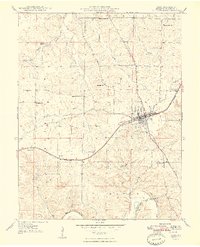
USGS Historical Quadrangle in GeoPDF.
Environmental DNA (eDNA) detection is a rapidly expanding technique used to non-invasively detect cryptic, low density, or logistically difficult-to-study species, such as imperiled manatees. Genetic material shed into the environment through tissue and body fluids is concentrated from water samples and analyzed for the presence of targeted eDNA. To help delineate manatee habitat ranges, high use areas, and seasonal population changes, a cytochrome-b quantitative PCR and state-of-the-art droplet digital PCR (ddPCR) eDNA assay was developed for the three extant and vulnerable manatee species: both subspecies of the West Indian manatee (Florida and Antillean), the African manatee and Amazonian manatee. Occurrence...
This data set contains imagery from the National Agriculture Imagery Program (NAIP). The NAIP program is administered by USDA FSA and has been established to support two main FSA strategic goals centered on agricultural production. These are, increase stewardship of America's natural resources while enhancing the environment, and to ensure commodities are procured and distributed effectively and efficiently to increase food security. The NAIP program supports these goals by acquiring and providing ortho imagery that has been collected during the agricultural growing season in the U.S. The NAIP ortho imagery is tailored to meet FSA requirements and is a fundamental tool used to support FSA farm and conservation programs....
Types: Citation;
Tags: 3.75 x 3.75 minute,
36009,
4207854,
Aerial Compliance,
CATTARAUGUS CO NY FSA,
This data set contains imagery from the National Agriculture Imagery Program (NAIP). The NAIP program is administered by USDA FSA and has been established to support two main FSA strategic goals centered on agricultural production. These are, increase stewardship of America's natural resources while enhancing the environment, and to ensure commodities are procured and distributed effectively and efficiently to increase food security. The NAIP program supports these goals by acquiring and providing ortho imagery that has been collected during the agricultural growing season in the U.S. The NAIP ortho imagery is tailored to meet FSA requirements and is a fundamental tool used to support FSA farm and conservation programs....
This data set contains imagery from the National Agriculture Imagery Program (NAIP). The NAIP program is administered by USDA FSA and has been established to support two main FSA strategic goals centered on agricultural production. These are increase stewardship of America's natural resources while enhancing the environment, and to ensure commodities are procured and distributed effectively and efficiently to increase food security. The NAIP program supports these goals by acquiring and providing ortho imagery that has been collected during the agricultural growing season in the U.S. The NAIP ortho imagery is tailored to meet FSA requirements and is a fundamental tool used to support FSA farm and conservation programs....
The Total Petroleum System is used in the World Petroleum Resource Project and incorporates the Assessment Unit, which is the fundamental geologic unit used for the assessment of undiscovered oil and gas resources. The Total Petroleum System is shown here as a geographic boundary defined and mapped by the geologist responsible for the province and incorporates not only the set of known or postulated oil and (or) gas accumulations, but also the geologic interpretation of the essential elements and processes within the petroleum system that relate to source, generation, migration, accumulation, and trapping of the discovered and undiscovered petroleum resource(s).
Categories: Data,
pre-SM502.8;
Types: Downloadable,
Map Service,
OGC WFS Layer,
OGC WMS Layer,
Shapefile;
Tags: 2000plusassessment,
611701 = Jurassic-Cretaceous Composite,
61170101 = North Cuba Fold and Thrust Belt,
61170102 = North Cuba Foreland Basin,
61170103 = North Cuba Platform Margin Carbonates,
This dataset includes polygons that describe the geologic age of surface outcrops of bedrock of the Caribbean region (Anguilla, Antigua and Barbuda, Aruba, Bahamas, Barbados, Belize, British Virgin Islands, Cayman Islands, Colombia, Costa Rica, Cuba, Dominica, Dominican Republic, El Salvador, Grenada, Guadeloupe, Guatemala, Guyana, Haiti, Honduras, Jamaica, Martinique, Mexico, Montserrat, Netherlands Antilles, Nicaragua, Panama, Puerto Rico, St. Kitts and Nevis, St. Lucia, St. Vincent and the Grenadines, Trinidad and Tobago, Turks and Caicos Islands, United States, Venezuela, and the Virgin Islands (named countries may not be completely shown on map)).
Categories: Data,
pre-SM502.8;
Types: Downloadable,
Map Service,
OGC WFS Layer,
OGC WMS Layer,
Shapefile;
Tags: AG,
AI,
AN,
AW,
Age,
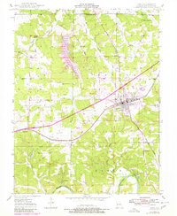
USGS Historical Quadrangle in GeoPDF.
This data set contains imagery from the National Agriculture Imagery Program (NAIP). The NAIP program is administered by USDA FSA and has been established to support two main FSA strategic goals centered on agricultural production. These are, increase stewardship of America's natural resources while enhancing the environment, and to ensure commodities are procured and distributed effectively and efficiently to increase food security. The NAIP program supports these goals by acquiring and providing ortho imagery that has been collected during the agricultural growing season in the U.S. The NAIP ortho imagery is tailored to meet FSA requirements and is a fundamental tool used to support FSA farm and conservation programs....
This data set contains imagery from the National Agriculture Imagery Program (NAIP). The NAIP program is administered by USDA FSA and has been established to support two main FSA strategic goals centered on agricultural production. These are increase stewardship of America's natural resources while enhancing the environment, and to ensure commodities are procured and distributed effectively and efficiently to increase food security. The NAIP program supports these goals by acquiring and providing ortho imagery that has been collected during the agricultural growing season in the U.S. The NAIP ortho imagery is tailored to meet FSA requirements and is a fundamental tool used to support FSA farm and conservation programs....
This data set contains imagery from the National Agriculture Imagery Program (NAIP). The NAIP program is administered by USDA FSA and has been established to support two main FSA strategic goals centered on agricultural production. These are increase stewardship of America's natural resources while enhancing the environment, and to ensure commodities are procured and distributed effectively and efficiently to increase food security. The NAIP program supports these goals by acquiring and providing ortho imagery that has been collected during the agricultural growing season in the U.S. The NAIP ortho imagery is tailored to meet FSA requirements and is a fundamental tool used to support FSA farm and conservation programs....
This data set contains imagery from the National Agriculture Imagery Program (NAIP). The NAIP program is administered by USDA FSA and has been established to support two main FSA strategic goals centered on agricultural production. These are increase stewardship of America's natural resources while enhancing the environment, and to ensure commodities are procured and distributed effectively and efficiently to increase food security. The NAIP program supports these goals by acquiring and providing ortho imagery that has been collected during the agricultural growing season in the U.S. The NAIP ortho imagery is tailored to meet FSA requirements and is a fundamental tool used to support FSA farm and conservation programs....
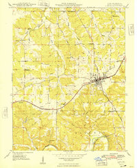
USGS Historical Quadrangle in GeoPDF.
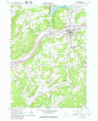
USGS Historical Quadrangle in GeoPDF.
|

|
