Filters: Tags: Cumero Canyon (X)
15 results (47ms)|
Filters
Date Range
Extensions Types Contacts
Categories Tag Types Tag Schemes |
This dataset includes the magnetotelluric (MT) sounding data collected in 2008 in and near the Patagonia Mountains of Arizona. The U.S. Geological Survey (USGS) conducted a series of multidisciplinary studies as part of the Assessment Techniques for Concealed Mineral Resources project funded by the USGS Minerals Resources Program in cooperation with the U.S. Forest Service.
This dataset includes the magnetotelluric (MT) sounding data collected in 2008 in and near the Patagonia Mountains of Arizona. The U.S. Geological Survey (USGS) conducted a series of multidisciplinary studies as part of the Assessment Techniques for Concealed Mineral Resources project funded by the USGS Minerals Resources Program in cooperation with the U.S. Forest Service.
Categories: Data;
Types: Citation,
Downloadable,
Map Service,
OGC WFS Layer,
OGC WMS Layer,
Shapefile;
Tags: Arizona,
CGGSC,
Crustal Geophysics and Geochemistry Science Center,
Cumero Canyon,
Electromagnetic surveying,

USGS Historical Quadrangle in GeoPDF.
This data set contains imagery from the National Agriculture Imagery Program (NAIP). The NAIP program is administered by USDA FSA and has been established to support two main FSA strategic goals centered on agricultural production. These are, increase stewardship of America's natural resources while enhancing the environment, and to ensure commodities are procured and distributed effectively and efficiently to increase food security. The NAIP program supports these goals by acquiring and providing ortho imagery that has been collected during the agricultural growing season in the U.S. The NAIP ortho imagery is tailored to meet FSA requirements and is a fundamental tool used to support FSA farm and conservation programs....
This dataset includes the magnetotelluric (MT) sounding data collected in 2008 in and near the Patagonia Mountains of Arizona. The U.S. Geological Survey (USGS) conducted a series of multidisciplinary studies as part of the Assessment Techniques for Concealed Mineral Resources project funded by the USGS Minerals Resources Program in cooperation with the U.S. Forest Service.
This dataset includes the magnetotelluric (MT) sounding data collected in 2008 in and near the Patagonia Mountains of Arizona. The U.S. Geological Survey (USGS) conducted a series of multidisciplinary studies as part of the Assessment Techniques for Concealed Mineral Resources project funded by the USGS Minerals Resources Program in cooperation with the U.S. Forest Service.
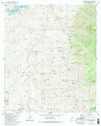
This data set contains imagery from the National Agriculture Imagery Program (NAIP). The NAIP program is administered by USDA FSA and has been established to support two main FSA strategic goals centered on agricultural production. These are, increase stewardship of America's natural resources while enhancing the environment, and to ensure commodities are procured and distributed effectively and efficiently to increase food security. The NAIP program supports these goals by acquiring and providing ortho imagery that has been collected during the agricultural growing season in the U.S. The NAIP ortho imagery is tailored to meet FSA requirements and is a fundamental tool used to support FSA farm and conservation programs....
This data set contains imagery from the National Agriculture Imagery Program (NAIP). The NAIP program is administered by USDA FSA and has been established to support two main FSA strategic goals centered on agricultural production. These are, increase stewardship of America's natural resources while enhancing the environment, and to ensure commodities are procured and distributed effectively and efficiently to increase food security. The NAIP program supports these goals by acquiring and providing ortho imagery that has been collected during the agricultural growing season in the U.S. The NAIP ortho imagery is tailored to meet FSA requirements and is a fundamental tool used to support FSA farm and conservation programs....

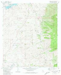
USGS Historical Quadrangle in GeoPDF.
USGS Historical Quadrangle in GeoPDF.
This dataset includes the magnetotelluric (MT) sounding data collected in 2008 in and near the Patagonia Mountains of Arizona. The U.S. Geological Survey (USGS) conducted a series of multidisciplinary studies as part of the Assessment Techniques for Concealed Mineral Resources project funded by the USGS Minerals Resources Program in cooperation with the U.S. Forest Service.
|

|
