Filters: Tags: DENVER (X)
174 results (252ms)|
Filters
Date Range
Types Contacts
Categories Tag Types
|
This data release includes 40Ar/39Ar intercalibration data from the U.S. Geological Survey for neutron fluence monitors HD-B1 (Heidelberg biotite) and FCs (Fish Canyon sanidine). Potassium-bearing mineral grains were analyzed by argon geochronology at the U.S. Geological Survey Argon Geochronology Laboratory in Denver, Colorado. These data provide intercalibration information between the two fluence monitors.
These data were released prior to the October 1, 2016 effective date for the USGS’s policy dictating the review, approval, and release of scientific data as referenced in USGS Survey Manual Chapter 502.8 Fundamental Science Practices: Review and Approval of Scientific Data for Release. The U.S. Geological Survey developed this dataset as part of the Colorado Front Range Infrastructure Resources Project (FRIRP). One goal of the FRIRP was to provide information on the availability of those hydrogeologic resources that are either critical to maintaining infrastructure along the northern Front Range or that may become less available because of urban expansion in the northern Front Range. This dataset extends from the...
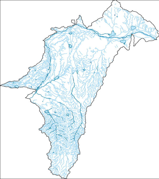
The National Hydrography Dataset (NHD) is a feature-based database that interconnects and uniquely identifies the stream segments or reaches that make up the nation's surface water drainage system. NHD data was originally developed at 1:100,000-scale and exists at that scale for the whole country. This high-resolution NHD, generally developed at 1:24,000/1:12,000 scale, adds detail to the original 1:100,000-scale NHD. (Data for Alaska, Puerto Rico and the Virgin Islands was developed at high-resolution, not 1:100,000 scale.) Local resolution NHD is being developed where partners and data exist. The NHD contains reach codes for networked features, flow direction, names, and centerline representations for areal water...
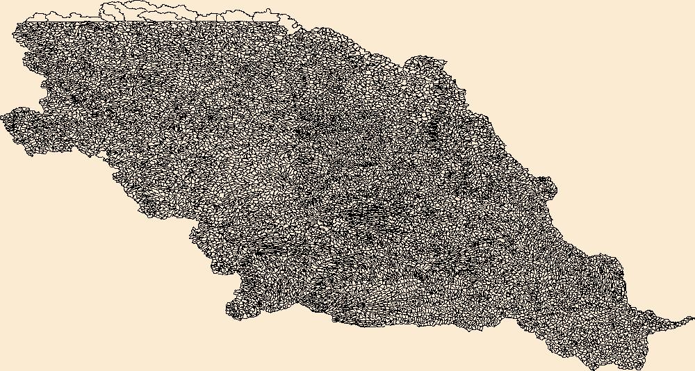
The Watershed Boundary Dataset (WBD) is a comprehensive aggregated collection of hydrologic unit data consistent with the national criteria for delineation and resolution. It defines the areal extent of surface water drainage to a point except in coastal or lake front areas where there could be multiple outlets as stated by the "Federal Standards and Procedures for the National Watershed Boundary Dataset (WBD)" "Standard" (https://pubs.usgs.gov/tm/11/a3/). Watershed boundaries are determined solely upon science-based hydrologic principles, not favoring any administrative boundaries or special projects, nor particular program or agency. This dataset represents the hydrologic unit boundaries to the 12-digit (6th level)...
This data set contains imagery from the National Agriculture Imagery Program (NAIP). The NAIP program is administered by USDA FSA and has been established to support two main FSA strategic goals centered on agricultural production. These are, increase stewardship of America's natural resources while enhancing the environment, and to ensure commodities are procured and distributed effectively and efficiently to increase food security. The NAIP program supports these goals by acquiring and providing ortho imagery that has been collected during the agricultural growing season in the U.S. The NAIP ortho imagery is tailored to meet FSA requirements and is a fundamental tool used to support FSA farm and conservation programs....
This data set contains imagery from the National Agriculture Imagery Program (NAIP). The NAIP program is administered by USDA FSA and has been established to support two main FSA strategic goals centered on agricultural production. These are, increase stewardship of America's natural resources while enhancing the environment, and to ensure commodities are procured and distributed effectively and efficiently to increase food security. The NAIP program supports these goals by acquiring and providing ortho imagery that has been collected during the agricultural growing season in the U.S. The NAIP ortho imagery is tailored to meet FSA requirements and is a fundamental tool used to support FSA farm and conservation programs....
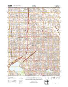
Layered GeoPDF 7.5 Minute Quadrangle Map. Layers of geospatial data include orthoimagery, roads, grids, geographic names, elevation contours, hydrography, and other selected map features.
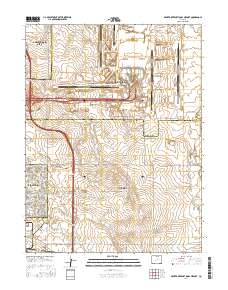
Layered geospatial PDF Map. Layers of geospatial data include orthoimagery, roads, grids, geographic names, elevation contours, hydrography, and other selected map features.
This dataset accompanies publication 'A supervolcano and its sidekicks: A 100 ka eruptive chronology of the Fish Canyon Tuff and associated units of the La Garita magmatic system', in review in Geology, which analyzed eruptive products from the La Garita caldera.
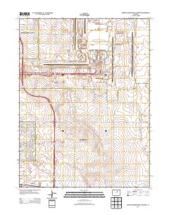
Layered GeoPDF 7.5 Minute Quadrangle Map. Layers of geospatial data include orthoimagery, roads, grids, geographic names, elevation contours, hydrography, and other selected map features.
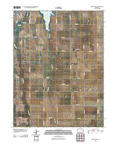
Layered GeoPDF 7.5 Minute Quadrangle Map. Layers of geospatial data include orthoimagery, roads, grids, geographic names, elevation contours, hydrography, and other selected map features.
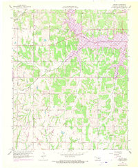
USGS Historical Quadrangle in GeoPDF.
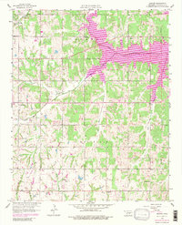
USGS Historical Quadrangle in GeoPDF.
Core Research Center, core W028, from well operated by USGS-NAWQA-SPLTRaw Properties from download, web scrape, MapServer, and Macrostrat API{"Lib Num": "W028", "API Num": null, "Operator": "USGS-NAWQA-SPLT", "Well Name": "AGLUS-2", "Field": null, "State": "CO", "County": "ADAMS", "Type": "FULL", "Photos": "F", "Thin Sec": "F", "Analysis": "T", "Latitude": "39.810778", "Longitude": "-104.431611", "coordinates_geohash": "9xjdrx74x4fv", "Source": "PROVIDED BY DONOR", "Security Flag": "NO SPECIAL RESTRICTIONS", "crc_collection_name": "core", "sb_parent_id": "4f4e49dae4b07f02db5e0486", "intervals": [{"Formation": "DENVER", "Age": "TERT", "Min Depth": "0", "Max Depth": "68"}], "crcwc_url": "https://my.usgs.gov/crcwc/core/report/14463",...
Core Research Center, core W035, from well operated by USGS-NAWQA-SPLTRaw Properties from download, web scrape, MapServer, and Macrostrat API{"Lib Num": "W035", "API Num": null, "Operator": "USGS-NAWQA-SPLT", "Well Name": "AGLUS-11", "Field": null, "State": "CO", "County": "ADAMS", "Type": "FULL", "Photos": "F", "Thin Sec": "F", "Analysis": "T", "Latitude": "39.8315", "Longitude": "-104.412861", "coordinates_geohash": "9xjf850g7czb", "Source": "PROVIDED BY DONOR", "Security Flag": "NO SPECIAL RESTRICTIONS", "crc_collection_name": "core", "sb_parent_id": "4f4e49dae4b07f02db5e0486", "intervals": [{"Formation": "DENVER", "Age": "TERT", "Min Depth": "0", "Max Depth": "77"}], "crcwc_url": "https://my.usgs.gov/crcwc/core/report/14470",...
Categories: Physical Item;
Tags: DENVER,
Gravels and alluviums,
Middle Pleistocene - Late Pleistocene,
TERT,
gravel
Core Research Center, core W038, from well operated by USGS-NAWQA-SPLTRaw Properties from download, web scrape, MapServer, and Macrostrat API{"Lib Num": "W038", "API Num": null, "Operator": "USGS-NAWQA-SPLT", "Well Name": "AGLUS-13", "Field": null, "State": "CO", "County": "ADAMS", "Type": "FULL", "Photos": "F", "Thin Sec": "F", "Analysis": "T", "Latitude": "39.792167", "Longitude": "-104.433444", "coordinates_geohash": "9xjdrecyhms4", "Source": "PROVIDED BY DONOR", "Security Flag": "NO SPECIAL RESTRICTIONS", "crc_collection_name": "core", "sb_parent_id": "4f4e49dae4b07f02db5e0486", "intervals": [{"Formation": "DENVER", "Age": "TERT", "Min Depth": "0", "Max Depth": "81"}], "crcwc_url": "https://my.usgs.gov/crcwc/core/report/14473",...
Categories: Physical Item;
Tags: DENVER,
Gravels and alluviums,
Middle Pleistocene - Late Pleistocene,
TERT,
gravel
This data represents the map extent for current and historical USGS topographic maps for the United States and Territories, including 1 X 2 Degree, 1 X 1 Degree, 30 X 60 Minute, 15 X 15 Minute, 7.5 X 7.5 Minute, and 3.75 X 3.75 Minute. The grid was generated using ESRI ArcInfo GIS software.

The Geographic Names Information System (GNIS) is the Federal standard for geographic nomenclature. The U.S. Geological Survey developed the GNIS for the U.S. Board on Geographic Names, a Federal inter-agency body chartered by public law to maintain uniform feature name usage throughout the Government and to promulgate standard names to the public. The GNIS is the official repository of domestic geographic names data; the official vehicle for geographic names use by all departments of the Federal Government; and the source for applying geographic names to Federal electronic and printed products of all types.
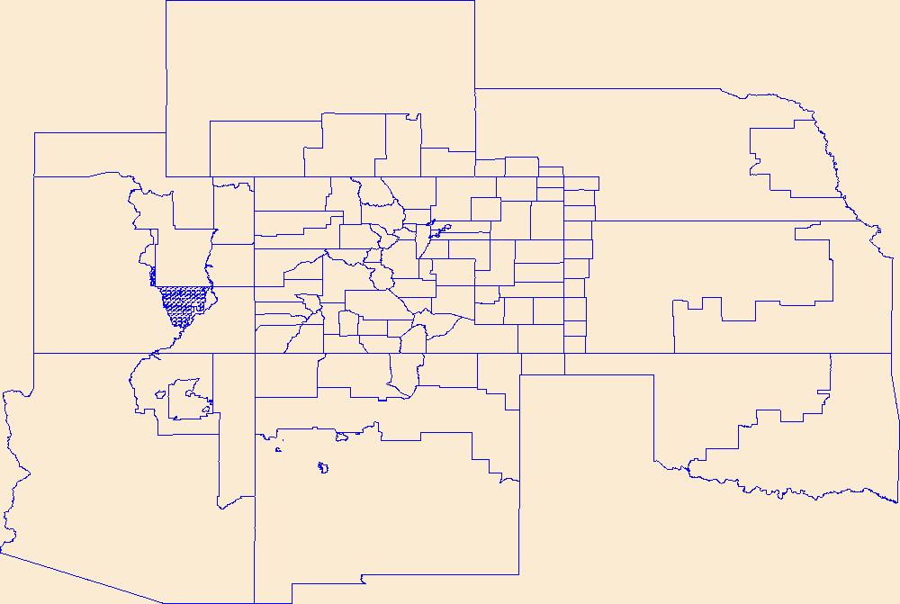
Geospatial data is comprised of government boundaries.
The National Hydrography Dataset (NHD) is a feature-based database that interconnects and uniquely identifies the stream segments or reaches that make up the nation's surface water drainage system. NHD data was originally developed at 1:100,000-scale and exists at that scale for the whole country. This high-resolution NHD, generally developed at 1:24,000/1:12,000 scale, adds detail to the original 1:100,000-scale NHD. (Data for Alaska, Puerto Rico and the Virgin Islands was developed at high-resolution, not 1:100,000 scale.) Local resolution NHD is being developed where partners and data exist. The NHD contains reach codes for networked features, flow direction, names, and centerline representations for areal water...
|

|
