Filters
Date Range
Contacts
Categories
Tag Types
Tag Schemes
|

This Benthic Invertebrate Community Analysis dataset, a conceptual subgroup of the Lake Erie Ecological Investigations (LEEI) dataset, focuses on the benthic invertebrates sampled at Areas of Concern (AOCs) on Lake Erie. Per the Quality Assurance Project Plan (QAPP), the invertebrate samples were taken from sediments remaining from the sediment analysis. Identification of the invertebrates was completed by the same invertebrate taxonomist for both the 1998-2000 evaluation and 1986-87 historical evaluation (Smith et al. 1994) for increased consistency. Oligochaetes were identified to species if possible, chironomids were identified to genus, as adult specimens are needed for specific identification, and other taxa...
Categories: Data;
Tags: AOCs,
Ameiurus nebulosus,
Ashtabula,
Ashtabula River,
Black River, All tags...
Black River,
Buffalo,
Buffalo River,
Cleveland Harbor,
Cleveland Harbor,
Cuyahoga River,
Cuyahoga River,
Detroit,
Detroit River,
Detroit River,
Great Lakes,
Great Lakes,
Great Lakes,
Great Lakes Areas of Concern,
Huron River,
Lake Erie,
Lake Erie,
Lake Erie,
Lake or marine sediment,
Love Canal (historical),
Maumee River,
Michigan,
Michigan,
Mud Brook,
Mud Brook,
New York,
New York,
Niagara River,
Niagara River,
Ohio,
Ohio,
Old River,
Old Woman Creek,
Old Woman Creek,
Ottawa River,
PAHs,
PCBs,
Pennsylvania,
Pennsylvania,
Presque Isle Bay,
Presque Isle Bay,
aquatic ecosystems,
benthos,
benthos,
biomarkers,
biota,
brown bullhead,
contamination and pollution,
datasets,
ecotoxicology,
environment,
field sampling,
fish,
fish,
freshwater ecosystems,
heavy metal pollution,
histology,
industrial pollution,
inlandWaters,
invertebrates,
invertebrates,
liver tumors,
metal elements,
pathology,
pesticide and herbicide contamination,
plant and animal testing,
polyaromatic hydrocarbons,
polychlorinated biphenyls,
population and community ecology,
remediation,
sediment,
sediment analysis,
species diversity,
specimen collecting,
toxic trace element contamination,
water resources, Fewer tags

Zebra and quagga mussel veligers were exposed to eleven distinct cultures (isolates) of cyanobacteria representing Anabaena, Aphanizomenon, Dolichospermum, Microcystis, and Planktothrix species and the cyanotoxin microcystin to determine the lethality of cyanobacteria on dreissenid veligers. Six-day laboratory bioassays were performed in microplates using dreissenid veligers collected from the Detroit River, Michigan, USA. Veligers were exposed to increasing concentrations of cyanobacteria and microcystin using the green algae Chlorella minutissima as a control. Raw data were fit to dose response curves formulated from a Probit model to calculate LC50 values. This data release presents the raw data summarized and...
Categories: Data;
Tags: Aquatic Biology,
Belle Isle,
Detroit,
Detroit River,
Ecology, All tags...
Environmental Health,
Great Lakes,
Michigan,
USGS Science Data Catalog (SDC),
Water Quality,
Water Resources,
aquatic biology,
developmental biology,
environment,
invasive species, Fewer tags
USGS Historical Quadrangle in GeoPDF.
Tags: 7.5 x 7.5 minute,
Detroit,
Downloadable Data,
GeoPDF,
GeoTIFF, All tags...
Historical Topographic Maps,
Historical Topographic Maps 7.5 x 7.5 Minute Map Series,
Map,
OR,
Provisional,
imageryBaseMapsEarthCover, Fewer tags
USGS Historical Quadrangle in GeoPDF.
Tags: 15 x 15 minute,
Detroit,
Downloadable Data,
GeoPDF,
GeoTIFF, All tags...
Historical Topographic Maps,
Historical Topographic Maps 15 x 15 Minute Map Series,
MI,
Map,
imageryBaseMapsEarthCover, Fewer tags
USGS Historical Quadrangle in GeoPDF.
Tags: 15 x 15 minute,
Detroit,
Downloadable Data,
GeoPDF,
GeoTIFF, All tags...
Historical Topographic Maps,
Historical Topographic Maps 15 x 15 Minute Map Series,
MI,
Map,
imageryBaseMapsEarthCover, Fewer tags
USGS Historical Quadrangle in GeoPDF.
Tags: 15 x 15 minute,
Detroit,
Downloadable Data,
GeoPDF,
GeoTIFF, All tags...
Historical Topographic Maps,
Historical Topographic Maps 15 x 15 Minute Map Series,
MI,
Map,
imageryBaseMapsEarthCover, Fewer tags

This Sediment Analysis dataset, a conceptual subgroup of the Lake Erie Ecological Investigations (LEEI) dataset, focuses on the sediments sampled at Areas of Concern (AOCs) on Lake Erie. Per the Quality Assurance Project Plan (QAPP), sediment collections were a composite of at least five randomly selected samples collected from each site. Per an internal summary report, sediment samples were collected using a stainless steel Eckman dredge. Analytical methods and QA/QC were directed by the Patuxent Analytical Control Facility (PACF) of the US Fish and Wildlife Service. Per Dora Passino-Reader, the Geochemical & Environmental Research Group at Texas A&M University, College Station performed the analytical chemistry...
Categories: Data;
Tags: AOCs,
Ameiurus nebulosus,
Ashtabula,
Ashtabula River,
Black River, All tags...
Black River,
Buffalo,
Buffalo River,
Cleveland Harbor,
Cleveland Harbor,
Cuyahoga River,
Cuyahoga River,
Detroit,
Detroit River,
Detroit River,
Great Lakes,
Great Lakes,
Great Lakes,
Great Lakes Areas of Concern,
Huron River,
Lake Erie,
Lake Erie,
Lake Erie,
Lake or marine sediment,
Love Canal (historical),
Maumee River,
Michigan,
Michigan,
Mud Brook,
Mud Brook,
New York,
New York,
Niagara River,
Niagara River,
Ohio,
Ohio,
Old River,
Old Woman Creek,
Old Woman Creek,
Ottawa River,
PAHs,
PCBs,
Pennsylvania,
Pennsylvania,
Presque Isle Bay,
Presque Isle Bay,
aquatic ecosystems,
benthos,
benthos,
biomarkers,
biota,
brown bullhead,
contamination and pollution,
datasets,
ecotoxicology,
environment,
field sampling,
fish,
fish,
freshwater ecosystems,
heavy metal pollution,
histology,
industrial pollution,
inlandWaters,
invertebrates,
invertebrates,
liver tumors,
metal elements,
pathology,
pesticide and herbicide contamination,
plant and animal testing,
polyaromatic hydrocarbons,
polychlorinated biphenyls,
population and community ecology,
remediation,
sediment,
sediment analysis,
species diversity,
specimen collecting,
toxic trace element contamination,
water resources, Fewer tags
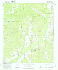
USGS Historical Quadrangle in GeoPDF.
Tags: 7.5 x 7.5 minute,
AL,
Detroit,
Downloadable Data,
GeoPDF, All tags...
GeoTIFF,
Historical Topographic Maps,
Historical Topographic Maps 7.5 x 7.5 Minute Map Series,
Map,
imageryBaseMapsEarthCover, Fewer tags
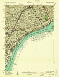
USGS Historical Quadrangle in GeoPDF.
Tags: 7.5 x 7.5 minute,
Detroit,
Downloadable Data,
GeoPDF,
GeoTIFF, All tags...
Historical Topographic Maps,
Historical Topographic Maps 7.5 x 7.5 Minute Map Series,
MI,
Map,
Preliminary,
imageryBaseMapsEarthCover, Fewer tags
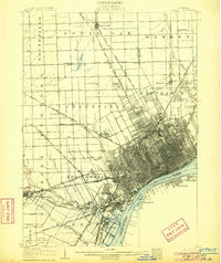
USGS Historical Quadrangle in GeoPDF.
Tags: 15 x 15 minute,
Detroit,
Downloadable Data,
GeoPDF,
GeoTIFF, All tags...
Historical Topographic Maps,
Historical Topographic Maps 15 x 15 Minute Map Series,
MI,
Map,
imageryBaseMapsEarthCover, Fewer tags
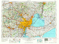
USGS Historical Quadrangle in GeoPDF.
Tags: 1 x 2 degree,
Detroit,
Downloadable Data,
GeoPDF,
GeoTIFF, All tags...
Historical Topographic Maps,
Historical Topographic Maps 1 x 2 Degree Map Series,
MI,
Map,
imageryBaseMapsEarthCover, Fewer tags
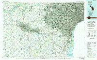
USGS Historical Quadrangle in GeoPDF.
Tags: 30 x 60 minute,
Detroit,
Downloadable Data,
GeoPDF,
GeoTIFF, All tags...
Historical Topographic Maps,
Historical Topographic Maps 30 x 60 Minute Map Series,
MI,
Map,
Planimetric,
imageryBaseMapsEarthCover, Fewer tags
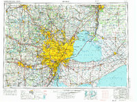
USGS Historical Quadrangle in GeoPDF.
Tags: 1 x 2 degree,
Detroit,
Downloadable Data,
GeoPDF,
GeoTIFF, All tags...
Historical Topographic Maps,
Historical Topographic Maps 1 x 2 Degree Map Series,
MI,
Map,
imageryBaseMapsEarthCover, Fewer tags

The Lake Erie Ecological Investigations (LEEI) dataset, housed at the Great Lakes Science Center (GLSC) was developed during a reevaluation of Lake Erie Areas of Concern (AOCs) from 1998-2000. These AOCs were recognized as such by the International Joint Commission (IJC) of the United States and Canada due to their severe water pollution problems. The dataset includes data from both the 1998-2000 reevaluation as well as data from other historical evaluations from the 1980’s to mid-1990’s for comparison where available. Data Description: Rivers and harbors of the Great Lakes have been impacted for decades by heavy industrialization, densely populated areas, and agriculture resulting in contamination, eutrophication,...
Tags: AOCs,
Ameiurus nebulosus,
Aquatic Biology,
Areas of Concern,
Ashtabula, All tags...
Ashtabula River,
Black River,
Black River,
Buffalo,
Buffalo River,
Cleveland Harbor,
Cleveland Harbor,
Cuyahoga River,
Cuyahoga River,
Detroit,
Detroit River,
Detroit River,
Ecology,
Great Lakes,
Great Lakes,
Great Lakes,
Huron River,
Lake Erie,
Lake Erie,
Lake Erie,
Lake or marine sediment,
Love Canal (historical),
Maumee River,
Michigan,
Michigan,
Mud Brook,
Mud Brook,
New York,
New York,
Niagara River,
Niagara River,
Ohio,
Ohio,
Old River,
Old Woman Creek,
Old Woman Creek,
Ottawa River,
PAHs,
PCBs,
Pennsylvania,
Pennsylvania,
Presque Isle Bay,
Presque Isle Bay,
USGS Science Data Catalog (SDC),
Water Quality,
aquatic ecosystems,
benthos,
benthos,
biomarkers,
biota,
brown bullhead,
contamination and pollution,
datasets,
ecotoxicology,
environment,
field sampling,
fish,
fish,
freshwater ecosystems,
heavy metal pollution,
histology,
industrial pollution,
inlandWaters,
invertebrates,
invertebrates,
liver tumors,
metal elements,
pathology,
pesticide and herbicide contamination,
plant and animal testing,
polyaromatic hydrocarbons,
polychlorinated biphenyls,
population and community ecology,
remediation,
sediment,
sediment analysis,
species diversity,
specimen collecting,
toxic trace element contamination,
water resources, Fewer tags
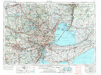
USGS Historical Quadrangle in GeoPDF.
Tags: 1 x 2 degree,
Detroit,
Downloadable Data,
GeoPDF,
GeoTIFF, All tags...
Historical Topographic Maps,
Historical Topographic Maps 1 x 2 Degree Map Series,
MI,
Map,
imageryBaseMapsEarthCover, Fewer tags
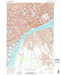
USGS Historical Quadrangle in GeoPDF.
Tags: 7.5 x 7.5 minute,
Detroit,
Downloadable Data,
GeoPDF,
GeoTIFF, All tags...
Historical Topographic Maps,
Historical Topographic Maps 7.5 x 7.5 Minute Map Series,
MI,
Map,
imageryBaseMapsEarthCover, Fewer tags

This Fish Community Analysis dataset, a conceptual subgroup of the Lake Erie Ecological Investigations (LEEI) dataset, focuses on the fish communities sampled at Areas of Concern (AOCs) on Lake Erie. Per the Quality Assurance Project Plan (QAPP), fish were sampled for identification and measurement of length and weight. Identification of fish were done by the same biologists for both the 1998-2000 data and the 1986-87 historical data (Smith et al. 1994). Any fish difficult to identify were preserved in buffered formalin for later identification. If large numbers of a particular species were collected the first thirty fish were measured and weighed; remaining fish were individually measured and group weighed. All...
Categories: Data;
Tags: AOCs,
Ameiurus nebulosus,
Ashtabula,
Ashtabula River,
Black River, All tags...
Black River,
Buffalo,
Buffalo River,
Cleveland Harbor,
Cleveland Harbor,
Cuyahoga River,
Cuyahoga River,
Detroit,
Detroit River,
Detroit River,
Great Lakes,
Great Lakes,
Great Lakes,
Great Lakes Areas of Concern,
Huron River,
Lake Erie,
Lake Erie,
Lake Erie,
Lake or marine sediment,
Love Canal (historical),
Maumee River,
Michigan,
Michigan,
Mud Brook,
Mud Brook,
New York,
New York,
Niagara River,
Niagara River,
Ohio,
Ohio,
Old River,
Old Woman Creek,
Old Woman Creek,
Ottawa River,
PAHs,
PCBs,
Pennsylvania,
Pennsylvania,
Presque Isle Bay,
Presque Isle Bay,
aquatic ecosystems,
benthos,
benthos,
biomarkers,
biota,
brown bullhead,
contamination and pollution,
datasets,
ecotoxicology,
environment,
field sampling,
fish,
fish,
freshwater ecosystems,
heavy metal pollution,
histology,
industrial pollution,
inlandWaters,
invertebrates,
invertebrates,
liver tumors,
metal elements,
pathology,
pesticide and herbicide contamination,
plant and animal testing,
polyaromatic hydrocarbons,
polychlorinated biphenyls,
population and community ecology,
remediation,
sediment,
sediment analysis,
species diversity,
specimen collecting,
toxic trace element contamination,
water resources, Fewer tags
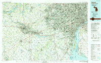
USGS Historical Quadrangle in GeoPDF.
Tags: 30 x 60 minute,
Detroit,
Downloadable Data,
GeoPDF,
GeoTIFF, All tags...
Historical Topographic Maps,
Historical Topographic Maps 30 x 60 Minute Map Series,
MI,
Map,
imageryBaseMapsEarthCover, Fewer tags
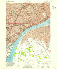
USGS Historical Quadrangle in GeoPDF.
Tags: 7.5 x 7.5 minute,
Detroit,
Downloadable Data,
GeoPDF,
GeoTIFF, All tags...
Historical Topographic Maps,
Historical Topographic Maps 7.5 x 7.5 Minute Map Series,
MI,
Map,
imageryBaseMapsEarthCover, Fewer tags
USGS Historical Quadrangle in GeoPDF.
Tags: 15 x 15 minute,
Detroit,
Downloadable Data,
GeoPDF,
GeoTIFF, All tags...
Historical Topographic Maps,
Historical Topographic Maps 15 x 15 Minute Map Series,
Map,
OR,
imageryBaseMapsEarthCover, Fewer tags
|
|
