Filters: Tags: DRECP (X)
225 results (34ms)|
Filters
Date Range
Types Contacts Tag Types Tag Schemes |

Utility scale renewable energy development projects are currently proposed across the deserts of the Southwestern United States. Agencies that manage biological resources must understand the potential impacts of these projects and infrastructure (e.g., transmission corridors, substations, access roads, etc.) in order to select appropriate development sites and to mitigate for anticipated effects. Of major concern is determining how future development will impact wildlife movement and genetic exchange among core protected areas and whether increased fragmentation will impact species' abilities to adapt to changing environmental conditions. The adaptive and evolutionary potential of a species is ultimately dependent...
CBI's species distribution model for Gila woodpecker (Melanerpes uropygialis) is based on expert knowledge of suitable habitat and species occurances in the DRECP study site. For the Imperial Valley population, the Gila woodpecker model includes 'Southwestern North American riparian evergreen and deciduous woodland' vegetation and areas with sparse to 40% tree canopy cover. For the eastern Gila woodpecker population, the model includes 'Riparian', 'Southwestern North American riparian evergreen and deciduous woodland', 'Southwestern North American introduced riparian scrub', 'Southwestern North American riparian evergreen and deciduous woodland', and 'Sonoran-Coloradan semi-desert wash woodland/scrub', excluding...

Description and data downloaded from DRECP Website: http://www.drecp.org/meetings/2012-07-25-26_workshop/background/Department_of_Defense_Materials/This information and data is provided in support of the Desert Renewable Energy Conservation Plan. Attachment 1 provides a Department of Defense (DoD) comprehensive matrix detailing potential military operational constraints by Development Focus Area. Attachment 2 provides associated conflict maps by renewable energy technology. Regarding the color coding:·        The red areas represent locations where there is a high likelihood of unacceptable risk to national security, and then technology identified might impact military operations, testing and training.Â...

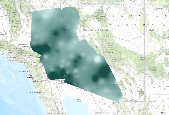
This dataset represents current terrestrial intactness values (estimated at the 1km level) within the modeled distribution of the Munz's cholla (Cylindropuntia munzii). Terrestrial intactness is high in areas where development is low, vegetation intactness is high, and fragmentation is low. Consequently, this dataset serves as a general* indication of habitat quality within the distribution of this conservation element. Estimates of current terrestrial intactness were generated by an EEMS fuzzy logic model that integrates multiple measures of landscape development and vegetation intactness, including agriculture development (from LANDFIRE EVT v1.1), urban development (from LANDFIRE EVT v1.1 and NLCD Impervious Surfaces),...

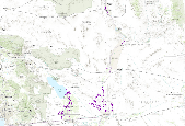
This group layer consists of two datasets which jointly describe Desert bighorn sheep (excluding the Peninsular Bighorn Sheep) habitat within the DRECP study area. Data were provided for upload by Diane Mastalir (California Department of Fish and Wildlife). A summary of each dataset is provided below. Refer to the individual layer descriptions for additional information on each dataset. Desert Bighorn Sheep Mountain Habitat in California This layer is intended to identify historic, current, and potential core habitat for desert bighorn sheep in California. California Desert Bighorn Sheep Intermountain Habitat:Â This layer represents intermountain, lower slope, valley bottom habitat used by desert bighorn...
Tags: desert bighorn sheep,
drecp

These data are statistical model outputs for Mojave tarplant (Deinandra mohavensis ) species distribution, completed by CBI. Predictions of habitat occupancy were generated from Maxent models for the DRECP. This species distribution model was produced at 270 m resolution for two limited extents within the DRECP region separately, north and south. The northern Mojave tarplant distribution model extent was defined as the union of 10km buffer of occurrences and the USDA ecoregion subsections with containing occurrences, with the addition of Kern Plateau, Tehachapi-Piute Mountains, and portions of Lower Batholith. The northern model used with 23 detection points obtained March 2013 from CNDDB (California Department...

California Department of Conservation Division of Oil, Gas, and Geothermal Resources data on Known Geothermal Resource Areas (KGRAs).Please contact Mike Howard at mhoward@dudek.com for more information. Original dataset named:Â Kgra_region.Â

Layer description from Appendix A of the DRECP Baseline Biology Report: Soil texture comes from the USDA National Resources Conservation Service (NRCS) Soil Survey Geographic Database (SSURGO). SSURGO Soils Survey - processed for Depth to Any Soil Restrictive Layer, Depth to Water Table, Drainage Class, Ecological Site Name, Hydric Rating, Map Unit Name, Parent Material Name, Soil Taxonomy and Surface Texture.These data were provided by Dudek, for full metadata please contact them directly.

This dataset represents current terrestrial intactness values (estimated at the 1km level) within the distribution of Mojave and Great Basin Upper Bajada and Toeslope. Terrestrial intactness is high in areas where development is low, vegetation intactness is high, and fragmentation is low. Consequently, this dataset serves as a general* indication of habitat quality within the distribution of this conservation element. Estimates of current terrestrial intactness were generated by an EEMS fuzzy logic model that integrates multiple measures of landscape development and vegetation intactness, including agriculture development (from LANDFIRE EVT v1.1), urban development (from LANDFIRE EVT v1.1 and NLCD Impervious Surfaces),...
This dataset represents current terrestrial intactness values (estimated at the 1km level) within the distribution of California Annual and Perennial Grassland. Terrestrial intactness is high in areas where development is low, vegetation intactness is high, and fragmentation is low. Consequently, this dataset serves as a general* indication of habitat quality within the distribution of this conservation element. Estimates of current terrestrial intactness were generated by an EEMS fuzzy logic model that integrates multiple measures of landscape development and vegetation intactness, including agriculture development (from LANDFIRE EVT v1.1), urban development (from LANDFIRE EVT v1.1 and NLCD Impervious Surfaces),...
This dataset represents current terrestrial intactness values (estimated at the 1km level) within the distribution of Arid West freshwater emergent marsh. Terrestrial intactness is high in areas where development is low, vegetation intactness is high, and fragmentation is low. Consequently, this dataset serves as a general* indication of habitat quality within the distribution of this conservation element. Estimates of current terrestrial intactness were generated by an EEMS fuzzy logic model that integrates multiple measures of landscape development and vegetation intactness, including agriculture development (from LANDFIRE EVT v1.1), urban development (from LANDFIRE EVT v1.1 and NLCD Impervious Surfaces), linear...

This dataset represents current terrestrial intactness values (estimated at the 1km level) within the modeled distribution of the Parish's phacelia (Phacelia parishii).Terrestrial intactness is high in areas where development is low, vegetation intactness is high, and fragmentation is low. Consequently, this dataset serves as a general* indication of habitat quality within the distribution of this conservation element. Estimates of current terrestrial intactness were generated by an EEMS fuzzy logic model that integrates multiple measures of landscape development and vegetation intactness, including agriculture development (from LANDFIRE EVT v1.1), urban development (from LANDFIRE EVT v1.1 and NLCD Impervious Surfaces),...

These data are statistical model outputs for Barstow woolly sunflower (Eriophyllum mohavense) species distribution, completed by Frank Davisâ Biogeography Lab at UC Santa Barbara. The UCSB Biogeography Lab used Maxent to generate predictions of habitat occupancy for ~70 species for the CA Energy Commissionâs project âCumulative Biological Impacts Framework for Solar Energy in the CA Desertâ, 500-10-021. Species distribution models were produced at 270 m resolution using a subset of 22 environmental variables. Models were evaluated with 10-fold cross validated AUC scores. Binary layers depicting predicted suitable habitat were derived using the equal training sensitivity and specificity threshold. For...

These data are statistical model outputs for Swainson's hawk (Buteo swainsoni ) species distribution, completed by Frank Davisâ Biogeography Lab at UC Santa Barbara. Based on examination of species observation data and consultation with biologists, CBI used the model's narrow extent output masked to the following USFS ecoregion subsections: 322Ag, 322Aa, 322Cc. The UCSB Biogeography Lab used Maxent to generate predictions of habitat occupancy for ~70 species for the CA Energy Commissionâs project âCumulative Biological Impacts Framework for Solar Energy in the CA Desertâ, 500-10-021. Species distribution models were produced at 270 m resolution using a subset of 22 environmental variables. Models were...

The dataset represents the work of multiple states and Federal agencies as part of the US Gap Analysis and LandFire programs. Multi-season satellite imagery (Landsat ETM+) from 1999-2001 were used in conjunction with digital elevation model (DEM) derived datasets (e.g. elevation, landform) to model natural and semi-natural vegetation. The minimum mapping unit for this dataset is approximately 1 acre. Landcover classes are drawn from NatureServe's Ecological System concept. Five-hundred and fourty-four land cover classes composed of 12 cultural and 532 Natural/Semi-natural types are described. Land cover classes were mapped with a variety of techniques including decision tree classifiers, terrian modeling, inductive...
Tags: drecp,
vegetation

This dataset contains basemap layers with Dept of Defense lands, Legally and Legislatively protected areas and ACECs.

These data are updated expert model outputs for Mohave tui chub (Siphateles bicolor mohavensis) species distribution for DRECP, completed by Dudek. Documentation from Dudek:A buffer of the known refugia has been applied to approximate suitable habitat for this species since it has been extirpated elsewhere and the refugia are isolated.

CBI's expert model for Palmer's jackass clover (Wislizenia refracta ssp. palmeri) includes areas with "North American warm desert dunes and sand flats" vegetation, sandy soils (porosity of < 0.4), and elevations under 150 meters, in ecoregion subsection 322Bc.

The flat-seeded spurge (Chamaesyce platysperma) CBI expert model includes areas within 1 km of species occurrence points.
Utility scale renewable energy development projects are currently proposed across the deserts of the Southwestern United States. Agencies that manage biological resources must understand the potential impacts of these projects and infrastructure (e.g., transmission corridors, substations, access roads, etc.) in order to select appropriate development sites and to mitigate for anticipated effects. Of major concern is determining how future development will impact wildlife movement and genetic exchange among core protected areas and whether increased fragmentation will impact species' abilities to adapt to changing environmental conditions. The adaptive and evolutionary potential of a species is ultimately dependent...
|

|
