Filters: Tags: Decision Support (X)
613 results (20ms)|
Filters
Date Range
Extensions Types
Contacts
Categories
Tag Types
|

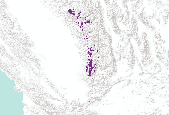
The Nature Conservancy (TNC) has derived climate suitability forecasts for most species of trees and shrubs considered to be ecological dominants of terrestrial Californian habitat types. Our plant projections are compiled as decision support tools to help Conservancy project staff, as well as our external partners, develop the necessary plans, priorities and strategies to successfully adapt to uncertain changes in future climate. In the recently completed Southern Sierra Partnership's 2010 Climate-Adapted Conservation Plan for the Southern Sierra Nevada and Tehachapi Mountains, species and habitat forecasts shown here informed the development of a regional conservation design that explicitly incorporates long-term...

The Nature Conservancy (TNC) has derived climate suitability forecasts for most species of trees and shrubs considered to be ecological dominants of terrestrial Californian habitat types. Our plant projections are compiled as decision support tools to help Conservancy project staff, as well as our external partners, develop the necessary plans, priorities and strategies to successfully adapt to uncertain changes in future climate. In the recently completed Southern Sierra Partnership's 2010 Climate-Adapted Conservation Plan for the Southern Sierra Nevada and Tehachapi Mountains, species and habitat forecasts shown here informed the development of a regional conservation design that explicitly incorporates long-term...

The Nature Conservancy (TNC) has derived climate suitability forecasts for most species of trees and shrubs considered to be ecological dominants of terrestrial Californian habitat types. Our plant projections are compiled as decision support tools to help Conservancy project staff, as well as our external partners, develop the necessary plans, priorities and strategies to successfully adapt to uncertain changes in future climate. In the recently completed Southern Sierra Partnership's 2010 Climate-Adapted Conservation Plan for the Southern Sierra Nevada and Tehachapi Mountains, species and habitat forecasts shown here informed the development of a regional conservation design that explicitly incorporates long-term...

The Nature Conservancy (TNC) has derived climate suitability forecasts for most species of trees and shrubs considered to be ecological dominants of terrestrial Californian habitat types. Our plant projections are compiled as decision support tools to help Conservancy project staff, as well as our external partners, develop the necessary plans, priorities and strategies to successfully adapt to uncertain changes in future climate. In the recently completed Southern Sierra Partnership's 2010 Climate-Adapted Conservation Plan for the Southern Sierra Nevada and Tehachapi Mountains, species and habitat forecasts shown here informed the development of a regional conservation design that explicitly incorporates long-term...

The Nature Conservancy (TNC) has derived climate suitability forecasts for most species of trees and shrubs considered to be ecological dominants of terrestrial Californian habitat types. Our plant projections are compiled as decision support tools to help Conservancy project staff, as well as our external partners, develop the necessary plans, priorities and strategies to successfully adapt to uncertain changes in future climate. In the recently completed Southern Sierra Partnership's 2010 Climate-Adapted Conservation Plan for the Southern Sierra Nevada and Tehachapi Mountains, species and habitat forecasts shown here informed the development of a regional conservation design that explicitly incorporates long-term...
The Nature Conservancy (TNC) has derived climate suitability forecasts for most species of trees and shrubs considered to be ecological dominants of terrestrial Californian habitat types. Our plant projections are compiled as decision support tools to help Conservancy project staff, as well as our external partners, develop the necessary plans, priorities and strategies to successfully adapt to uncertain changes in future climate. In the recently completed Southern Sierra Partnership's 2010 Climate-Adapted Conservation Plan for the Southern Sierra Nevada and Tehachapi Mountains, species and habitat forecasts shown here informed the development of a regional conservation design that explicitly incorporates long-term...

The Nature Conservancy (TNC) has derived climate suitability forecasts for most species of trees and shrubs considered to be ecological dominants of terrestrial Californian habitat types. Our plant projections are compiled as decision support tools to help Conservancy project staff, as well as our external partners, develop the necessary plans, priorities and strategies to successfully adapt to uncertain changes in future climate. In the recently completed Southern Sierra Partnership's 2010 Climate-Adapted Conservation Plan for the Southern Sierra Nevada and Tehachapi Mountains, species and habitat forecasts shown here informed the development of a regional conservation design that explicitly incorporates long-term...

The Nature Conservancy (TNC) has derived climate suitability forecasts for most species of trees and shrubs considered to be ecological dominants of terrestrial Californian habitat types. Our plant projections are compiled as decision support tools to help Conservancy project staff, as well as our external partners, develop the necessary plans, priorities and strategies to successfully adapt to uncertain changes in future climate. In the recently completed Southern Sierra Partnership's 2010 Climate-Adapted Conservation Plan for the Southern Sierra Nevada and Tehachapi Mountains, species and habitat forecasts shown here informed the development of a regional conservation design that explicitly incorporates long-term...

The Nature Conservancy (TNC) has derived climate suitability forecasts for most species of trees and shrubs considered to be ecological dominants of terrestrial Californian habitat types. Our plant projections are compiled as decision support tools to help Conservancy project staff, as well as our external partners, develop the necessary plans, priorities and strategies to successfully adapt to uncertain changes in future climate. In the recently completed Southern Sierra Partnership's 2010 Climate-Adapted Conservation Plan for the Southern Sierra Nevada and Tehachapi Mountains, species and habitat forecasts shown here informed the development of a regional conservation design that explicitly incorporates long-term...

The Nature Conservancy (TNC) has derived climate suitability forecasts for most species of trees and shrubs considered to be ecological dominants of terrestrial Californian habitat types. Our plant projections are compiled as decision support tools to help Conservancy project staff, as well as our external partners, develop the necessary plans, priorities and strategies to successfully adapt to uncertain changes in future climate. In the recently completed Southern Sierra Partnership's 2010 Climate-Adapted Conservation Plan for the Southern Sierra Nevada and Tehachapi Mountains, species and habitat forecasts shown here informed the development of a regional conservation design that explicitly incorporates long-term...
These data were compiled to fit an integrated population model of brown trout in the Glen Canyon Reach of the Colorado River and test different hypotheses regarding the driver of brown trout population dynamics. Also, data were compiled as inputs for a model to simulate population dynamics and species interactions among brown trout, rainbow trout and humpback chub in the Colorado River between Glen Canyon Dam and the confluence of the Colorado River and the Little Colorado River.
The SPARROW Decision Support System (SPARROW DSS) provides access to national, regional, and basin-wide SPARROW models ( Spatially Referenced Regressions On Watershed attributes) for water managers, researchers, and the general public. Models are available for a variety of water-quality constituents and time periods. For each model, users can: Map predictions of long-term average water-quality conditions (loads, yields, concentrations) and source contributions by stream reach and catchment Track transport to downstream receiving waters, such as reservoirs and estuaries Evaluate management source-reduction scenarios Overlay land use, shaded relief, street-level data, states, counties, and hydrologic units. Differences...
This workshop introduced and demonstrated key concepts and a series of software tools, whichallow managers, biologists, and conservationists to efficiently evaluate predictors of wildlife space-use and generate spatial models based on that analysis.Specific content of the workshop: Access to free or low-cost remote sensing information on vegetation, climate, habitat metrics, disturbance, etc., in a useable format, including covariate datasets currently available or under development by the NASA Terrestrial Observation and Prediction System (TOPS) Explanation of how this information is derived, created, integrated, validated and matched with species data sets prior to analysis Demonstration of user-friendly computer...
Categories: Data,
Project;
Types: Map Service,
OGC WFS Layer,
OGC WMS Layer,
OGC WMS Service;
Tags: Academics & scientific researchers,
Alberta,
British Columbia,
CO-2,
CO-3,
Across the Tennessee River Basin is a collaboration within the Appalachian LCC bringing together multiple agencies and stakeholders in a joint effort to plan and deliver landscape conservation actions to protect one of the most diverse areas for aquatic species in North America.The mainstem Tennessee River winds its way for roughly 650 miles through Tennessee, Alabama, Mississippi, back into Tennessee, and finally into Kentucky, where it empties into the Ohio River. Streams from these states, but also North Carolina and Georgia, feed the river along its course. Indeed, the entire basin encompasses over 40,000 square miles. Five major physiographic provinces are represented within the basin: the Blue Ridge, the Valley...
Categories: Data,
Project;
Tags: Applications and Tools,
Aquatic Resources,
Aquatics,
Biological Planning,
Communities of Practice,
Knowing where a species is found or may be found in the future is critical to developing a successful habitat conservation plan. This quick guide reviews correlation-based and process-based species distribution models and their uses in the context of HCPs. It also addresses considerations for evaluating species distribution models, using multiple models, and working with model uncertainty. Examples are provided.
Categories: Data;
Tags: Completed,
Conservation NGOs,
EARTH SCIENCE > LAND SURFACE > LANDSCAPE,
Federal resource managers,
Great Basin,
FY2014There is increasing interest in climate change adaptation, particularly since the release of the Presidents Executive Order on Climate Preparedness in November, 2013, yet many field staff remain uncertain how to put adaptation into practice. Our goal with this project is to bridge the gap between the wealth of high-level climate adaptation guidance and the field staff who carry out specific regulatory processes, specifically Habitat Conservation Plans. Following best practices from the literature on linking science and management, we will begin with a focus on what people do rather than on the climate science. We will map the current HCP development and approval process in Region 8, identify where and how...
Categories: Data,
Project;
Types: Map Service,
OGC WFS Layer,
OGC WMS Layer,
OGC WMS Service;
Tags: Applications and Tools,
Conservation NGOs,
Conservation Planning,
Decision Support,
Federal resource managers,
With HCPs, reserves are created as one means of mitigating take. This means they are designed to provide a target level of benefits for a particular species or set of species. This quick guide reviews approaches for designing and implementing reserves that address climate change impacts, vulnerabilities, and uncertainty. Examples are provided.
Categories: Data;
Tags: Completed,
Conservation NGOs,
EARTH SCIENCE > LAND SURFACE > LANDSCAPE,
Federal resource managers,
Great Basin,
Prioritization for maintenance of intact habitat (i.e., habitat quality rating of Good or Very Good), based on local scale ecological integrity, degree of threats faced, potential conservation opportunities, and conservation value of surrounding landscape. In contrast to ecological integrity ratings; threat, opportunity and landscape rankings are largely based on the range of values of any given indicator across the geography, sorted by quantile. There are some exceptions, particularly for indicators used to develop threat rankings (e.g., urban development risk).Prioritization for restoration of degraded habitat (i.e., habitat quality rating of Fair or Poor), based on local scale ecological integrity, potential...
Purpose of the PA-CAT:To provide information and guidance in support of establishment and management of comprehensive protected areas systems in Puerto Rico and the U.S. Virgin Islands.Role/Tasks:Short-term• Build an open-access national protected areas database consistent with the IUCN classification system applied to Puerto Rico and the US Virgin Islands and determine what lands and marine extents are currently under protection and by what mechanisms.• Develop a conservation strategy that standardizes the language used for discussing protected areas in Puerto Rico, details the existing and potential mechanisms and tactics for protection (i.e., acquisition, easements, land use, donation) based on the database,...
Southern Nevada Water Authority will add new modeling and analytical capabilities to tools developed as part of a previous WaterSMART Climate Analysis Tools Grant that assessed impacts of climate change on water quality and sediment transport in Lake Mead. Project results are intended to increase an understanding of how water quality characteristics and nutrient levels in Lake Mead may be affected by climate change.
Categories: Data,
Project;
Types: Downloadable,
Map Service,
OGC WFS Layer,
OGC WMS Layer,
Shapefile;
Tags: 2014,
AZ-04,
Applications and Tools,
Arizona,
Decision Support,
|

|
