Filters
Date Range
Extensions
Types
Contacts
Categories
Tag Types
Tag Schemes
|
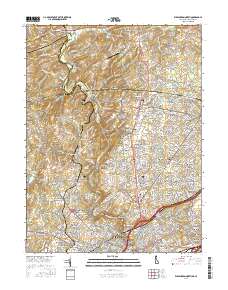
Layered geospatial PDF Map. Layers of geospatial data include orthoimagery, roads, grids, geographic names, elevation contours, hydrography, and other selected map features.
Tags: 7.5 x 7.5 minute,
Chester,
Delaware,
Delaware,
Downloadable Data, All tags...
EarthCover,
GeoPDF,
Imagery and Base Maps,
Map,
New Castle,
Pennsylvania,
Public Land Survey System,
U.S. National Grid,
US,
US Topo,
US Topo Historical,
United States,
Wilmington North, DE-PA,
boundary,
contour,
geographic names,
hydrography,
imageryBaseMapsEarthCover,
orthoimage,
structures,
topographic,
transportation,
woodland, Fewer tags
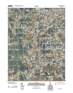
Layered GeoPDF 7.5 Minute Quadrangle Map. Layers of geospatial data include orthoimagery, roads, grids, geographic names, elevation contours, hydrography, and other selected map features.
Tags: 7.5 x 7.5 minute,
Delaware,
Downloadable Data,
EarthCover,
GeoPDF, All tags...
Imagery and Base Maps,
Kent,
Map,
U.S. National Grid,
US,
US Topo,
US Topo Historical,
United States,
Wyoming, DE,
contour,
geographic names,
hydrography,
imageryBaseMapsEarthCover,
orthoimage,
structures,
topographic,
transportation, Fewer tags
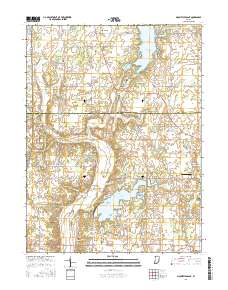
Layered geospatial PDF Map. Layers of geospatial data include orthoimagery, roads, grids, geographic names, elevation contours, hydrography, and other selected map features.
Tags: 7.5 x 7.5 minute,
Delaware,
Downloadable Data,
EarthCover,
GeoPDF, All tags...
Henry,
Imagery and Base Maps,
Indiana,
Map,
Mount Pleasant, IN,
Public Land Survey System,
U.S. National Grid,
US,
US Topo,
US Topo Historical,
United States,
boundary,
contour,
geographic names,
hydrography,
imageryBaseMapsEarthCover,
orthoimage,
structures,
topographic,
transportation,
woodland, Fewer tags
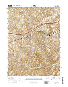
Layered geospatial PDF Map. Layers of geospatial data include orthoimagery, roads, grids, geographic names, elevation contours, hydrography, and other selected map features.
Tags: 7.5 x 7.5 minute,
Chester,
Delaware,
Downloadable Data,
EarthCover, All tags...
GeoPDF,
Imagery and Base Maps,
Map,
New Castle,
Pennsylvania,
Public Land Survey System,
U.S. National Grid,
US,
US Topo,
US Topo Historical,
United States,
West Grove, PA-DE,
boundary,
contour,
geographic names,
hydrography,
imageryBaseMapsEarthCover,
orthoimage,
structures,
topographic,
transportation,
woodland, Fewer tags
Layered GeoPDF 7.5 Minute Quadrangle Map. Layers of geospatial data include orthoimagery, roads, grids, geographic names, elevation contours, hydrography, and other selected map features.
Tags: 7.5 x 7.5 minute,
Delaware,
Downloadable Data,
EarthCover,
Farmland, IN, All tags...
GeoPDF,
Imagery and Base Maps,
Indiana,
Map,
Randolph,
U.S. National Grid,
US,
US Topo,
US Topo Historical,
United States,
contour,
geographic names,
hydrography,
orthoimage,
topographic,
transportation, Fewer tags
Layered GeoPDF 7.5 Minute Quadrangle Map. Layers of geospatial data include orthoimagery, roads, grids, geographic names, elevation contours, hydrography, and other selected map features.
Tags: 7.5 x 7.5 minute,
Delaware,
Downloadable Data,
EarthCover,
GeoPDF, All tags...
Gilman, IN,
Imagery and Base Maps,
Indiana,
Madison,
Map,
U.S. National Grid,
US,
US Topo,
US Topo Historical,
United States,
contour,
geographic names,
hydrography,
orthoimage,
topographic,
transportation, Fewer tags

Near-surface site characteristics are critical for accurately modeling ground motion, which in turn influences seismic hazard analysis and design of critical infrastructure. Currently, there are many strong motion accelerometers within the Advanced National Seismic System (ANSS) that are missing this information. We use a Geographic Information Systems (GIS) based framework to intersect the site coordinates of approximately 5,500 ANSS accelerometers located throughout the United States and its territories with geology and velocity information. We consider: (1) surficial geology from digitized geologic maps (Horton, 2017; Wilson et al., 2015; Sherrod et al., 2007; Bawiec, 1999; Saucedo, 2005; Bedrossian et al., 2012;...
Categories: Data;
Types: Map Service,
OGC WFS Layer,
OGC WMS Layer,
OGC WMS Service;
Tags: ANSS,
Alabama,
American Samoa,
Arizona,
Arkansas, All tags...
California,
Colorado,
Connecticut,
Delaware,
Florida,
Geography,
Geophysics,
Georgia,
Guam,
Idaho,
Illinois,
Indiana,
Information Sciences,
Iowa,
Kansas,
Kentucky,
Louisiana,
Maine,
Maryland,
Massachusetts,
Michigan,
Minnesota,
Mississippi,
Missouri,
Montana,
Nebraska,
Nevada,
New Hampshire,
New Jersey,
New Mexico,
New York,
North Carolina,
North Dakota,
Ohio,
Oklahoma,
Oregon,
Pennsylvania,
Puerto Rico,
Remote Sensing,
Rhode Island,
Seismic site characteristics,
Seismology,
Soil Sciences,
South Carolina,
South Dakota,
Strong Motion,
Structural Geology,
Tennesee,
Texas,
USGS Science Data Catalog (SDC),
United States,
Utah,
Vermont,
Virginia,
Vs30,
Washington,
West Virginia,
Wisconsin,
Wyoming,
earthquake seismology,
seismic stations,
vs30 measurements,
vs30 proxy, Fewer tags
Geospatial data includes structures and other selected map features.
Tags: Campground,
College / University,
Courthouse,
DE,
Delaware, All tags...
Downloadable Data,
Esri File GeoDatabase 10,
FileGDB,
Fire Station/ EMS Station,
Hospital/Medical Center,
Information Center,
Kent,
Law Enforcement,
National Structures Dataset (NSD),
National Structures Dataset (NSD),
New Castle,
Post Office,
Prison/ Correctional Facility,
School,
School:Elementary,
School:High School,
School:Middle School,
State,
State,
State Capitol,
Structures,
Sussex,
Technical School,
Town Hall,
Trade School,
Trailhead,
US,
United States,
Visitor Center,
structure, Fewer tags
Geospatial data includes structures and other selected map features.
Tags: Adair,
Alfalfa,
Atoka,
Beaver,
Beckham, All tags...
Blaine,
Bryan,
Caddo,
Campground,
Canadian,
Carter,
Cherokee,
Choctaw,
Cimarron,
Cleveland,
Coal,
College / University,
Comanche,
Cotton,
Courthouse,
Craig,
Creek,
Custer,
Delaware,
Dewey,
Downloadable Data,
Ellis,
Esri Shapefile nan,
Fire Station/ EMS Station,
Garfield,
Garvin,
Grady,
Grant,
Greer,
Harmon,
Harper,
Haskell,
Hospital/Medical Center,
Hughes,
Information Center,
Jackson,
Jefferson,
Johnston,
Kay,
Kingfisher,
Kiowa,
Latimer,
Law Enforcement,
Le Flore,
Lincoln,
Logan,
Love,
Major,
Marshall,
Mayes,
McClain,
McCurtain,
McIntosh,
Murray,
Muskogee,
National Structures Dataset (NSD),
National Structures Dataset (NSD),
Noble,
Nowata,
OK,
Okfuskee,
Oklahoma,
Oklahoma,
Okmulgee,
Osage,
Ottawa,
Pawnee,
Payne,
Pittsburg,
Pontotoc,
Post Office,
Pottawatomie,
Prison/ Correctional Facility,
Pushmataha,
Roger Mills,
Rogers,
School,
School:Elementary,
School:High School,
School:Middle School,
Seminole,
Sequoyah,
Shapefile,
State,
State,
State Capitol,
Stephens,
Structures,
Technical School,
Texas,
Tillman,
Town Hall,
Trade School,
Trailhead,
Tulsa,
US,
United States,
Visitor Center,
Wagoner,
Washington,
Washita,
Woods,
Woodward,
structure, Fewer tags

Geospatial data is comprised of government boundaries.
Types: Citation;
Tags: Adams,
Allen,
Bartholomew,
Benton,
Blackford, All tags...
Boone,
Boundaries,
Brown,
Carroll,
Cass,
Clark,
Clay,
Clinton,
County or Equivalent,
Crawford,
Daviess,
DeKalb,
Dearborn,
Decatur,
Delaware,
Downloadable Data,
Dubois,
Elkhart,
Esri File GeoDatabase 10,
Fayette,
FileGDB,
Floyd,
Fountain,
Franklin,
Fulton,
Gibson,
Grant,
Greene,
Hamilton,
Hancock,
Harrison,
Hendricks,
Henry,
Howard,
Huntington,
IN,
Incorporated Place,
Indiana,
Jackson,
Jasper,
Jay,
Jefferson,
Jennings,
Johnson,
Jurisdictional,
Knox,
Kosciusko,
LaGrange,
LaPorte,
Lake,
Lawrence,
Madison,
Marion,
Marshall,
Martin,
Miami,
Minor Civil Division,
Monroe,
Montgomery,
Morgan,
National Boundary Dataset (NBD),
National Boundary Dataset (NBD),
Native American Area,
Newton,
Noble,
Ohio,
Orange,
Owen,
PLSS First Division,
PLSS Special Survey,
PLSS Township,
Parke,
Perry,
Pike,
Porter,
Posey,
Public Land Survey System,
Pulaski,
Putnam,
Randolph,
Reserve,
Ripley,
Rush,
Scott,
Shelby,
Spencer,
St. Joseph,
Starke,
State,
State,
State or Territory,
Steuben,
Sullivan,
Switzerland,
Tippecanoe,
Tipton,
U.S. National Grid,
US,
Unincorporated Place,
Union,
United States,
Vanderburgh,
Vermillion,
Vigo,
Wabash,
Warren,
Warrick,
Washington,
Wayne,
Wells,
White,
Whitley,
boundaries,
boundary,
cadastral surveys,
geographic names,
land ownership,
land use maps,
legal land descriptions,
political and administrative boundaries,
zoning maps, Fewer tags

Geospatial data is comprised of government boundaries.
Types: Citation;
Tags: Adams,
Allen,
Ashland,
Ashtabula,
Athens, All tags...
Auglaize,
Belmont,
Boundaries,
Brown,
Butler,
Carroll,
Champaign,
Clark,
Clermont,
Clinton,
Columbiana,
Coshocton,
County or Equivalent,
Crawford,
Cuyahoga,
Darke,
Defiance,
Delaware,
Downloadable Data,
Erie,
Esri File GeoDatabase 10,
Fairfield,
Fayette,
FileGDB,
Franklin,
Fulton,
Gallia,
Geauga,
Greene,
Guernsey,
Hamilton,
Hancock,
Hardin,
Harrison,
Henry,
Highland,
Hocking,
Holmes,
Huron,
Incorporated Place,
Jackson,
Jefferson,
Jurisdictional,
Knox,
Lake,
Lawrence,
Licking,
Logan,
Lorain,
Lucas,
Madison,
Mahoning,
Marion,
Medina,
Meigs,
Mercer,
Miami,
Minor Civil Division,
Monroe,
Montgomery,
Morgan,
Morrow,
Muskingum,
National Boundary Dataset (NBD),
National Boundary Dataset (NBD),
Native American Area,
Noble,
OH,
Ohio,
Ottawa,
PLSS First Division,
PLSS Special Survey,
PLSS Township,
Paulding,
Perry,
Pickaway,
Pike,
Portage,
Preble,
Public Land Survey System,
Putnam,
Reserve,
Richland,
Ross,
Sandusky,
Scioto,
Seneca,
Shelby,
Stark,
State,
State,
State or Territory,
Summit,
Trumbull,
Tuscarawas,
U.S. National Grid,
US,
Unincorporated Place,
Union,
United States,
Van Wert,
Vinton,
Warren,
Washington,
Wayne,
Williams,
Wood,
Wyandot,
boundaries,
boundary,
cadastral surveys,
geographic names,
land ownership,
land use maps,
legal land descriptions,
political and administrative boundaries,
zoning maps, Fewer tags

Geospatial data is comprised of government boundaries.
Types: Citation;
Tags: Adair,
Alfalfa,
Atoka,
Beaver,
Beckham, All tags...
Blaine,
Boundaries,
Bryan,
Caddo,
Canadian,
Carter,
Cherokee,
Choctaw,
Cimarron,
Cleveland,
Coal,
Comanche,
Cotton,
County or Equivalent,
Craig,
Creek,
Custer,
Delaware,
Dewey,
Downloadable Data,
Ellis,
Esri File GeoDatabase 10,
FileGDB,
Garfield,
Garvin,
Grady,
Grant,
Greer,
Harmon,
Harper,
Haskell,
Hughes,
Incorporated Place,
Jackson,
Jefferson,
Johnston,
Jurisdictional,
Kay,
Kingfisher,
Kiowa,
Latimer,
Le Flore,
Lincoln,
Logan,
Love,
Major,
Marshall,
Mayes,
McClain,
McCurtain,
McIntosh,
Minor Civil Division,
Murray,
Muskogee,
National Boundary Dataset (NBD),
National Boundary Dataset (NBD),
Native American Area,
Noble,
Nowata,
OK,
Okfuskee,
Oklahoma,
Oklahoma,
Okmulgee,
Osage,
Ottawa,
PLSS First Division,
PLSS Special Survey,
PLSS Township,
Pawnee,
Payne,
Pittsburg,
Pontotoc,
Pottawatomie,
Public Land Survey System,
Pushmataha,
Reserve,
Roger Mills,
Rogers,
Seminole,
Sequoyah,
State,
State,
State or Territory,
Stephens,
Texas,
Tillman,
Tulsa,
U.S. National Grid,
US,
Unincorporated Place,
United States,
Wagoner,
Washington,
Washita,
Woods,
Woodward,
boundaries,
boundary,
cadastral surveys,
geographic names,
land ownership,
land use maps,
legal land descriptions,
political and administrative boundaries,
zoning maps, Fewer tags

Geospatial data is comprised of government boundaries.
Types: Citation;
Tags: Albany,
Allegany,
Boundaries,
Bronx,
Broome, All tags...
Cattaraugus,
Cayuga,
Chautauqua,
Chemung,
Chenango,
Clinton,
Columbia,
Cortland,
County or Equivalent,
Delaware,
Downloadable Data,
Dutchess,
Erie,
Esri File GeoDatabase 10,
Essex,
FileGDB,
Franklin,
Fulton,
Genesee,
Greene,
Hamilton,
Herkimer,
Incorporated Place,
Jefferson,
Jurisdictional,
Kings,
Lewis,
Livingston,
Madison,
Minor Civil Division,
Monroe,
Montgomery,
NY,
Nassau,
National Boundary Dataset (NBD),
National Boundary Dataset (NBD),
Native American Area,
New York,
New York,
Niagara,
Oneida,
Onondaga,
Ontario,
Orange,
Orleans,
Oswego,
Otsego,
PLSS First Division,
PLSS Special Survey,
PLSS Township,
Public Land Survey System,
Putnam,
Queens,
Rensselaer,
Reserve,
Richmond,
Rockland,
Saratoga,
Schenectady,
Schoharie,
Schuyler,
Seneca,
St. Lawrence,
State,
State,
State or Territory,
Steuben,
Suffolk,
Sullivan,
Tioga,
Tompkins,
U.S. National Grid,
US,
Ulster,
Unincorporated Place,
United States,
Warren,
Washington,
Wayne,
Westchester,
Wyoming,
Yates,
boundaries,
boundary,
cadastral surveys,
geographic names,
land ownership,
land use maps,
legal land descriptions,
political and administrative boundaries,
zoning maps, Fewer tags

Coastal communities are uniquely vulnerable to sea-level rise (SLR) and severe storms such as hurricanes. These events enhance the dispersion and concentration of natural and anthropogenic chemicals and pathogenic microorganisms that could adversely affect the health and resilience of coastal communities and ecosystems in coming years. The U.S. Geological Survey has developed the Sediment-Bound Contaminant Resiliency and Response (SCoRR) strategy to define baseline and post-event sediment-bound environmental health (EH) stressors. These data document toxicity measured by reduction of the light emission of Aliivibrio (formerly Photobacterium) fischeri and the inhibition of polymerase chain reactions caused by environmental...
Categories: Data;
Tags: Connecticut,
Delaware,
District of Columbia,
Maine,
Maryland, All tags...
Massachusetts,
Microtox 81.9% screening,
New Hampshire,
New Jersey,
New York,
PCR,
Pennsylvania,
Rhode Island,
South Carolina,
USGS Science Data Catalog (SDC),
Virginia,
chemical analysis,
contamination and pollution,
environmental health,
field monitoring stations,
field sampling,
matrix inhibition,
sediment analysis, Fewer tags

This dataset contains four tables: (1) site, regression and weighted peak flow estimates (peak_flow_estimates.csv) (2) site, regression and weighted low flow estimates (low_flow_estimates.csv) (3) basin characteristics for peak flow sites (peak_basin_stats.csv) (4) basin characteristics for low flow sites (low_basin_stats.csv). These tables support the USGS report "Magnitude and Frequency of Peak Flows and Low Flows on Nontidal Streams in Delaware."
Categories: Data;
Tags: Delaware,
Maryland,
New Jersey,
Pennsylvania,
USGS Science Data Catalog (SDC), All tags...
Water Resources,
biota,
low flow,
peak flow,
surface water (non-marine), Fewer tags
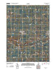
Layered geospatial PDF 7.5 Minute Quadrangle Map. Layers of geospatial data include orthoimagery, roads, grids, geographic names, elevation contours, hydrography, and other selected map features. This map is derived from GIS (geospatial information system) data. It represents a repackaging of GIS data in traditional map form, not creation of new information. The geospatial data in this map are from selected National Map data holdings and other government sources.
Tags: 7.5 x 7.5 minute,
Delaware,
Downloadable Data,
EarthCover,
Geospatial PDF, All tags...
Imagery and Base Maps,
Kent County,
Map,
New Castle County,
Public Land Survey System,
U.S. National Grid,
US,
US Topo,
US Topo Current,
boundary,
contour,
geographic names,
hydrography,
imageryBaseMapsEarthCover,
orthoimage,
structures,
topographic,
transportation,
woodland, Fewer tags
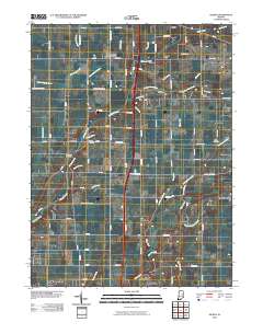
Layered geospatial PDF 7.5 Minute Quadrangle Map. Layers of geospatial data include orthoimagery, roads, grids, geographic names, elevation contours, hydrography, and other selected map features. This map is derived from GIS (geospatial information system) data. It represents a repackaging of GIS data in traditional map form, not creation of new information. The geospatial data in this map are from selected National Map data holdings and other government sources.
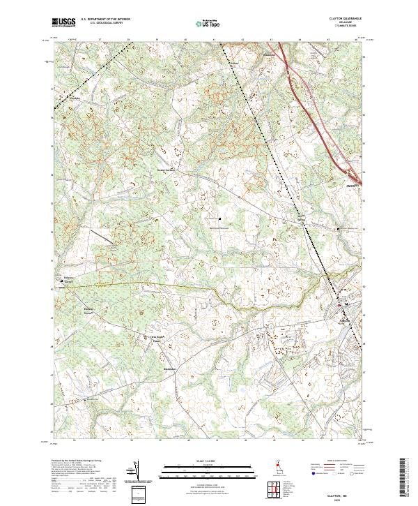
Tags: 7.5 x 7.5 minute,
Clayton, DE,
Delaware,
Downloadable Data,
EarthCover, All tags...
Geospatial PDF,
Imagery and Base Maps,
Kent County,
Map,
New Castle County,
Public Land Survey System,
U.S. National Grid,
US,
US Topo,
US Topo Historical,
boundary,
contour,
geographic names,
hydrography,
imageryBaseMapsEarthCover,
orthoimage,
structures,
topographic,
transportation,
woodland, Fewer tags

The Geographic Names Information System (GNIS) is the Federal standard for geographic nomenclature. The U.S. Geological Survey developed the GNIS for the U.S. Board on Geographic Names, a Federal inter-agency body chartered by public law to maintain uniform feature name usage throughout the Government and to promulgate standard names to the public. The GNIS is the official repository of domestic geographic names data; the official vehicle for geographic names use by all departments of the Federal Government; and the source for applying geographic names to Federal electronic and printed products of all types.
Tags: AK,
AL,
AR,
AS,
AZ, All tags...
Alabama,
Alaska,
American Samoa,
Antarctica,
Antarctica,
Arizona,
Arkansas,
BGN,
Board on Geographic Names,
Borough,
CA,
CO,
CT,
California,
Census Area,
Colorado,
Commonwealth,
Connecticut,
County,
DC,
DE,
Delaware,
District,
District of Columbia,
Downloadable Data,
Esri File GeoDatabase 10,
FL,
Feature class,
Feature coordinates,
Feature county,
Feature description,
Feature designation,
Feature history,
Feature indentification,
Feature name,
Feature state,
FileGDB,
Florida,
GA,
GNIS,
GU,
Geographic Names,
Geographic Names Full Model,
Geographic Names Information System,
Geographic feature,
Geographic name,
Geographical feature,
Geographical name,
Georgia,
Guam,
HI,
Hawaii,
IA,
ID,
IL,
IN,
Idaho,
Illinois,
Indiana,
Iowa,
KS,
KY,
Kansas,
Kentucky,
LA,
Louisiana,
MA,
MD,
ME,
MI,
MN,
MO,
MP,
MS,
MT,
Maine,
Maryland,
Massachusetts,
Michigan,
Minnesota,
Mississippi,
Missouri,
Montana,
Municipio,
NC,
ND,
NE,
NH,
NJ,
NM,
NV,
NY,
National,
National,
National Geographic Names Information System (GNIS),
National Geographic Names Information System (GNIS),
Nebraska,
Nevada,
New Hampshire,
New Jersey,
New Mexico,
New York,
North Carolina,
North Dakota,
Northern Mariana Islands,
OH,
OK,
OR,
Official feature name,
Ohio,
Oklahoma,
Oregon,
Outlying Area,
PA,
PR,
Parish,
Pennsylvania,
Place name,
Populated Place,
Puerto Rico,
RI,
Rhode Island,
SC,
SD,
South Carolina,
South Dakota,
TN,
TX,
Tennessee,
Territories,
Territory,
Texas,
Topographic Map,
U.S. Board on Geographic Names,
U.S. Geological Survey,
US,
USA,
USBGN,
USGS,
UT,
United States,
United States,
United States,
Utah,
VA,
VI,
VT,
Variant name,
Vermont,
Virgin Islands,
Virginia,
WA,
WI,
WV,
WY,
Washington,
West Virginia,
Wisconsin,
Wyoming,
antarctic,
database,
economy,
environment,
feature,
gazetteer,
geographic,
geographic names,
geographical,
geography,
geospatial,
imageryBaseMapsEarthCover,
inlandWaters,
location,
map,
name,
place,
placename,
society,
structure,
topographic map,
toponymy, Fewer tags

The Geographic Names Information System (GNIS) is the Federal standard for geographic nomenclature. The U.S. Geological Survey developed the GNIS for the U.S. Board on Geographic Names, a Federal inter-agency body chartered by public law to maintain uniform feature name usage throughout the Government and to promulgate standard names to the public. The GNIS is the official repository of domestic geographic names data; the official vehicle for geographic names use by all departments of the Federal Government; and the source for applying geographic names to Federal electronic and printed products of all types.
Tags: Adams,
Allegheny,
Antarctica,
Antarctica,
Armstrong, All tags...
BGN,
Beaver,
Bedford,
Berks,
Blair,
Board on Geographic Names,
Borough,
Bradford,
Bucks,
Butler,
Cambria,
Cameron,
Carbon,
Census Area,
Centre,
Chester,
Clarion,
Clearfield,
Clinton,
Columbia,
Commonwealth,
County,
Crawford,
Cumberland,
Dauphin,
Delaware,
District,
Downloadable Data,
Elk,
Erie,
Fayette,
Feature class,
Feature coordinates,
Feature county,
Feature description,
Feature designation,
Feature history,
Feature indentification,
Feature name,
Feature state,
Forest,
Franklin,
Fulton,
GNIS,
Geographic Names,
Geographic Names Federal Codes,
Geographic Names Information System,
Geographic feature,
Geographic name,
Geographical feature,
Geographical name,
Greene,
Huntingdon,
Indiana,
Jefferson,
Juniata,
Lackawanna,
Lancaster,
Lawrence,
Lebanon,
Lehigh,
Luzerne,
Lycoming,
McKean,
Mercer,
Mifflin,
Monroe,
Montgomery,
Montour,
Municipio,
National Geographic Names Information System (GNIS),
National Geographic Names Information System (GNIS),
Northampton,
Northumberland,
Official feature name,
Outlying Area,
PA,
Parish,
Pennsylvania,
Perry,
Philadelphia,
Pike,
Place name,
Populated Place,
Potter,
Schuylkill,
Snyder,
Somerset,
State,
Sullivan,
Susquehanna,
TXT (pipes),
Territories,
Territory,
Tioga,
Topographic Map,
U.S. Board on Geographic Names,
U.S. Geological Survey,
US,
USA,
USBGN,
USGS,
UTF-8 Pipe Delimited Text File nan,
Union,
United States,
United States,
United States,
Variant name,
Venango,
Warren,
Washington,
Wayne,
Westmoreland,
Wyoming,
York,
antarctic,
database,
economy,
environment,
feature,
gazetteer,
geographic,
geographic names,
geographical,
geography,
geospatial,
imageryBaseMapsEarthCover,
inlandWaters,
location,
map,
name,
place,
placename,
society,
structure,
topographic map,
toponymy, Fewer tags
The Geographic Names Information System (GNIS) is the Federal standard for geographic nomenclature. The U.S. Geological Survey developed the GNIS for the U.S. Board on Geographic Names, a Federal inter-agency body chartered by public law to maintain uniform feature name usage throughout the Government and to promulgate standard names to the public. The GNIS is the official repository of domestic geographic names data; the official vehicle for geographic names use by all departments of the Federal Government; and the source for applying geographic names to Federal electronic and printed products of all types.
Tags: Antarctica,
Antarctica,
BGN,
Board on Geographic Names,
Borough, All tags...
Census Area,
Commonwealth,
County,
DE,
Delaware,
District,
Downloadable Data,
Feature class,
Feature coordinates,
Feature county,
Feature description,
Feature designation,
Feature history,
Feature indentification,
Feature name,
Feature state,
GNIS,
GeoPackage,
Geographic Names,
Geographic Names Full Model,
Geographic Names Information System,
Geographic feature,
Geographic name,
Geographical feature,
Geographical name,
Kent,
Municipio,
National Geographic Names Information System (GNIS),
National Geographic Names Information System (GNIS),
New Castle,
Official feature name,
Open Geospatial Consortium GeoPackage 1.2,
Outlying Area,
Parish,
Place name,
Populated Place,
State,
Sussex,
Territories,
Territory,
Topographic Map,
U.S. Board on Geographic Names,
U.S. Geological Survey,
US,
USA,
USBGN,
USGS,
United States,
United States,
United States,
Variant name,
antarctic,
database,
economy,
environment,
feature,
gazetteer,
geographic,
geographic names,
geographical,
geography,
geospatial,
imageryBaseMapsEarthCover,
inlandWaters,
location,
map,
name,
place,
placename,
society,
structure,
topographic map,
toponymy, Fewer tags
|
|

