Filters: Tags: Desert (X)
147 results (12ms)|
Filters
Date Range
Extensions
Types Contacts
Categories Tag Types
|
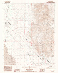
USGS Historical Quadrangle in GeoPDF.
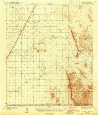
USGS Historical Quadrangle in GeoPDF.
The GAP National Terrestrial Ecosystems - Ver 3.0 is a 2011 update of the National Gap Analysis Project Land Cover Data - Version 2.2 for the conterminous U.S. The GAP National Terrestrial Ecosystems - Version 3.0 represents a highly thematically detailed land cover map of the U.S. The map legend includes types described by NatureServe's Ecological Systems Classification (Comer et al. 2002) as well as land use classes described in the National Land Cover Dataset 2011 (Homer et al. 2015). These data cover the entire continental U.S. and are a continuous data layer. These raster data have a 30 m x 30 m cell resolution. GAP used the best information available to create the land cover data; however GAP seeks to improve...
Categories: Data;
Types: Map Service,
OGC WMS Layer;
Tags: Alabama,
Alaska,
Appalachian,
Arizona,
Arkansas,
The RCMAP (Rangeland Condition Monitoring Assessment and Projection) dataset quantifies the percent cover of rangeland components across western North America using Landsat imagery from 1985-2023. The RCMAP product suite consists of ten fractional components: annual herbaceous, bare ground, herbaceous, litter, non-sagebrush shrub, perennial herbaceous, sagebrush, shrub, tree, and shrub height in addition to the temporal trends of each component. Several enhancements were made to the RCMAP process relative to prior generations. First, high-resolution training was revised using an improved neural-net classifier and modelling approach. These data serve as foundation to the RCMAP approach. The training database was...
The RCMAP (Rangeland Condition Monitoring Assessment and Projection) dataset quantifies the percent cover of rangeland components across western North America using Landsat imagery from 1985-2023. The RCMAP product suite consists of ten fractional components: annual herbaceous, bare ground, herbaceous, litter, non-sagebrush shrub, perennial herbaceous, sagebrush, shrub, tree, and shrub height in addition to the temporal trends of each component. Several enhancements were made to the RCMAP process relative to prior generations. First, high-resolution training was revised using an improved neural-net classifier and modelling approach. These data serve as foundation to the RCMAP approach. The training database was...
FY2017There is an increasing concern and need for the conservation of springsnails and other endemic mollusks and for conservation of the unique spring and springbrook habitats on which they depend (Hershler et al 2014; Abele 2011). Nationwide, several of these species have been listed as endangered or threatened under provisions of the ESA; others are candidates for federal listing or are undergoing review by USFWS for possible future listing actions. These species can be particularly susceptible to localized threats and specific knowledge necessary for effective site-based conservation is often limited or lacking.Springsnail are particularly susceptible to extinction because the entire population of any single...
Categories: Data,
Project;
Types: Map Service,
OGC WFS Layer,
OGC WMS Layer,
OGC WMS Service;
Tags: Academics & scientific researchers,
California,
Climate Change,
Conservation Design,
Conservation Planning,
A Comprehensive Conservation Plan (CCP) provides management direction for a refuge for 15 years. With input for the public, the Service forms a vision of a refuge's desired conditions and the actions needed to achieve it. A refuge's vision may include improved habitat conditions and expanded public use programs that are compatible with resource conservation.
Types: Map Service,
OGC WFS Layer,
OGC WMS Layer,
OGC WMS Service;
Tags: California,
Nevada,
bird,
desert,
invasive,
Studies to understand, measure, and predict changes in physical and ecological landscapes and how these changes influence landscape stability, ecosystem dynamics, and human communities of American drylands.
Many soils in southeastern Utah are protected from surface disturbance by biological soil crusts that stabilize soils and reduce erosion by wind and water. When these crusts are disturbed by land use, soils become susceptible to erosion. In this study, we compare a never-grazed grassland in Canyonlands National Park with two historically grazed sites with similar geologic, geomorphic, and geochemical characteristics that were grazed from the late 1800s until 1974. We show that, despite almost 30 years without livestock grazing, surface soils in the historically grazed sites have 38-43% less silt, as well as 14-51% less total elemental soil Mg, Na, P, and Mn content relative to soils never exposed to livestock disturbances....
Categories: Publication;
Types: Citation,
Journal Citation;
Tags: Ecological Applications,
Utah,
arid,
desert,
erosion,
Microbial activity in semiarid and arid environments is closely related to the timing, intensity, and amount of precipitation. The characteristics of the soil surface, especially the influence of biological soil crusts, can determine the amount, location, and timing of water infiltration into desert soils, which, in turn, determines the type and size of microbial response. Nutrients resulting from this pulse then create a positive feedback as increases in microbial and plant biomass enhance future resource capture or, alternatively, may be lost to the atmosphere, deeper soils, or downslope patches. When rainfall intensity overwhelms the water infiltration capacity of the plant interspace or the plant patch, overland...
Categories: Publication;
Types: Citation,
Journal Citation;
Tags: Ecology,
activity pulse,
biological soil crusts,
desert,
infiltration,
Fire risk in deserts is increased by high production of annual forbs and invasive grasses that create a continuous fine fuel bed in the interspaces between shrubs. Interspace production is influenced by water, nitrogen (N) availability, and soil texture, and in some areas N availability is increasing due to anthropogenic N deposition. The DayCent model was used to investigate how production of herbaceous annuals changes along gradients of precipitation, N availability, and soil texture, and to develop risk-based critical N loads. DayCent was parameterized for two vegetation types within Joshua Tree National Park, California, USA: creosote bush (CB) and pi�on?juniper (PJ). The model was successfully calibrated in...
Categories: Publication;
Types: Citation,
Journal Citation;
Tags: Bromus,
California,
Century,
Ecological Applications,
Ecological Society of America,
Woody plant encroachment and overall declines in perennial vegetation in dryland regions can alter ecosystem properties and indicate land degradation, but the causes of these shifts remain controversial. Determining how changes in the abundance and distribution of grass and woody plants are influenced by conditions that regulate water availability at a regional scale provides a baseline to which compare how management actions alter the composition of these vegetation types at a more local scale and can be used to predict future shifts under climate change. Using a remote sensing-based approach, we assessed the balance between grasses and woody plants and how climate and topo-edaphic conditions affected their abundances...
Types: Citation;
Tags: Aridity,
Drought,
Drought, Fire and Extreme Weather,
National CASC,
Sonoran Desert,
This dataset includes the cover of perennial grasses in 1989, 1995, 1999, 2005, and 2009 across southern Arizona. Cover was determined using sub-pixel classifications of two Landsat scenes from path 36, row 38 (centered on latitude: 31.7470, longitude: -111.3981) and path 37, row 38 (31.7470, -112.9431) that encompass Tucson, AZ.
Categories: Data;
Types: Citation;
Tags: Drought,
Drought, Fire and Extreme Weather,
National CASC,
Sonoran Desert; southern Arizona,
aridity,
The following plans are in various stages of preparation, from early pre-planning to complete. The list includes the name of the National Wildlife Refuge, location reference, type of plan being prepared, general plan status, name of planning team leader, and planner's contact information including a clickable email link. The plans are arranged geographically by the four states of the Southwest Region: Arizona, New Mexico, Oklahoma, and Texas
Types: Map Service,
OGC WFS Layer,
OGC WMS Layer,
OGC WMS Service;
Tags: Arizona,
New Mexico,
bird,
desert,
grassland,
Landscape Conservation Cooperatives (LCCs) are public-private partnerships composed of states, tribes, federal agencies, non-governmental organizations, universities, international jurisdictions, and others working together to address landscape and seascape scale conservation issues. LCCs inform resource management decisions to address broad-scale stressors-including habitat fragmentation, genetic isolation, spread of invasive species, and water scarcity-all of which are magnified by a rapidly changing climate. For further information go to https://www.fws.gov/science/catalog. The previous 2011 LCC Network Areas data is available at https://www.sciencebase.gov/catalog/item/52f2735ee4b0a6f0bd498c2f
Categories: Data,
Publication;
Types: ArcGIS Map Package,
ArcGIS REST Map Service,
ArcGIS Service Definition,
Citation,
Downloadable,
Map Service;
Tags: Aleutian and Bering Sea Islands,
Appalachian,
Arctic,
California,
Caribbean,
Landscape Conservation Cooperatives (LCCs) are public-private partnerships composed of states, tribes, federal agencies, non-governmental organizations, universities, international jurisdictions, and others working together to address landscape and seascape scale conservation issues. LCCs inform resource management decisions to address broad-scale stressors-including habitat fragmentation, genetic isolation, spread of invasive species, and water scarcity-all of which are magnified by a rapidly changing climate. For further information go to https://www.fws.gov/science/catalog. The previous 2011 LCC Network Areas data is available at https://www.sciencebase.gov/catalog/item/52f2735ee4b0a6f0bd498c2f
Categories: Data,
Publication;
Types: Citation,
Downloadable,
Map Service,
OGC WFS Layer,
OGC WMS Layer,
Shapefile;
Tags: Aleutian and Bering Sea Islands,
Appalachian,
Arctic,
California,
Caribbean,
Climate change predictions include warming and drying trends, which are expected to be particularly pronounced in the southwestern United States. In this region, grassland dynamics are tightly linked to available moisture, yet it has proven difficult to resolve what aspects of climate drive vegetation change.Here, we combine climate and soil properties with a mechanistic soil water model to explain temporal fluctuations in perennial grass cover, quantify where and the degree to which incorporating soil water dynamics enhances our ability to understand temporal patterns, and explore the potential consequences of climate change by assessing future trajectories of important climate and soil water variables.Our analyses...
The RCMAP (Rangeland Condition Monitoring Assessment and Projection) dataset quantifies the percent cover of rangeland components across the western U.S. using Landsat imagery from 1985-2020. The RCMAP product suite consists of eight fractional components: annual herbaceous, bare ground, herbaceous, litter, non-sagebrush shrub, perennial herbaceous, sagebrush, shrub and rule-based error maps including the temporal trends of each component. Several enhancements were made to the RCMAP process relative to prior generations. We used an updated version of the 2016 base training data, with a more aggressive forest mask and reduced shrub and sagebrush cover bias in pinyon-juniper woodlands. We pooled training data in areas...
The RCMAP (Rangeland Condition Monitoring Assessment and Projection) dataset quantifies the percent cover of rangeland components across the western U.S. using Landsat imagery from 1985-2020. The RCMAP product suite consists of eight fractional components: annual herbaceous, bare ground, herbaceous, litter, non-sagebrush shrub, perennial herbaceous, sagebrush, shrub and rule-based error maps including the temporal trends of each component. Several enhancements were made to the RCMAP process relative to prior generations. We used an updated version of the 2016 base training data, with a more aggressive forest mask and reduced shrub and sagebrush cover bias in pinyon-juniper woodlands. We pooled training data in areas...
The RCMAP (Rangeland Condition Monitoring Assessment and Projection) dataset quantifies the percent cover of rangeland components across the western U.S. using Landsat imagery from 1985-2021. The RCMAP product suite consists of nine fractional components: annual herbaceous, bare ground, herbaceous, litter, non-sagebrush shrub, perennial herbaceous, sagebrush, shrub, and tree, in addition to the temporal trends of each component. Several enhancements were made to the RCMAP process relative to prior generations. First, we have trained time-series predictions directly from 331 high-resolution sites collected from 2013-2018 from Assessment, Inventory, and Monitoring (AIM) instead of using the 2016 “base” map as an intermediary....
|

|
