Filters: Tags: Detroit (X)
59 results (14ms)|
Filters
Date Range
Types (Less) Contacts (Less)
Categories (Less) Tag Types
|
This data set contains imagery from the National Agriculture Imagery Program (NAIP). The NAIP program is administered by USDA FSA and has been established to support two main FSA strategic goals centered on agricultural production. These are, increase stewardship of America's natural resources while enhancing the environment, and to ensure commodities are procured and distributed effectively and efficiently to increase food security. The NAIP program supports these goals by acquiring and providing ortho imagery that has been collected during the agricultural growing season in the U.S. The NAIP ortho imagery is tailored to meet FSA requirements and is a fundamental tool used to support FSA farm and conservation programs....
This Benthic Invertebrate Community Analysis dataset, a conceptual subgroup of the Lake Erie Ecological Investigations (LEEI) dataset, focuses on the benthic invertebrates sampled at Areas of Concern (AOCs) on Lake Erie. Per the Quality Assurance Project Plan (QAPP), the invertebrate samples were taken from sediments remaining from the sediment analysis. Identification of the invertebrates was completed by the same invertebrate taxonomist for both the 1998-2000 evaluation and 1986-87 historical evaluation (Smith et al. 1994) for increased consistency. Oligochaetes were identified to species if possible, chironomids were identified to genus, as adult specimens are needed for specific identification, and other taxa...
Zebra and quagga mussel veligers were exposed to eleven distinct cultures (isolates) of cyanobacteria representing Anabaena, Aphanizomenon, Dolichospermum, Microcystis, and Planktothrix species and the cyanotoxin microcystin to determine the lethality of cyanobacteria on dreissenid veligers. Six-day laboratory bioassays were performed in microplates using dreissenid veligers collected from the Detroit River, Michigan, USA. Veligers were exposed to increasing concentrations of cyanobacteria and microcystin using the green algae Chlorella minutissima as a control. Raw data were fit to dose response curves formulated from a Probit model to calculate LC50 values. This data release presents the raw data summarized and...
Intracoelomic implantation of electronic tags has become a common method in fishery research, but rarely are fish examined by scientists after release to understand the extent that surgical incisions have healed. Walleye (Sander vitreus) are a valuable, highly-exploited fishery resource in the Laurentian Great Lakes. Here, fishery capture of walleye with internal acoustic transmitters combined with a high reward program provided multiple opportunities to examine photographs and quantify the status of surgical incisions. Walleye (n=926) from reef and river spawning populations in Lake Erie and Lake Huron were implanted with acoustic transmitters during spring spawning events from 2011 to 2016. Incisions were closed...
Categories: Data;
Types: Citation,
Map Service,
OGC WFS Layer,
OGC WMS Layer,
OGC WMS Service;
Tags: Detroit,
Lake Huron,
Lower Maumee,
Plant and animal tagging,
Sandusky,
This data set contains imagery from the National Agriculture Imagery Program (NAIP). The NAIP program is administered by USDA FSA and has been established to support two main FSA strategic goals centered on agricultural production. These are increase stewardship of America's natural resources while enhancing the environment, and to ensure commodities are procured and distributed effectively and efficiently to increase food security. The NAIP program supports these goals by acquiring and providing ortho imagery that has been collected during the agricultural growing season in the U.S. The NAIP ortho imagery is tailored to meet FSA requirements and is a fundamental tool used to support FSA farm and conservation programs....
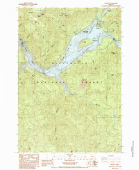
USGS Historical Quadrangle in GeoPDF.

USGS Historical Quadrangle in GeoPDF.
This data set contains imagery from the National Agriculture Imagery Program (NAIP). The NAIP program is administered by USDA FSA and has been established to support two main FSA strategic goals centered on agricultural production. These are increase stewardship of America's natural resources while enhancing the environment, and to ensure commodities are procured and distributed effectively and efficiently to increase food security. The NAIP program supports these goals by acquiring and providing ortho imagery that has been collected during the agricultural growing season in the U.S. The NAIP ortho imagery is tailored to meet FSA requirements and is a fundamental tool used to support FSA farm and conservation programs....
This data set contains imagery from the National Agriculture Imagery Program (NAIP). The NAIP program is administered by USDA FSA and has been established to support two main FSA strategic goals centered on agricultural production. These are, increase stewardship of America's natural resources while enhancing the environment, and to ensure commodities are procured and distributed effectively and efficiently to increase food security. The NAIP program supports these goals by acquiring and providing ortho imagery that has been collected during the agricultural growing season in the U.S. The NAIP ortho imagery is tailored to meet FSA requirements and is a fundamental tool used to support FSA farm and conservation programs....

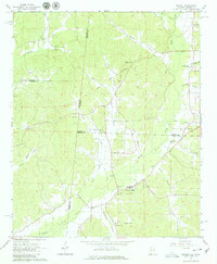
USGS Historical Quadrangle in GeoPDF.

USGS Historical Quadrangle in GeoPDF.
This Sediment Analysis dataset, a conceptual subgroup of the Lake Erie Ecological Investigations (LEEI) dataset, focuses on the sediments sampled at Areas of Concern (AOCs) on Lake Erie. Per the Quality Assurance Project Plan (QAPP), sediment collections were a composite of at least five randomly selected samples collected from each site. Per an internal summary report, sediment samples were collected using a stainless steel Eckman dredge. Analytical methods and QA/QC were directed by the Patuxent Analytical Control Facility (PACF) of the US Fish and Wildlife Service. Per Dora Passino-Reader, the Geochemical & Environmental Research Group at Texas A&M University, College Station performed the analytical chemistry...
This dataset contains the physical collection information (e.g., sample location, date, gear type) and microsatellite DNA genotype of egg and larval Lake Sturgeon collected in the St. Clair and Detroit rivers in 2015 and 2016. Individuals were genotyped for 18 microsatellite loci (13 disomic and 5 polysomic). Alleles (base pair sizes) were recorded as presence absence scores (1:present, 2:absent, 0:missing data) for all previously observed alleles. Thus individual genotypes were recorded as pseudo diploid dominant phenotypes resulting in individual vectors of length n=205 for each genotyped egg or larval individual.
Categories: Data;
Tags: Acipenser,
Acipenser fulvescens,
Acipenseridae,
Anthropogenic,
Anthropogenic Rock,
USGS Historical Quadrangle in GeoPDF.

USGS Historical Quadrangle in GeoPDF.
This data set contains imagery from the National Agriculture Imagery Program (NAIP). The NAIP program is administered by USDA FSA and has been established to support two main FSA strategic goals centered on agricultural production. These are, increase stewardship of America's natural resources while enhancing the environment, and to ensure commodities are procured and distributed effectively and efficiently to increase food security. The NAIP program supports these goals by acquiring and providing ortho imagery that has been collected during the agricultural growing season in the U.S. The NAIP ortho imagery is tailored to meet FSA requirements and is a fundamental tool used to support FSA farm and conservation programs....
This data set contains imagery from the National Agriculture Imagery Program (NAIP). The NAIP program is administered by USDA FSA and has been established to support two main FSA strategic goals centered on agricultural production. These are increase stewardship of America's natural resources while enhancing the environment, and to ensure commodities are procured and distributed effectively and efficiently to increase food security. The NAIP program supports these goals by acquiring and providing ortho imagery that has been collected during the agricultural growing season in the U.S. The NAIP ortho imagery is tailored to meet FSA requirements and is a fundamental tool used to support FSA farm and conservation programs....

USGS Historical Quadrangle in GeoPDF.

USGS Historical Quadrangle in GeoPDF.
This data set contains imagery from the National Agriculture Imagery Program (NAIP). The NAIP program is administered by USDA FSA and has been established to support two main FSA strategic goals centered on agricultural production. These are, increase stewardship of America's natural resources while enhancing the environment, and to ensure commodities are procured and distributed effectively and efficiently to increase food security. The NAIP program supports these goals by acquiring and providing ortho imagery that has been collected during the agricultural growing season in the U.S. The NAIP ortho imagery is tailored to meet FSA requirements and is a fundamental tool used to support FSA farm and conservation programs....
|

|
