Filters: Tags: Disease (X)
144 results (15ms)|
Filters
Date Range
Extensions Types
Contacts
Categories Tag Types
|
From 2003-2018, USGS researchers and collaborators conducted mark-recapture studies of the boreal toad at the Lost Trail National Wildlife Refuge in northwestern Montana, USA. The datasets included here contain information on individual toad capture history, body size, and disease status. These data were collected annually over the 16-year period at up to 11 breeding sites per year on the refuge. We include datasets for (1) male toad captures over time, (2) female toad captures over time, (3) male disease status (tested - positive or negative, or not tested in a given year), (4) all toad length and weight data over time, and (5) male toad size and body condition over time.
Categories: Data;
Tags: Aquatic Biology,
Ecology,
Lost Trail National Wildlife Refuge,
Montana,
USGS Science Data Catalog (SDC),
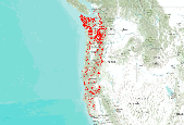
Data describes where Port-Orford-cedar exists on U.S. Forest Service Region 6 lands.
Native and introduced forest birds were captured and then released across the Hawaiian Islands to acquire a blood sample for obtaining DNA and test for exposure to avian malaria (Plasmodium relictum). A total of 2,945 samples were collected and analyzed for avian malaria prevalence from 39 species captured at 66 sites from Kauai, Oahu, Molokai, Maui, and Hawaii islands.
Land use was quantified within a 4-km radius around 36 apiaries in North Dakota, South Dakota, and Minnesota over two years, 2015-16 and 2016-17. The area (hectares) of Ag (corn, soy, small grains), Grass (pasture, grassland, fallow land, wildflowers, shrub land, and hay land), Wetlands (herbaceous and woody), and Bee crops (alfalfa, canola, sunflower) were quantified around each apiary in each year. Within each apiary, the average change in frames of adult bees among all colonies from June to September was calculated. Additionally, the average September Varroa mite infestation rate, the average adult population size during almond pollination, the count of colonies exhibiting queen events in September, and the count...
Of the 3 major factors (habitat loss, poisoning, and disease) that limit abundance of prairie dogs today, sylvatic plague caused by Yersinia pestis is the I factor that is beyond human control. Plague epizootics frequently kill > 99% of prairie dogs in infected colonies. Although epizootics of sylvatic plague occur throughout most of the range of prairie dogs in the United States and are well described, long-term maintenance of plague in enzootic rodent species is not well documented or understood. We review dynamics of plague in white-tailed (Cynomys leucurus), Gunnison's (C gunnisoni), and black-tailed (C ludovicianus) prairie dogs, and their rodent and flea associates. We use epidemiologic concepts to support...
Categories: Publication;
Types: Citation,
Journal Citation;
Tags: American Society of Mammalogists,
C. leucurus,
C. ludovicianus,
Cynomys gunnisoni,
Journal of Mammalogy,
This dataset is a compilation of forest insect, disease and abiotic damage mapped by aerial detection surveys on forested areas in the United States. At this time, the National Aerial Survey Data Standards require only mortality and defoliation data be collected and reported. However, many cooperators collect data on other types of damage and therefore, the national database has been designed to accommodate these data. Low-level flights, typically 1,000 to 2,000 feet above ground level, are used to map forest damage. Observers use paper maps, typically 1:100,000 scale USGS maps, upon which they record the damage. There is also a digital sketchmap system that may be used. The digital system uses GPS to display the...

The acquisition of host species distributions is a significant factor in the identification of areas at risk of mortality to a particular agent. The most readily-available forest type maps do not contain enough location-specific information for insect and disease risk assessments, in particular species' age and stocking. Estimates for total and individual species' basal area (BA), quadratic mean diameter (QMD), stand density index (SDI), percent host composition, and predominant canopy position were developed for all 57 tree species and species groups modeled for the National Insect and Disease Risk Map. After extensively testing various interpolation methods, the Risk Map Integration Team (RMIT) utilized a...

Two maps (PCT_BALOSS_AK - the ArcInfo Grid referenced to this metadata - and PCT_BALOSS - see accompanying CONUS Grid and its associated metadata) represent, in map form, the comprehensive version of the final results of the 2006 National Insect and Disease Risk Map (NIDRM) Project. Specifically, their pixel values range from 0 to 100 percent, representing the predicted percent of basal area loss over the next 15 years due to insects and diseases.

This data represents areas of forest damage due to insect infestation, fire, flood, landslides, windthrow and other mortalities. The information was collected by aerial surveys by both the USFS and ADNR, Div. of Forestry in cooperation with the Forest Health Protection (FHP) project. Surveys are conducted in July and August so that pest "signatures" may be obtained during the optimal period for symptom development of ocular estimation. The aerial survey is coordinated with known pest outbreaks so that the maximum extent of recent bark beetle damage (fading trees) and insect defoliation (discoloration, foliage loss) patterns may be determined. Aerial survey flights are termed as "local" if they can be completed...
ABSTRACT: The fungal pathogen Batrachochytrium dendrobatidis (Bd) causes chytridiomycosis, a disease implicated in amphibian declines on 5 continents. Polymerase chain reaction (PCR) primer sets exist with which amphibians can be tested for this disease, and advances in sampling techniques allow non-invasive testing of animals. We developed filtering and PCR based quantitative methods by modifying existing PCR assays to detect Bd DNA in water and sediments, without the need for testing amphibians; we tested the methods at 4 field sites. The SYBR based assay using Boyle primers (SYBR/Boyle assay) and the Taqman based assay using Wood primers performed similarly with samples generated in the laboratory (Bd spiked...
Categories: Publication;
Types: Citation;
Tags: Amphibian,
Chytridiomycosis,
Detection,
Disease,
Filte

Emerald Ash Borer damage areas by damage type are displayed within the insect and disease survey areas. The 2011 insect and disease survey is displayed by default. A map service on the www depicting a compilation of forest insect, disease and abiotic damage mapped on forested areas in the United States that provides a single, consistent data source to facilitate national and multi-regional reporting for Forest Health Monitoring and Forest Health Protection. All reported emerald ash borer damage types are shown within the insect and disease survey areas from 2007 to 2011.
Current density of invasive species, insects, and disease within KM grid cell reporting units for the San Luis Valley - Taos Plateau Study Area. Attribute IID_C_CAT1 is valued along a scale of low current density (1) to high current density (4). This dataset is the result of a fuzzy model that integrates currently known and potential occurrences of invasive speices and forest insect pests and diseases. Data from a variety of sources were included, including LANDFIRE Existing Vegetation Types, LANDFIRE Succession Classes, SWReGAP Landcover Types, SLV weed management polygons, and U.S. Forest Service Forest Health survey areas.
Compiled areas of insect and disease damage from 1989 to 2013 in Yukon River Lowlands - Kuskokwim Mountains - Lime Hills. These data are provided by Bureau of Land Management (BLM) "as is" and may contain errors or omissions. The User assumes the entire risk associated with its use of these data and bears all responsibility in determining whether these data are fit for the User's intended use. These data may not have the accuracy, resolution, completeness, timeliness, or other characteristics appropriate for applications that potential users of the data may contemplate. The User is encouraged to carefully consider the content of the metadata file associated with these data. The BLM should be cited as the data source...
This is part of a 3-tiered dataset consisting ofIDS_shapes: footprint polygon featuresIDS_attrib: attribute descriptions of polygonsIDS_rollup: lookup information for features that are summarized as a group (rollup)This dataset is a compilation of forest insect, disease and abiotic damage mapped by aerial detection surveys on forested areas in the United States. At this time, the National Aerial Survey Data Standards require only mortality and defoliation data be collected and reported. However, many cooperators collect data on other types of damage and therefore, the national database has been designed to accommodate these data. Low-level flights, typically 1,000 to 2,000 feet above ground level, are used to map...
This map shows the distribution, vegetation departure, current/future landscape intactness, current/future change agents, and potential for change of Grassland Fauna Habitat in the study area. These data are provided by Bureau of Land Management (BLM) "as is" and may contain errors or omissions. The User assumes the entire risk associated with its use of these data and bears all responsibility in determining whether these data are fit for the User's intended use. These data may not have the accuracy, resolution, completeness, timeliness, or other characteristics appropriate for applications that potential users of the data may contemplate. The User is encouraged to carefully consider the content of the metadata...
This map shows the distribution, vegetation departure, current/future landscape intactness, current/future change agents, and potential for change of Native Fish in the study area. These data are provided by Bureau of Land Management (BLM) "as is" and may contain errors or omissions. The User assumes the entire risk associated with its use of these data and bears all responsibility in determining whether these data are fit for the User's intended use. These data may not have the accuracy, resolution, completeness, timeliness, or other characteristics appropriate for applications that potential users of the data may contemplate. The User is encouraged to carefully consider the content of the metadata file associated...
This map shows insect and disease related forest damage. Layers include: Total area surveyed along flight paths for aerial forest damage surveys conducted from 2000 to 2014 and unsurveyed patches of forest and shrub; Cumulative areas of insect- and disease-related forest damage from 2000 to 2014; Impacted proportion of ecoregions in the CYR study area from 2000 to 2014; . Impacted proportion of five tree- and shrub-dominated CEs from 2000 to 2014 in the CYR study area; Impacted proportion of five tree- and shrub-dominated CEs with spruce mortality from 2000 to 2014 in the CYR study area; Kernel density of aspen defoliation caused by aspen leaf miner within Alaska from 2000 to 2014 with CYR study area shown for reference;...
Species loss can result in the subsequent loss of affiliate species. Though largely ignored to date, these coextinctions can pose threats to human health by altering the composition, quantity and distribution of zoonotic parasites. We simulated host extinctions from more than 1300 host–parasite associations for 29 North American carnivores to investigate changes in parasite composition and species richness. We also explored the geography of zoonotic parasite richness under three carnivore composition scenarios and examined corresponding levels of human exposure. We found that changes in parasite assemblages differed among parasite groups. Because viruses tend to be generalists, the proportion of parasites that are...
Categories: Publication;
Types: Citation;
Tags: Epidemiology,
Other Wildlife,
Plants,
Southeast CASC,
Wildlife and Plants,
This map shows the managed/un-managed sites of Ecological Value. This map also shows distribution, vegetation departure, current/future landscape intactness, current/future change agents, and potential for change of the Sites of Conservation Concern (SCC). These data are provided by Bureau of Land Management (BLM) "as is" and may contain errors or omissions. The User assumes the entire risk associated with its use of these data and bears all responsibility in determining whether these data are fit for the User's intended use. These data may not have the accuracy, resolution, completeness, timeliness, or other characteristics appropriate for applications that potential users of the data may contemplate. The User...
This dataset provides a watershed index of surface drinking water importance, a watershed index of forest importance to surface drinking water, and a watershed index to highlight the extent to which development, fire, and insects and disease threaten forests important for surface drinking water. This symbology for this layer is based on the index value for insect and disease threat to forests which are important to surface drinking water on a range from 1-100.
|

|
