Filters: Tags: Dixie Valley (X)
15 results (57ms)|
Filters
Date Range
Extensions Types Contacts
Categories Tag Types Tag Schemes |
Desert spring wetlands host many endemic species that require aquatic habitat and are isolated by the surrounding xeric terrestrial habitat. The Dixie Valley Toad (Anaxyrus williamsi) is a recently described anuran species endemic to desert spring wetlands in the Dixie Valley, Churchill County, Nevada, USA. Given this species was only recently recognized as distinct from Anaxyrus boreas, little is known about its ecology and habitat requirements. These data represent the results of surveys for Dixie Valley Toads conducted from April 2018 to May 2021 in Churchill County, Nevada, USA and associated covariates from surveys and study sites. The potential wetland habitat for the Dixie Valley Toad was divided into 20...

These data were released prior to the October 1, 2016 effective date for the USGS’s policy dictating the review, approval, and release of scientific data as referenced in USGS Survey Manual Chapter 502.8 Fundamental Science Practices: Review and Approval of Scientific Data for Release. This data set contains the potentiometric water-level altitude contours representing the 2009 potentiometric surface of the basin fill groundwater system of Dixie Valley, west-central Nevada.
This data set contains imagery from the National Agriculture Imagery Program (NAIP). The NAIP program is administered by USDA FSA and has been established to support two main FSA strategic goals centered on agricultural production. These are, increase stewardship of America's natural resources while enhancing the environment, and to ensure commodities are procured and distributed effectively and efficiently to increase food security. The NAIP program supports these goals by acquiring and providing ortho imagery that has been collected during the agricultural growing season in the U.S. The NAIP ortho imagery is tailored to meet FSA requirements and is a fundamental tool used to support FSA farm and conservation programs....

These data were released prior to the October 1, 2016 effective date for the USGS’s policy dictating the review, approval, and release of scientific data as referenced in USGS Survey Manual Chapter 502.8 Fundamental Science Practices: Review and Approval of Scientific Data for Release. This data set contains lines illustrating general direction of groundwater flow within Dixie Valley, west-central Nevada.

These data were released prior to the October 1, 2016 effective date for the USGS’s policy dictating the review, approval, and release of scientific data as referenced in USGS Survey Manual Chapter 502.8 Fundamental Science Practices: Review and Approval of Scientific Data for Release. With increasing population growth and land-use change, urban communities in the desert southwest are progressively looking to remote basins to supplement existing water supplies. Recent applications for groundwater appropriations from Dixie Valley, Nevada, a primarily undeveloped basin neighboring the Carson Desert to the east, have prompted a reevaluation of the quantity of naturally discharging groundwater. The objective of this...
These data provide temperatures and relative conductivity to determine the presence or absence of water at specific locations in Dixie Meadows, Dixie Valley, Churchill County, Nevada, 2019-2021.
Categories: Data;
Tags: Dixie Valley,
Nevada,
USGS Science Data Catalog (SDC),
Water Resources,
air temperature,
These data were compiled to provide satellite remote sensing observations of landcover in the vicinity of wetlands fed by geothermal springs in Dixie Meadows, Nevada, USA. Objectives of the study were to map landcover of water, vegetation, and soil between October 5, 2015, and January 21, 2022, using available imagery from the Sentinel-2 mission. The U.S. Geological Survey's Southwest Biological Science Center (SBSC) and Grand Canyon Monitoring and Research Center (GCMRC) processed 110 Sentinel-2 satellite images representing bottom of atmosphere surface reflectance and classified them within Google Earth Engine (GEE) using threshold values of the Green Normalized Difference Vegetation Index (gNDVI) and its inverse...
Categories: Data;
Tags: Bureau of Land Management Lands,
Churchill County,
Department of Defense Lands,
Dixie Meadows,
Dixie Valley,
These data include site- and survey-specific information for occupancy surveys of Dixie Valley Toads (Anaxyrus williamsi) collected in the Dixie Valley, Churchill County, Nevada, in May 2019. The data include both multiple surveys of the same sites and time-to-detection information to quantify detection probabilities and account for imperfect detection in assessments of Dixie Valley Toad occupancy. These data support the following publication: Schimel, D.S., 2018, Editorial: Ecological Applications, v. 28, no. 4, p. 869–870, https://doi.org/10.1002/eap.1735.
Categories: Data;
Types: Map Service,
OGC WFS Layer,
OGC WMS Layer,
OGC WMS Service;
Tags: Churchill County,
Dixie Valley,
Nevada,
USGS Science Data Catalog (SDC),
USGS-EMA-LOW-SB SMC: Amphibians/ARMI,

These data were released prior to the October 1, 2016 effective date for the USGS’s policy dictating the review, approval, and release of scientific data as referenced in USGS Survey Manual Chapter 502.8 Fundamental Science Practices: Review and Approval of Scientific Data for Release. With increasing population growth and land-use change, urban communities in the desert southwest are progressively looking to remote basins to supplement existing water supplies. Recent applications for groundwater appropriations from Dixie Valley, Nevada, a primarily undeveloped basin neighboring the Carson Desert to the east, have prompted a reevaluation of the quantity of naturally discharging groundwater.The objective of this...

These data were released prior to the October 1, 2016 effective date for the USGS’s policy dictating the review, approval, and release of scientific data as referenced in USGS Survey Manual Chapter 502.8 Fundamental Science Practices: Review and Approval of Scientific Data for Release. With increasing population growth and land-use change, urban communities in the desert southwest are progressively looking to remote basins to supplement existing water supplies. Recent applications for groundwater appropriations from Dixie Valley, Nevada, a primarily undeveloped basin neighboring the Carson Desert to the east, have prompted a reevaluation of the quantity of naturally discharging groundwater.The objective of this...
This data set contains imagery from the National Agriculture Imagery Program (NAIP). The NAIP program is administered by USDA FSA and has been established to support two main FSA strategic goals centered on agricultural production. These are, increase stewardship of America's natural resources while enhancing the environment, and to ensure commodities are procured and distributed effectively and efficiently to increase food security. The NAIP program supports these goals by acquiring and providing ortho imagery that has been collected during the agricultural growing season in the U.S. The NAIP ortho imagery is tailored to meet FSA requirements and is a fundamental tool used to support FSA farm and conservation programs....
This paper quantifies atmospheric mercury (Hg) emissions from substrates and fumaroles associated with three hydrothermal systems: Lassen Volcanic Center, California (LVC); Yellowstone Caldera, Wyoming (YC); and Dixie Valley, Nevada (DV). Substrate Hg fluxes were measured using field chamber methods at thermal and nonthermal sites. The highest Hg fluxes (up to 541 ng m−2 h−1) were measured at thermal active areas. Fluxes from altered and unaltered nonthermal sites were <10 ng m−2 h−1 and were comparable to those measured in natural low-Hg background regions for YC and DV, and at LVC they were slightly elevated. Similarly, reactive gaseous mercury concentrations were higher in thermal active areas. Using a Geographic...
Categories: Publication;
Types: Citation;
Tags: Dixie Valley,
Lassen,
geothermal,
hydrothermal,
mercur
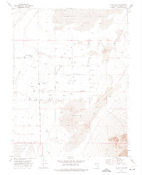
USGS Historical Quadrangle in GeoPDF.
This data set contains imagery from the National Agriculture Imagery Program (NAIP). The NAIP program is administered by USDA FSA and has been established to support two main FSA strategic goals centered on agricultural production. These are, increase stewardship of America's natural resources while enhancing the environment, and to ensure commodities are procured and distributed effectively and efficiently to increase food security. The NAIP program supports these goals by acquiring and providing ortho imagery that has been collected during the agricultural growing season in the U.S. The NAIP ortho imagery is tailored to meet FSA requirements and is a fundamental tool used to support FSA farm and conservation programs....
This data set contains imagery from the National Agriculture Imagery Program (NAIP). The NAIP program is administered by USDA FSA and has been established to support two main FSA strategic goals centered on agricultural production. These are, increase stewardship of America's natural resources while enhancing the environment, and to ensure commodities are procured and distributed effectively and efficiently to increase food security. The NAIP program supports these goals by acquiring and providing ortho imagery that has been collected during the agricultural growing season in the U.S. The NAIP ortho imagery is tailored to meet FSA requirements and is a fundamental tool used to support FSA farm and conservation programs....
|

|
