Filters: Tags: Doe (X)
30 results (40ms)|
Filters
Date Range
Extensions Types Contacts
Categories Tag Types Tag Schemes
|
This data set contains imagery from the National Agriculture Imagery Program (NAIP). The NAIP program is administered by USDA FSA and has been established to support two main FSA strategic goals centered on agricultural production. These are increase stewardship of America's natural resources while enhancing the environment, and to ensure commodities are procured and distributed effectively and efficiently to increase food security. The NAIP program supports these goals by acquiring and providing ortho imagery that has been collected during the agricultural growing season in the U.S. The NAIP ortho imagery is tailored to meet FSA requirements and is a fundamental tool used to support FSA farm and conservation programs....

This map layer consists of federally owned or administered lands of the United States, Puerto Rico, and the U.S. Virgin Islands. For the most part, only areas of 320 acres or more are included; some smaller areas deemed to be important or significant are also included. There may be private inholdings within the boundaries of Federal lands in this map layer. Some established Federal lands which are larger than 320 acres are not included in this map layer, because their boundaries were not available from the owning or administering agency.
In spring and summer 2017, the U.S. Geological Survey’s Gas Hydrates Project conducted two cruises aboard the research vessel Hugh R. Sharp to explore the geology, chemistry, ecology, physics, and oceanography of sea-floor methane seeps and water column gas plumes on the northern U.S. Atlantic margin between the Baltimore and Keller Canyons. Split-beam and multibeam echo sounders and a chirp subbottom profiler were deployed during the cruises to map water column backscatter, sea-floor bathymetry and backscatter, and subsurface stratigraphy associated with known and undiscovered sea-floor methane seeps. The first cruise, known as the Interagency Mission for Methane Research on Seafloor Seeps and designated as field...
Categories: Data;
Types: Downloadable,
Map Service,
OGC WFS Layer,
OGC WMS Layer,
Shapefile;
Tags: Accomac Canyon,
Atlantic Ocean,
CMHRP,
Chincoteague Ridge,
Coastal and Marine Hazards and Resources Program,
In spring and summer 2017, the U.S. Geological Survey’s Gas Hydrates Project conducted two cruises aboard the research vessel Hugh R. Sharp to explore the geology, chemistry, ecology, physics, and oceanography of sea-floor methane seeps and water column gas plumes on the northern U.S. Atlantic margin between the Baltimore and Keller Canyons. Split-beam and multibeam echo sounders and a chirp subbottom profiler were deployed during the cruises to map water column backscatter, sea-floor bathymetry and backscatter, and subsurface stratigraphy associated with known and undiscovered sea-floor methane seeps. The first cruise, known as the Interagency Mission for Methane Research on Seafloor Seeps and designated as field...
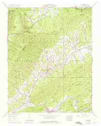
USGS Historical Quadrangle in GeoPDF.
The geology of an area of 660 square miles mostly in the northeastern corner of Tennessee and small adjacent areas in Virginia and North Carolina is the subject of this report. The region lies principally in the Unaka province, with extensions northwestward into the Appalachian Valley and southwestward into the Blue Ridge province. The report combines results of surveys made between 1941 and 1953 by the U. S. Geological Survey, the Tennessee Division of Geology, and the Tennessee Valley Authority, and is published in cooperation with the Tennessee Division of Geology. Northeasternmost Tennessee is a region of widespread mineralization and was formerly important for mineral production. Iron, manganese, and bauxite...
In spring and summer 2017, the U.S. Geological Survey’s Gas Hydrates Project conducted two cruises aboard the research vessel Hugh R. Sharp to explore the geology, chemistry, ecology, physics, and oceanography of sea-floor methane seeps and water column gas plumes on the northern U.S. Atlantic margin between the Baltimore and Keller Canyons. Split-beam and multibeam echo sounders and a chirp subbottom profiler were deployed during the cruises to map water column backscatter, sea-floor bathymetry and backscatter, and subsurface stratigraphy associated with known and undiscovered sea-floor methane seeps. The first cruise, known as the Interagency Mission for Methane Research on Seafloor Seeps and designated as field...
Categories: Data;
Types: Downloadable,
Map Service,
OGC WFS Layer,
OGC WMS Layer,
Shapefile;
Tags: Accomac Canyon,
Applied Acoustics,
Atlantic Margin,
Atlantic Ocean,
Baltimore Canyon,
This data set contains imagery from the National Agriculture Imagery Program (NAIP). The NAIP program is administered by USDA FSA and has been established to support two main FSA strategic goals centered on agricultural production. These are increase stewardship of America's natural resources while enhancing the environment, and to ensure commodities are procured and distributed effectively and efficiently to increase food security. The NAIP program supports these goals by acquiring and providing ortho imagery that has been collected during the agricultural growing season in the U.S. The NAIP ortho imagery is tailored to meet FSA requirements and is a fundamental tool used to support FSA farm and conservation programs....
In spring and summer 2017, the U.S. Geological Survey’s Gas Hydrates Project conducted two cruises aboard the research vessel Hugh R. Sharp to explore the geology, chemistry, ecology, physics, and oceanography of sea-floor methane seeps and water column gas plumes on the northern U.S. Atlantic margin between the Baltimore and Keller Canyons. Split-beam and multibeam echo sounders and a chirp subbottom profiler were deployed during the cruises to map water column backscatter, sea-floor bathymetry and backscatter, and subsurface stratigraphy associated with known and undiscovered sea-floor methane seeps. The first cruise, known as the Interagency Mission for Methane Research on Seafloor Seeps and designated as field...
Categories: Data;
Types: Downloadable,
GeoTIFF,
Map Service,
Raster;
Tags: 7160,
Accomac Canyon,
Atlantic Margin,
Atlantic Ocean,
CMHRP,
In summer 2018, the U.S. Geological Survey partnered with the U.S Department of Energy and the Bureau of Ocean Energy Management to conduct the Mid-Atlantic Resources Imaging Experiment (MATRIX) as part of the U.S. Geological Survey Gas Hydrates Project. The field program objectives were to acquire high-resolution 2-dimensional multichannel seismic-reflection and split-beam echosounder data along the U.S Atlantic margin between North Carolina and New Jersey to determine the distribution of methane gas hydrates in below-sea floor sediments and investigate potential connections between gas hydrate dynamics and sea floor methane seepage. MATRIX field work was carried out between August 8 and August 28, 2018 on the...
Categories: Data,
Data Release - In Progress;
Types: Downloadable,
Map Service,
OGC WFS Layer,
OGC WMS Layer,
Shapefile;
Tags: Atlantic Ocean,
BOEM,
Bureau of Ocean Energy Management,
CMHRP,
Cape Hatteras,
In summer 2018, the U.S. Geological Survey partnered with the U.S Department of Energy and the Bureau of Ocean Energy Management to conduct the Mid-Atlantic Resources Imaging Experiment (MATRIX) as part of the U.S. Geological Survey Gas Hydrates Project. The field program objectives were to acquire high-resolution 2-dimensional multichannel seismic-reflection and split-beam echosounder data along the U.S Atlantic margin between North Carolina and New Jersey to determine the distribution of methane gas hydrates in below-sea floor sediments and investigate potential connections between gas hydrate dynamics and sea floor methane seepage. MATRIX field work was carried out between August 8 and August 28, 2018 on the...
Categories: Data;
Types: Downloadable,
Map Service,
OGC WFS Layer,
OGC WMS Layer,
Shapefile;
Tags: Atlantic Ocean,
BOEM,
Bureau of Ocean Energy Management,
CMHRP,
Cape Hatteras,
This data set contains imagery from the National Agriculture Imagery Program (NAIP). The NAIP program is administered by USDA FSA and has been established to support two main FSA strategic goals centered on agricultural production. These are increase stewardship of America's natural resources while enhancing the environment, and to ensure commodities are procured and distributed effectively and efficiently to increase food security. The NAIP program supports these goals by acquiring and providing ortho imagery that has been collected during the agricultural growing season in the U.S. The NAIP ortho imagery is tailored to meet FSA requirements and is a fundamental tool used to support FSA farm and conservation programs....
The microalga Haematococcus pluvialis Flotow has been the subject of a number of studies concerned with maximizing astaxanthin production for use in animal feeds and for human consumption. Several of these studies have specifically attempted to ascertain the optimal temperature and irradiance combination for growth of H. pluvialis, but there has been a great deal of disagreement between laboratories. Ideal levels of temperature and irradiance have been reported to range from 14 to 28�C and 30 to 200 ?mol photons m?2 s?1. The objective of the present study was to simultaneously explore temperature and irradiance effects for a single strain of H. pluvialis (UTEX 2505) across an experimental region that encompassed...
Categories: Publication;
Types: Citation,
Journal Citation;
Tags: Algal physiology,
DOE,
Design of experiments,
Journal of Applied Phycology,
Microalgae,
In spring and summer 2017, the U.S. Geological Survey’s Gas Hydrates Project conducted two cruises aboard the research vessel Hugh R. Sharp to explore the geology, chemistry, ecology, physics, and oceanography of sea-floor methane seeps and water column gas plumes on the northern U.S. Atlantic margin between the Baltimore and Keller Canyons. Split-beam and multibeam echo sounders and a chirp subbottom profiler were deployed during the cruises to map water column backscatter, sea-floor bathymetry and backscatter, and subsurface stratigraphy associated with known and undiscovered sea-floor methane seeps. The first cruise, known as the Interagency Mission for Methane Research on Seafloor Seeps and designated as field...
Categories: Data;
Types: Downloadable,
Map Service,
OGC WFS Layer,
OGC WMS Layer,
Shapefile;
Tags: Accomac Canyon,
Atlantic Margin,
Atlantic Ocean,
CMHRP,
Chincoteague Ridge,
In summer 2018, the U.S. Geological Survey partnered with the U.S Department of Energy and the Bureau of Ocean Energy Management to conduct the Mid-Atlantic Resources Imaging Experiment (MATRIX) as part of the U.S. Geological Survey Gas Hydrates Project. The field program objectives were to acquire high-resolution 2-dimensional multichannel seismic-reflection and split-beam echo sounder data along the U.S Atlantic margin between North Carolina and New Jersey to determine the distribution of methane gas hydrates in below-sea floor sediments and investigate potential connections between gas hydrate dynamics and sea floor methane seepage. MATRIX field work was carried out between August 8 and August 28, 2018 on the...
Categories: Data;
Types: Downloadable,
Map Service,
OGC WFS Layer,
OGC WMS Layer,
Shapefile;
Tags: Atlantic Ocean,
BOEM,
Bureau of Ocean Energy Management,
CMHRP,
Cape Hatteras,
Selected archived sample splits collected as part of the National Uranium Resource Evaluation (NURE) Hydrogeochemical and Stream Sediment Reconnaissance (HSSR) program, were reanalyzed by the U.S. Geological Survey (USGS) as part of a NURE-HSSR Reanalysis project (Smith and others, 2018). A small amount (approximately 0.25 grams [g]) of sieved less than 75-micron sample material was retrieved from the USGS National Geochemical Sample Archive for geochemical analysis. These samples were analyzed for 51 elements under a Technical Assistance Agreement with a third party by ALS Global laboratories using their ultra-trace four-acid-digestion dual-mode inductively coupled plasma-optical emission spectrometry/mass spectrometry...
Categories: Data;
Types: Downloadable,
Map Service,
OGC WFS Layer,
OGC WMS Layer,
Shapefile;
Tags: Alaska,
DOE,
Economic Geology,
GGGSC,
Geochemistry,
USGS Historical Quadrangle in GeoPDF.
USGS Historical Quadrangle in GeoPDF.
USGS Historical Quadrangle in GeoPDF.
USGS Historical Quadrangle in GeoPDF.
|

|
