Filters: Tags: Draft (X)
46 results (35ms)|
Filters
Date Range
Extensions Types Contacts Categories Tag Schemes |

Link to brief summary

link to brief summary
Link to brief summary

This layer was created at the Blueprint workshops held in Raleigh, NC on 10/22/1013 - 10/23/2013. Participants were broken down into 4 groups (North Piedmont, Cape Fear/Pee Dee Coastal Area, Albemarle - Pamilco Coastal Area, and the entire South Atlantic Area). This layer represents a DRAFT spatial result from the Landscapes breakout groups. At the workshop participants were instructed to select areas where conservation actions should be targeted. The base layer for selection was the 12-digit hydrologic unit code (HUC) watershed boundary dataset (WBD).
Tags: draft

This layer was created by rescaling and averaging the circuit scape results for the following species: Eastern Cougar, Eastern Diamondback, Pine Snake, Timber Rattlesnakelink to brief summary

Draft version of the Marine Blueprint Feb 20, 2014. This contains information from both workshops. Â It is expected to be updated in the last week of Feb.
Tags: Draft

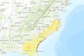
This layer was created at the Blueprint workshops held in Savannah, GA on 11/19/2013 - 11/20/2013. Participants were broken down into 4 groups (South Piedmont, Santee to Ogeechee, South Coastal Plain , and the entire South Atlantic Area). This layer represents a DRAFT spatial result from the South Coastal Plain Day 2 breakout group.  It is being provided so that participants who created this layer can review and provide additional comments about these areas. At the workshop participants were instructed to select areas where conservation actions should be targeted. The base layer for selection was the 12-digit hydrologic unit code (HUC) watershed boundary dataset (WBD).
Tags: draft

link to brief description
Draft baseline Blueprint 2.0 for review
Categories: Data;
Types: ArcGIS REST Map Service,
ArcGIS Service Definition,
Downloadable,
Map Service;
Tags: draft

This layer was created at the Blueprint workshops held in Raleigh, NC on 10/22/1013 - 10/23/2013. Participants were broken down into 4 groups (North Piedmont, Cape Fear/Pee Dee Coastal Area, Albemarle - Pamilco Coastal Area, and the entire South Atlantic Area). This layer represents a DRAFT spatial result from the North Piedmont breakout groups. At the workshop participants were instructed to select areas where conservation actions should be targeted. The base layer for selection was the 12-digit hydrologic unit code (HUC) watershed boundary dataset (WBD).
Tags: draft

This layer was created at the Blueprint workshops held in Savannah, GA on 11/19/2013 - 11/20/2013. Participants were broken down into 4 groups (South Piedmont, Santee to Ogeechee, South Coastal Plain , and the entire South Atlantic Area). This layer represents a DRAFT spatial result from the South Piedmont breakout groups.  It is being provided so that participants who created this layer can review and provide additional comments about these areas. At the workshop participants were instructed to select areas where conservation actions should be targeted. The base layer for selection was the 12-digit hydrologic unit code (HUC) watershed boundary dataset (WBD).
Tags: draft

This layer was created at the Blueprint workshops held in Savannah, GA on 11/19/2013 - 11/20/2013. Participants were broken down into 4 groups (South Piedmont, Santee to Ogeechee, South Coastal Plain , and the entire South Atlantic Area). This layer represents a DRAFT spatial result from the Santee to Ogeechee Day 1 breakout group.  It is being provided so that participants who created this layer can review and provide additional comments about these areas. At the workshop participants were instructed to select areas where conservation actions should be targeted. The base layer for selection was the 12-digit hydrologic unit code (HUC) watershed boundary dataset (WBD).
Tags: draft

This layer was created at the Blueprint workshops held in Savannah, GA on 11/19/2013 - 11/20/2013. Participants were broken down into 4 groups (South Piedmont, Santee to Ogeechee, South Coastal Plain , and the entire South Atlantic Area). This layer represents a DRAFT spatial result from the Santee to Ogeechee Day 2 breakout group.  It is being provided so that participants who created this layer can review and provide additional comments about these areas. At the workshop participants were instructed to select areas where conservation actions should be targeted. The base layer for selection was the 12-digit hydrologic unit code (HUC) watershed boundary dataset (WBD).
Tags: draft
Rule: Urban open space index areas within Upland Hardwood in top 30% Reason: Many rare plants that require disturbance in the Upland Hardwood ecosystem are not effectively covered by LCC indicators and natural disturbances are no longer sufficient to maintain their populations. Many rare upland hardwood plants now rely on railroad tracks, roadsides, and small human created prairies for their survival. Cultivation and establishment of rare disturbance dependent upland hardwood plants in high priority Blueprint areas near urban areas could provide a unique way for urban areas to improve the overall integrity of the upland hardwoods ecosystem
Categories: Data;
Types: ArcGIS REST Map Service,
ArcGIS Service Definition,
Downloadable,
Map Service;
Tags: draft

Background The lands and waters of the South Atlantic are changing rapidly. Climate change, urban growth, and increasing human demands on resources are reshaping the landscape. While these forces cut across political and jurisdictional boundaries, the conservation community does not have a consistent cross-boundary, cross-organization plan for how to respond. The South Atlantic Conservation Blueprint will be that plan. Potential uses Uses under discussion include: Finding places to pool resources, raising new conservation dollars, guiding infrastructure development, developing conservation incentives, showing how local actions fit into a larger strategy, and locating places to build resilience to major disasters...

Marine Spatial Data: This dataset came from the Southeast Area Monitoring and Assessment Program (SEAMAP) which has conducted shallow water trawl surveys of the South Atlantic Bight coastal zone since 1986. This dataset was based on a recent five year time frame (2006-2010). The data were summarized into 1 x 1 minute latitude/longitude grid cells (blocks), which provide the number of collections, percent occurrence, mean catch per unit effort (CPUE), and the coefficient of variance for the CPUE. General SEAMAP Overview: The SEAMAP - South Atlantic Coastal Survey, funded by the National Marine Fisheries Service (NMFS) and conducted by the South Carolina Department of Natural Resources - Marine Resources Division...

Link to brief summary

link to brief description

link to brief summary
|

|

