Filters: Tags: Drainage (X)
49 results (1.4s)|
Filters
Date Range
Extensions Types Contacts
Categories Tag Types
|
Excess phosphorus (P) in freshwater systems has been associated with eutrophication in agro-ecosystems of the US Midwest and elsewhere. A better understanding of processes regulating both soluble reactive phosphorus (SRP) and total phosphorus (TP) exports to tile-drains is therefore critical to minimize P losses to streams while maintaining crop yield. This paper investigates SRP and TP dynamics at a high temporal resolution during four spring storms in two tile-drains in the US Midwest. Depending on the storm, median concentrations varied between 0.006–0.025 mg/L for SRP and 0.057–0.176 mg/L for TP. For large storms (>6 cm bulk precipitation), for which macropore flow represented between 43 and 50% of total tile-drain...
Categories: Publication;
Types: Citation;
Tags: Data Visualization & Tools,
Drainage,
Landscapes,
Macropore flow,
Matrix flow,
This represents the flowline network in Western Lale Erie Restoration Assessment (WLERA). It is attributed with the number of disconnections between the reach and the connecting river system. These data will help identify the condition of hydrologic separation between potential restoration areas and the connecting river system. Low numbers represent fewer disconnections such as culverts between the reach and the rivers requiring no flow network modification to restore the area.
Categories: Data;
Types: Citation,
Downloadable,
Map Service,
OGC WFS Layer,
OGC WMS Layer,
Shapefile;
Tags: Artificial Path,
Canal / Ditch,
FWHydrography,
Great Lakes,
Hydrography,
Map of the Hulahula River Area and location of observation sites. This focal watershed provides the greatest opportunity to characterize conditions within and fluxes from the Brooks Range Ecoregion. Though the Foothills region isextensive, the watersheds narrow as they cross the Coastal Plain in the easternpart of the North Slope. Inset shows the location of the seven TEON focal watersheds. Image by Arctic LCC staff.
Categories: Data;
Types: Map Service,
OGC WFS Layer,
OGC WMS Layer,
OGC WMS Service;
Tags: AIR TEMPERATURE,
AIR TEMPERATURE,
ATMOSPHERE,
ATMOSPHERE,
Academics & scientific researchers,
The Yukon-Kuskokwim Delta (YKD) encompasses the southernmost, warmest parts of the arctic tundra biome and is renowned for its high biological productivity and large subsistence-based human population. Ice-rich permafrost currently is widespread and strongly influences terrestrial and aquatic habitats, including local topography, vegetation, soil hydrology, and the water balance of lakes. Ground temperatures are near the freezing point, however, and recent projections indicate that the YKD is poised for widespread loss of permafrost by the end of this century. This has implications for the region’s extensive and heretofore stable terrestrial and aquatic habitats. Tundra wildfire is a common ecological “pulse” disturbance...
Categories: Data,
Project;
Types: Map Service,
OGC WFS Layer,
OGC WMS Layer,
OGC WMS Service;
Tags: 2016,
AK-00,
Academics & scientific researchers,
Academics & scientific researchers,
Conservation NGOs,

This geodatabase contains streams, waterbodies and wetlands, streamflow gaging stations, and coastlines for the United States, Puerto Rico, and the U.S. Virgin Islands. The streams are incorporated into a geometric network. All feature classes are vertically integrated with each other and with 1:1,000,000-scale transportation and boundary data sets.
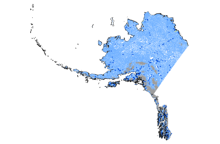
This geodatabase contains streams, waterbodies and wetlands, streamflow gaging stations, and coastlines for Alaska. The streams are incorporated into a geometric network. All feature classes are vertically integrated with each other and with 1:1,000,000-scale transportation and boundary data sets.
Map of the Agashashok River Area and location of proposed observation sites (numbered circles). This focal watershed is in the southwest corner of the Arctic LCC and largely drains the Brooks Range ecoregion with a small portion of the lower basin in the Kobuk Ridges and Valleys ecoregion. The braided character of the lower river prevents us from suggesting a long term gaging station in that location. Inset shows the location of the seven TEON focal watersheds. Image by Arctic LCC staff.
Categories: Data;
Types: Map Service,
OGC WFS Layer,
OGC WMS Layer,
OGC WMS Service;
Tags: AIR TEMPERATURE,
AIR TEMPERATURE,
ATMOSPHERE,
ATMOSPHERE,
Academics & scientific researchers,
This is a release of data presented in the report "Binational Study of the Transboundary San Pedro Aquifer", Callegary and others, 2016: Callegary, J.B., Minjárez Sosa, I., Tapia Villaseñor, E.M., dos Santos, P., Monreal Saavedra, R., Grijalva Noriega, F.J., Huth, A.K., Gray, F., Scott, C.A., Megdal, S.B., Oroz Ramos, L.A., Rangel Medina, M., Leenhouts, J.M., 2016, Binational Study of the Transboundary San Pedro Aquifer: International Boundary and Water Commission. The United States and Mexico share waters in a number of hydrological basins and aquifers that cross the International Boundary. Both the United States and Mexico recognize that, in a region of scarce water and expanding populations, better...
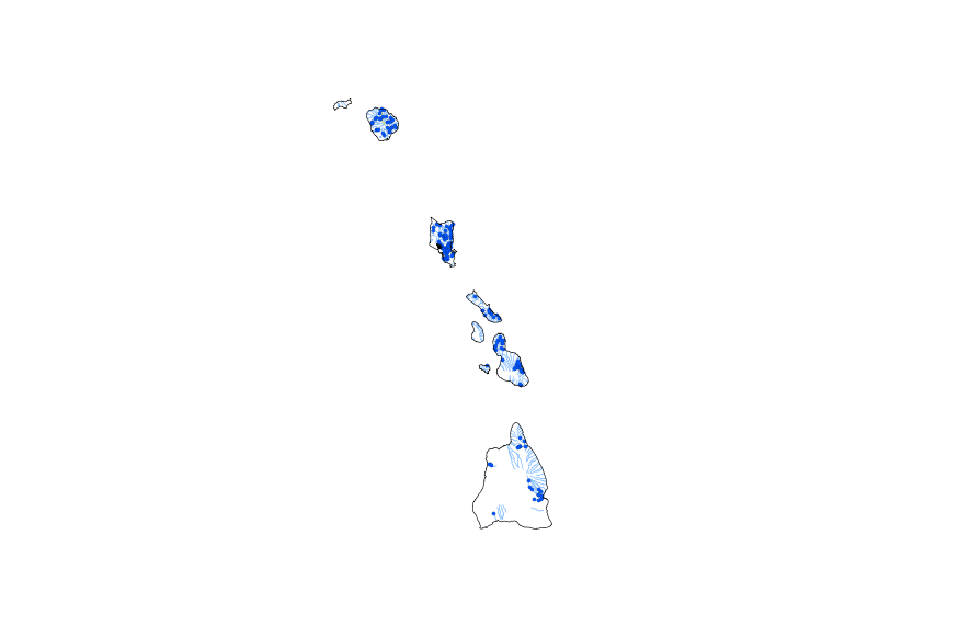
This geodatabase contains streams, waterbodies and wetlands, streamflow gaging stations, and coastlines for Hawaii. The streams are incorporated into a geometric network. All feature classes are vertically integrated with each other and with 1:1,000,000-scale transportation and boundary data sets.
This represents the flowline network in Connecting River Systems Restoration Assessment (CRSRA). It is attributed with the number of disconnections between the reach and the connecting river system. These data will help identify the condition of hydrologic separation between potential restoration areas and the connecting river system. Low numbers represent fewer disconnections such as culverts between the reach and the rivers requiring no flow network modification to restore the area.
Categories: Data;
Types: Citation,
Downloadable,
Map Service,
OGC WFS Layer,
OGC WMS Layer,
Shapefile;
Tags: Artificial Path,
Canal / Ditch,
Detroit River,
FWHydrography,
Great Lakes,
This map service is an information surface representing the dominant class within the soil map unit polygon for soil drainage class. Each component (and therefore soil map unit polygon) falls into one of the following classes according to NRCS: Very Poorly Drained, Poorly Drained, Somewhat Poorly Drained, Moderately Well Drained, Well Drained, Somewhat Excessively Drained and Excessively Drained. Of soil components which make up greater than or equal to 15% of the soil map unit, the wettest component is reported by the map service. Another service exists for drainage class which reports the dominant class in the soil map unit. The concept is similar but for some purposes knowing the dominant component may be...
Categories: Data;
Types: ArcGIS REST Map Service,
Map Service;
Tags: SSURGO,
drainage,
infiltration,
percolate,
permeability,
Map of the Kokolik River Area and location of proposed observation sites (numbered circles). The Kokolik River drains from the northwestern corner of the Brooks Range south and west to Kasegaluk Lagoon and the Chukchi Sea. It crosses the three ecoregions but has very little high elevation area. Inset shows the location of the seven TEON focal watersheds. Image by Arctic LCC staff.
Categories: Data;
Types: Map Service,
OGC WFS Layer,
OGC WMS Layer,
OGC WMS Service;
Tags: AIR TEMPERATURE,
AIR TEMPERATURE,
ATMOSPHERE,
ATMOSPHERE,
Academics & scientific researchers,
This map service is an information surface representing the dominant class within the soil map unit polygon for soil drainage class. Each component (and therefore soil map unit polygon) falls into one of the following classes according to NRCS: Very Poorly Drained, Poorly Drained, Somewhat Poorly Drained, Moderately Well Drained, Well Drained, Somewhat Excessively Drained and Excessively Drained. The class belonging to the component that makes up the highest percentage of the map unit is reported by the map service. Another service exists for drainage class which reports the wettest class in the soil map unit. The concept is similar but for some purposes knowing the wettest component may be the most useful piece...
Categories: Data;
Types: ArcGIS REST Map Service,
Map Service;
Tags: SSURGO,
drainage,
infiltration,
permeability,
porosity,
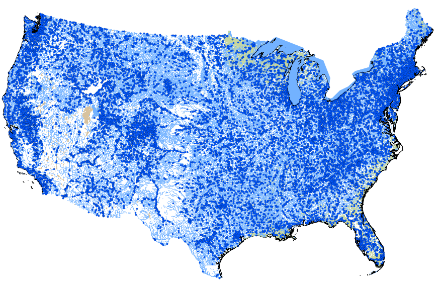
This geodatabase contains streams, waterbodies and wetlands, streamflow gaging stations, and coastlines for the conterminous United States. The streams are incorporated into a geometric network. All feature classes are vertically integrated with each other and with 1:1,000,000-scale transportation and boundary data sets.
The Terrestrial Environmental Observation Network (TEON) is intended to meet the need for asustainable environmental observing network for northern Alaska. TEON is organized aroundrepresentative focal watersheds (Figure 1). TEON will collect, distribute, and synthesize long-termobservational data needed to detect and forecast effects of a changing climate, hydrology, andpermafrost regime on wildlife, habitat, and infrastructure in northern Alaska.
Categories: Data;
Types: Map Service,
OGC WFS Layer,
OGC WMS Layer,
OGC WMS Service;
Tags: AIR TEMPERATURE,
AIR TEMPERATURE,
ATMOSPHERE,
ATMOSPHERE,
Academics & scientific researchers,
Ideal observation sites are located near tributary-mainstem confluences and provide frequent,synchronous measurements of physical, chemical, and biological attributes. This “nested watershed”design supports characterization of environmental conditions adjacent to the sampling stations, whileinstream hydrological measurements will reflect both local conditions and inputs from upstream. TEON observations sites are stratified by ecoregions, so we can aggregate data sets across the network to characterize conditions at the ecoregion scale.
Categories: Data;
Types: Map Service,
OGC WFS Layer,
OGC WMS Layer,
OGC WMS Service;
Tags: AIR TEMPERATURE,
AIR TEMPERATURE,
ATMOSPHERE,
ATMOSPHERE,
Academics & scientific researchers,
This dataset is the output of a python script/ArcGIS model that identifes dikes as having a difference in elevation above a certain threshold. If the elevation difference was below a certain threshold the area was not considered a dike; however, if the difference in elevation between two points was significantly high then the area was marked as a dike. Areas continuous with eachother were considered part of the same dike. Post processing occured. Users examined the data output, comparing the proposed dike locations to aerial imagery, flowline data, and the DEM. Dikes that appeared to be false positives were deleted from the data set.
Categories: Data;
Types: Citation,
Downloadable,
Map Service,
OGC WFS Layer,
OGC WMS Layer,
Shapefile;
Tags: Great Lakes,
LIDAR,
Saginaw Bay,
biogeography,
coastal ecosystems,
This represents the flowline network in Sagina Bay Restoration Assessment (SBRA). It is attributed with the number of disconnections between the reach and the connecting river system. These data will help identify the condition of hydrologic separation between potential restoration areas and the connecting river system. Low numbers represent fewer disconnections such as culverts between the reach and the rivers requiring no flow network modification to restore the area.
Categories: Data;
Types: Citation,
Downloadable,
Map Service,
OGC WFS Layer,
OGC WMS Layer,
Shapefile;
Tags: Artificial Path,
Canal / Ditch,
FWHydrography,
Great Lakes,
Hydrography,
PEM_Projects contains Predictive Ecosystem Mapping (PEM) project boundaries (study areas) and attributes describing each project (project level metadata), plus links to the locations of other data associated with the project (e.g., reports, polygon datasets, plotfiles, legends). PEM uses modeling to divide the landscape into units according to a variety of ecological features including climate, physiography, surficial material, bedrock geology, soils and vegetation. This layer is derived from the STE_TEI_PROJECT_BOUNDARIES_SP layer by filtering on the PROJECT_TYPE attribute

The USGS National Hydrography Dataset (NHD) service from The National Map (TNM) is a comprehensive set of digital spatial data that encodes information about naturally occurring and constructed bodies of surface water (lakes, ponds, and reservoirs), paths through which water flows (canals, ditches, streams, and rivers), and related entities such as point features (springs, wells, stream gages, and dams). The information encoded about these features includes classification and other characteristics, delineation, geographic name, position and related measures, a "reach code" through which other information can be related to the NHD, and the direction of water flow. The network of reach codes delineating water and...
Categories: Data;
Types: ArcGIS REST Map Service,
Map Service;
Tags: HU,
Hydrography,
NGP-TNM,
NHD,
Overlay Map Service,
|

|
