Filters: Tags: ELK (X)
542 results (38ms)|
Filters
Date Range
Extensions Types Contacts
Categories Tag Types
|
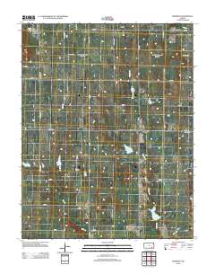
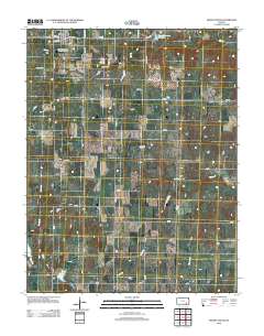
This data set contains imagery from the National Agriculture Imagery Program (NAIP). The NAIP program is administered by USDA FSA and has been established to support two main FSA strategic goals centered on agricultural production. These are, increase stewardship of America's natural resources while enhancing the environment, and to ensure commodities are procured and distributed effectively and efficiently to increase food security. The NAIP program supports these goals by acquiring and providing ortho imagery that has been collected during the agricultural growing season in the U.S. The NAIP ortho imagery is tailored to meet FSA requirements and is a fundamental tool used to support FSA farm and conservation programs....
This data set contains imagery from the National Agriculture Imagery Program (NAIP). The NAIP program is administered by USDA FSA and has been established to support two main FSA strategic goals centered on agricultural production. These are, increase stewardship of America's natural resources while enhancing the environment, and to ensure commodities are procured and distributed effectively and efficiently to increase food security. The NAIP program supports these goals by acquiring and providing ortho imagery that has been collected during the agricultural growing season in the U.S. The NAIP ortho imagery is tailored to meet FSA requirements and is a fundamental tool used to support FSA farm and conservation programs....
This data set contains imagery from the National Agriculture Imagery Program (NAIP). The NAIP program is administered by USDA FSA and has been established to support two main FSA strategic goals centered on agricultural production. These are, increase stewardship of America's natural resources while enhancing the environment, and to ensure commodities are procured and distributed effectively and efficiently to increase food security. The NAIP program supports these goals by acquiring and providing ortho imagery that has been collected during the agricultural growing season in the U.S. The NAIP ortho imagery is tailored to meet FSA requirements and is a fundamental tool used to support FSA farm and conservation programs....
This data set contains imagery from the National Agriculture Imagery Program (NAIP). The NAIP program is administered by USDA FSA and has been established to support two main FSA strategic goals centered on agricultural production. These are, increase stewardship of America's natural resources while enhancing the environment, and to ensure commodities are procured and distributed effectively and efficiently to increase food security. The NAIP program supports these goals by acquiring and providing ortho imagery that has been collected during the agricultural growing season in the U.S. The NAIP ortho imagery is tailored to meet FSA requirements and is a fundamental tool used to support FSA farm and conservation programs....
This data set contains imagery from the National Agriculture Imagery Program (NAIP). The NAIP program is administered by USDA FSA and has been established to support two main FSA strategic goals centered on agricultural production. These are, increase stewardship of America's natural resources while enhancing the environment, and to ensure commodities are procured and distributed effectively and efficiently to increase food security. The NAIP program supports these goals by acquiring and providing ortho imagery that has been collected during the agricultural growing season in the U.S. The NAIP ortho imagery is tailored to meet FSA requirements and is a fundamental tool used to support FSA farm and conservation programs....
This data set contains imagery from the National Agriculture Imagery Program (NAIP). The NAIP program is administered by USDA FSA and has been established to support two main FSA strategic goals centered on agricultural production. These are, increase stewardship of America's natural resources while enhancing the environment, and to ensure commodities are procured and distributed effectively and efficiently to increase food security. The NAIP program supports these goals by acquiring and providing ortho imagery that has been collected during the agricultural growing season in the U.S. The NAIP ortho imagery is tailored to meet FSA requirements and is a fundamental tool used to support FSA farm and conservation programs....
This data set contains imagery from the National Agriculture Imagery Program (NAIP). The NAIP program is administered by USDA FSA and has been established to support two main FSA strategic goals centered on agricultural production. These are, increase stewardship of America's natural resources while enhancing the environment, and to ensure commodities are procured and distributed effectively and efficiently to increase food security. The NAIP program supports these goals by acquiring and providing ortho imagery that has been collected during the agricultural growing season in the U.S. The NAIP ortho imagery is tailored to meet FSA requirements and is a fundamental tool used to support FSA farm and conservation programs....
Funds are requested to provide financial compensation for the permittee (on a willing seller / willing buyer basis) to waive his allotment complex grazing permit back to the USFS. USFS will then close 5,115 acres to livestock grazing, and place 53,560 into Forage Reserve (i.e. “grassbank”) status, with strict language/terms/conditions under which this portion of the allotment complex could be grazed by domestic sheep. Project implementation will ensure the long-term, sustainable health of vegetative communities and create a forage reserve to facilitate future treatments to benefit fish and wildlife habitats. Improvement of watershed/vegetative conditions in upland and riparian habitats on 58,657 acres throughout...
Categories: Project;
Types: ScienceBase Project;
Tags: Habitat,
big horn sheep,
elk,
habitat conservation project,
moose,

This dataset represents Rocky Mountain Elk use areas in Utah as determined by wildlife biologists during 2001. Includes an update from the Book Cliffs in 2003, a maintenance update January 2004, an update in August 2004 because of the Richfield BLM RMP process, and another update November 2004 because of the Richfield BLM RMP process. In May 2006 the dataset was converted from a Critical, High, Substantial and Limited value system to a Crucial/Substantial value system. Additional updates were made in Southwestern Utah in August 2007. Dataset was acquired from UDWR in January 2011.
Note: The data were created by dissolving on the HERDUNIT attribute of the ant10hh data. This data set represents the 2010 elk huntarea and herdunit boundaries for Wyoming. The layer was originally digitized at a scale of 1:100,000, using USGS 1:100,000 DRGs as a backdrop for heads up digitizing. Updates are currently done by selecting needed features from other layers, including roads, streams, HUCs, etc. Huntarea boundary descriptions are part of hunting regulations, which are approved and published annually by the Wyoming Game and Fish Commission. When needed, the 2008 edition (First Edition) of the Wyoming Road and Recreation Atlas (Benchmark Maps) was consulted for road information.
This dataset represents the 2010 parturition areas for elk in Wyoming as mapped by the Wyoming Game and Fish Department. Delineated parturition areas indicate areas with seasonally high concentrations of birthing animals. Boundaries are based on systematic and opportunistic long-term observation data. Depending on location and habitat conditions, birthing often occurs over dispersed areas. Such areas are not mapped as parturition areas.
This data set contains imagery from the National Agriculture Imagery Program (NAIP). The NAIP program is administered by USDA FSA and has been established to support two main FSA strategic goals centered on agricultural production. These are, increase stewardship of America's natural resources while enhancing the environment, and to ensure commodities are procured and distributed effectively and efficiently to increase food security. The NAIP program supports these goals by acquiring and providing ortho imagery that has been collected during the agricultural growing season in the U.S. The NAIP ortho imagery is tailored to meet FSA requirements and is a fundamental tool used to support FSA farm and conservation programs....

Statewide migration barriers for Elk. The severity of the threat to the migration route and the severity of problem noted.
Beaver (Castor canadensis) populations have declined or failed to recover in heavily browsed enviÂronments. I suggest that intense browsing by livestock or ungulates can disrupt beaver-willow (Salix spp.) mutuÂalisms that likely evolved under relatively low herbivory in a more predator-rich environment, and that this inter action may explain beaver and willow declines. Field experiments in Rocky Mountain National Park, Colorado, USA, found the interaction of beaver and elk (Cervus elaphus) herbivory suppressed compensatory growth in wilÂlow. Intense elk browsing of simulated beaver-cut willow produced plants which were small and hedged with a high percentage of dead stems, whereas protected plants were large...
Categories: Publication;
Types: Citation,
Journal Citation;
Tags: Castor canadensis,
Cervus elaphus,
Lutra,
Mutualism,
Salix,
Land management practices often directly alter vegetation structure and composition, but the degree to which ecological processes such as herbivory interact with management to influence biodiversity is less well understood. We hypothesized that intensive forest management and large herbivores have compounding effects on early-seral plant communities and plantation establishment (i.e., tree survival and growth), and the degree of such effects is dependent on the intensity of management practices. We established 225 m2 wild ungulate (deer and elk) exclosures nested within a manipulated gradient of management intensity (no-spray Control, Light herbicide, Moderate herbicide and Intensive herbicide treatments), replicated...
Categories: Data;
Types: Citation;
Tags: Oregon,
Pacific Northwest,
biodiversity,
cervidae,
community,
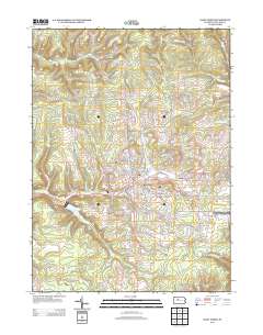
Layered GeoPDF 7.5 Minute Quadrangle Map. Layers of geospatial data include orthoimagery, roads, grids, geographic names, elevation contours, hydrography, and other selected map features.
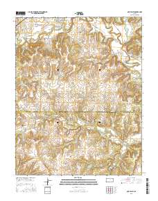
Layered GeoPDF 7.5 Minute Quadrangle Map. Layers of geospatial data include orthoimagery, roads, grids, geographic names, elevation contours, hydrography, and other selected map features.
Layered GeoPDF 7.5 Minute Quadrangle Map. Layers of geospatial data include orthoimagery, roads, grids, geographic names, elevation contours, hydrography, and other selected map features.
Layered GeoPDF 7.5 Minute Quadrangle Map. Layers of geospatial data include orthoimagery, roads, grids, geographic names, elevation contours, hydrography, and other selected map features.
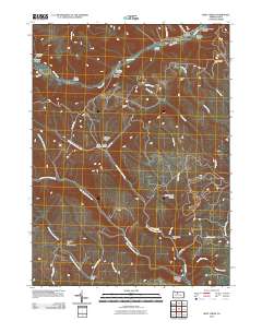
Layered GeoPDF 7.5 Minute Quadrangle Map. Layers of geospatial data include orthoimagery, roads, grids, geographic names, elevation contours, hydrography, and other selected map features.
|

|
