Filters: Tags: Edwards, CO (X)
8 results (27ms)|
Filters
Date Range
Contacts
Categories Tag Types Tag Schemes |
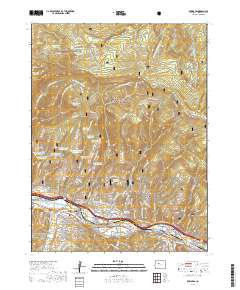
Layered geospatial PDF 7.5 Minute Quadrangle Map. Layers of geospatial data include orthoimagery, roads, grids, geographic names, elevation contours, hydrography, and other selected map features. This map is derived from GIS (geospatial information system) data. It represents a repackaging of GIS data in traditional map form, not creation of new information. The geospatial data in this map are from selected National Map data holdings and other government sources.
These data were released prior to the October 1, 2016 effective date for the USGS’s policy dictating the review, approval, and release of scientific data as referenced in USGS Survey Manual Chapter 502.8 Fundamental Science Practices: Review and Approval of Scientific Data for Release. This vector data set delineates the approximate boundary of the Eagle River watershed valley-fill aquifer (ERWVFA). This data set was developed by a cooperative project between the U.S. Geological Survey, Eagle County, the Eagle River Water and Sanitation District, the Town of Eagle, the Town of Gypsum, and the Upper Eagle Regional Water Authority. This project was designed to evaluate potential land-development effects on groundwater...
These data were released prior to the October 1, 2016 effective date for the USGS’s policy dictating the review, approval, and release of scientific data as referenced in USGS Survey Manual Chapter 502.8 Fundamental Science Practices: Review and Approval of Scientific Data for Release. This raster data set delineates the predicted probability of elevated nitrate concentrations in groundwater in the Eagle River watershed valley-fill aquifer, Eagle County, North-Central Colorado, 2006-2007. This data set was developed by a cooperative project between the U.S. Geological Survey, Eagle County, the Eagle River Water and Sanitation District, the Town of Eagle, the Town of Gypsum, and the Upper Eagle Regional Water Authority....
These data were released prior to the October 1, 2016 effective date for the USGS’s policy dictating the review, approval, and release of scientific data as referenced in USGS Survey Manual Chapter 502.8 Fundamental Science Practices: Review and Approval of Scientific Data for Release. This raster data set delineates the predicted probability of elevated volatile organic compound (VOC) concentrations in groundwater in the Eagle River watershed valley-fill aquifer, Eagle County, North-Central Colorado, 2006-2007. This data set was developed by a cooperative project between the U.S. Geological Survey, Eagle County, the Eagle River Water and Sanitation District, the Town of Eagle, the Town of Gypsum, and the Upper...
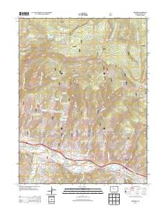
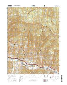
Layered GeoPDF 7.5 Minute Quadrangle Map. Layers of geospatial data include orthoimagery, roads, grids, geographic names, elevation contours, hydrography, and other selected map features.
Layered GeoPDF 7.5 Minute Quadrangle Map. Layers of geospatial data include orthoimagery, roads, grids, geographic names, elevation contours, hydrography, and other selected map features.
These data were released prior to the October 1, 2016 effective date for the USGS’s policy dictating the review, approval, and release of scientific data as referenced in USGS Survey Manual Chapter 502.8 Fundamental Science Practices: Review and Approval of Scientific Data for Release. This raster data set delineates the predicted probability of unmixed young groundwater (defined using chlorofluorocarbon-11 concentrations and tritium activities) in groundwater in the Eagle River watershed valley-fill aquifer, Eagle County, North-Central Colorado, 2006-2007. This data set was developed by a cooperative project between the U.S. Geological Survey, Eagle County, the Eagle River Water and Sanitation District, the Town...
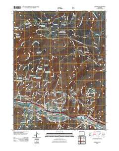
Layered geospatial PDF Map. Layers of geospatial data include orthoimagery, roads, grids, geographic names, elevation contours, hydrography, and other selected map features.
|

|
