Filters: Tags: Egypt (X)
54 results (24ms)|
Filters
Date Range
Extensions Types Contacts
Categories Tag Types
|
Cassiterite (SnO2) samples were collected from alluvial ore concentrate from the Abu Dabbab Granite in eastern Egypt. Samples (in the form of mounted loose grains) were prepared and analyzed for direct age dating on a laser ablation inductively coupled plasma mass spectrometer (LA-ICPMS) system at the U.S. Geological Survey in Denver, Colorado in February 2019. This data release accompanies the publication, 'Monazite and cassiterite U-Pb dating of the Abu Dabbab rare-metal granite, Egypt: Late Cryogenian metalliferous granite magmatism in the Arabian-Nubian Shield.' (Lehmann and others, 2020). The publication constrains the timing of the magmatic-hydrothermal processes of the Abu Dabbab Granite which represents...
Categories: Data;
Tags: Abu Dabbab mine,
Egypt,
GGGSC,
Geochemistry,
Geology, Geophysics, and Geochemistry Science Center,
Severed screen bridge, Kharga well 1A, Kharga Oasis. Egypt. ca.1964. Published in U.S. Geological Survey Water Supply Paper 1757-O, Figure 7. 1979.
Album Caption: Corroded, aluminum specimen from down-hole string, Mut well 2. Egypt. ca. 1964. Published in U.S. Geological Survey Water Supply Paper 1757- O, Figure 17. 1979.
This data set contains imagery from the National Agriculture Imagery Program (NAIP). The NAIP program is administered by USDA FSA and has been established to support two main FSA strategic goals centered on agricultural production. These are increase stewardship of America's natural resources while enhancing the environment, and to ensure commodities are procured and distributed effectively and efficiently to increase food security. The NAIP program supports these goals by acquiring and providing ortho imagery that has been collected during the agricultural growing season in the U.S. The NAIP ortho imagery is tailored to meet FSA requirements and is a fundamental tool used to support FSA farm and conservation programs....
This data set contains imagery from the National Agriculture Imagery Program (NAIP). The NAIP program is administered by USDA FSA and has been established to support two main FSA strategic goals centered on agricultural production. These are, increase stewardship of America's natural resources while enhancing the environment, and to ensure commodities are procured and distributed effectively and efficiently to increase food security. The NAIP program supports these goals by acquiring and providing ortho imagery that has been collected during the agricultural growing season in the U.S. The NAIP ortho imagery is tailored to meet FSA requirements and is a fundamental tool used to support FSA farm and conservation programs....
This data set contains imagery from the National Agriculture Imagery Program (NAIP). The NAIP program is administered by USDA FSA and has been established to support two main FSA strategic goals centered on agricultural production. These are, increase stewardship of America's natural resources while enhancing the environment, and to ensure commodities are procured and distributed effectively and efficiently to increase food security. The NAIP program supports these goals by acquiring and providing ortho imagery that has been collected during the agricultural growing season in the U.S. The NAIP ortho imagery is tailored to meet FSA requirements and is a fundamental tool used to support FSA farm and conservation programs....
This data set contains imagery from the National Agriculture Imagery Program (NAIP). The NAIP program is administered by USDA FSA and has been established to support two main FSA strategic goals centered on agricultural production. These are, increase stewardship of America's natural resources while enhancing the environment, and to ensure commodities are procured and distributed effectively and efficiently to increase food security. The NAIP program supports these goals by acquiring and providing ortho imagery that has been collected during the agricultural growing season in the U.S. The NAIP ortho imagery is tailored to meet FSA requirements and is a fundamental tool used to support FSA farm and conservation programs....
Compilation of Geospatial Data (GIS) for the Mineral Industries and Related Infrastructure of Africa
This geodatabase reflects the U.S. Geological Survey’s (USGS) ongoing commitment to its mission of understanding the nature and distribution of global mineral commodity supply chains by updating and publishing the georeferenced locations of mineral commodity production and processing facilities, mineral exploration and development sites, and mineral commodity exporting ports in Africa. The geodatabase and geospatial data layers serve to create a new geographic information product in the form of a geospatial portable document format (PDF) map. The geodatabase contains data layers from USGS, foreign governmental, and open-source sources as follows: (1) mineral production and processing facilities, (2) mineral exploration...
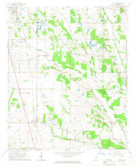
USGS Historical Quadrangle in GeoPDF.
Album Caption: Hassan Mostafa (right), Egyptian General Desert Development Organization, and the late Paul Bieber, USGS, measuring bicarbonate ion in water from Kharga Oasis well. Egypt. 1962. Published in U.S. Geological Survey Water Supply Paper 1757-O, Figure 27. 1979.
Album Caption: Etched aluminum probe, Kharga well 1A. (x10) Egypt. ca. 1964. Published in U.S. Geological Survey Water Supply Paper 1757-O, Figure 25. 1979.
Album Caption: Undamaged stainless steel screen specimen, surface line, Mut well 1. (x5) Egypt. ca. 1964. Published in U.S. Geological Survey Water Supply Paper 1757-O, Figure 18. 1979.
This data set contains imagery from the National Agriculture Imagery Program (NAIP). The NAIP program is administered by USDA FSA and has been established to support two main FSA strategic goals centered on agricultural production. These are increase stewardship of America's natural resources while enhancing the environment, and to ensure commodities are procured and distributed effectively and efficiently to increase food security. The NAIP program supports these goals by acquiring and providing ortho imagery that has been collected during the agricultural growing season in the U.S. The NAIP ortho imagery is tailored to meet FSA requirements and is a fundamental tool used to support FSA farm and conservation programs....
Album Caption: Corroded discharge line, Kharge well 1A, Kharga Oasis. Rule at right for scale. Egypt. ca.1964. Published in U.S. Geological Survey Water Supply Paper 1757-O, Figure 8. 1979.
This data set contains imagery from the National Agriculture Imagery Program (NAIP). The NAIP program is administered by USDA FSA and has been established to support two main FSA strategic goals centered on agricultural production. These are increase stewardship of America's natural resources while enhancing the environment, and to ensure commodities are procured and distributed effectively and efficiently to increase food security. The NAIP program supports these goals by acquiring and providing ortho imagery that has been collected during the agricultural growing season in the U.S. The NAIP ortho imagery is tailored to meet FSA requirements and is a fundamental tool used to support FSA farm and conservation programs....
This data set contains imagery from the National Agriculture Imagery Program (NAIP). The NAIP program is administered by USDA FSA and has been established to support two main FSA strategic goals centered on agricultural production. These are, increase stewardship of America's natural resources while enhancing the environment, and to ensure commodities are procured and distributed effectively and efficiently to increase food security. The NAIP program supports these goals by acquiring and providing ortho imagery that has been collected during the agricultural growing season in the U.S. The NAIP ortho imagery is tailored to meet FSA requirements and is a fundamental tool used to support FSA farm and conservation programs....
Album Caption: Photomicrograph of Nubian sandstone, showing loosely cemented angular grains. Egypt. n.d. Published in U.S. Geological Survey Water Supply Paper 1757-O, Figure 3. 1979.
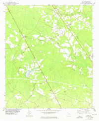
USGS Historical Quadrangle in GeoPDF.
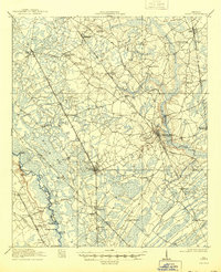
USGS Historical Quadrangle in GeoPDF.
This data set contains imagery from the National Agriculture Imagery Program (NAIP). The NAIP program is administered by USDA FSA and has been established to support two main FSA strategic goals centered on agricultural production. These are, increase stewardship of America's natural resources while enhancing the environment, and to ensure commodities are procured and distributed effectively and efficiently to increase food security. The NAIP program supports these goals by acquiring and providing ortho imagery that has been collected during the agricultural growing season in the U.S. The NAIP ortho imagery is tailored to meet FSA requirements and is a fundamental tool used to support FSA farm and conservation programs....
|

|
