Filters: Tags: Elk River (X)
23 results (109ms)|
Filters
Date Range
Extensions Types
Contacts
Categories Tag Types Tag Schemes |
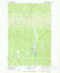
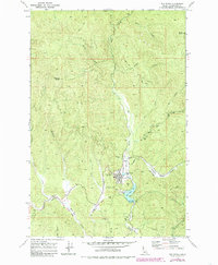
USGS Historical Quadrangle in GeoPDF.
Canadian discrete water quality data and daily streamflow records were evaluated using the Weighted Regression on Time, Discharge, and Seasons (WRTDS) model implemented with the EGRET R package (Hirsch et al. 2010, Hirsch and De Cicco 2015). Models were used to estimate loads of solutes and evaluate trends for three constituents of interest (selenium, nitrate, and sulfate). Six models were generated; one model for each of the three constituents of interest, in each of the two major tributaries to Lake Koocanusa: the Kootenay River at Fenwick (BC08NG0009), and the Elk River above Highway 93 Near Elko (BC08NK0003). Data were obtained by downloading data from the British Columbia Water Tool (https://kwt.bcwatertool.ca/surface-water-quality,...
This data set contains imagery from the National Agriculture Imagery Program (NAIP). The NAIP program is administered by USDA FSA and has been established to support two main FSA strategic goals centered on agricultural production. These are, increase stewardship of America's natural resources while enhancing the environment, and to ensure commodities are procured and distributed effectively and efficiently to increase food security. The NAIP program supports these goals by acquiring and providing ortho imagery that has been collected during the agricultural growing season in the U.S. The NAIP ortho imagery is tailored to meet FSA requirements and is a fundamental tool used to support FSA farm and conservation programs....
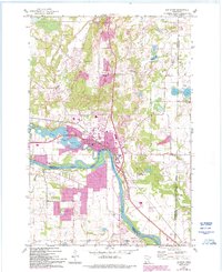
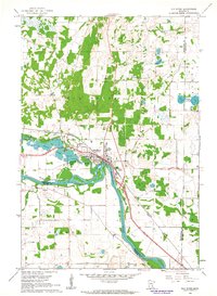
USGS Historical Quadrangle in GeoPDF.
This dataset consists of select contaminants of emerging concern (CEC) including pesticides and transformation products, pharmaceuticals and transformation products, and wastewater indicator compound results measured in 131 surface water, 129 bottom sediment, 7 field replicate, and 6 field blank samples collected from 131 sites located on 27 tributaries of the Great Lakes during the summer of 2019. Samples were analyzed at the U.S. Geological Survey National Water Quality Laboratory (NWQL). Surface water samples were collected and analyzed for 238 pesticides, pesticide transformation products, and surrogate compounds (NWQL laboratory schedule 2437; Sandstrom and others, 2015), 152 pharmaceuticals, pharmaceutical...
Categories: Data;
Types: Map Service,
OGC WFS Layer,
OGC WMS Layer,
OGC WMS Service;
Tags: Au Gres River,
Buffalo River,
Cattaraugus River,
Chippewa River,
East Twin River,
Canadian discrete water quality data and daily streamflow records were evaluated using the Weighted Regression on Time, Discharge, and Seasons (WRTDS) model implemented with the EGRET R package (Hirsch et al. 2010, Hirsch and De Cicco 2015). Models were used to estimate loads of solutes and evaluate trends for three constituents of interest (selenium, nitrate, and sulfate). Six models were generated; one model for each of the three constituents of interest, in each of the two major tributaries to Lake Koocanusa: the Kootenay River at Fenwick (BC08NG0009), and the Elk River above Highway 93 Near Elko (BC08NK0003). Data were obtained by downloading data from the British Columbia Water Tool (https://kwt.bcwatertool.ca/surface-water-quality,...
Categories: Data;
Tags: Coal Mining,
Elk River,
Koocanusa Reservoir,
Kootenai River,
Kootenay Boundary,
Canadian discrete water quality data and daily streamflow records were evaluated using the Weighted Regression on Time, Discharge, and Seasons (WRTDS) model implemented with the EGRET R package (Hirsch et al. 2010, Hirsch and De Cicco 2015). Models were used to estimate loads of solutes and evaluate trends for three constituents of interest (selenium, nitrate, and sulfate). Six models were generated; one model for each of the three constituents of interest, in each of the two major tributaries to Lake Koocanusa: the Kootenay River at Fenwick (BC08NG0009), and the Elk River above Highway 93 Near Elko (BC08NK0003). Data were obtained by downloading data from the British Columbia Water Tool (https://kwt.bcwatertool.ca/surface-water-quality,...
Types: Map Service,
OGC WFS Layer,
OGC WMS Layer,
OGC WMS Service;
Tags: British Columbia,
Canada,
Coal Mining,
Elk River,
Koocanusa Reservoir,
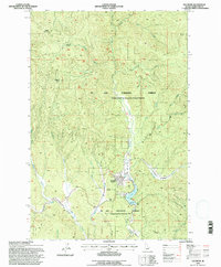
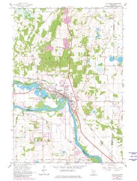
USGS Historical Quadrangle in GeoPDF.
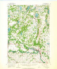
USGS Historical Quadrangle in GeoPDF.
Canadian discrete water quality data and daily streamflow records were evaluated using the Weighted Regression on Time, Discharge, and Seasons (WRTDS) model implemented with the EGRET R package (Hirsch et al. 2010, Hirsch and De Cicco 2015). Models were used to estimate loads of solutes and evaluate trends for three constituents of interest (selenium, nitrate, and sulfate). Six models were generated; one model for each of the three constituents of interest, in each of the two major tributaries to Lake Koocanusa: the Kootenay River at Fenwick (BC08NG0009), and the Elk River above Highway 93 Near Elko (BC08NK0003). Data were obtained by downloading data from the British Columbia Water Tool (https://kwt.bcwatertool.ca/surface-water-quality,...
This data set contains imagery from the National Agriculture Imagery Program (NAIP). The NAIP program is administered by USDA FSA and has been established to support two main FSA strategic goals centered on agricultural production. These are, increase stewardship of America's natural resources while enhancing the environment, and to ensure commodities are procured and distributed effectively and efficiently to increase food security. The NAIP program supports these goals by acquiring and providing ortho imagery that has been collected during the agricultural growing season in the U.S. The NAIP ortho imagery is tailored to meet FSA requirements and is a fundamental tool used to support FSA farm and conservation programs....
USGS Historical Quadrangle in GeoPDF.
This data set contains imagery from the National Agriculture Imagery Program (NAIP). The NAIP program is administered by USDA FSA and has been established to support two main FSA strategic goals centered on agricultural production. These are, increase stewardship of America's natural resources while enhancing the environment, and to ensure commodities are procured and distributed effectively and efficiently to increase food security. The NAIP program supports these goals by acquiring and providing ortho imagery that has been collected during the agricultural growing season in the U.S. The NAIP ortho imagery is tailored to meet FSA requirements and is a fundamental tool used to support FSA farm and conservation programs....
This data set contains imagery from the National Agriculture Imagery Program (NAIP). The NAIP program is administered by USDA FSA and has been established to support two main FSA strategic goals centered on agricultural production. These are, increase stewardship of America's natural resources while enhancing the environment, and to ensure commodities are procured and distributed effectively and efficiently to increase food security. The NAIP program supports these goals by acquiring and providing ortho imagery that has been collected during the agricultural growing season in the U.S. The NAIP ortho imagery is tailored to meet FSA requirements and is a fundamental tool used to support FSA farm and conservation programs....
USGS Historical Quadrangle in GeoPDF.
In February 2017, the Grand River Dam Authority filed to relicense the Pensacola Hydroelectric Project with the Federal Energy Regulatory Commission. The predominant feature of the Pensacola Hydroelectric Project is Pensacola Dam, which impounds Grand Lake O’ the Cherokees (locally called Grand Lake) in northeastern Oklahoma. Identification of information gaps and assessment of project effects on stakeholders are central aspects of the Federal Energy Regulatory Commission relicensing process. Some upstream stakeholders have expressed concerns about the dynamics of sedimentation and flood flows in the transition zone between major rivers and Grand Lake O’ the Cherokees. To relicense the Pensacola Hydroelectric Project...
Categories: Data;
Types: Downloadable,
Map Service,
OGC WFS Layer,
OGC WMS Layer,
Shapefile;
Tags: Elk River,
Geomorphology,
Grand Lake O' the Cherokees,
Hydrogeology,
Missouri,
This data set contains imagery from the National Agriculture Imagery Program (NAIP). The NAIP program is administered by USDA FSA and has been established to support two main FSA strategic goals centered on agricultural production. These are, increase stewardship of America's natural resources while enhancing the environment, and to ensure commodities are procured and distributed effectively and efficiently to increase food security. The NAIP program supports these goals by acquiring and providing ortho imagery that has been collected during the agricultural growing season in the U.S. The NAIP ortho imagery is tailored to meet FSA requirements and is a fundamental tool used to support FSA farm and conservation programs....
USGS Historical Quadrangle in GeoPDF.
Canadian discrete water quality data and daily streamflow records were evaluated using the Weighted Regression on Time, Discharge, and Seasons (WRTDS) model implemented with the EGRET R package (Hirsch et al. 2010, Hirsch and De Cicco 2015). Models were used to estimate loads of solutes and evaluate trends for three constituents of interest (selenium, nitrate, and sulfate). Six models were generated; one model for each of the three constituents of interest, in each of the two major tributaries to Lake Koocanusa: the Kootenay River at Fenwick (BC08NG0009), and the Elk River above Highway 93 Near Elko (BC08NK0003). Data were obtained by downloading data from the British Columbia Water Tool (https://kwt.bcwatertool.ca/surface-water-quality,...
This data set contains imagery from the National Agriculture Imagery Program (NAIP). The NAIP program is administered by USDA FSA and has been established to support two main FSA strategic goals centered on agricultural production. These are, increase stewardship of America's natural resources while enhancing the environment, and to ensure commodities are procured and distributed effectively and efficiently to increase food security. The NAIP program supports these goals by acquiring and providing ortho imagery that has been collected during the agricultural growing season in the U.S. The NAIP ortho imagery is tailored to meet FSA requirements and is a fundamental tool used to support FSA farm and conservation programs....
|

|
