Filters: Tags: Endangered (X)
68 results (36ms)|
Filters
Date Range
Extensions (Less) Types (Less)
Contacts (Less)
Categories (Less) Tag Types
|
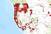
This is a web map service from the USFWS. It contains multiple layers related to final critical habitat for threatened and endangered species. Critical habitat are areas considered essential for the conservation of a listed species. These datasets include both line and polygon features.More information can be found here: http://criticalhabitat.fws.gov/crithab/
This dataset was created to monitor the status, condition and trend of national BLM resources in accordance with BLM policies. The methodology used for the collection of these data can be found on landscapetoolbox.org and the Monitoring Manual, 2nd Edition. These data should not be used for statistical or spatial inferences without knowledge of how the sample design was drawn or without calculating spatial weights for the points based on the sample design. These include monitoring data collected nationally to understand the status, condition, and trend of resources on BLM lands. Data are collected in accordance with the BLM Assessment, Inventory, and Monitoring (AIM) Strategy. The AIM Strategy specifies a probabilistic...
This EnviroAtlas web service supports research and online mapping activities related to EnviroAtlas (https://www.epa.gov/enviroatlas). The Clean and Plentiful Water category in this web service includes layers illustrating the ecosystems and natural resources that filter and regulate water, the need or demand for clean and plentiful water, the impacts associated with water quality, and factors that place stress on water quality and supply. EnviroAtlas allows the user to interact with a web-based, easy-to-use, mapping application to view and analyze multiple ecosystem services for the conterminous United States. Additional descriptive information about each attribute in this web service is located within each web...
Grasslands comprise a small part of the Chihuahuan Desert but are vital to the biological diversity of the ecoregion. Characteristic grasses of the Chihuahuan Desert are tobosa (Pleuraphis mutica) and black grama (Bouteloua eriopoda) but other common species include alakali sacaton (Sporobolus airoides), big alkali sacaton (S. wrightii), mesa dropseed (S. flexuosus), blue grama (B. gracilis), sideoats grama (B. curtipendula ), hairy grama (B. hirsuta), slender grama (B. filiformis), chino grama (B. brevista), spruce top grama (B. chondrosioides), bush muhly (Muhlenbergia porteri), several three awns (Aristida spp.), and fluff grass (Dasyochloa pulchela) (Johnson 1974, Dinerstein et al. 2000). Many of the sites discussed...
Categories: Publication;
Types: Citation,
Map Service,
OGC WFS Layer,
OGC WMS Layer,
OGC WMS Service;
Tags: English,
Madrean,
Spanish,
agriculture,
assessment,
The Desert Renewable Energy Conservation Plan (DRECP), a major component of California's renewable energy planning efforts, will help provide effective protection and conservation of desert ecosystems while allowing for the appropriate development of renewable energy projects. The DRECP is focused on the desert regions and adjacent lands of seven California counties - Imperial, Inyo, Kern, Los Angeles, Riverside, San Bernardino, and San Diego. It is being prepared through an unprecedented collaborative effort between the California Energy Commission, California Department of Fish and Wildlife, the U.S. Bureau of Land Management, and the U.S. Fish and Wildlife Service also known as the Renewable Energy Action Team....
Categories: Publication;
Types: Citation,
Map Service,
OGC WFS Layer,
OGC WMS Layer,
OGC WMS Service;
Tags: English,
GIS,
OHV,
US,
bird,
What are current conditions for important park natural resources? What are the critical data and knowledge gaps? What are some of the factors that are influencing park resource conditions? Natural Resource Condition Assessments (NRCAs) evaluate and report on the above for a subset of important natural resources in national park units (hereafter, parks). Focal study resources and indicators are selected on a park-by-park basis, guided by use of structured resource assessment and reporting frameworks. Considerations include park resource setting and enabling legislation (what are this park's most important natural resources?) and presently available data and expertise (what can be evaluated at this time?). In addition...
Categories: Data;
Types: ArcGIS REST Map Service,
Map Service,
OGC WFS Layer,
OGC WMS Layer,
OGC WMS Service;
Tags: Chihuahuan Desert,
English,
GIS,
Madrean,
Mojave Desert,
Natural landscapes in the Southwestern United States are changing. In recent decades, rising temperatures and drought have led to drier conditions, contributed to large-scale ecological impacts, and affected many plant and animal species across the region. The current and future trajectory of climate change underscores the need for managers and conservation professionals to understand the impacts of these patterns on natural resources. In this regional assessment of the Southwest Climate Change Initiative, we evaluate changes in annual average temperatures from 1951–2006 across major habitats and large watersheds and compare these changes to the number of species of conservation concern that are found within these...
Categories: Publication;
Types: Citation,
Map Service,
OGC WFS Layer,
OGC WMS Layer,
OGC WMS Service;
Tags: Chihuahuan Desert,
English,
Madrean,
Mojave Desert,
Sonoran Desert,
Welcome to the Wind and Wildlife Landscape Assessment Tool (LAT), a collaboration organized by the American Wind Wildlife Institute (AWWI) and The Nature Conservancy (TNC). The LAT is designed as a landscape-level planning tool to identify sensitive wildlife habitat and areas that are likely to have low wildlife risk where wind energy development could be prioritized. Although the siting of individual wind energy projects will require on-the-ground surveys to verify data shown here, our hope is that this tool will provide stakeholders with information that facilitates the siting of wind energy in areas with minimal impacts to wildlife, as well as the development of conservation plans, monitoring plans and mitigation...
Types: Map Service,
OGC WFS Layer,
OGC WMS Layer,
OGC WMS Service;
Tags: English,
GIS,
US,
agriculture,
amphibian,
Provisional Tennessee State Wildlife Action Plan (TN-SWAP) terrestrial habitat priorities versus results of the population growth model developed by the Tennessee Chapter of The Nature Conservancy, 2008, converted to percent projected developed landcover in the year 2040. Spatial growth model was developed using population growth projections from the University of Tennessee Center for Business and Economic Research (UT-CBER), county urban growth boundaries, 2000 census blocks, and various ancillary datasets.
Categories: Data;
Tags: Academics & scientific researchers,
AppLCC,
Appalachian,
Conservation NGOs,
Data,
This EnviroAtlas web service supports research and online mapping activities related to EnviroAtlas (https://www.epa.gov/enviroatlas). The Food, Fuel, and Materials category in this web service includes layers illustrating the ecosystems and natural resources that provide or support the production of food, fuel, or other materials, the need or demand for these items, the impacts associated with their presence and accessibility, and factors that place stress on the natural environment's capability to provide these benefits. EnviroAtlas allows the user to interact with a web-based, easy-to-use, mapping application to view and analyze multiple ecosystem services for the conterminous United States. Additional descriptive...
This dataset consists of three datafiles: 1) vegetation, 2) abiotic factors, and 3) groundwater levels. Vegetation data were collected twice per month between July and September of 2019 and 2020. Data was collected by establishing 1m x 1m subplots within 12 5m-radius sampling plots distributed across the management units of Bitter Lake National Wildlife Refuge. Subplots were established to represent plot-level vegetation structure and facilitate estimates of rare plant relative abundance. The abiotic factors dataset includes observations of surface soil moisture, salinity, groundwater quality data, and rare plant presence taken weekly between March – October 2019 and May – October 2020 at each established plot within...
Results of the population growth model developed by the Tennessee Chapter of The Nature Conservancy, 2008, converted to percent projected developed landcover in the year 2040. Spatial growth model was developed using population growth projections from the University of Tennessee Center for Business and Economic Research (UT-CBER), county urban growth boundaries, 2000 census blocks, and various ancillary datasets.
Categories: Data;
Tags: Academics & scientific researchers,
AppLCC,
Appalachian,
Conservation NGOs,
Data,
Geoinformación es un portal de información geográfica donde se puede consultar, visualizar y descargar cartografía temática de diferentes escalas generada y recopilada por CONABIO. Para desarrollar este portal se utilizó software de código abierto (open source). Las características principales del portal, son, desarrollar mecanismos de acceso a los acervos de datos geográficos de la CONABIO a través de servicios de información especializados, como: Vista gráfica de la información por temas generales. Información detallada sobre la cartografía disponible a través de búsquedas en los metadatos. Descarga de información en un formato compatible (shapefile) La información cartográfica es administrada por la Subdirección...
Types: Map Service,
OGC WFS Layer,
OGC WMS Layer,
OGC WMS Service;
Tags: GIS,
Mexico,
Spanish,
agriculture,
amphibian,
The Department of Defense's (DoD) Natural Resources Conservation Program (NR Program) provides policy, guidance, and oversight for management of natural resources on nearly 25 million acres of military land, air, and water resources. The NR Program's goal is to ensure continued access to realistic habitat conditions to support the military's combat readiness mission, while simultaneously working to ensure the long term sustainability of our country's priceless natural heritage. The NR Program 's primary responsibilities are to: Oversee development and implementation of natural resource-related policy, guidance , procedures, and metrics; Ensure Military Service compliance with legislative obligations Executive...
Types: Map Service,
OGC WFS Layer,
OGC WMS Layer,
OGC WMS Service;
Tags: agency,
biodiversity,
climate,
endangered,
invasive,
LandScope America—a collaborative project of NatureServe and the National Geographic Society—is a new online resource for the land-protection community and the public. By bringing together maps, data, photos, and stories about America’s natural places and open spaces, our goal is to inform and inspire conservation of our lands and waters.
Types: Map Service,
OGC WFS Layer,
OGC WMS Layer,
OGC WMS Service;
Tags: Chihuahuan Desert,
English,
GIS,
Mojave Desert,
Sonoran Desert,
The Southwest Regional Gap Analysis Project (SWReGAP) is an update of the Gap Analysis Program’s mapping and assessment of biodiversity for the five-state region encompassing Arizona, Colorado, Nevada, New Mexico, and Utah. It is a multi-institutional cooperative effort coordinated by the U.S. Geological Survey Gap Analysis Program. The primary objective of the update is to use a coordinated mapping approach to create detailed, seamless GIS maps of land cover, all native terrestrial vertebrate species, land stewardship, and management status, and to analyze this information to identify those biotic elements that are underrepresented on lands managed for their long term conservation or are “gaps.”
Types: Map Service,
OGC WFS Layer,
OGC WMS Layer,
OGC WMS Service;
Tags: Chihuahuan Desert,
English,
GIS,
Madrean,
Mojave Desert,
Pima County makes extensive use of Geographical Information System (GIS) technology for making maps. For the Sonoran Desert Conservation Plan, this was an important technology for assembling the extensive existing data, both digital and non-digital, identifying critical gaps in the data and potential remedies, and providing a means for analyzing the information on biological and physical resources over the six million acre study area. SDCP Mapguide was created to display many of the natural resource GIS data layers, but Mapguide is being replaced with PimaMaps. You can use either to make your own overlays on aerial photos, line maps, or USGS topography. Customize your online map while panning and zooming on the...
Types: Map Service,
OGC WFS Layer,
OGC WMS Layer,
OGC WMS Service;
Tags: BMP,
GIS,
amphibian,
biodiversity,
bird,

This dataset represents bald eagle locations compiled for the United States Bureau of Land Management's Western Oregon Plan Revision. Included is forest type found at each site.
This is an aggregate national dataset describing the geographic boundaries of the ACEC within the BLM managed public lands. The designated ACECs are "areas within the public lands where special management attention is required to protect and prevent irreparable damage to important historic, cultural, or scenic values, fish and wildlife resources or other natural systems of processes, or to protect life and safety from natural hazards."
Types: Downloadable;
Tags: ACEC,
Areas of Critical Environmental Concern,
BLM,
Biological,
Bureau of Land Management,
Grasslands of the Sky Islands region once covered over 13 million acres in southeastern Arizona and adjacent portions of New Mexico, Sonora, and Chihuahua. Attempts to evaluate current ecological conditions suggest that approximately two thirds of these remain as intact or restorable grassland habitat. These grasslands provide watershed services such as flood control and aquifer recharge across the region, and continue to support dozens of species of concern. Prioritizing conservation interventions for these remaining grassland blocks has been challenging. Reliable data on condition and conservation value of grasslands in the region have not been systematically summarized. State and national boundaries further complicate...
Categories: Publication;
Types: Citation,
Map Service,
OGC WFS Layer,
OGC WMS Layer,
OGC WMS Service;
Tags: Chihuahuan Desert,
English,
Madrean,
Mexico,
US,
|

|
