Filters: Tags: Endangered species (X)
221 results (12ms)|
Filters
Date Range
Extensions Types Contacts
Categories Tag Types
|

These data identify the areas where final critical habitat has been mapped by the USFWS for invertebrate species. These data were compiled by the Conservation Biology Institute (CBI) from a series of individual shapefiles published by the USFWS (http://criticalhabitat.fws.gov/). For more information on the process for mapping the critical habitat for each species, please see the metadata for each species listed on the USFWS web site. This particular dataset contains the fish species critical habitat areas that are represented by polygons. Critical habitat represented by lines are contained in a separate dataset. Critical habitat designations have not been made for all listed endangered species. Where critical habitat...

These data identify the areas where final critical habitat has been mapped by the USFWS for plant species in the western United States. These data were compiled by the Conservation Biology Institute (CBI) from a series of individual shapefiles published by the USFWS (http://criticalhabitat.fws.gov/). For more information on the process for mapping the critical habitat for each species, please see the metadata for each species listed on the USFWS web site. Critical habitat designations have not been made for all listed endangered species. Where critical habitat has been mapped, this dataset only contains those species for which GIS datasets have been made publicly available. Other critical habitat maps exist for...
To understand the genetic structure of six rare plant species (Acanthomintha ilicifolia, Baccharis vanessae, Chloropyron maritimum ssp. maritimus, Deinandra conjugens, Dicranostegia orcuttiana, Monardella viminea), we obtained samples from known occurrences in San Diego County, prepared and sequenced ddRAD genomic libraries, and developed and analyzed a panel of genetic markers to assess population diversity and divergence. We provide this SNP genotype dataset in Structure format, produced in Stacks v2.0b8, for future monitoring efforts and population genetic analysis. These data support the following publication: Milano, E.R., and Vandergast, A.G., 2018, Population genomic surveys for six rare plant species in...
Conversion and fragmentation of wildlife habitat often leads to smaller and isolated populations and can reduce a species’ ability to disperse across the landscape. As a consequence, genetic drift can quickly lower genetic variation and increase vulnerability to extirpation. For species of conservation concern, quantification of population size and connectivity can clarify the influence of genetic drift in local populations and provides important information for conservation management and recovery strategies. Here, we used genome-wide single nucleotide polymorphism (SNP) data and capture-mark-recapture methods to evaluate the population structure, genetic diversity and abundance of seven focal sites of the endangered...
The Long Term Resource Monitoring (LTRM) annual fish monitoring began on the Upper Mississippi and Illinois Rivers in 1989. During the first two years samples were collected at a series of fixed sampling sites, then in 1993 a stratified random sampling approach was added to the collection effort. This approach utilizes a computer routine that randomly selects sampling sites from a pool of potential sites that have been categorized by strata (e.g., aquatic habitat type, distance to shore, connectivity to main channel). The results from these collections are stored in an Oracle database at the Upper Midwest Environmental Science Center (UMESC). UMESC provides free access to the data through the Centers Web site (www.umesc.usgs.gov)....
Types: Map Service,
OGC WFS Layer,
OGC WMS Layer,
OGC WMS Service;
Tags: Fish,
Fishery,
Illinois,
Illinois River,
Iowa,
These data include potential Yuma Ridgway’s rail (Rallus obsoletus yumanensis) habitat classified from concurrently occurring Landsat images taken during telemetry field studies of and call count surveys for Yuma Ridgway's rail in 2016.
Categories: Data;
Types: Downloadable,
GeoTIFF,
Map Service,
Raster;
Tags: Landsat images,
Listed birds,
Salton Sea,
Sonny Bono Salton Sea National Wildlife Refuge,
Wister Waterfowl Management Area,
The whooping crane is a listed endangered species in North America, protected under federal legislation in the United States and Canada. The only self-sustaining and wild population of Whooping Cranes nests at and near Wood Buffalo National Park near the provincial border of Northwest Territories and Alberta, Canada. Birds from this population migrate through the Great Plains of North America and winter along the Gulf Coast of Texas at Aransas National Wildlife Refuge and surrounding lands. These data represent predictions from a resource selection function using GPS locations between 2010 and 2016 during migration. This surface represents predictions under drought conditions across the study area. Pixel values...
Categories: Data;
Types: Downloadable,
GeoTIFF,
Map Service,
Raster;
Tags: Kansas,
Migratory birds,
Montana,
Nebraska,
North Dakota,
Longstanding taxonomic uncertainties have limited conservation efforts for species currently assigned to the freshwater mussel genus Alasmidonta. Here, we present mitochondrial and nuclear DNA sequence data needed to assess the genus- and species-level taxonomy of Alasmidonta. These molecular data allowed us to test whether cryptic diversity exists within Alasmidonta and whether A. triangulata and A. arcula are distinct species. Details associated with specimens and DNA sequence data are provided here to provide a foundation for future research on Alasmidonta and give conservation agencies greater confidence in the findings of our work.
Categories: Data;
Tags: DNA sequencing,
Genetics,
USGS Science Data Catalog (SDC),
biota,
conservation genetics,
This data is a companion to the manuscript titled "Data integration reveals dynamic and systematic patterns of breeding habitat use by a threatened shorebird". Advances in both remote sensing and analytical tools for spatial data have allowed for the integration of dynamic processes into species distribution models. We developed a spatiotemporal model of breeding habitat use and density for a federally threatened shorebird (piping plover, Charadrius melodus) by integrating a 20-year (2000 – 2019) nesting dataset with opportunistic, volunteer collected (eBird), sightings. Piping plovers are an ideal candidate for dynamic habitat models because this species depends on habitat created and maintained by highly variable...
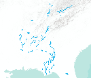
Critical habitat lines - Mississippi River BasinWhen a species is proposed for listing as endangered or threatened under the Endangered Species Act, the U.S. Fish and Wildlife Service must consider whether there are areas of habitat believed to be essential the species’ conservation. Those areas may be proposed for designation as “critical habitat.” Critical habitat is a term defined and used in the Act. It is a specific geographic area(s) that contains features essential for the conservation of a threatened or endangered species and that may require special management and protection. Critical habitat may include an area that is not currently occupied by the species but that will be needed for its recovery. An area...
Categories: Data;
Types: Citation,
Downloadable,
Map Service,
OGC WFS Layer,
OGC WMS Layer,
Shapefile;
Tags: Biota,
Critical Habitat,
Endangered species,
Listed species,
Threatened species,
This project evaluated the potential impacts of storm surges and relative sea level rise on nesting geese and eider species that commonly breed on the Yukon-Kuskokwim Delta (Y-K Delta). Habitat suitability maps for breeding waterbirds were developed to identify current waterbird breeding habitat and distributions. Short-term climate change impacts were assessed by comparing nest densities in relation to magnitude of storms that occurred in the prior fall from 2000-2013. Additionally, nest densities were modeled using random forests in relation to the time-integrated flood index (e.g., a storm specific measure accounting for both water depth and duration of flooding) for four modeled storms (2005, 2006, 2009, and...
Categories: Data,
Project;
Types: Map Service,
OGC WFS Layer,
OGC WMS Layer,
OGC WMS Service;
Tags: DELTAS,
DELTAS,
DUCKS/GEESE/SWANS,
DUCKS/GEESE/SWANS,
Decision Support,
Data presented are results of surveys in 2020 for Southwestern Willow Flycatcher (Empidonax traillii extimus) in San Diego County, California. Surveys were conducted at the 2016-19 nest monitoring locations (Cleveland National Forest, Rey River Ranch, and Vista Irrigation District) and at Lake Henshaw along the Upper San Luis Rey River. Surveys were conducted along multiple sections of the river where permission to access properties could be obtained. Locations were surveyed using a standardized protocol three to four times between 15 May and 31 July. The number, age (adult or juvenile), sex, banding status (color banded or not, and if so, color combination), and breeding status (paired, undetermined, or transient)...
Categories: Data;
Types: Downloadable,
Map Service,
OGC WFS Layer,
OGC WMS Layer,
Shapefile;
Tags: San Diego,
San Luis Rey River,
biota,
birds,
endangered species,
Data presented are results of surveys in 2022 for Southwestern Willow Flycatcher (Empidonax traillii extimus) in San Diego County, California. Surveys were conducted at the 2016-19 nest monitoring locations (Cleveland National Forest, Rey River Ranch, and Vista Irrigation District) and at Lake Henshaw along the Upper San Luis Rey River. Surveys were conducted along multiple sections of the river where permission to access properties could be obtained. Locations were surveyed using a standardized protocol three to four times between 15 May and 31 July. The number, age (adult or juvenile), sex, banding status (color banded or not, and if so, color combination), and breeding status (paired, undetermined, or transient)...
Categories: Data;
Types: Downloadable,
Map Service,
OGC WFS Layer,
OGC WMS Layer,
Shapefile;
Tags: Ecology,
San Diego,
San Luis Rey River,
USGS Science Data Catalog (SDC),
Wildlife Biology,
Hawaiian hoary bats ('ōpe'ape'a; Lasiurus semotus) were captured and tracked back to roosting locations on Hawaiʻi Island from 2018-2021. We examined resource selection at multiple spatial scales - perch location within a roost tree, roost tree, and forest stand. We used a discrete choice modeling approach to investigate roost selection and describe attributes of day-roost trees including those used as maternity roosts. ‘Ōpe‘ape‘a were found roosting in a variety of tree species and in an assortment of habitat types including native and non-native habitats. This data release consists of six tabular datasets: (1) Hawaiʻi Island ʻōpeʻapeʻa roost perch metrics, 2019–2021, (2) Hawai‘i Island ʻōpeʻapeʻa roost tree metrics,...
Hawaiian hoary bats ('ōpe'ape'a; Lasiurus semotus) were captured and tracked back to roosting locations on Hawaiʻi Island. Roost stand metrics were observed and collected from 2018 to 2021. We observed a total of 123 roost trees used by 90 bats (29 female; 58 male; 3 unknown). This data file includes data pertaining to roost stand metrics including, elevation, slope, canopy tree species, and mean canopy height.
Target Lists for Lanai Island Spatial Prioritization of Native Plant Habitat and Hunting Areas, 2021
Broadly, recovery of threatened and endangered species requires specific management actions by natural resource managers at a fine scale. We used a systematic conservation planning framework to outline conservation goals across multiple land-uses, including native habitat protection and identifying endangered species-specific recovery areas while minimizing intrusion on existing hunting areas on the island of Lanai. We used spatial prioritization tools to generate multiple scenarios where both conservation and hunting areas (deemed zones for analysis purposes) were delineated to meet land-use goals. These delineated areas will help land managers to minimize conflicts between uses for populations of non-native game...
When a species is proposed for listing as endangered or threatened under the Endangered Species Act, the U.S. Fish and Wildlife Service must consider whether there are areas of habitat believed to be essential the species’ conservation. Those areas may be proposed for designation as “critical habitat.” Critical habitat is a term defined and used in the Act. It is a specific geographic area(s) that contains features essential for the conservation of a threatened or endangered species and that may require special management and protection. Critical habitat may include an area that is not currently occupied by the species but that will be needed for its recovery. An area is designated as “critical habitat” after the...
Categories: Data;
Types: ArcGIS REST Map Service,
ArcGIS Service Definition,
Citation,
Downloadable,
Map Service;
Tags: Alabama,
Alaska,
Arizona,
Arkansas,
Biota,
The Proposed Action is needed to protect and enhance shrub-steppe and riparian habitat for sharp-tailed grouse (Tympanuchus phasianellus columbianus), Pygmy rabbits (Brachylagus idahoensis), and other indigenous wildlife species. The purpose of the Proposed Action is to compensate, in part, for wildlife habitat lost from the construction of Grand Coulee Dam and the inundation of Lake Roosevelt. Bonneville Power Administration proposes to fund management agreements, conservation easements, acquisition of fee title, or a combination of these on as many as 29,000 acres in Lincoln and Douglas Counties to improve shrub-steppe and riparian habitat for sharp-tailed grouse and pygmy rabbits. The BPA also proposes to fund...
Categories: Publication;
Types: Citation;
Tags: animals,
birds,
endangered species,
environmental impacts,
environmental sciences,
Accurate assessment of species identity is fundamental for conservation biology. Using molecular markers from the mitochondrial and nuclear genomes, we discovered that many putatively native populations of greenback cutthroat trout (Oncorhynchus clarkii stomias) comprised another subspecies of cutthroat trout, Colorado River cutthroat trout (Oncorhynchus clarkii pleuriticus). The error can be explained by the introduction of Colorado River cutthroat trout throughout the native range of greenback cutthroat trout in the late 19th and early 20th centuries by fish stocking activities. Our results suggest greenback cutthroat trout within its native range is at a higher risk of extinction than ever before despite conservation...
Categories: Publication;
Types: Citation,
Journal Citation;
Tags: AFLP,
Molecular Ecology,
conservation genetics,
cutthroat trout,
endangered species,
These data identify the areas where final critical habitat has been mapped by the USFWS for invertebrate species. These data were compiled by the Conservation Biology Institute (CBI) from a series of individual shapefiles published by the USFWS (http://criticalhabitat.fws.gov/). For more information on the process for mapping the critical habitat for each species, please see the metadata for each species listed on the USFWS web site. This particular dataset contains the invertebrate species critical habitat areas that are represented by lines. Critical habitat represented by polygons are contained in a separate dataset. Critical habitat designations have not been made for all listed endangered species. Where critical...
|

|
