Filters
Date Types (for Date Range)
Contacts
Tag Types
Tag Schemes
|

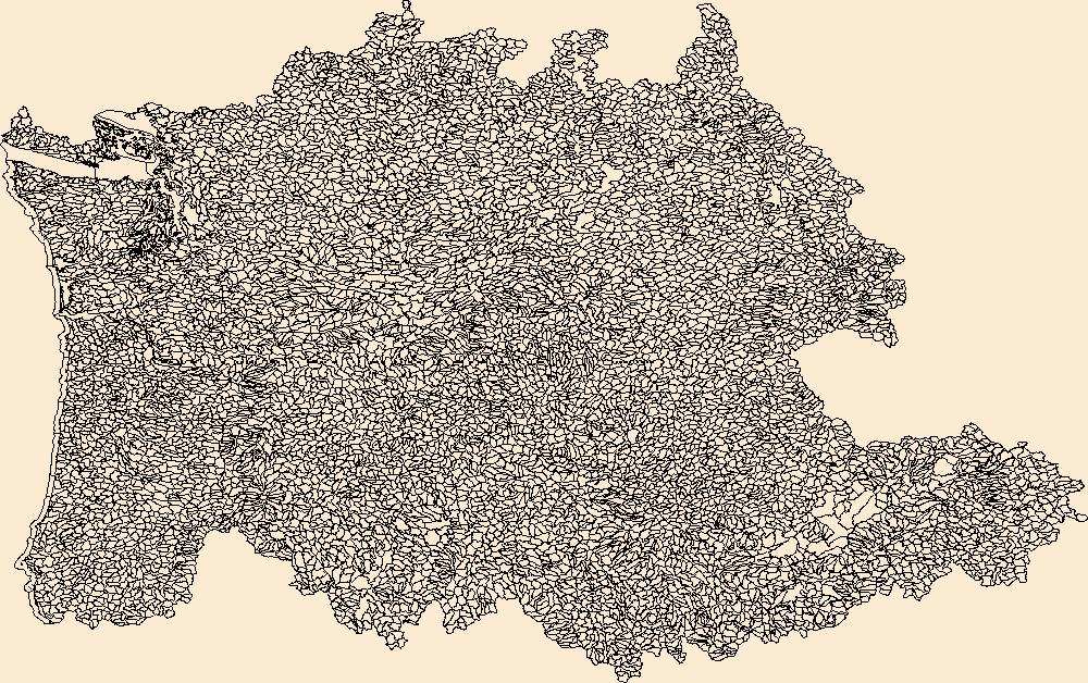
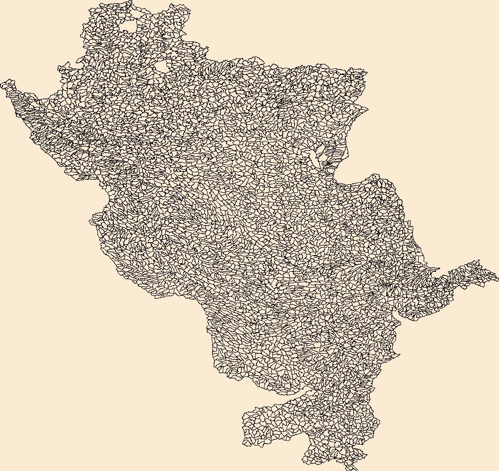
The Watershed Boundary Dataset (WBD) is a comprehensive aggregated collection of hydrologic unit data consistent with the national criteria for delineation and resolution. It defines the areal extent of surface water drainage to a point except in coastal or lake front areas where there could be multiple outlets as stated by the "Federal Standards and Procedures for the National Watershed Boundary Dataset (WBD)" "Standard" (https://pubs.usgs.gov/tm/11/a3/). Watershed boundaries are determined solely upon science-based hydrologic principles, not favoring any administrative boundaries or special projects, nor particular program or agency. This dataset represents the hydrologic unit boundaries to the 12-digit (6th level)...
Tags: 10-digit,
12-digit,
14-digit,
16-digit,
2-digit, All tags...
4-digit,
6-digit,
8-digit,
AL,
Abbeville,
Aiken,
Alabama,
Alachua,
Alamance,
Alexander,
Alleghany,
Allendale,
Anderson,
Anson,
Appling,
Appomattox,
Ashe,
Atkinson,
Attala,
Autauga,
Avery,
Bacon,
Baker,
Baldwin,
Bamberg,
Banks,
Barbour,
Barnwell,
Barrow,
Bartow,
Basin,
Bay,
Beaufort,
Bedford,
Ben Hill,
Berkeley,
Berrien,
Bertie,
Bibb,
Bladen,
Bleckley,
Blount,
Botetourt,
Bradford,
Bradley,
Brantley,
Brevard,
Brooks,
Broward,
Brunswick,
Bryan,
Bulloch,
Bullock,
Buncombe,
Burke,
Butler,
Butts,
Cabarrus,
Caldwell,
Calhoun,
Camden,
Campbell,
Candler,
Carroll,
Carteret,
Caswell,
Catawba,
Chambers,
Charleston,
Charlotte,
Charlton,
Chatham,
Chattahoochee,
Chattooga,
Cherokee,
Chesapeake,
Chester,
Chesterfield,
Chickasaw,
Chilton,
Choctaw,
Chowan,
Citrus,
Clarendon,
Clarke,
Clay,
Clayton,
Cleburne,
Cleveland,
Clinch,
Cobb,
Coffee,
Colleton,
Collier,
Colquitt,
Columbia,
Columbus,
Conecuh,
Cook,
Coosa,
Copiah,
Covington,
Coweta,
Craig,
Craven,
Crawford,
Crenshaw,
Crisp,
Cullman,
Cumberland,
Currituck,
Dade,
Dale,
Dallas,
Danville,
Dare,
Darlington,
Davidson,
Davie,
Dawson,
DeKalb,
DeSoto,
Decatur,
Dillon,
Dinwiddie,
Dixie,
Dodge,
Dooly,
Dorchester,
Dougherty,
Douglas,
Downloadable Data,
Duplin,
Durham,
Duval,
Early,
Echols,
Edgecombe,
Edgefield,
Effingham,
Elbert,
Elmore,
Emanuel,
Emporia,
Escambia,
Esri File GeoDatabase 10,
Etowah,
Evans,
FL,
Fairfield,
Fannin,
Fayette,
FileGDB,
Flagler,
Florence,
Florida,
Floyd,
Forrest,
Forsyth,
Franklin,
Fulton,
GA,
Gadsden,
Gaston,
Gates,
Geneva,
George,
Georgetown,
Georgia,
Gilchrist,
Gilmer,
Glades,
Glascock,
Glynn,
Gordon,
Grady,
Granville,
Grayson,
Greene,
Greensville,
Greenville,
Greenwood,
Guilford,
Gulf,
Gwinnett,
HU-2,
HU-2 Region,
HU2_03,
HUC,
Habersham,
Hale,
Halifax,
Hall,
Hamilton,
Hampton,
Hancock,
Haralson,
Hardee,
Harnett,
Harris,
Harrison,
Hart,
Heard,
Henderson,
Hendry,
Henry,
Hernando,
Hertford,
Highlands,
Hillsborough,
Hinds,
Hoke,
Holmes,
Horry,
Houston,
Hyde,
Hydrography,
Hydrologic Unit Code,
Hydrologic Units,
Indian River,
Iredell,
Irwin,
Isle of Wight,
Itawamba,
Jackson,
Jasper,
Jeff Davis,
Jefferson,
Jefferson Davis,
Jenkins,
Johnson,
Johnston,
Jones,
Kemper,
Kershaw,
LA,
Lafayette,
Lake,
Lamar,
Lancaster,
Lanier,
Lauderdale,
Laurens,
Lawrence,
Leake,
Lee,
Lenoir,
Leon,
Levy,
Lexington,
Liberty,
Lincoln,
Long,
Louisiana,
Lowndes,
Lumpkin,
Lunenburg,
MS,
Macon,
Madison,
Manatee,
Marengo,
Marion,
Marlboro,
Marshall,
Martin,
Martinsville,
McCormick,
McDowell,
McDuffie,
McIntosh,
Mecklenburg,
Meriwether,
Miami-Dade,
Miller,
Mississippi,
Mitchell,
Mobile,
Monroe,
Montgomery,
Moore,
Morgan,
Murray,
Muscogee,
NC,
Nash,
Nassau,
National Watershed Boundary Dataset (WBD),
National Watershed Boundary Dataset (WBD),
Neshoba,
New Hanover,
Newberry,
Newton,
North Carolina,
Northampton,
Nottoway,
Noxubee,
Oconee,
Oglethorpe,
Okaloosa,
Okeechobee,
Oktibbeha,
Onslow,
Orange,
Orangeburg,
Osceola,
Palm Beach,
Pamlico,
Pasco,
Pasquotank,
Patrick,
Paulding,
Peach,
Pearl River,
Pender,
Perquimans,
Perry,
Person,
Petersburg,
Pickens,
Pierce,
Pike,
Pinellas,
Pitt,
Pittsylvania,
Polk,
Pontotoc,
Prentiss,
Prince Edward,
Prince George,
Pulaski,
Putnam,
Quitman,
Rabun,
Randolph,
Rankin,
Region,
Richland,
Richmond,
Roanoke,
Robeson,
Rockdale,
Rockingham,
Rowan,
Russell,
Rutherford,
SC,
Salem,
Saluda,
Sampson,
Santa Rosa,
Sarasota,
Schley,
Scotland,
Scott,
Screven,
Seminole,
Shelby,
Simpson,
Smith,
South Carolina,
Southampton,
Spalding,
Spartanburg,
St. Bernard,
St. Clair,
St. Johns,
St. Lucie,
St. Tammany,
Stanly,
Stephens,
Stewart,
Stokes,
Stone,
Sub-basin,
Sub-region,
Subwatershed,
Suffolk,
Sumter,
Surry,
Sussex,
Suwannee,
TN,
Talbot,
Taliaferro,
Talladega,
Tallapoosa,
Tangipahoa,
Tattnall,
Taylor,
Telfair,
Tennessee,
Terrell,
Thomas,
Tift,
Tippah,
Tishomingo,
Toombs,
Towns,
Transylvania,
Treutlen,
Troup,
Turner,
Tuscaloosa,
Twiggs,
Tyrrell,
US,
Union,
United States,
Upson,
VA,
Vance,
Virginia,
Virginia Beach,
Volusia,
WBD,
Wake,
Wakulla,
Walker,
Walthall,
Walton,
Ware,
Warren,
Washington,
Watauga,
Watershed,
Watershed Boundary Dataset,
Wayne,
Webster,
Wheeler,
White,
Whitfield,
Wilcox,
Wilkes,
Wilkinson,
Williamsburg,
Wilson,
Winston,
Worth,
Yadkin,
Yancey,
York,
inlandWaters, Fewer tags
The Watershed Boundary Dataset (WBD) is a comprehensive aggregated collection of hydrologic unit data consistent with the national criteria for delineation and resolution. It defines the areal extent of surface water drainage to a point except in coastal or lake front areas where there could be multiple outlets as stated by the "Federal Standards and Procedures for the National Watershed Boundary Dataset (WBD)" "Standard" (https://pubs.usgs.gov/tm/11/a3/). Watershed boundaries are determined solely upon science-based hydrologic principles, not favoring any administrative boundaries or special projects, nor particular program or agency. This dataset represents the hydrologic unit boundaries to the 12-digit (6th level)...
Tags: 10-digit,
12-digit,
14-digit,
16-digit,
2-digit, All tags...
4-digit,
6-digit,
8-digit,
AL,
Alabama,
Alcorn,
Anderson,
Ashe,
Avery,
Basin,
Bedford,
Bell,
Benton,
Bland,
Bledsoe,
Blount,
Bradley,
Bristol,
Buchanan,
Buncombe,
Caldwell,
Calloway,
Campbell,
Cannon,
Carroll,
Carter,
Catoosa,
Cherokee,
Chester,
Claiborne,
Clay,
Cocke,
Coffee,
Colbert,
Cullman,
Cumberland,
Dade,
DeKalb,
Decatur,
Dickenson,
Dickson,
Downloadable Data,
Esri File GeoDatabase 10,
Etowah,
Fannin,
Fentress,
FileGDB,
Franklin,
GA,
Georgia,
Giles,
Gilmer,
Graham,
Grainger,
Graves,
Grayson,
Greene,
Greenville,
Grundy,
HU-2,
HU-2 Region,
HU2_06,
HUC,
Habersham,
Hamblen,
Hamilton,
Hancock,
Hardin,
Harlan,
Hawkins,
Haywood,
Henderson,
Henry,
Hickman,
Houston,
Humphreys,
Hydrography,
Hydrologic Unit Code,
Hydrologic Units,
Itawamba,
Jackson,
Jefferson,
Johnson,
KY,
Kentucky,
Knox,
Lauderdale,
Lawrence,
Lee,
Letcher,
Lewis,
Limestone,
Lincoln,
Livingston,
Loudon,
Lumpkin,
Lyon,
MS,
Macon,
Madison,
Marion,
Marshall,
Maury,
McCracken,
McDowell,
McMinn,
McNairy,
Meigs,
Mississippi,
Mitchell,
Monroe,
Moore,
Morgan,
NC,
National Watershed Boundary Dataset (WBD),
National Watershed Boundary Dataset (WBD),
North Carolina,
Norton,
Perry,
Pickens,
Polk,
Prentiss,
Putnam,
Rabun,
Region,
Rhea,
Roane,
Russell,
Rutherford,
SC,
Scott,
Sequatchie,
Sevier,
Smyth,
South Carolina,
Stewart,
Sub-basin,
Sub-region,
Subwatershed,
Sullivan,
Swain,
TN,
Tazewell,
Tennessee,
Tishomingo,
Towns,
Transylvania,
Trigg,
US,
Unicoi,
Union,
United States,
VA,
Van Buren,
Virginia,
WBD,
WV,
Walker,
Washington,
Watauga,
Watershed,
Watershed Boundary Dataset,
Wayne,
West Virginia,
White,
Whitfield,
Williamson,
Winston,
Wise,
Wythe,
Yancey,
inlandWaters, Fewer tags
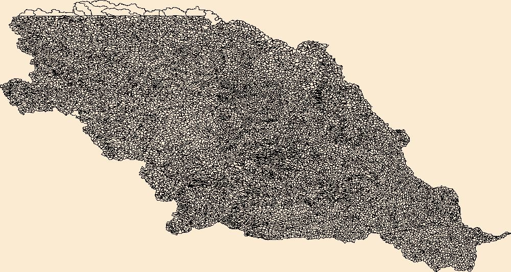
The Watershed Boundary Dataset (WBD) is a comprehensive aggregated collection of hydrologic unit data consistent with the national criteria for delineation and resolution. It defines the areal extent of surface water drainage to a point except in coastal or lake front areas where there could be multiple outlets as stated by the "Federal Standards and Procedures for the National Watershed Boundary Dataset (WBD)" "Standard" (https://pubs.usgs.gov/tm/11/a3/). Watershed boundaries are determined solely upon science-based hydrologic principles, not favoring any administrative boundaries or special projects, nor particular program or agency. This dataset represents the hydrologic unit boundaries to the 12-digit (6th level)...
Tags: 10-digit,
12-digit,
14-digit,
16-digit,
2-digit, All tags...
4-digit,
6-digit,
8-digit,
Adair,
Adams,
Albany,
Allen,
Anderson,
Andrew,
Antelope,
Appanoose,
Arapahoe,
Arthur,
Atchison,
Audrain,
Audubon,
Aurora,
Banner,
Barnes,
Barton,
Basin,
Bates,
Beadle,
Beaverhead,
Bennett,
Benton,
Big Horn,
Billings,
Blaine,
Bon Homme,
Boone,
Boulder,
Bourbon,
Bowman,
Box Butte,
Boyd,
Broadwater,
Brookings,
Broomfield,
Brown,
Brule,
Buchanan,
Buena Vista,
Buffalo,
Burke,
Burleigh,
Burt,
Butler,
Butte,
CO,
Caldwell,
Callaway,
Camden,
Campbell,
Carbon,
Carroll,
Carter,
Cascade,
Cass,
Cedar,
Chaffee,
Chariton,
Charles Mix,
Chase,
Cherokee,
Cherry,
Cheyenne,
Chouteau,
Christian,
Clark,
Clarke,
Clay,
Clear Creek,
Clinton,
Cloud,
Codington,
Coffey,
Cole,
Colfax,
Colorado,
Converse,
Cooper,
Corson,
Crawford,
Crook,
Cuming,
Custer,
Dade,
Dakota,
Dallas,
Daniels,
Daviess,
Davis,
Davison,
Dawes,
Dawson,
Day,
DeKalb,
Decatur,
Deer Lodge,
Dent,
Denver,
Deuel,
Dewey,
Dickey,
Dickinson,
Divide,
Dixon,
Dodge,
Doniphan,
Douglas,
Downloadable Data,
Dundy,
Dunn,
Eddy,
Edmunds,
El Paso,
Elbert,
Ellis,
Ellsworth,
Emmet,
Emmons,
Esri File GeoDatabase 10,
Fall River,
Fallon,
Faulk,
Fergus,
FileGDB,
Fillmore,
Flathead,
Foster,
Franklin,
Fremont,
Frontier,
Furnas,
Gage,
Gallatin,
Garden,
Garfield,
Gasconade,
Geary,
Gentry,
Gilpin,
Glacier,
Golden Valley,
Goshen,
Gosper,
Gove,
Graham,
Grand,
Granite,
Grant,
Greeley,
Greene,
Gregory,
Grundy,
Guthrie,
HU-2,
HU-2 Region,
HU2_10,
HUC,
Haakon,
Hall,
Hamilton,
Hamlin,
Hand,
Hanson,
Harding,
Harlan,
Harrison,
Hayes,
Henry,
Hettinger,
Hickory,
Hill,
Hitchcock,
Holt,
Hooker,
Hot Springs,
Howard,
Howell,
Hughes,
Hutchinson,
Hyde,
Hydrography,
Hydrologic Unit Code,
Hydrologic Units,
IA,
ID,
Ida,
Idaho,
Iowa,
Jackson,
Jefferson,
Jerauld,
Jewell,
Johnson,
Jones,
Judith Basin,
KS,
Kansas,
Kearney,
Keith,
Keya Paha,
Kidder,
Kimball,
Kingsbury,
Kit Carson,
Knox,
LaMoure,
Laclede,
Lafayette,
Lake,
Lancaster,
Lane,
Laramie,
Larimer,
Lawrence,
Leavenworth,
Lemhi,
Lewis and Clark,
Liberty,
Lincoln,
Linn,
Livingston,
Logan,
Loup,
Lucas,
Lyman,
Lyon,
MN,
MO,
MT,
Macon,
Madison,
Maries,
Marion,
Marshall,
McCone,
McCook,
McHenry,
McIntosh,
McKenzie,
McLean,
McPherson,
Meade,
Meagher,
Mellette,
Mercer,
Merrick,
Miami,
Miller,
Mills,
Miner,
Minnehaha,
Minnesota,
Missouri,
Mitchell,
Moniteau,
Monona,
Monroe,
Montana,
Montgomery,
Moody,
Morgan,
Morrill,
Morris,
Morton,
Mountrail,
Murray,
Musselshell,
ND,
NE,
Nance,
National Watershed Boundary Dataset (WBD),
National Watershed Boundary Dataset (WBD),
Natrona,
Nebraska,
Nemaha,
Ness,
Niobrara,
Nobles,
Nodaway,
North Dakota,
Norton,
Nuckolls,
O'Brien,
Oglala Lakota,
Oliver,
Osage,
Osborne,
Osceola,
Otoe,
Ottawa,
Page,
Palo Alto,
Park,
Pawnee,
Pennington,
Perkins,
Petroleum,
Pettis,
Phelps,
Phillips,
Pierce,
Pipestone,
Platte,
Plymouth,
Polk,
Pondera,
Pottawatomie,
Pottawattamie,
Potter,
Powder River,
Powell,
Prairie,
Pulaski,
Putnam,
Randolph,
Ransom,
Ravalli,
Rawlins,
Ray,
Red Willow,
Region,
Republic,
Rice,
Richardson,
Richland,
Riley,
Ringgold,
Roberts,
Rock,
Rooks,
Roosevelt,
Rosebud,
Routt,
Rush,
Russell,
SD,
Sac,
Saline,
Sanborn,
Sargent,
Sarpy,
Saunders,
Schuyler,
Scott,
Scotts Bluff,
Sedgwick,
Seward,
Shawnee,
Shelby,
Sheridan,
Sherman,
Silver Bow,
Sioux,
Slope,
Smith,
South Dakota,
Spink,
St. Charles,
St. Clair,
St. Louis,
Stanley,
Stanton,
Stark,
Stillwater,
Stutsman,
Sub-basin,
Sub-region,
Sublette,
Subwatershed,
Sullivan,
Sully,
Summit,
Sweet Grass,
Sweetwater,
Taylor,
Teller,
Teton,
Texas,
Thayer,
Thomas,
Thurston,
Todd,
Toole,
Treasure,
Trego,
Tripp,
Turner,
US,
Union,
United States,
Valley,
Vernon,
WBD,
WY,
Wabaunsee,
Wallace,
Walworth,
Ward,
Warren,
Washakie,
Washington,
Watershed,
Watershed Boundary Dataset,
Wayne,
Webster,
Weld,
Wells,
Weston,
Wheatland,
Wheeler,
Wibaux,
Wichita,
Williams,
Woodbury,
Worth,
Wright,
Wyandotte,
Wyoming,
Yankton,
Yellowstone,
York,
Yuma,
Ziebach,
inlandWaters, Fewer tags
The Watershed Boundary Dataset (WBD) is a comprehensive aggregated collection of hydrologic unit data consistent with the national criteria for delineation and resolution. It defines the areal extent of surface water drainage to a point except in coastal or lake front areas where there could be multiple outlets as stated by the "Federal Standards and Procedures for the National Watershed Boundary Dataset (WBD)" "Standard" (https://pubs.usgs.gov/tm/11/a3/). Watershed boundaries are determined solely upon science-based hydrologic principles, not favoring any administrative boundaries or special projects, nor particular program or agency. This dataset represents the hydrologic unit boundaries to the 12-digit (6th level)...
Tags: 10-digit,
12-digit,
14-digit,
16-digit,
2-digit, All tags...
4-digit,
6-digit,
8-digit,
Barnes,
Basin,
Becker,
Beltrami,
Benson,
Big Stone,
Bottineau,
Burke,
Cass,
Cavalier,
Clay,
Clearwater,
Cook,
Dickey,
Divide,
Downloadable Data,
Eddy,
Esri File GeoDatabase 10,
FileGDB,
Flathead,
Foster,
Glacier,
Grand Forks,
Grant,
Griggs,
HU-2,
HU-2 Region,
HU2_09,
HUC,
Hydrography,
Hydrologic Unit Code,
Hydrologic Units,
Itasca,
Kittson,
Koochiching,
Lake,
Lake of the Woods,
MN,
MT,
Mahnomen,
Marshall,
McHenry,
McLean,
Minnesota,
Montana,
Mountrail,
ND,
National Watershed Boundary Dataset (WBD),
National Watershed Boundary Dataset (WBD),
Nelson,
Norman,
North Dakota,
Otter Tail,
Pembina,
Pennington,
Pierce,
Polk,
Ramsey,
Ransom,
Red Lake,
Region,
Renville,
Richland,
Roberts,
Rolette,
Roseau,
SD,
Sargent,
Sheridan,
South Dakota,
St. Louis,
Steele,
Stevens,
Stutsman,
Sub-basin,
Sub-region,
Subwatershed,
Towner,
Traill,
Traverse,
US,
United States,
WBD,
Walsh,
Ward,
Watershed,
Watershed Boundary Dataset,
Wells,
Wilkin,
inlandWaters, Fewer tags
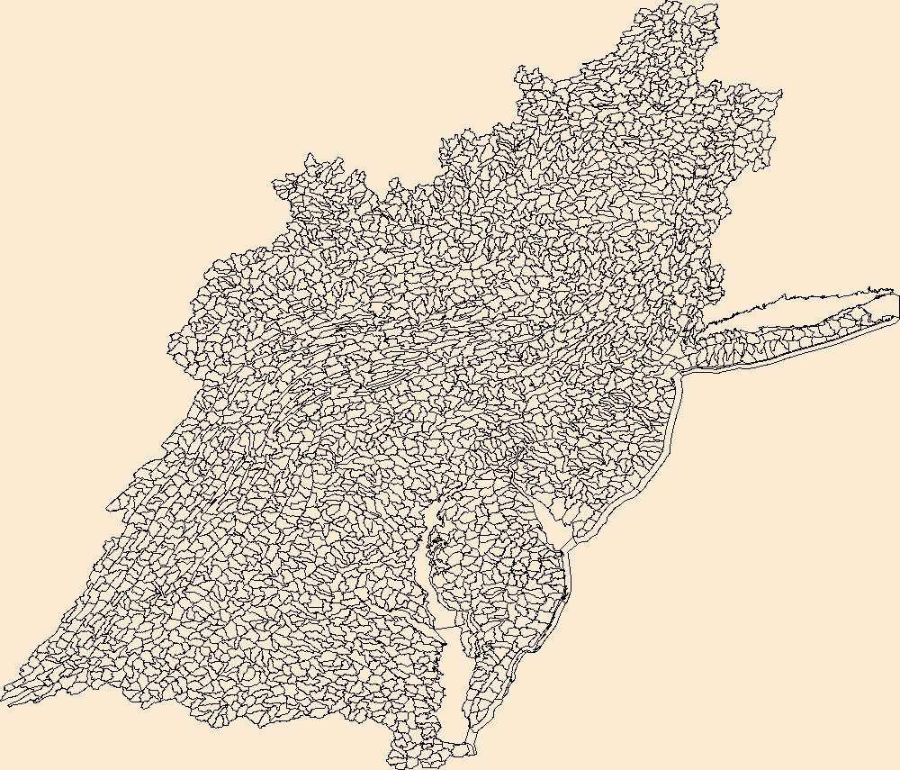
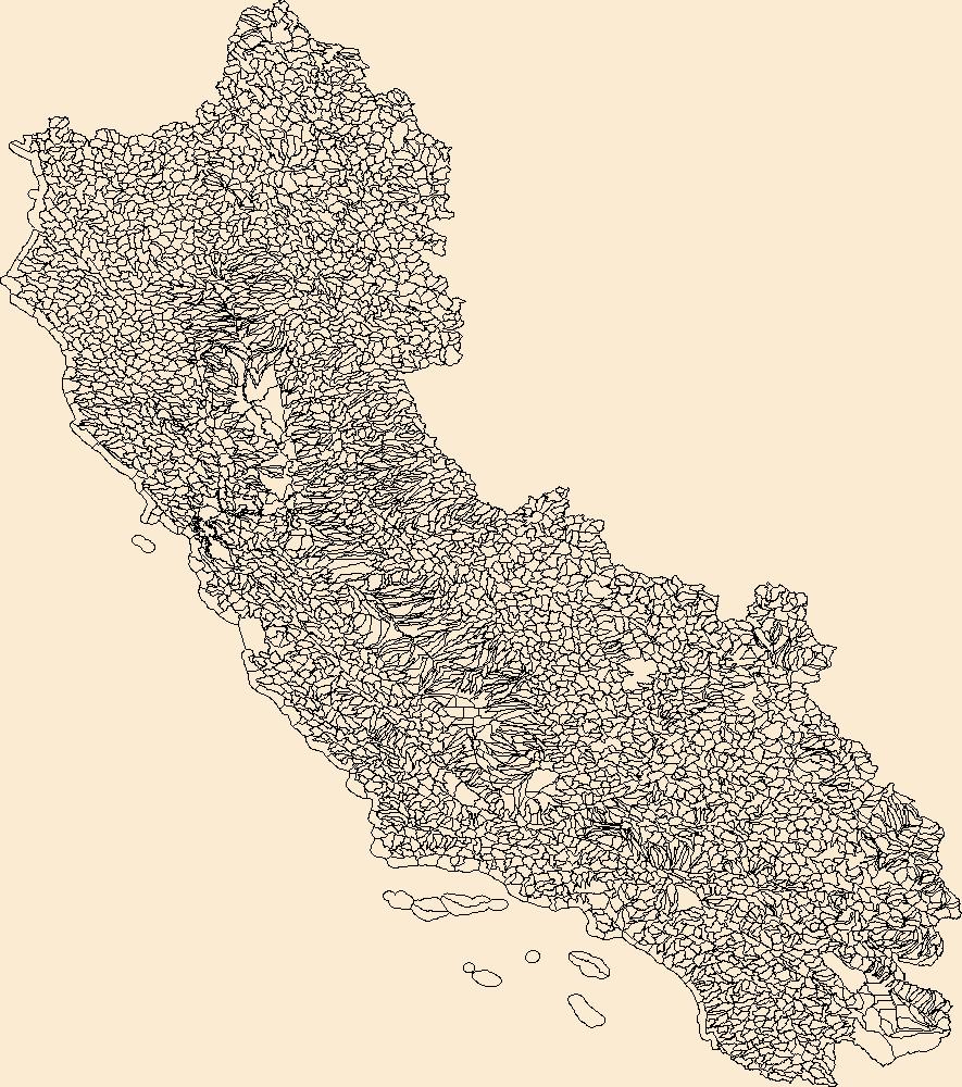
The Watershed Boundary Dataset (WBD) is a comprehensive aggregated collection of hydrologic unit data consistent with the national criteria for delineation and resolution. It defines the areal extent of surface water drainage to a point except in coastal or lake front areas where there could be multiple outlets as stated by the "Federal Standards and Procedures for the National Watershed Boundary Dataset (WBD)" "Standard" (https://pubs.usgs.gov/tm/11/a3/). Watershed boundaries are determined solely upon science-based hydrologic principles, not favoring any administrative boundaries or special projects, nor particular program or agency. This dataset represents the hydrologic unit boundaries to the 12-digit (6th level)...
Tags: 10-digit,
12-digit,
14-digit,
16-digit,
2-digit, All tags...
4-digit,
6-digit,
8-digit,
Accomack,
Adams,
Albany,
Albemarle,
Alexandria,
Allegany,
Alleghany,
Amelia,
Amherst,
Anne Arundel,
Appomattox,
Arlington,
Atlantic,
Augusta,
Baltimore,
Basin,
Bath,
Bedford,
Bennington,
Bergen,
Berkeley,
Berks,
Berkshire,
Blair,
Botetourt,
Bradford,
Bronx,
Broome,
Buckingham,
Bucks,
Buena Vista,
Burlington,
CT,
Calvert,
Cambria,
Camden,
Cameron,
Campbell,
Cape May,
Carbon,
Caroline,
Carroll,
Cecil,
Centre,
Charles,
Charles City,
Charlotte,
Charlottesville,
Chemung,
Chenango,
Chesapeake,
Chester,
Chesterfield,
Clarke,
Clearfield,
Clinton,
Colonial Heights,
Columbia,
Connecticut,
Cortland,
Covington,
Craig,
Culpeper,
Cumberland,
DC,
DE,
Dauphin,
Delaware,
Delaware,
Dinwiddie,
District of Columbia,
District of Columbia,
Dorchester,
Downloadable Data,
Dutchess,
Elk,
Esri File GeoDatabase 10,
Essex,
Fairfax,
Falls Church,
Fauquier,
FileGDB,
Fluvanna,
Franklin,
Frederick,
Fredericksburg,
Fulton,
Garrett,
Giles,
Gloucester,
Goochland,
Grant,
Greater Bridgeport,
Greenbrier,
Greene,
HU-2,
HU-2 Region,
HU2_02,
HUC,
Hamilton,
Hampshire,
Hampton,
Hanover,
Hardy,
Harford,
Harrisonburg,
Henrico,
Herkimer,
Highland,
Hopewell,
Howard,
Hudson,
Hunterdon,
Huntingdon,
Hydrography,
Hydrologic Unit Code,
Hydrologic Units,
Indiana,
Isle of Wight,
James City,
Jefferson,
Juniata,
Kent,
King George,
King William,
King and Queen,
Kings,
Lackawanna,
Lancaster,
Lebanon,
Lehigh,
Lewis,
Lexington,
Livingston,
Loudoun,
Louisa,
Lower Connecticut River Valley,
Lunenburg,
Luzerne,
Lycoming,
Lynchburg,
MA,
MD,
Madison,
Manassas,
Manassas Park,
Maryland,
Massachusetts,
Mathews,
McKean,
Mercer,
Middlesex,
Mifflin,
Mineral,
Monmouth,
Monroe,
Montgomery,
Montour,
Morgan,
Morris,
NJ,
NY,
Nassau,
National Watershed Boundary Dataset (WBD),
National Watershed Boundary Dataset (WBD),
Nelson,
New Castle,
New Jersey,
New Kent,
New York,
New York,
Newport News,
Norfolk,
Northampton,
Northumberland,
Nottoway,
Ocean,
Oneida,
Onondaga,
Ontario,
Orange,
Otsego,
PA,
Page,
Passaic,
Pendleton,
Pennsylvania,
Perry,
Petersburg,
Philadelphia,
Pike,
Pocahontas,
Poquoson,
Portsmouth,
Potter,
Powhatan,
Preston,
Prince Edward,
Prince George,
Prince George's,
Prince William,
Putnam,
Queen Anne's,
Queens,
RI,
Randolph,
Rappahannock,
Region,
Rensselaer,
Rhode Island,
Richmond,
Roanoke,
Rockbridge,
Rockingham,
Rockland,
Rutland,
Salem,
Saratoga,
Schenectady,
Schoharie,
Schuyler,
Schuylkill,
Shenandoah,
Snyder,
Somerset,
South Central Connecticut,
Southeastern Connecticut,
Spotsylvania,
St. Mary's,
Stafford,
Staunton,
Steuben,
Sub-basin,
Sub-region,
Subwatershed,
Suffolk,
Sullivan,
Surry,
Susquehanna,
Sussex,
Talbot,
Tioga,
Tompkins,
Tucker,
US,
Ulster,
Union,
United States,
VA,
VT,
Vermont,
Virginia,
Virginia Beach,
WBD,
WV,
Warren,
Washington,
Watershed,
Watershed Boundary Dataset,
Wayne,
Waynesboro,
West Virginia,
Westchester,
Western Connecticut,
Westmoreland,
Wicomico,
Williamsburg,
Winchester,
Windham,
Worcester,
Wyoming,
Yates,
York,
inlandWaters, Fewer tags
The Watershed Boundary Dataset (WBD) is a comprehensive aggregated collection of hydrologic unit data consistent with the national criteria for delineation and resolution. It defines the areal extent of surface water drainage to a point except in coastal or lake front areas where there could be multiple outlets as stated by the "Federal Standards and Procedures for the National Watershed Boundary Dataset (WBD)" "Standard" (https://pubs.usgs.gov/tm/11/a3/). Watershed boundaries are determined solely upon science-based hydrologic principles, not favoring any administrative boundaries or special projects, nor particular program or agency. This dataset represents the hydrologic unit boundaries to the 12-digit (6th level)...
Tags: 10-digit,
12-digit,
14-digit,
16-digit,
2-digit, All tags...
4-digit,
6-digit,
8-digit,
Ada,
Adams,
Asotin,
Baker,
Bannock,
Basin,
Bear Lake,
Beaverhead,
Benewah,
Benton,
Bingham,
Blaine,
Boise,
Bonner,
Bonneville,
Boundary,
Box Elder,
Butte,
CA,
California,
Camas,
Canyon,
Caribou,
Cassia,
Chelan,
Clackamas,
Clallam,
Clark,
Clatsop,
Clearwater,
Columbia,
Coos,
Cowlitz,
Crook,
Curry,
Custer,
Deer Lodge,
Del Norte,
Deschutes,
Douglas,
Downloadable Data,
Elko,
Elmore,
Esri File GeoDatabase 10,
Ferry,
FileGDB,
Flathead,
Franklin,
Fremont,
Gallatin,
Garfield,
Gem,
Gilliam,
Glacier,
Gooding,
Granite,
Grant,
Grays Harbor,
HU-2,
HU-2 Region,
HU2_17,
HUC,
Harney,
Hood River,
Humboldt,
Hydrography,
Hydrologic Unit Code,
Hydrologic Units,
ID,
Idaho,
Idaho,
Island,
Jackson,
Jefferson,
Jerome,
Josephine,
King,
Kitsap,
Kittitas,
Klamath,
Klickitat,
Kootenai,
Lake,
Lane,
Latah,
Lemhi,
Lewis,
Lewis and Clark,
Lincoln,
Linn,
MT,
Madison,
Malheur,
Marion,
Mason,
Mineral,
Minidoka,
Missoula,
Modoc,
Montana,
Morrow,
Multnomah,
NV,
National Watershed Boundary Dataset (WBD),
National Watershed Boundary Dataset (WBD),
Nevada,
Nez Perce,
OR,
Okanogan,
Oneida,
Oregon,
Owyhee,
Pacific,
Park,
Payette,
Pend Oreille,
Pierce,
Polk,
Pondera,
Powell,
Power,
Ravalli,
Region,
San Juan,
Sanders,
Sherman,
Shoshone,
Silver Bow,
Siskiyou,
Skagit,
Skamania,
Snohomish,
Spokane,
Stevens,
Sub-basin,
Sub-region,
Sublette,
Subwatershed,
Teton,
Thurston,
Tillamook,
Twin Falls,
US,
UT,
Umatilla,
Union,
United States,
Utah,
Valley,
WA,
WBD,
WY,
Wahkiakum,
Walla Walla,
Wallowa,
Wasco,
Washington,
Washington,
Washoe,
Watershed,
Watershed Boundary Dataset,
Whatcom,
Wheeler,
Whitman,
Wyoming,
Yakima,
Yamhill,
inlandWaters, Fewer tags
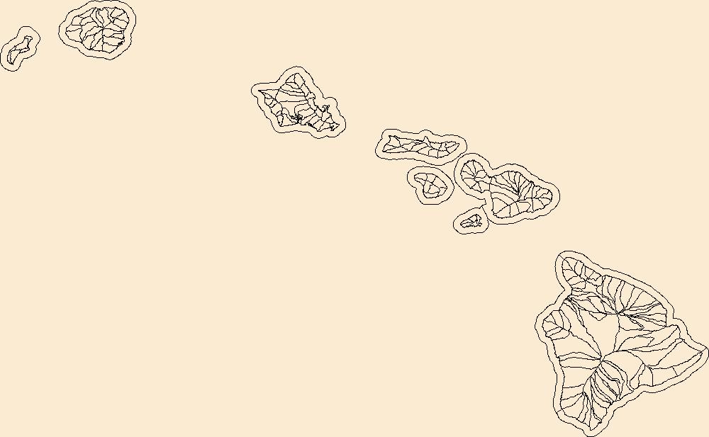
The Watershed Boundary Dataset (WBD) is a comprehensive aggregated collection of hydrologic unit data consistent with the national criteria for delineation and resolution. It defines the areal extent of surface water drainage to a point except in coastal or lake front areas where there could be multiple outlets as stated by the "Federal Standards and Procedures for the National Watershed Boundary Dataset (WBD)" "Standard" (https://pubs.usgs.gov/tm/11/a3/). Watershed boundaries are determined solely upon science-based hydrologic principles, not favoring any administrative boundaries or special projects, nor particular program or agency. This dataset represents the hydrologic unit boundaries to the 12-digit (6th level)...
Tags: 10-digit,
12-digit,
14-digit,
16-digit,
2-digit, All tags...
4-digit,
6-digit,
8-digit,
Basin,
Downloadable Data,
Esri File GeoDatabase 10,
FileGDB,
HI,
HU-2,
HU-2 Region,
HU2_20,
HUC,
Hawaii,
Hawaii,
Honolulu,
Hydrography,
Hydrologic Unit Code,
Hydrologic Units,
Kalawao,
Kauai,
Maui,
National Watershed Boundary Dataset (WBD),
National Watershed Boundary Dataset (WBD),
Region,
Sub-basin,
Sub-region,
Subwatershed,
US,
United States,
WBD,
Watershed,
Watershed Boundary Dataset,
inlandWaters, Fewer tags
The Watershed Boundary Dataset (WBD) is a comprehensive aggregated collection of hydrologic unit data consistent with the national criteria for delineation and resolution. It defines the areal extent of surface water drainage to a point except in coastal or lake front areas where there could be multiple outlets as stated by the "Federal Standards and Procedures for the National Watershed Boundary Dataset (WBD)" "Standard" (https://pubs.usgs.gov/tm/11/a3/). Watershed boundaries are determined solely upon science-based hydrologic principles, not favoring any administrative boundaries or special projects, nor particular program or agency. This dataset represents the hydrologic unit boundaries to the 12-digit (6th level)...
Tags: 10-digit,
12-digit,
14-digit,
16-digit,
2-digit, All tags...
4-digit,
6-digit,
8-digit,
Alpine,
Bannock,
Basin,
Bear Lake,
Beaver,
Box Elder,
CA,
Cache,
California,
Carbon,
Caribou,
Carson City,
Cassia,
Churchill,
Clark,
Davis,
Douglas,
Downloadable Data,
Duchesne,
El Dorado,
Elko,
Esmeralda,
Esri File GeoDatabase 10,
Eureka,
FileGDB,
Franklin,
Garfield,
HU-2,
HU-2 Region,
HU2_16,
HUC,
Harney,
Humboldt,
Hydrography,
Hydrologic Unit Code,
Hydrologic Units,
ID,
Idaho,
Inyo,
Iron,
Juab,
Kane,
Lander,
Lassen,
Lincoln,
Lyon,
Malheur,
Millard,
Mineral,
Mono,
Morgan,
NV,
National Watershed Boundary Dataset (WBD),
National Watershed Boundary Dataset (WBD),
Nevada,
Nevada,
Nye,
OR,
Oneida,
Oregon,
Pershing,
Piute,
Placer,
Power,
Region,
Rich,
Salt Lake,
San Bernardino,
Sanpete,
Sevier,
Sierra,
Storey,
Sub-basin,
Sub-region,
Subwatershed,
Summit,
Tooele,
Tuolumne,
US,
UT,
Uinta,
United States,
Utah,
Utah,
WBD,
WY,
Wasatch,
Washington,
Washoe,
Watershed,
Watershed Boundary Dataset,
Wayne,
Weber,
White Pine,
Wyoming,
inlandWaters, Fewer tags
The Watershed Boundary Dataset (WBD) is a comprehensive aggregated collection of hydrologic unit data consistent with the national criteria for delineation and resolution. It defines the areal extent of surface water drainage to a point except in coastal or lake front areas where there could be multiple outlets as stated by the "Federal Standards and Procedures for the National Watershed Boundary Dataset (WBD)" "Standard" (https://pubs.usgs.gov/tm/11/a3/). Watershed boundaries are determined solely upon science-based hydrologic principles, not favoring any administrative boundaries or special projects, nor particular program or agency. This dataset represents the hydrologic unit boundaries to the 12-digit (6th level)...
Tags: 10-digit,
12-digit,
14-digit,
16-digit,
2-digit, All tags...
4-digit,
6-digit,
8-digit,
AZ,
Apache,
Arizona,
Basin,
CA,
California,
Catron,
Cibola,
Clark,
Cochise,
Coconino,
Downloadable Data,
Esri File GeoDatabase 10,
FileGDB,
Gila,
Graham,
Grant,
Greenlee,
HU-2,
HU-2 Region,
HU2_15,
HUC,
Hidalgo,
Hydrography,
Hydrologic Unit Code,
Hydrologic Units,
Imperial,
Iron,
Kane,
La Paz,
Lincoln,
Luna,
Maricopa,
McKinley,
Mohave,
NM,
NV,
National Watershed Boundary Dataset (WBD),
National Watershed Boundary Dataset (WBD),
Navajo,
Nevada,
New Mexico,
Nye,
Pima,
Pinal,
Region,
Riverside,
San Bernardino,
San Juan,
Santa Cruz,
Sierra,
Sub-basin,
Sub-region,
Subwatershed,
US,
UT,
United States,
Utah,
WBD,
Washington,
Watershed,
Watershed Boundary Dataset,
White Pine,
Yavapai,
Yuma,
inlandWaters, Fewer tags
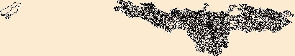
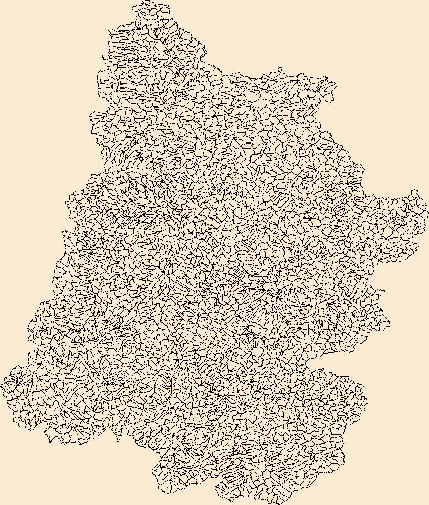
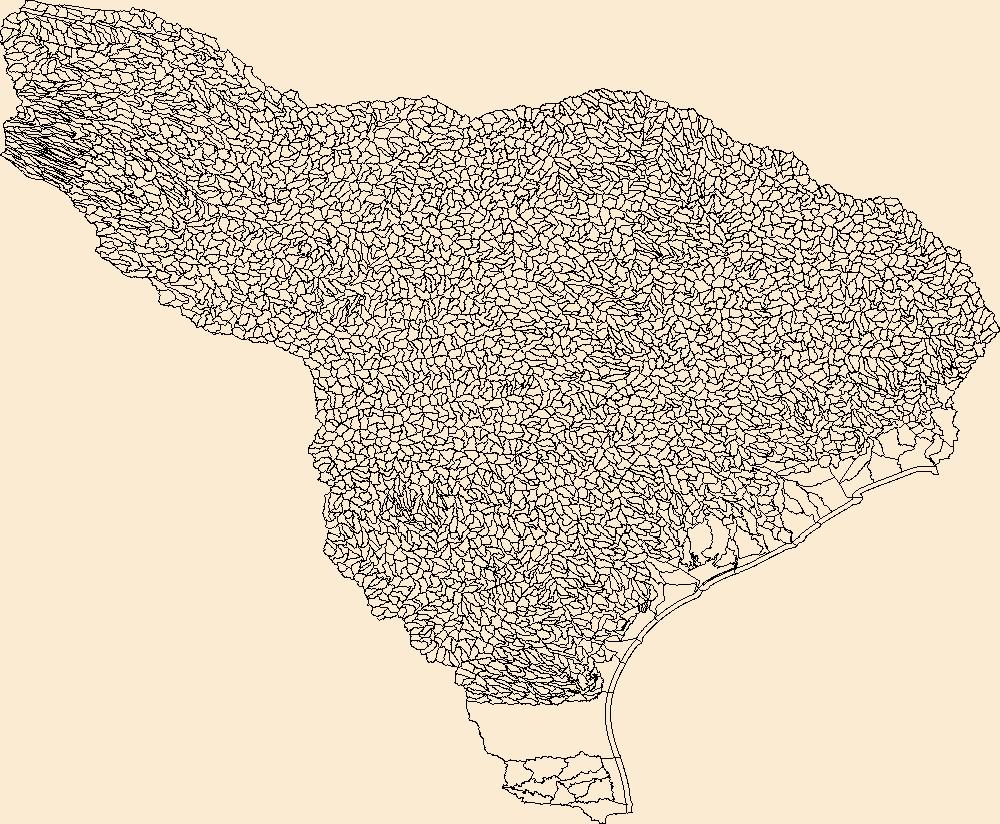
The Watershed Boundary Dataset (WBD) is a comprehensive aggregated collection of hydrologic unit data consistent with the national criteria for delineation and resolution. It defines the areal extent of surface water drainage to a point except in coastal or lake front areas where there could be multiple outlets as stated by the "Federal Standards and Procedures for the National Watershed Boundary Dataset (WBD)" "Standard" (https://pubs.usgs.gov/tm/11/a3/). Watershed boundaries are determined solely upon science-based hydrologic principles, not favoring any administrative boundaries or special projects, nor particular program or agency. This dataset represents the hydrologic unit boundaries to the 12-digit (6th level)...
Tags: 10-digit,
12-digit,
14-digit,
16-digit,
2-digit, All tags...
4-digit,
6-digit,
8-digit,
Adams,
Addison,
Aitkin,
Alcona,
Alger,
Allegan,
Allegany,
Allen,
Alpena,
Antrim,
Arenac,
Ashland,
Ashtabula,
Auglaize,
Baraga,
Barry,
Basin,
Bay,
Bayfield,
Bennington,
Benzie,
Berrien,
Branch,
Brown,
Caledonia,
Calhoun,
Calumet,
Carlton,
Cass,
Cattaraugus,
Cayuga,
Charlevoix,
Chautauqua,
Cheboygan,
Chemung,
Chippewa,
Chittenden,
Clare,
Clinton,
Columbia,
Cook,
Coos,
Cortland,
Crawford,
Cuyahoga,
DeKalb,
Defiance,
Delta,
Dickinson,
Dodge,
Door,
Douglas,
Downloadable Data,
Eaton,
Elkhart,
Emmet,
Erie,
Esri File GeoDatabase 10,
Essex,
FileGDB,
Florence,
Fond du Lac,
Forest,
Franklin,
Fulton,
Geauga,
Genesee,
Gladwin,
Gogebic,
Grand Isle,
Grand Traverse,
Gratiot,
Green Lake,
HU-2,
HU-2 Region,
HU2_04,
HUC,
Hamilton,
Hancock,
Hardin,
Henry,
Herkimer,
Hillsdale,
Houghton,
Huron,
Hydrography,
Hydrologic Unit Code,
Hydrologic Units,
IL,
IN,
Illinois,
Indiana,
Ingham,
Ionia,
Iosco,
Iron,
Isabella,
Itasca,
Jackson,
Jefferson,
Kalamazoo,
Kalkaska,
Kenosha,
Kent,
Kewaunee,
Keweenaw,
Kosciusko,
LaGrange,
LaPorte,
Lake,
Lamoille,
Langlade,
Lapeer,
Leelanau,
Lenawee,
Lewis,
Livingston,
Lorain,
Lucas,
Luce,
ME,
MI,
MN,
Mackinac,
Macomb,
Madison,
Maine,
Manistee,
Manitowoc,
Marathon,
Marinette,
Marion,
Marquette,
Mason,
Mecosta,
Medina,
Menominee,
Mercer,
Michigan,
Midland,
Milwaukee,
Minnesota,
Missaukee,
Monroe,
Montcalm,
Montmorency,
Muskegon,
NH,
NY,
National Watershed Boundary Dataset (WBD),
National Watershed Boundary Dataset (WBD),
New Hampshire,
New York,
Newaygo,
Niagara,
Noble,
OH,
Oakland,
Oceana,
Oconto,
Ogemaw,
Ohio,
Oneida,
Onondaga,
Ontario,
Ontonagon,
Orange,
Orleans,
Osceola,
Oscoda,
Oswego,
Otsego,
Ottawa,
Outagamie,
Oxford,
Ozaukee,
PA,
Paulding,
Pennsylvania,
Pine,
Portage,
Porter,
Potter,
Presque Isle,
Putnam,
Racine,
Region,
Richland,
Roscommon,
Rutland,
Saginaw,
Sandusky,
Sanilac,
Schoolcraft,
Schuyler,
Seneca,
Shawano,
Sheboygan,
Shelby,
Shiawassee,
Somerset,
St. Clair,
St. Joseph,
St. Lawrence,
St. Louis,
Stark,
Steuben,
Sub-basin,
Sub-region,
Subwatershed,
Summit,
Tioga,
Tompkins,
Trumbull,
Tuscola,
US,
United States,
VT,
Van Buren,
Van Wert,
Vermont,
Vilas,
WBD,
WI,
Warren,
Washington,
Washtenaw,
Watershed,
Watershed Boundary Dataset,
Waukesha,
Waupaca,
Waushara,
Wayne,
Wells,
Wexford,
Whitley,
Williams,
Windsor,
Winnebago,
Wisconsin,
Wood,
Wyandot,
Wyoming,
Yates,
inlandWaters, Fewer tags
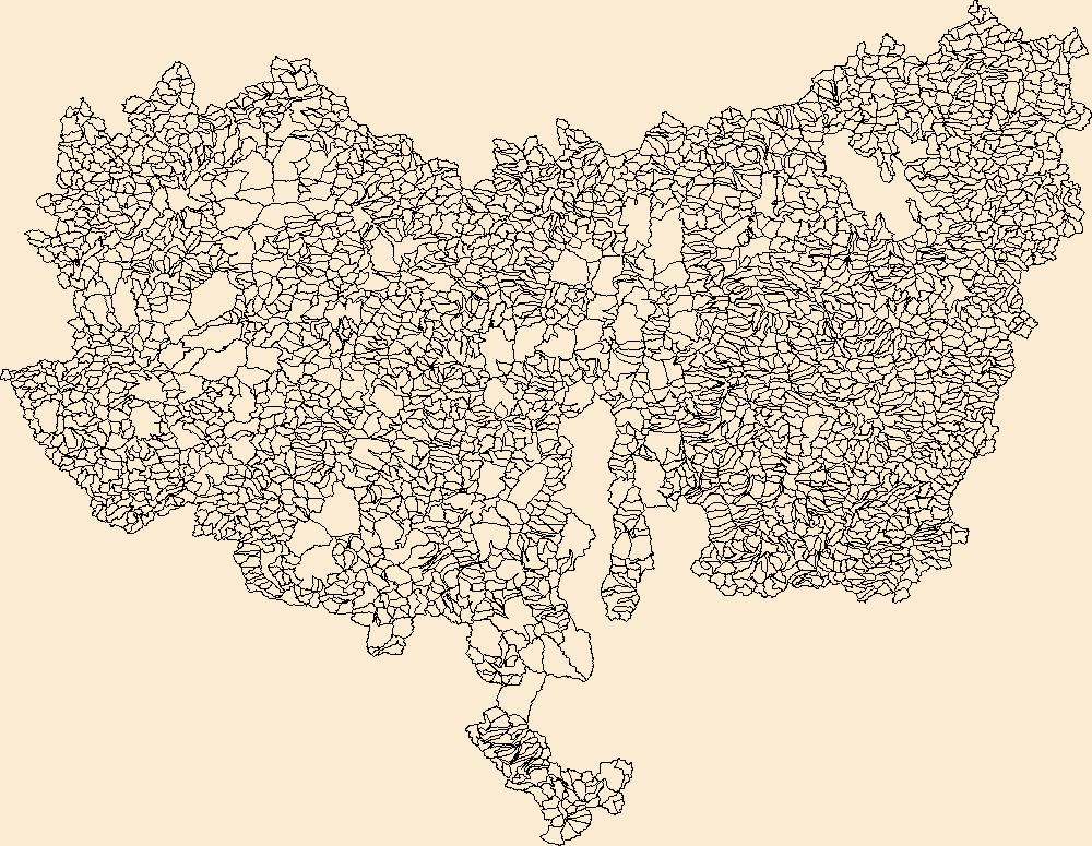
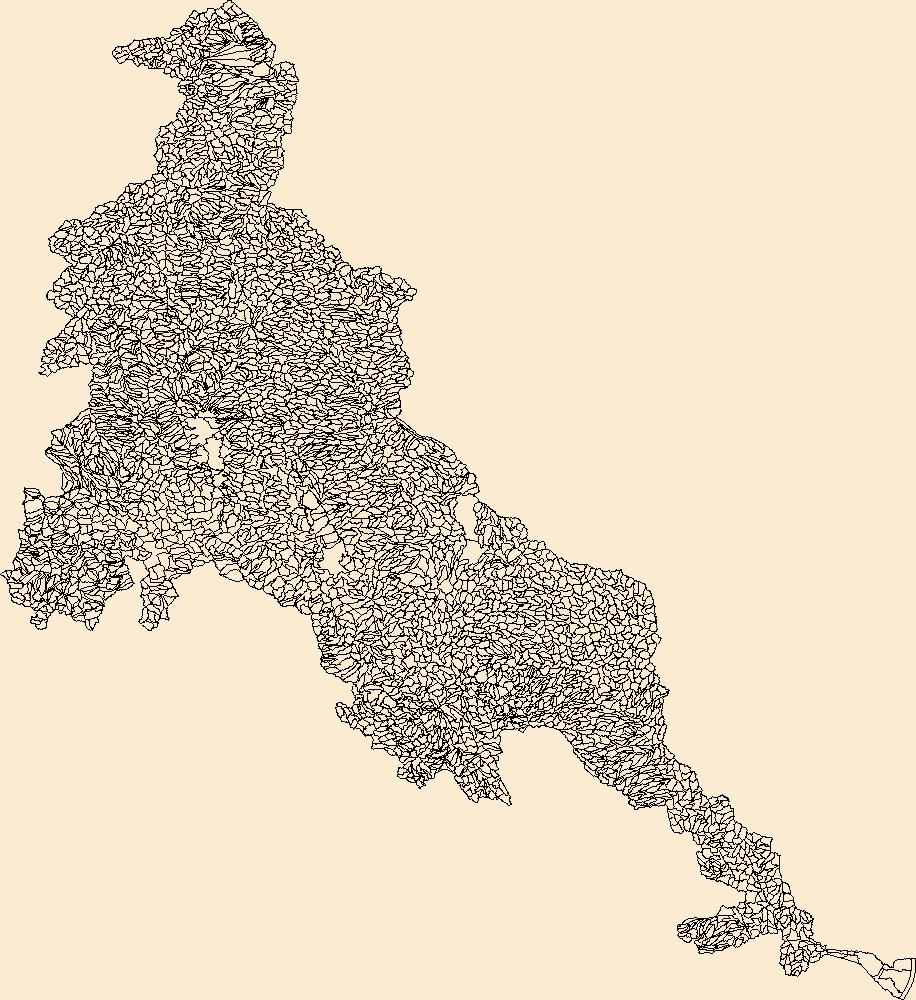
The Watershed Boundary Dataset (WBD) is a comprehensive aggregated collection of hydrologic unit data consistent with the national criteria for delineation and resolution. It defines the areal extent of surface water drainage to a point except in coastal or lake front areas where there could be multiple outlets as stated by the "Federal Standards and Procedures for the National Watershed Boundary Dataset (WBD)" "Standard" (https://pubs.usgs.gov/tm/11/a3/). Watershed boundaries are determined solely upon science-based hydrologic principles, not favoring any administrative boundaries or special projects, nor particular program or agency. This dataset represents the hydrologic unit boundaries to the 12-digit (6th level)...
Tags: 10-digit,
12-digit,
14-digit,
16-digit,
2-digit, All tags...
4-digit,
6-digit,
8-digit,
Adair,
Adams,
Alexander,
Allegany,
Alleghany,
Allegheny,
Allen,
Anderson,
Armstrong,
Ashe,
Ashland,
Ashtabula,
Athens,
Auglaize,
Ballard,
Barbour,
Barren,
Bartholomew,
Basin,
Bath,
Beaver,
Bedford,
Bell,
Belmont,
Benton,
Blackford,
Blair,
Bland,
Bledsoe,
Boone,
Bourbon,
Boyd,
Boyle,
Bracken,
Braxton,
Breathitt,
Breckinridge,
Brooke,
Brown,
Buchanan,
Bullitt,
Butler,
Cabell,
Caldwell,
Calhoun,
Cambria,
Cameron,
Campbell,
Cannon,
Carroll,
Carter,
Casey,
Cass,
Cattaraugus,
Champaign,
Chautauqua,
Cheatham,
Christian,
Claiborne,
Clarion,
Clark,
Clay,
Clearfield,
Clermont,
Clinton,
Coffee,
Coles,
Columbiana,
Coshocton,
Craig,
Crawford,
Crittenden,
Cumberland,
Darke,
Davidson,
Daviess,
DeKalb,
Dearborn,
Decatur,
Delaware,
Dickenson,
Dickson,
Doddridge,
Douglas,
Downloadable Data,
Dubois,
Edgar,
Edmonson,
Edwards,
Effingham,
Elk,
Elliott,
Erie,
Esri File GeoDatabase 10,
Estill,
Fairfield,
Fayette,
Fentress,
FileGDB,
Fleming,
Floyd,
Ford,
Forest,
Fountain,
Franklin,
Fulton,
Galax,
Gallatin,
Gallia,
Garrard,
Garrett,
Geauga,
Gibson,
Giles,
Gilmer,
Grant,
Grayson,
Green,
Greenbrier,
Greene,
Greenup,
Grundy,
Guernsey,
HU-2,
HU-2 Region,
HU2_05,
HUC,
Hamilton,
Hancock,
Hardin,
Harlan,
Harrison,
Hart,
Henderson,
Hendricks,
Henry,
Hickman,
Highland,
Hocking,
Holmes,
Hopkins,
Houston,
Howard,
Humphreys,
Huntington,
Hydrography,
Hydrologic Unit Code,
Hydrologic Units,
IL,
IN,
Illinois,
Indiana,
Indiana,
Iroquois,
Jackson,
Jasper,
Jay,
Jefferson,
Jennings,
Jessamine,
Johnson,
KY,
Kanawha,
Kenton,
Kentucky,
Knott,
Knox,
Kosciusko,
Larue,
Laurel,
Lawrence,
Lee,
Leslie,
Letcher,
Lewis,
Licking,
Lincoln,
Livingston,
Logan,
Lyon,
MD,
Macon,
Madison,
Magoffin,
Mahoning,
Marion,
Marshall,
Martin,
Maryland,
Mason,
Massac,
McCracken,
McCreary,
McDowell,
McKean,
McLean,
Meade,
Medina,
Meigs,
Menifee,
Mercer,
Metcalfe,
Miami,
Mingo,
Monongalia,
Monroe,
Montgomery,
Morgan,
Morrow,
Moultrie,
Muhlenberg,
Muskingum,
NC,
NY,
National Watershed Boundary Dataset (WBD),
National Watershed Boundary Dataset (WBD),
Nelson,
New York,
Nicholas,
Noble,
North Carolina,
OH,
Ohio,
Ohio,
Oldham,
Orange,
Overton,
Owen,
Owsley,
PA,
Parke,
Patrick,
Pendleton,
Pennsylvania,
Perry,
Pickaway,
Pickett,
Pike,
Pleasants,
Pocahontas,
Pope,
Portage,
Posey,
Potter,
Powell,
Preble,
Preston,
Pulaski,
Putnam,
Radford,
Raleigh,
Randolph,
Region,
Richland,
Ripley,
Ritchie,
Roane,
Robertson,
Rockcastle,
Ross,
Rowan,
Rush,
Russell,
Rutherford,
Saline,
Scioto,
Scott,
Sequatchie,
Shelby,
Simpson,
Smith,
Smyth,
Somerset,
Spencer,
Stark,
Starke,
Stewart,
Sub-basin,
Sub-region,
Subwatershed,
Sullivan,
Summers,
Summit,
Sumner,
Surry,
Switzerland,
TN,
Taylor,
Tazewell,
Tennessee,
Tippecanoe,
Tipton,
Todd,
Trigg,
Trimble,
Trousdale,
Trumbull,
Tucker,
Tuscarawas,
Tyler,
US,
Union,
United States,
Upshur,
VA,
Van Buren,
Vanderburgh,
Venango,
Vermilion,
Vermillion,
Vigo,
Vinton,
Virginia,
WBD,
WV,
Wabash,
Warren,
Warrick,
Washington,
Watauga,
Watershed,
Watershed Boundary Dataset,
Wayne,
Webster,
Wells,
West Virginia,
Westmoreland,
Wetzel,
White,
Whitley,
Wilkes,
Williamson,
Wilson,
Wirt,
Wise,
Wolfe,
Wood,
Woodford,
Wyandot,
Wyoming,
Wythe,
inlandWaters, Fewer tags
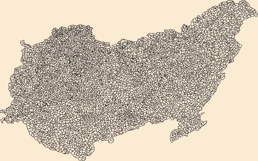
The Watershed Boundary Dataset (WBD) is a comprehensive aggregated collection of hydrologic unit data consistent with the national criteria for delineation and resolution. It defines the areal extent of surface water drainage to a point except in coastal or lake front areas where there could be multiple outlets as stated by the "Federal Standards and Procedures for the National Watershed Boundary Dataset (WBD)" "Standard" (https://pubs.usgs.gov/tm/11/a3/). Watershed boundaries are determined solely upon science-based hydrologic principles, not favoring any administrative boundaries or special projects, nor particular program or agency. This dataset represents the hydrologic unit boundaries to the 12-digit (6th level)...
Tags: 10-digit,
12-digit,
14-digit,
16-digit,
2-digit, All tags...
4-digit,
6-digit,
8-digit,
AZ,
Apache,
Archuleta,
Arizona,
Basin,
Boulder,
CO,
Carbon,
Chaffee,
Clear Creek,
Coconino,
Colorado,
Conejos,
Daggett,
Delta,
Dolores,
Downloadable Data,
Duchesne,
Eagle,
Emery,
Esri File GeoDatabase 10,
FileGDB,
Fremont,
Garfield,
Gilpin,
Grand,
Gunnison,
HU-2,
HU-2 Region,
HU2_14,
HUC,
Hinsdale,
Hydrography,
Hydrologic Unit Code,
Hydrologic Units,
Jackson,
Kane,
La Plata,
Lake,
Larimer,
Lincoln,
McKinley,
Mesa,
Mineral,
Moffat,
Montezuma,
Montrose,
NM,
National Watershed Boundary Dataset (WBD),
National Watershed Boundary Dataset (WBD),
Navajo,
New Mexico,
Ouray,
Park,
Pitkin,
Piute,
Region,
Rio Arriba,
Rio Blanco,
Rio Grande,
Routt,
Saguache,
San Juan,
San Miguel,
Sandoval,
Sanpete,
Sevier,
Sub-basin,
Sub-region,
Sublette,
Subwatershed,
Summit,
Sweetwater,
Teton,
US,
UT,
Uinta,
Uintah,
United States,
Utah,
Utah,
WBD,
WY,
Wasatch,
Watershed,
Watershed Boundary Dataset,
Wayne,
Wyoming,
inlandWaters, Fewer tags
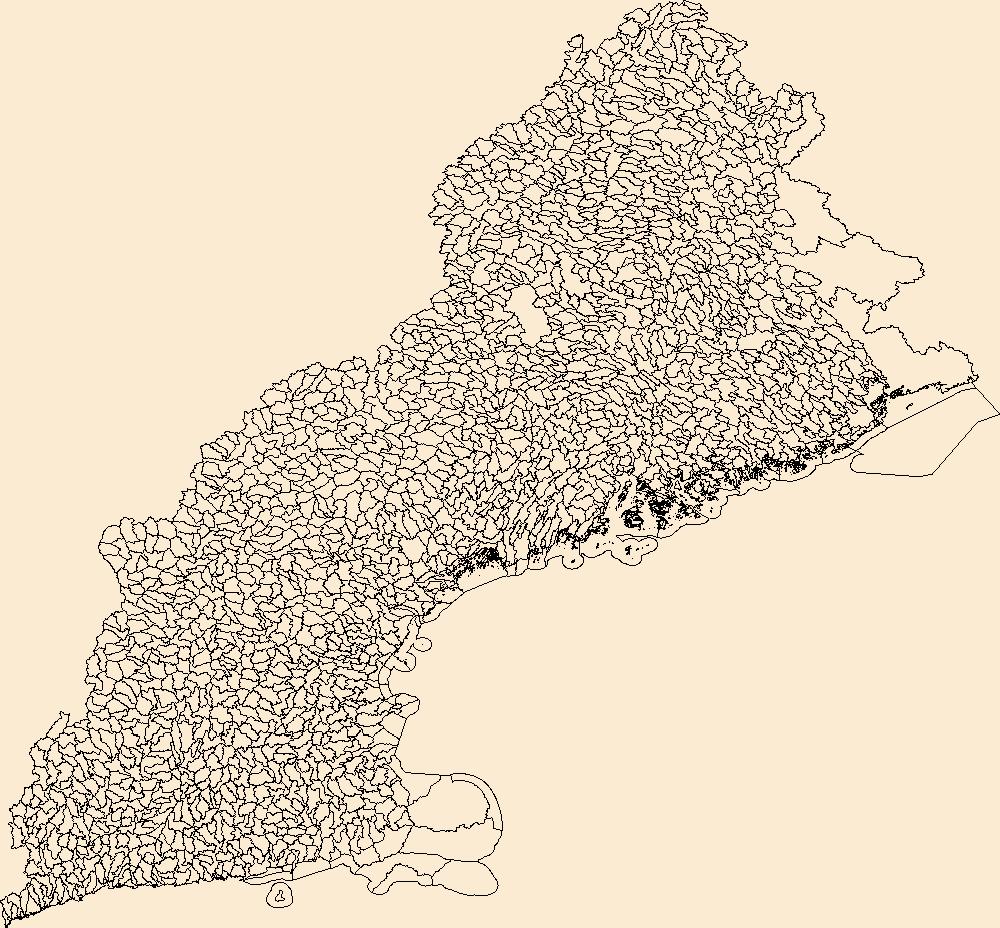
The Watershed Boundary Dataset (WBD) is a comprehensive aggregated collection of hydrologic unit data consistent with the national criteria for delineation and resolution. It defines the areal extent of surface water drainage to a point except in coastal or lake front areas where there could be multiple outlets as stated by the "Federal Standards and Procedures for the National Watershed Boundary Dataset (WBD)" "Standard" (https://pubs.usgs.gov/tm/11/a3/). Watershed boundaries are determined solely upon science-based hydrologic principles, not favoring any administrative boundaries or special projects, nor particular program or agency. This dataset represents the hydrologic unit boundaries to the 12-digit (6th level)...
Tags: 10-digit,
12-digit,
14-digit,
16-digit,
2-digit, All tags...
4-digit,
6-digit,
8-digit,
Addison,
Androscoggin,
Aroostook,
Barnstable,
Basin,
Belknap,
Bennington,
Berkshire,
Bristol,
CT,
Caledonia,
Capitol,
Carroll,
Cheshire,
Columbia,
Connecticut,
Coos,
Cumberland,
Downloadable Data,
Dukes,
Dutchess,
Esri File GeoDatabase 10,
Essex,
FileGDB,
Franklin,
Grafton,
Greater Bridgeport,
HU-2,
HU-2 Region,
HU2_01,
HUC,
Hampden,
Hampshire,
Hancock,
Hillsborough,
Hydrography,
Hydrologic Unit Code,
Hydrologic Units,
Kennebec,
Kent,
Knox,
Lincoln,
Lower Connecticut River Valley,
MA,
ME,
Maine,
Massachusetts,
Merrimack,
Middlesex,
NH,
NY,
Nantucket,
National Watershed Boundary Dataset (WBD),
National Watershed Boundary Dataset (WBD),
Naugatuck Valley,
New Hampshire,
New York,
Newport,
Norfolk,
Northeastern Connecticut,
Northwest Hills,
Orange,
Orleans,
Oxford,
Penobscot,
Piscataquis,
Plymouth,
Providence,
Putnam,
RI,
Region,
Rhode Island,
Rockingham,
Rutland,
Sagadahoc,
Somerset,
South Central Connecticut,
Southeastern Connecticut,
Strafford,
Sub-basin,
Sub-region,
Subwatershed,
Suffolk,
Sullivan,
US,
United States,
VT,
Vermont,
WBD,
Waldo,
Washington,
Watershed,
Watershed Boundary Dataset,
Westchester,
Western Connecticut,
Windham,
Windsor,
Worcester,
York,
inlandWaters, Fewer tags
The Watershed Boundary Dataset (WBD) is a comprehensive aggregated collection of hydrologic unit data consistent with the national criteria for delineation and resolution. It defines the areal extent of surface water drainage to a point except in coastal or lake front areas where there could be multiple outlets as stated by the "Federal Standards and Procedures for the National Watershed Boundary Dataset (WBD)" "Standard" (https://pubs.usgs.gov/tm/11/a3/). Watershed boundaries are determined solely upon science-based hydrologic principles, not favoring any administrative boundaries or special projects, nor particular program or agency. This dataset represents the hydrologic unit boundaries to the 12-digit (6th level)...
Tags: 10-digit,
12-digit,
14-digit,
16-digit,
2-digit, All tags...
4-digit,
6-digit,
8-digit,
AK,
AL,
AR,
AS,
AZ,
Alabama,
Alaska,
American Samoa,
Arizona,
Arkansas,
Basin,
CA,
CO,
CT,
California,
Colorado,
Connecticut,
DC,
DE,
Delaware,
District of Columbia,
Downloadable Data,
Esri File GeoDatabase 10,
FL,
FileGDB,
Florida,
GA,
GU,
Georgia,
Guam,
HI,
HUC,
Hawaii,
Hydrography,
Hydrologic Unit Code,
Hydrologic Units,
IA,
ID,
IL,
IN,
Idaho,
Illinois,
Indiana,
Iowa,
KS,
KY,
Kansas,
Kentucky,
LA,
Louisiana,
MA,
MD,
ME,
MI,
MN,
MO,
MP,
MS,
MT,
Maine,
Maryland,
Massachusetts,
Michigan,
Minnesota,
Mississippi,
Missouri,
Montana,
NC,
ND,
NE,
NH,
NJ,
NM,
NV,
NY,
National,
National,
National Watershed Boundary Dataset (WBD),
National Watershed Boundary Dataset (WBD),
Nebraska,
Nevada,
New Hampshire,
New Jersey,
New Mexico,
New York,
North Carolina,
North Dakota,
Northern Mariana Islands,
OH,
OK,
OR,
Ohio,
Oklahoma,
Oregon,
PA,
PR,
Pennsylvania,
Puerto Rico,
RI,
Region,
Rhode Island,
SC,
SD,
South Carolina,
South Dakota,
Sub-basin,
Sub-region,
Subwatershed,
TN,
TX,
Tennessee,
Texas,
US,
UT,
United States,
Utah,
VA,
VI,
VT,
Vermont,
Virgin Islands,
Virginia,
WA,
WBD,
WI,
WV,
WY,
Washington,
Watershed,
Watershed Boundary Dataset,
West Virginia,
Wisconsin,
Wyoming,
inlandWaters, Fewer tags
The Watershed Boundary Dataset (WBD) is a comprehensive aggregated collection of hydrologic unit data consistent with the national criteria for delineation and resolution. It defines the areal extent of surface water drainage to a point except in coastal or lake front areas where there could be multiple outlets as stated by the "Federal Standards and Procedures for the National Watershed Boundary Dataset (WBD)" "Standard" (https://pubs.usgs.gov/tm/11/a3/). Watershed boundaries are determined solely upon science-based hydrologic principles, not favoring any administrative boundaries or special projects, nor particular program or agency. This dataset represents the hydrologic unit boundaries to the 12-digit (6th level)...
Tags: 10-digit,
12-digit,
14-digit,
16-digit,
2-digit, All tags...
4-digit,
6-digit,
8-digit,
Alameda,
Alpine,
Amador,
Basin,
Butte,
CA,
Calaveras,
California,
Colusa,
Contra Costa,
Curry,
Del Norte,
Douglas,
Downloadable Data,
El Dorado,
Esmeralda,
Esri File GeoDatabase 10,
FileGDB,
Fresno,
Glenn,
HU-2,
HU-2 Region,
HU2_18,
HUC,
Humboldt,
Hydrography,
Hydrologic Unit Code,
Hydrologic Units,
Imperial,
Inyo,
Jackson,
Josephine,
Kern,
Kings,
Klamath,
Lake,
Lassen,
Los Angeles,
Madera,
Marin,
Mariposa,
Mendocino,
Merced,
Mineral,
Modoc,
Mono,
Monterey,
NV,
Napa,
National Watershed Boundary Dataset (WBD),
National Watershed Boundary Dataset (WBD),
Nevada,
Nevada,
Nye,
OR,
Orange,
Oregon,
Placer,
Plumas,
Region,
Riverside,
Sacramento,
San Benito,
San Bernardino,
San Diego,
San Francisco,
San Joaquin,
San Luis Obispo,
San Mateo,
Santa Barbara,
Santa Clara,
Santa Cruz,
Shasta,
Sierra,
Siskiyou,
Solano,
Sonoma,
Stanislaus,
Sub-basin,
Sub-region,
Subwatershed,
Sutter,
Tehama,
Trinity,
Tulare,
Tuolumne,
US,
United States,
Ventura,
WBD,
Washoe,
Watershed,
Watershed Boundary Dataset,
Yolo,
Yuba,
inlandWaters, Fewer tags
The Watershed Boundary Dataset (WBD) is a comprehensive aggregated collection of hydrologic unit data consistent with the national criteria for delineation and resolution. It defines the areal extent of surface water drainage to a point except in coastal or lake front areas where there could be multiple outlets as stated by the "Federal Standards and Procedures for the National Watershed Boundary Dataset (WBD)" "Standard" (https://pubs.usgs.gov/tm/11/a3/). Watershed boundaries are determined solely upon science-based hydrologic principles, not favoring any administrative boundaries or special projects, nor particular program or agency. This dataset represents the hydrologic unit boundaries to the 12-digit (6th level)...
Tags: 10-digit,
12-digit,
14-digit,
16-digit,
2-digit, All tags...
4-digit,
6-digit,
8-digit,
Anderson,
Andrews,
Angelina,
Aransas,
Archer,
Atascosa,
Austin,
Bailey,
Bandera,
Basin,
Bastrop,
Baylor,
Beauregard,
Bee,
Bell,
Bexar,
Blanco,
Borden,
Bosque,
Brazoria,
Brazos,
Brooks,
Brown,
Burleson,
Burnet,
Caddo,
Calcasieu,
Caldwell,
Calhoun,
Callahan,
Cameron,
Castro,
Chambers,
Chaves,
Cherokee,
Clay,
Cochran,
Coke,
Coleman,
Collin,
Colorado,
Comal,
Comanche,
Concho,
Cooke,
Coryell,
Crockett,
Crosby,
Curry,
Dallas,
Dawson,
De Soto,
DeWitt,
Denton,
Dickens,
Dimmit,
Downloadable Data,
Duval,
Eastland,
Ector,
Edwards,
Ellis,
Erath,
Esri File GeoDatabase 10,
Falls,
Fannin,
Fayette,
FileGDB,
Fisher,
Floyd,
Fort Bend,
Franklin,
Freestone,
Frio,
Gaines,
Galveston,
Garza,
Gillespie,
Glasscock,
Goliad,
Gonzales,
Grayson,
Gregg,
Grimes,
Guadalupe,
HU-2,
HU-2 Region,
HU2_12,
HUC,
Hale,
Hamilton,
Hardin,
Harris,
Harrison,
Haskell,
Hays,
Henderson,
Hidalgo,
Hill,
Hockley,
Hood,
Hopkins,
Houston,
Howard,
Hunt,
Hydrography,
Hydrologic Unit Code,
Hydrologic Units,
Irion,
Jack,
Jackson,
Jasper,
Jefferson,
Jim Hogg,
Jim Wells,
Johnson,
Jones,
Karnes,
Kaufman,
Kendall,
Kenedy,
Kent,
Kerr,
Kimble,
King,
Kinney,
Kleberg,
Knox,
LA,
La Salle,
Lamb,
Lampasas,
Lavaca,
Lea,
Lee,
Leon,
Liberty,
Limestone,
Live Oak,
Llano,
Louisiana,
Lubbock,
Lynn,
Madison,
Martin,
Mason,
Matagorda,
Maverick,
McCulloch,
McLennan,
McMullen,
Medina,
Menard,
Midland,
Milam,
Mills,
Mitchell,
Montague,
Montgomery,
NM,
Nacogdoches,
Natchitoches,
National Watershed Boundary Dataset (WBD),
National Watershed Boundary Dataset (WBD),
Navarro,
New Mexico,
Newton,
Nolan,
Nueces,
Orange,
Palo Pinto,
Panola,
Parker,
Parmer,
Polk,
Rains,
Reagan,
Real,
Refugio,
Region,
Robertson,
Rockwall,
Roosevelt,
Runnels,
Rusk,
Sabine,
San Augustine,
San Jacinto,
San Patricio,
San Saba,
Schleicher,
Scurry,
Shackelford,
Shelby,
Smith,
Somervell,
Starr,
Stephens,
Sterling,
Stonewall,
Sub-basin,
Sub-region,
Subwatershed,
Sutton,
Swisher,
TX,
Tarrant,
Taylor,
Terry,
Texas,
Throckmorton,
Tom Green,
Travis,
Trinity,
Tyler,
US,
United States,
Upshur,
Upton,
Uvalde,
Van Zandt,
Vernon,
Victoria,
WBD,
Walker,
Waller,
Washington,
Watershed,
Watershed Boundary Dataset,
Webb,
Wharton,
Willacy,
Williamson,
Wilson,
Winkler,
Wise,
Wood,
Yoakum,
Young,
Zavala,
inlandWaters, Fewer tags

The Watershed Boundary Dataset (WBD) is a comprehensive aggregated collection of hydrologic unit data consistent with the national criteria for delineation and resolution. It defines the areal extent of surface water drainage to a point except in coastal or lake front areas where there could be multiple outlets as stated by the "Federal Standards and Procedures for the National Watershed Boundary Dataset (WBD)" "Standard" (https://pubs.usgs.gov/tm/11/a3/). Watershed boundaries are determined solely upon science-based hydrologic principles, not favoring any administrative boundaries or special projects, nor particular program or agency. This dataset represents the hydrologic unit boundaries to the 12-digit (6th level)...
Tags: 10-digit,
12-digit,
14-digit,
16-digit,
2-digit, All tags...
4-digit,
6-digit,
8-digit,
AS,
American Samoa,
Basin,
Downloadable Data,
Eastern,
Esri File GeoDatabase 10,
FileGDB,
GU,
Guam,
Guam,
HU-2,
HU-2 Region,
HU2_22,
HUC,
Hydrography,
Hydrologic Unit Code,
Hydrologic Units,
MP,
Manu'a,
National Watershed Boundary Dataset (WBD),
National Watershed Boundary Dataset (WBD),
Northern Islands,
Northern Mariana Islands,
Region,
Rose Island,
Rota,
Saipan,
Sub-basin,
Sub-region,
Subwatershed,
Swains Island,
Tinian,
US,
United States,
WBD,
Watershed,
Watershed Boundary Dataset,
Western,
inlandWaters, Fewer tags
The Watershed Boundary Dataset (WBD) is a comprehensive aggregated collection of hydrologic unit data consistent with the national criteria for delineation and resolution. It defines the areal extent of surface water drainage to a point except in coastal or lake front areas where there could be multiple outlets as stated by the "Federal Standards and Procedures for the National Watershed Boundary Dataset (WBD)" "Standard" (https://pubs.usgs.gov/tm/11/a3/). Watershed boundaries are determined solely upon science-based hydrologic principles, not favoring any administrative boundaries or special projects, nor particular program or agency. This dataset represents the hydrologic unit boundaries to the 12-digit (6th level)...
Tags: 10-digit,
12-digit,
14-digit,
16-digit,
2-digit, All tags...
4-digit,
6-digit,
8-digit,
Alamosa,
Andrews,
Archuleta,
Basin,
Bernalillo,
Brewster,
CO,
Cameron,
Catron,
Chaffee,
Chaves,
Cibola,
Colfax,
Colorado,
Conejos,
Costilla,
Crane,
Crockett,
Culberson,
Curry,
Custer,
De Baca,
Dimmit,
Downloadable Data,
Doña Ana,
Ector,
Eddy,
Edwards,
El Paso,
Esri File GeoDatabase 10,
FileGDB,
Fremont,
Grant,
Guadalupe,
HU-2,
HU-2 Region,
HU2_13,
HUC,
Hidalgo,
Hinsdale,
Hudspeth,
Huerfano,
Hydrography,
Hydrologic Unit Code,
Hydrologic Units,
Jeff Davis,
Jim Hogg,
Kinney,
Las Animas,
Lea,
Lincoln,
Los Alamos,
Loving,
Luna,
Maverick,
McKinley,
Midland,
Mineral,
Mora,
NM,
National Watershed Boundary Dataset (WBD),
National Watershed Boundary Dataset (WBD),
New Mexico,
Otero,
Pecos,
Presidio,
Quay,
Reagan,
Reeves,
Region,
Rio Arriba,
Rio Grande,
Roosevelt,
Saguache,
San Juan,
San Miguel,
Sandoval,
Santa Fe,
Schleicher,
Sierra,
Socorro,
Starr,
Sub-basin,
Sub-region,
Subwatershed,
Sutton,
TX,
Taos,
Terrell,
Texas,
Torrance,
US,
United States,
Upton,
Val Verde,
Valencia,
WBD,
Ward,
Watershed,
Watershed Boundary Dataset,
Webb,
Winkler,
Zapata,
inlandWaters, Fewer tags

The Watershed Boundary Dataset (WBD) is a comprehensive aggregated collection of hydrologic unit data consistent with the national criteria for delineation and resolution. It defines the areal extent of surface water drainage to a point except in coastal or lake front areas where there could be multiple outlets as stated by the "Federal Standards and Procedures for the National Watershed Boundary Dataset (WBD)" "Standard" (https://pubs.usgs.gov/tm/11/a3/). Watershed boundaries are determined solely upon science-based hydrologic principles, not favoring any administrative boundaries or special projects, nor particular program or agency. This dataset represents the hydrologic unit boundaries to the 12-digit (6th level)...
Tags: 10-digit,
12-digit,
14-digit,
16-digit,
2-digit, All tags...
4-digit,
6-digit,
8-digit,
AK,
Alaska,
Aleutians East,
Aleutians West,
Anchorage,
Basin,
Bethel,
Bristol Bay,
Chugach,
Copper River,
Denali,
Dillingham,
Downloadable Data,
Esri File GeoDatabase 10,
Fairbanks North Star,
FileGDB,
HU-2,
HU-2 Region,
HU2_19,
HUC,
Haines,
Hoonah-Angoon,
Hydrography,
Hydrologic Unit Code,
Hydrologic Units,
Juneau,
Kenai Peninsula,
Ketchikan Gateway,
Kodiak Island,
Kusilvak,
Lake and Peninsula,
Matanuska-Susitna,
National Watershed Boundary Dataset (WBD),
National Watershed Boundary Dataset (WBD),
Nome,
North Slope,
Northwest Arctic,
Petersburg,
Prince of Wales-Hyder,
Region,
Sitka,
Skagway,
Southeast Fairbanks,
Sub-basin,
Sub-region,
Subwatershed,
US,
United States,
WBD,
Watershed,
Watershed Boundary Dataset,
Wrangell,
Yakutat,
Yukon-Koyukuk,
inlandWaters, Fewer tags
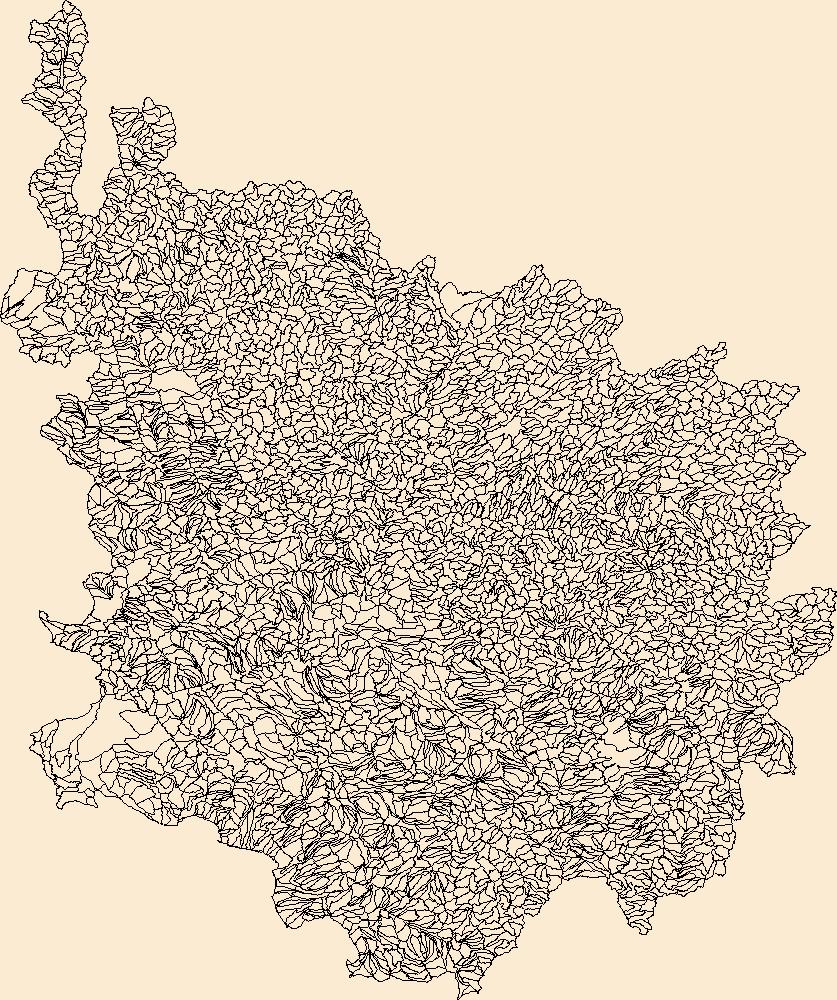
The Watershed Boundary Dataset (WBD) is a comprehensive aggregated collection of hydrologic unit data consistent with the national criteria for delineation and resolution. It defines the areal extent of surface water drainage to a point except in coastal or lake front areas where there could be multiple outlets as stated by the "Federal Standards and Procedures for the National Watershed Boundary Dataset (WBD)" "Standard" (https://pubs.usgs.gov/tm/11/a3/). Watershed boundaries are determined solely upon science-based hydrologic principles, not favoring any administrative boundaries or special projects, nor particular program or agency. This dataset represents the hydrologic unit boundaries to the 12-digit (6th level)...
Tags: 10-digit,
12-digit,
14-digit,
16-digit,
2-digit, All tags...
4-digit,
6-digit,
8-digit,
Adair,
Adams,
Aitkin,
Alexander,
Allamakee,
Anoka,
Appanoose,
Ashland,
Audrain,
Audubon,
Ballard,
Barron,
Basin,
Bayfield,
Becker,
Beltrami,
Benton,
Berrien,
Big Stone,
Black Hawk,
Blue Earth,
Bollinger,
Bond,
Boone,
Bremer,
Brookings,
Brown,
Buchanan,
Buena Vista,
Buffalo,
Bureau,
Burnett,
Butler,
Calhoun,
Callaway,
Cape Girardeau,
Carlton,
Carroll,
Carver,
Cass,
Cedar,
Cerro Gordo,
Champaign,
Chickasaw,
Chippewa,
Chisago,
Christian,
Clark,
Clarke,
Clay,
Clayton,
Clearwater,
Clinton,
Codington,
Coles,
Columbia,
Cook,
Cottonwood,
Crawford,
Crow Wing,
Dakota,
Dallas,
Dane,
Davis,
Day,
De Witt,
DeKalb,
Delaware,
Dent,
Des Moines,
Deuel,
Dickinson,
Dodge,
Douglas,
Downloadable Data,
DuPage,
Dubuque,
Dunn,
Eau Claire,
Effingham,
Elkhart,
Emmet,
Esri File GeoDatabase 10,
Faribault,
Fayette,
FileGDB,
Fillmore,
Floyd,
Fond du Lac,
Ford,
Forest,
Franklin,
Freeborn,
Fulton,
Gasconade,
Gogebic,
Goodhue,
Grant,
Green,
Green Lake,
Greene,
Grundy,
Guthrie,
HU-2,
HU-2 Region,
HU2_07,
HUC,
Hamilton,
Hancock,
Hardin,
Henderson,
Hennepin,
Henry,
Houston,
Howard,
Hubbard,
Humboldt,
Hydrography,
Hydrologic Unit Code,
Hydrologic Units,
IA,
IL,
IN,
Illinois,
Indiana,
Iowa,
Iowa,
Iron,
Iroquois,
Isanti,
Itasca,
Jackson,
Jasper,
Jefferson,
Jersey,
Jo Daviess,
Johnson,
Jones,
Juneau,
KY,
Kanabec,
Kandiyohi,
Kane,
Kankakee,
Kendall,
Kenosha,
Kentucky,
Keokuk,
Knox,
Kosciusko,
Kossuth,
La Crosse,
LaPorte,
LaSalle,
Lac qui Parle,
Lafayette,
Lake,
Langlade,
Le Sueur,
Lee,
Lewis,
Lincoln,
Linn,
Livingston,
Logan,
Louisa,
Lucas,
Lyon,
MI,
MN,
MO,
Macon,
Macoupin,
Madison,
Mahaska,
Marathon,
Maries,
Marion,
Marquette,
Marshall,
Martin,
Mason,
McDonough,
McHenry,
McLean,
McLeod,
Meeker,
Menard,
Mercer,
Michigan,
Mille Lacs,
Milwaukee,
Minnesota,
Mississippi,
Missouri,
Mitchell,
Monroe,
Montgomery,
Morgan,
Morrison,
Moultrie,
Mower,
Murray,
Muscatine,
ND,
National Watershed Boundary Dataset (WBD),
National Watershed Boundary Dataset (WBD),
Newton,
Nicollet,
Nobles,
North Dakota,
Ogle,
Olmsted,
Oneida,
Osage,
Otter Tail,
Palo Alto,
Peoria,
Pepin,
Perry,
Phelps,
Piatt,
Pierce,
Pike,
Pine,
Pipestone,
Pocahontas,
Polk,
Pope,
Portage,
Porter,
Poweshiek,
Price,
Pulaski,
Putnam,
Racine,
Ralls,
Ramsey,
Randolph,
Redwood,
Region,
Renville,
Reynolds,
Rice,
Richland,
Roberts,
Rock,
Rock Island,
Rusk,
SD,
Sac,
Sangamon,
Sauk,
Sawyer,
Schuyler,
Scotland,
Scott,
Shawano,
Shelby,
Sherburne,
Sibley,
South Dakota,
St. Charles,
St. Clair,
St. Croix,
St. Francois,
St. Joseph,
St. Louis,
Stark,
Starke,
Ste. Genevieve,
Stearns,
Steele,
Stephenson,
Stevens,
Story,
Sub-basin,
Sub-region,
Subwatershed,
Swift,
Tama,
Taylor,
Tazewell,
Texas,
Todd,
Traverse,
Trempealeau,
US,
Union,
United States,
Van Buren,
Vermilion,
Vernon,
Vilas,
WBD,
WI,
Wabasha,
Wadena,
Walworth,
Wapello,
Warren,
Waseca,
Washburn,
Washington,
Watershed,
Watershed Boundary Dataset,
Watonwan,
Waukesha,
Waushara,
Wayne,
Webster,
White,
Whiteside,
Will,
Williamson,
Winnebago,
Winneshiek,
Winona,
Wisconsin,
Wood,
Woodford,
Worth,
Wright,
Yellow Medicine,
inlandWaters, Fewer tags
|
|

