Filters: Tags: FIRE MANAGEMENT (X)
16 results (44ms)|
Filters
Date Range
Extensions Contacts
Categories Tag Types
|

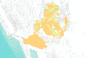
In The Wilderness Society’s report, Targeting the Community Fire Planning Zone: Mapping Matters, landscape ecologist Bo Wilmer and forest ecologist Dr. Greg Aplet find these definitions to be both immensely important and extremely elusive. Community Fire Planning Zones (CFPZ) — areas in and around communities where federal, state and local fire managers should focus their efforts to mitigate fire risk — include tens of millions of acres, much of which is private land. In order to successfully tackle such an immense planning challenge, protection strategies must be tightly focused and well-informed. But because each state uses a different method to designate communities at risk, no national-scale definition of the...
These data were compiled for the Altar Valley Conservation Alliance and the U. S. Fish and Wildlife Service to identify and quantify the spatial distribution of fine fuels in relation to wildfire management across jurisdictional boundaries. Objective(s) of our study were to map the 2021 annual distribution of the biomass (kg/ha) of fine fuels (grasses, shrubs, and forbs) for the whole of the Altar Valley, AZ, including the Buenos Aires National Wildlife Refuge. These data represent estimated biomass of fine fuels (kg/ha) at a 10-m resolution. These data were collected/created in September through October 2021 for the Altar Valley, located in Pima County, AZ, USA. These data were collected/created by the U.S. Geological...
This pending report will describe and quantify the extent of and trends climate change impacts on fire return intervals in Alaska and Canada’s boreal forests.
Categories: Data,
Project;
Tags: Academics & scientific researchers,
CLIMATE INDICATORS,
CLIMATE INDICATORS,
Data,
Data Acquisition and Development,
This dataset is an extract from a national (U.S.) forest canopy base height dataset created by the Landscape Fire and Resource Management Planning Tools Project (LANDFIRE). It only contains data for the areas within the Colorado Basin, Arizona/New Mexico Basin, and Sonoran Desert eco-regions. From LANDFIRE: The LANDFIRE fuel data describe the composition and characteristics of both surface fuel and canopy fuel. Specific products include fire behavior fuel models, canopy bulk density (CBD), canopy base height (CBH), canopy cover (CC), canopy height (CH), and fuel loading models (FLMs). These data may be implemented within models to predict the behavior and effects of wildland fire. These data are useful for strategic...
Note: this data release has been deprecated. Please see new data release here: https://doi.org/10.5066/P9347I2H. These data were compiled to estimate fine-fuel abundance and distribution across the Buenos Aires National Wildlife Refuge in southern Arizona, USA. The objectives of the study were to develop and validate annual estimates of fine fuel (biomass of herbaceous vegetation) for the refuge and to assess changes in fine fuels through time in response to wildfire and prescribed fire. These data represent the amount of herbaceous biomass or fine fuels (kg/ha) present at a 10-m resolution derived from in-situ estimates of ground cover modeled with satellite imagery. These satellite image data were collected over...
Categories: Data;
Tags: 10-m resolution,
Arizona,
Botany,
Buenos Aires National Wildlife Refuge,
Ecology,
EcoAdapt staff located and compiled relevant gray literature from Northwest national forests (e.g., forest management plans, fire management plans and policies, climate change strategy documents) written between 1986-2015, and categorized the ways in which fire-related climate adaptation actions appear in these documents. A coding system was created to review and catalog how climate adaptation actions appear in each document. Each document was reviewed and scored based on a 0-2 scale with 0 indicating no presence of climate adaptation action(s) within the document, 1 indicating presence of climate adaptation action(s) within the document, and 2 indicating climate adaptation action(s) are the focus/priority of the...
These data were compiled to estimate fine-fuel abundance and distribution across the Buenos Aires National Wildlife Refuge in southern Arizona, USA. The objectives of the study were to develop and validate annual estimates of fine fuel (biomass of herbaceous vegetation) for the refuge and to assess changes in fine fuels through time in response to wildfire and prescribed fire. These data represent the amount of herbaceous biomass or fine fuels (kg/ha) present at a 10-m resolution derived from in-situ estimates of ground cover modeled with satellite imagery. These satellite image data were collected over the Buenos Aires National Wildlife Refuge during leaf-on (August) and leaf-off (November) time periods annually...

In The Wilderness Society’s report, Targeting the Community Fire Planning Zone:Mapping Matters, landscape ecologist Bo Wilmer and forest ecologist Dr. Greg Apletfind these definitions to be both immensely important and extremely elusive. CommunityFire Planning Zones (CFPZ) — areas in and around communities where federal,state and local fire managers should focus their efforts to mitigate fire risk —include tens of millions of acres, much of which is private land. In order to successfullytackle such an immense planning challenge, protection strategies must be tightlyfocused and well-informed. But because each state uses a different method to designatecommunities at risk, no national-scale definition of the CFPZ exists...
%20Website%20Template_files/banner_left.png)
The Upper Colorado River Interagency Fire Management Unit (UCR) provides a full range of fire management services to participating federal, state and local jurisdictions in western Colorado. The UCR is composed of the Glenwood Springs and Grand Junction Field Offices of the Bureau of Land Management; Grand Valley Ranger District of the Grand Mesa, Uncompahgre and Gunnison National Forests; White River National Forest, and the Colorado National Monument. The UCR cooperates with state agencies, local communities and fire departments on a wide range of activities including fuels treatments, fire prevention and fire suppression.
Wildfires, Traditional Burning, and Prescribed have been a way of shaping the landscape of the Klamath Basin for thousands of years. I’ve been researching these subjects for the past summer during my internship for the KBTYP (Klamath Basin Tribal Youth Program). In my time spent up and down the Klamath Basin I have found a great interest in fire, so I decided to write my report on it. This report will detail information about the different types of burning and how each one has a different effect on the climate of the Klamath Basin. It’s been a great experience for me and I have learned a lot from different agencies and people such as, tribal governments, tribal elders, fish and wildlife, people from various communities,...

In The Wilderness Society’s report, Targeting the Community Fire Planning Zone:Mapping Matters, landscape ecologist Bo Wilmer and forest ecologist Dr. Greg Apletfind these definitions to be both immensely important and extremely elusive. CommunityFire Planning Zones (CFPZ) — areas in and around communities where federal,state and local fire managers should focus their efforts to mitigate fire risk —include tens of millions of acres, much of which is private land. In order to successfullytackle such an immense planning challenge, protection strategies must be tightlyfocused and well-informed. But because each state uses a different method to designatecommunities at risk, no national-scale definition of the CFPZ exists...

In The Wilderness Society’s report, Targeting the Community Fire Planning Zone:Mapping Matters, landscape ecologist Bo Wilmer and forest ecologist Dr. Greg Apletfind these definitions to be both immensely important and extremely elusive. CommunityFire Planning Zones (CFPZ) — areas in and around communities where federal,state and local fire managers should focus their efforts to mitigate fire risk —include tens of millions of acres, much of which is private land. In order to successfullytackle such an immense planning challenge, protection strategies must be tightlyfocused and well-informed. But because each state uses a different method to designatecommunities at risk, no national-scale definition of the CFPZ exists...

In The Wilderness Society’s report, Targeting the Community Fire Planning Zone:Mapping Matters, landscape ecologist Bo Wilmer and forest ecologist Dr. Greg Apletfind these definitions to be both immensely important and extremely elusive. CommunityFire Planning Zones (CFPZ) — areas in and around communities where federal,state and local fire managers should focus their efforts to mitigate fire risk —include tens of millions of acres, much of which is private land. In order to successfullytackle such an immense planning challenge, protection strategies must be tightlyfocused and well-informed. But because each state uses a different method to designatecommunities at risk, no national-scale definition of the CFPZ exists...
This pending report will describe and quantify the extent of and trends climate change impacts on fire return intervals in Alaska and Canada’s boreal forests.
Categories: Data;
Tags: Academics & scientific researchers,
CLIMATE INDICATORS,
CLIMATE INDICATORS,
FIRE ECOLOGY,
FIRE ECOLOGY,
On July 31st, 2014 a fire started on the Lower Salmon River Basin and continued to burn upstream. This fire gave local scientists and water quality managers an opportunity to study how fires in the ecosystem can impact our fisheries. (Robinson, 2013) In a theoretically “perfect” world there should never be a “bad” fire. For example, back before the Europeans and foreigners arrived, long before forest service was around, the native people used fire so frequently that when lightning would touch down that all the lightning would do nothing but burn all the unwanted brush or tress that wasn’t useful and using a lot of groundwater that can also be generated more toward the old growth. It wasn’t until the forest service...
The Use of Fire as a Tool to Enhance Traditional Foods among the Tribal Nations of the Klamath Basin
The six federally recognized tribes of the Klamath Basin have depended on traditional foods for survival since time immemorial. Frequent, low-severity fires were implemented historically by tribal peoples to help enhance traditional foods and manage forest growth. For the Karuk Tribe, living in the Mid-Klamath region, over 75% of traditional foods were enriched by fire (Norgaard 2014). Due to the enactment of fire suppression as a national policy for almost a century, many tribal members today do not have access to traditional foods, negatively impacting biological and psychological health. The procurement of traditional foods requires detailed knowledge of the environment, and since the tribal peoples of the Klamath...
|

|
