Filters: Tags: FORT UNION (X)
96 results (164ms)|
Filters
Date Range
Types Contacts
Categories Tag Types Tag Schemes |
Core Research Center, core T201, from well operated by MOUNTAIN FUEL SUPPLYRaw Properties from download, web scrape, MapServer, and Macrostrat API{"Lib Num": "T201", "API Num": "4903506207", "Operator": "MOUNTAIN FUEL SUPPLY", "Well Name": "1 ANTELOPE DRAW", "Field": "ANTELOPE DRAW", "State": "WY", "County": "SUBLETTE", "Type": "FULL", "Photos": "F", "Thin Sec": "F", "Analysis": "F", "Latitude": "42.73577", "Longitude": "-110.0539", "coordinates_geohash": "9x9epev1ykbm", "Source": "FROM STATE RECORDS", "Security Flag": "NO SPECIAL RESTRICTIONS", "crc_collection_name": "core", "sb_parent_id": "4f4e49dae4b07f02db5e0486", "intervals": [{"Formation": "FORT UNION", "Age": "CRET", "Min Depth": "8575", "Max Depth": "8633"}],...
Core Research Center, core C246, from well operated by MICH WISC PIPELINERaw Properties from download, web scrape, MapServer, and Macrostrat API{"Lib Num": "C246", "API Num": "4901308280", "Operator": "MICH WISC PIPELINE", "Well Name": "1-18A BOYSEN-AMOCO-TRIBAL", "Field": "SAND MESA", "State": "WY", "County": "FREMONT", "Type": "SLABBED", "Photos": "T", "Thin Sec": "F", "Analysis": "T", "Latitude": "43.32229", "Longitude": "-108.33778", "coordinates_geohash": "9xdyqwwfdu0n", "Source": "FROM STATE RECORDS", "Security Flag": "NO SPECIAL RESTRICTIONS", "crc_collection_name": "core", "sb_parent_id": "4f4e49dae4b07f02db5e0486", "intervals": [{"Formation": "FORT UNION", "Age": "TERT", "Min Depth": "13462", "Max Depth":...
This data set contains imagery from the National Agriculture Imagery Program (NAIP). The NAIP program is administered by USDA FSA and has been established to support two main FSA strategic goals centered on agricultural production. These are, increase stewardship of America's natural resources while enhancing the environment, and to ensure commodities are procured and distributed effectively and efficiently to increase food security. The NAIP program supports these goals by acquiring and providing ortho imagery that has been collected during the agricultural growing season in the U.S. The NAIP ortho imagery is tailored to meet FSA requirements and is a fundamental tool used to support FSA farm and conservation programs....
This data set contains imagery from the National Agriculture Imagery Program (NAIP). The NAIP program is administered by USDA FSA and has been established to support two main FSA strategic goals centered on agricultural production. These are increase stewardship of America's natural resources while enhancing the environment, and to ensure commodities are procured and distributed effectively and efficiently to increase food security. The NAIP program supports these goals by acquiring and providing ortho imagery that has been collected during the agricultural growing season in the U.S. The NAIP ortho imagery is tailored to meet FSA requirements and is a fundamental tool used to support FSA farm and conservation programs....
Fort Union topography, looking north from northeast corner of T. 16 N., R. 101 W. South Bitter Creek quadrangle. Sweetwater County, Wyoming. 1907.
Core Research Center, core U933, from well operated by ENERGY INTERNATIONALRaw Properties from download, web scrape, MapServer, and Macrostrat API{"Lib Num": "U933", "API Num": null, "Operator": "ENERGY INTERNATIONAL", "Well Name": "L-1", "Field": "NORTH KNOBS GAS PROJ", "State": "WY", "County": "CARBON", "Type": "FULL", "Photos": "F", "Thin Sec": "F", "Analysis": "F", "Latitude": "41.80412", "Longitude": "-107.41034", "coordinates_geohash": "9x7tgf4ntsv9", "Source": "CENTER OF QUARTER SECTION", "Security Flag": "VIEWING ALLOWED, NO SAMPLING UNLESS APPROVED", "crc_collection_name": "core", "sb_parent_id": "4f4e49dae4b07f02db5e0486", "intervals": [{"Formation": "FORT UNION", "Age": "CRET", "Min Depth": "1060", "Max...
Categories: Physical Item;
Tags: CRET,
FORT UNION,
Fort Union Formation,
Fort Union Formation,
Paleocene,
Core Research Center, core B995, from well operated by MOUNTAIN FUEL SUPPLYRaw Properties from download, web scrape, MapServer, and Macrostrat API{"Lib Num": "B995", "API Num": "4903705294", "Operator": "MOUNTAIN FUEL SUPPLY", "Well Name": "2 JACKNIFE SPRINGS", "Field": "JACKNIFE SPRINGS", "State": "WY", "County": "SWEETWATER", "Type": "SLABBED", "Photos": "T", "Thin Sec": "F", "Analysis": "T", "Latitude": "41.39801", "Longitude": "-108.75015", "coordinates_geohash": "9x6et268cu6u", "Source": "FROM STATE RECORDS", "Security Flag": "NO SPECIAL RESTRICTIONS", "crc_collection_name": "core", "sb_parent_id": "4f4e49dae4b07f02db5e0486", "intervals": [{"Formation": "BLAIR", "Age": "CRET", "Min Depth": "6170", "Max Depth":...
Core Research Center, core C485, from well operated by AMERICAN HUNTER EXPLRaw Properties from download, web scrape, MapServer, and Macrostrat API{"Lib Num": "C485", "API Num": "4903520656", "Operator": "AMERICAN HUNTER EXPL", "Well Name": "4 NEW FORK", "Field": "PINEDALE", "State": "WY", "County": "SUBLETTE", "Type": "SLABBED", "Photos": "T", "Thin Sec": "T", "Analysis": "T", "Latitude": "42.61278", "Longitude": "-109.79759", "coordinates_geohash": "9x9fmmrv6tyy", "Source": "FROM STATE RECORDS", "Security Flag": "NO SPECIAL RESTRICTIONS", "crc_collection_name": "core", "sb_parent_id": "4f4e49dae4b07f02db5e0486", "intervals": [{"Formation": "FORT UNION", "Age": "TERT", "Min Depth": "8260", "Max Depth": "8293"},...
Core Research Center, core B433, from well operated by EL PASO NATURAL GASRaw Properties from download, web scrape, MapServer, and Macrostrat API{"Lib Num": "B433", "API Num": "4903520124", "Operator": "EL PASO NATURAL GAS", "Well Name": "1 WAGON WHEEL", "Field": "PINEDALE", "State": "WY", "County": "SUBLETTE", "Type": "SLABBED", "Photos": "T", "Thin Sec": "T", "Analysis": "T", "Latitude": "42.59999", "Longitude": "-109.74624", "coordinates_geohash": "9x9fqej4zm8q", "Source": "FROM STATE RECORDS", "Security Flag": "NO SPECIAL RESTRICTIONS", "crc_collection_name": "core", "sb_parent_id": "4f4e49dae4b07f02db5e0486", "intervals": [{"Formation": "FORT UNION", "Age": "TERT", "Min Depth": "7040", "Max Depth": "7138"},...
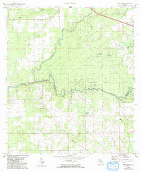
USGS Historical Quadrangle in GeoPDF.
Core Research Center, cutting HH01390, from well operated by J-W OPERATINGRaw Properties from download, web scrape, MapServer, and Macrostrat API{"Lib Num": "HH01390", "API Num": "0508107358", "Operator": "J-W OPERATING", "Well Name": "COUNTS 22-30", "Field": "GREAT DIVIDE", "State": "CO", "County": "MOFFAT", "Thin Sec": "F", "Analysis": "F", "Latitude": "40.79912", "Longitude": "-107.87939", "coordinates_geohash": "9x7215k8h50w", "Source": "PROVIDED BY DONOR", "Min": "4500", "Max": "8025", "Security Flag": null, "crc_collection_name": "cutting", "sb_parent_id": "4f4e49d8e4b07f02db5df2d2", "intervals": [{"Formation": null, "Age": null, "Min Depth": "4500", "Max Depth": "4917"}, {"Formation": "ALMOND", "Age": null,...
Categories: Physical Item;
Tags: ALMOND,
Cathedral Bluffs Tongue Member,
Eocene,
FORT UNION,
FOX HILLS,
Core Research Center, core E929, from well operated by PENNACO ENERGYRaw Properties from download, web scrape, MapServer, and Macrostrat API{"Lib Num": "E929", "API Num": "4900534514", "Operator": "PENNACO ENERGY", "Well Name": "6 OSTLUND 34-51-73 WY", "Field": "UNNAMED", "State": "WY", "County": "CAMPBELL", "Type": "SLABBED", "Photos": "T", "Thin Sec": "F", "Analysis": "T", "Latitude": "44.35654", "Longitude": "-105.62398", "coordinates_geohash": "9xuuk6ygwfk5", "Source": "FROM STATE RECORDS", "Security Flag": "NO SPECIAL RESTRICTIONS", "crc_collection_name": "core", "sb_parent_id": "4f4e49dae4b07f02db5e0486", "intervals": [{"Formation": "FORT UNION", "Age": "TERT", "Min Depth": "535", "Max Depth": "570"}, {"Formation":...
Core Research Center, core U937, from well operated by ENERGY INTERNATIONALRaw Properties from download, web scrape, MapServer, and Macrostrat API{"Lib Num": "U937", "API Num": null, "Operator": "ENERGY INTERNATIONAL", "Well Name": "RC-2", "Field": "NORTH KNOBS GASIFICATI", "State": "WY", "County": "CARBON", "Type": "FULL", "Photos": "F", "Thin Sec": "F", "Analysis": "F", "Latitude": "41.80412", "Longitude": "-107.41034", "coordinates_geohash": "9x7tgf4ntsv9", "Source": "CENTER OF QUARTER SECTION", "Security Flag": "VIEWING ALLOWED, NO SAMPLING UNLESS APPROVED", "crc_collection_name": "core", "sb_parent_id": "4f4e49dae4b07f02db5e0486", "intervals": [{"Formation": "FORT UNION", "Age": "CRET", "Min Depth": "752",...
Categories: Physical Item;
Tags: CRET,
FORT UNION,
Fort Union Formation,
Fort Union Formation,
Paleocene,
Core Research Center, core U935, from well operated by ENERGY INTERNATIONALRaw Properties from download, web scrape, MapServer, and Macrostrat API{"Lib Num": "U935", "API Num": null, "Operator": "ENERGY INTERNATIONAL", "Well Name": "L-3", "Field": "NORTH KNOBS GAS PROJ", "State": "WY", "County": "CARBON", "Type": "FULL", "Photos": "F", "Thin Sec": "F", "Analysis": "F", "Latitude": "41.80412", "Longitude": "-107.41034", "coordinates_geohash": "9x7tgf4ntsv9", "Source": "CENTER OF QUARTER SECTION", "Security Flag": "VIEWING ALLOWED, NO SAMPLING UNLESS APPROVED", "crc_collection_name": "core", "sb_parent_id": "4f4e49dae4b07f02db5e0486", "intervals": [{"Formation": "FORT UNION", "Age": "CRET", "Min Depth": "20", "Max...
Categories: Physical Item;
Tags: CRET,
FORT UNION,
Fort Union Formation,
Fort Union Formation,
Paleocene,
Core Research Center, core U942, from well operated by ENERGY INTERNATIONALRaw Properties from download, web scrape, MapServer, and Macrostrat API{"Lib Num": "U942", "API Num": null, "Operator": "ENERGY INTERNATIONAL", "Well Name": "G-6", "Field": "NORTH KNOBS GASIFICATI", "State": "WY", "County": "CARBON", "Type": "FULL", "Photos": "F", "Thin Sec": "F", "Analysis": "F", "Latitude": "41.80411", "Longitude": "-107.41514", "coordinates_geohash": "9x7tgdnwtffm", "Source": "CENTER OF QUARTER SECTION", "Security Flag": "VIEWING ALLOWED, NO SAMPLING UNLESS APPROVED", "crc_collection_name": "core", "sb_parent_id": "4f4e49dae4b07f02db5e0486", "intervals": [{"Formation": "FORT UNION", "Age": "CRET", "Min Depth": "1041",...
Categories: Physical Item;
Tags: CRET,
FORT UNION,
Fort Union Formation,
Fort Union Formation,
Paleocene,
Core Research Center, core D187, from well operated by VOYAGER PETROLEUMSRaw Properties from download, web scrape, MapServer, and Macrostrat API{"Lib Num": "D187", "API Num": "0508106523", "Operator": "VOYAGER PETROLEUMS", "Well Name": "29-1 POWDER WASH FEDERAL", "Field": "POWDER WASH", "State": "CO", "County": "MOFFAT", "Type": "SLABBED", "Photos": "T", "Thin Sec": "T", "Analysis": "T", "Latitude": "40.889629", "Longitude": "-108.308526", "coordinates_geohash": "9x6bx7spk7m9", "Source": "FROM STATE RECORDS", "Security Flag": "NO SPECIAL RESTRICTIONS", "crc_collection_name": "core", "sb_parent_id": "4f4e49dae4b07f02db5e0486", "intervals": [{"Formation": "FORT UNION", "Age": "TERTIARY", "Min Depth": "7846", "Max...
Categories: Physical Item;
Tags: Calabrian - Middle Pleistocene,
FORT UNION,
Older gravels and alluviums,
TERTIARY,
gravel
Core Research Center, core D663, from well operated by HUSKY OILRaw Properties from download, web scrape, MapServer, and Macrostrat API{"Lib Num": "D663", "API Num": "4901320735", "Operator": "HUSKY OIL", "Well Name": "12-19 FULLER FEDERAL", "Field": "FULLER RESERVOIR", "State": "WY", "County": "FREMONT", "Type": "SLABBED", "Photos": "F", "Thin Sec": "F", "Analysis": "F", "Latitude": "43.07806", "Longitude": "-108.02911", "coordinates_geohash": "9xejjdpegk3j", "Source": "FROM STATE RECORDS", "Security Flag": "NO SPECIAL RESTRICTIONS", "crc_collection_name": "core", "sb_parent_id": "4f4e49dae4b07f02db5e0486", "intervals": [{"Formation": "FORT UNION", "Age": "TERT", "Min Depth": "6550", "Max Depth": "6598"}, {"Formation":...
Categories: Physical Item;
Tags: Dune sand and loess,
FORT UNION,
FORT UNION,
Pleistocene - Holocene,
TERT,
This data set contains imagery from the National Agriculture Imagery Program (NAIP). The NAIP program is administered by USDA FSA and has been established to support two main FSA strategic goals centered on agricultural production. These are increase stewardship of America's natural resources while enhancing the environment, and to ensure commodities are procured and distributed effectively and efficiently to increase food security. The NAIP program supports these goals by acquiring and providing ortho imagery that has been collected during the agricultural growing season in the U.S. The NAIP ortho imagery is tailored to meet FSA requirements and is a fundamental tool used to support FSA farm and conservation programs....
Core Research Center, core E930, from well operated by PENNACO ENERGYRaw Properties from download, web scrape, MapServer, and Macrostrat API{"Lib Num": "E930", "API Num": "4900534197", "Operator": "PENNACO ENERGY", "Well Name": "11 PARKS LONGHORN 14-55-73W", "Field": "SPOTTED HORSE", "State": "WY", "County": "CAMPBELL", "Type": "SLABBED", "Photos": "T", "Thin Sec": "F", "Analysis": "T", "Latitude": "44.73883", "Longitude": "-105.59783", "coordinates_geohash": "9xuyt06n84qu", "Source": "FROM STATE RECORDS", "Security Flag": "NO SPECIAL RESTRICTIONS", "crc_collection_name": "core", "sb_parent_id": "4f4e49dae4b07f02db5e0486", "intervals": [{"Formation": "FORT UNION", "Age": "TERT", "Min Depth": "460", "Max Depth":...
Categories: Physical Item;
Tags: FORT UNION,
Holocene,
TERT,
Terrace alluvium, sheetwash alluvium, and fan and pediment deposits
Core Research Center, core D921, from well operated by CITIES SERVICERaw Properties from download, web scrape, MapServer, and Macrostrat API{"Lib Num": "D921", "API Num": "0508105517", "Operator": "CITIES SERVICE", "Well Name": "1 GOVERNMENT", "Field": "EAST POWDER WASH", "State": "CO", "County": "MOFFAT", "Type": "SLABBED", "Photos": "F", "Thin Sec": "F", "Analysis": "F", "Latitude": "40.972299", "Longitude": "-108.164563", "coordinates_geohash": "9x714dubzn05", "Source": "FROM STATE RECORDS", "Security Flag": "NO SPECIAL RESTRICTIONS", "crc_collection_name": "core", "sb_parent_id": "4f4e49dae4b07f02db5e0486", "intervals": [{"Formation": "FORT UNION", "Age": "CRET", "Min Depth": "4701", "Max Depth": "4718"}, {"Formation":...
Categories: Physical Item;
Tags: CRET,
Cathedral Bluffs Tongue Member,
Eocene,
FORT UNION,
Wasatch Fm--Cathedral Bluffs Tongue,
|

|
