Filters: Tags: FOURMILE CANYON (X)
15 results (81ms)|
Filters
Date Range
Types Contacts
Categories Tag Types Tag Schemes |
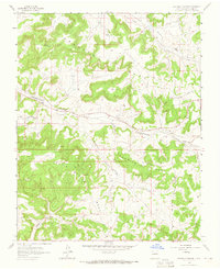
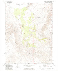
USGS Historical Quadrangle in GeoPDF.
This section of the data release includes core images in the format of photos (JPG) that have been compressed into a zipped file (2018LakePowellCoring_CorePhotos.zip). It is Part 4 (of four) in this data release and contains images of the cleaned archival half from split cores as they appeared immediately after splitting (late March and early April 2019). Each photo includes a ruler (in centimeters) and X-Rite ColorChecker Classic color correction card that may be used for corrections. Drillhole information, such as location and total recovery, are outlined in “Part 1 – Drillhole information from the 2018 coring project in Lake Powell, Utah” (2018LakePowellCoring_DrillholeInfo.csv) of this data release. Each drillhole...
Development of a high-resolution digital elevation model (DEM) of the pre-Glen Canyon Dam topography in Glen Canyon National Recreation Area, Utah and Arizona was initiated to assist the U.S. Geological Survey (USGS) in its Lake Powell coring program in the fall of 2018 (https://www.usgs.gov/centers/ut-water/science/lake-powell-coring). Topographic surveys of Glen Canyon were commissioned by the Bureau of Reclamation during the planning stages for Lake Powell as part of the Colorado River Storage Project (S. 500, 1956). The Colorado River arm was surveyed by Alster and Associates, Inc. in 1958 and 1959 at a contour interval of 10-feet from the river surface at the future dam site through where the 3,750-foot contour...
This section of the data release includes drillhole information in the format of a comma-separated value (CSV) file (2018LakePowellCoring_DrillholeInfo.csv). It is Part 1 (of four) in this data release and represents the broadest hierarchical information on the dataset including the drillhole name, location, water depth, sediments top and bottom, drillhole depth, and recovery for each coring location. Each drillhole comprises multiple cores which are outlined in “Part 2 – Core and core section information from the 2018 coring project in Lake Powell, Utah” (2018LakePowellCoring_CoreSectionInfo.csv) of this data release. Core logs and spectrophotometry data are available in “Part 3 – Multi-Sensor Core Logger and spectrophotometry...
Categories: Data;
Types: Map Service,
OGC WFS Layer,
OGC WMS Layer,
OGC WMS Service;
Tags: Animas River,
Antelope Canyon,
Bears Ears National Monument,
Bullfrog,
Bullfrog Bay,
The Lake Powell Coring Project was a USGS research effort, in cooperation with the Utah Department of Environmental Quality, U.S. Bureau of Reclamation, and U.S. National Park Service. In the fall of 2018, hydraulic piston cores targeted sediment that had been deposited in Lake Powell. This large reservoir on the Colorado River in Utah and Arizona was created after the completion of Glen Canyon Dam in 1963. Retrieval and analysis of cores was undertaken in response to the Gold King mine release from the Bonita Peak Mining District in Colorado on August 5, 2015. This event resulted in the containment loss of three-million gallons of mine-impacted waters which flowed from the Animas River into the San Juan River,...
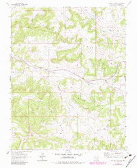
USGS Historical Quadrangle in GeoPDF.
This data set contains imagery from the National Agriculture Imagery Program (NAIP). The NAIP program is administered by USDA FSA and has been established to support two main FSA strategic goals centered on agricultural production. These are, increase stewardship of America's natural resources while enhancing the environment, and to ensure commodities are procured and distributed effectively and efficiently to increase food security. The NAIP program supports these goals by acquiring and providing ortho imagery that has been collected during the agricultural growing season in the U.S. The NAIP ortho imagery is tailored to meet FSA requirements and is a fundamental tool used to support FSA farm and conservation programs....
This section of the data release includes core log and spectrophotometry data in the format of a comma-separated value (CSV) file (2018LakePowellCoring_CoreLogData.csv). It is Part 3 (of four) in this data release and provides geophysical core logs at 0.5-cm intervals from a Multi-Sensor Core Logger and Konica Minolta spectrophotometer. This CSV includes the depth in section and hole for each logged point, p-wave amplitude and velocity, gamma density, loop- and point-sensor magnetic susceptibility, electrical resistivity, colorspace data, and measured reflectance wavelengths. Drillhole information, such as location and total recovery, are outlined in “Part 1 – Drillhole information from the 2018 coring project in...
Categories: Data;
Types: Map Service,
OGC WFS Layer,
OGC WMS Layer,
OGC WMS Service;
Tags: Animas River,
Antelope Canyon,
Bears Ears National Monument,
Bullfrog,
Bullfrog Bay,
This section of the data release includes core and core section information in the format of a comma-separated value (CSV) file (2018LakePowellCoring_CoreSectionInfo.csv). It is Part 2 (of four) in this data release and provides detailed core information. Complete recovery of a core resulted in approximately 3 m of sediment, which was sectioned into lengths not exceeding 1.5 m shipboard. Thus, all cores with >50% recovery contain multiple sections. This CSV includes drillhole, core, and core section identifiers, section lengths, section tops and bottoms, scaled section tops and bottoms, filenames for corresponding core images, and drilling comments. Drillhole information, such as location and total recovery, are...
Categories: Data;
Types: Map Service,
OGC WFS Layer,
OGC WMS Layer,
OGC WMS Service;
Tags: Animas River,
Antelope Canyon,
Bears Ears National Monument,
Bullfrog,
Bullfrog Bay,
USGS Historical Quadrangle in GeoPDF.
This data set contains imagery from the National Agriculture Imagery Program (NAIP). The NAIP program is administered by USDA FSA and has been established to support two main FSA strategic goals centered on agricultural production. These are, increase stewardship of America's natural resources while enhancing the environment, and to ensure commodities are procured and distributed effectively and efficiently to increase food security. The NAIP program supports these goals by acquiring and providing ortho imagery that has been collected during the agricultural growing season in the U.S. The NAIP ortho imagery is tailored to meet FSA requirements and is a fundamental tool used to support FSA farm and conservation programs....
This data set contains imagery from the National Agriculture Imagery Program (NAIP). The NAIP program is administered by USDA FSA and has been established to support two main FSA strategic goals centered on agricultural production. These are, increase stewardship of America's natural resources while enhancing the environment, and to ensure commodities are procured and distributed effectively and efficiently to increase food security. The NAIP program supports these goals by acquiring and providing ortho imagery that has been collected during the agricultural growing season in the U.S. The NAIP ortho imagery is tailored to meet FSA requirements and is a fundamental tool used to support FSA farm and conservation programs....
This data set contains imagery from the National Agriculture Imagery Program (NAIP). The NAIP program is administered by USDA FSA and has been established to support two main FSA strategic goals centered on agricultural production. These are increase stewardship of America's natural resources while enhancing the environment, and to ensure commodities are procured and distributed effectively and efficiently to increase food security. The NAIP program supports these goals by acquiring and providing ortho imagery that has been collected during the agricultural growing season in the U.S. The NAIP ortho imagery is tailored to meet FSA requirements and is a fundamental tool used to support FSA farm and conservation programs....
This data set contains imagery from the National Agriculture Imagery Program (NAIP). The NAIP program is administered by USDA FSA and has been established to support two main FSA strategic goals centered on agricultural production. These are increase stewardship of America's natural resources while enhancing the environment, and to ensure commodities are procured and distributed effectively and efficiently to increase food security. The NAIP program supports these goals by acquiring and providing ortho imagery that has been collected during the agricultural growing season in the U.S. The NAIP ortho imagery is tailored to meet FSA requirements and is a fundamental tool used to support FSA farm and conservation programs....
This data set contains imagery from the National Agriculture Imagery Program (NAIP). The NAIP program is administered by USDA FSA and has been established to support two main FSA strategic goals centered on agricultural production. These are increase stewardship of America's natural resources while enhancing the environment, and to ensure commodities are procured and distributed effectively and efficiently to increase food security. The NAIP program supports these goals by acquiring and providing ortho imagery that has been collected during the agricultural growing season in the U.S. The NAIP ortho imagery is tailored to meet FSA requirements and is a fundamental tool used to support FSA farm and conservation programs....
|

|
