Filters: Tags: FRONTIER (X)
460 results (21ms)|
Filters
Date Range
Extensions Types Contacts
Categories Tag Types Tag Schemes |
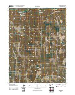
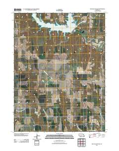
Layered GeoPDF 7.5 Minute Quadrangle Map. Layers of geospatial data include orthoimagery, roads, grids, geographic names, elevation contours, hydrography, and other selected map features.
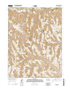
Layered GeoPDF 7.5 Minute Quadrangle Map. Layers of geospatial data include orthoimagery, roads, grids, geographic names, elevation contours, hydrography, and other selected map features.
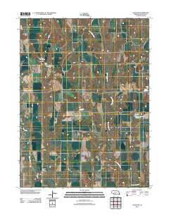
Layered GeoPDF 7.5 Minute Quadrangle Map. Layers of geospatial data include orthoimagery, roads, grids, geographic names, elevation contours, hydrography, and other selected map features.
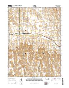
Layered GeoPDF 7.5 Minute Quadrangle Map. Layers of geospatial data include orthoimagery, roads, grids, geographic names, elevation contours, hydrography, and other selected map features.
Layered GeoPDF 7.5 Minute Quadrangle Map. Layers of geospatial data include orthoimagery, roads, grids, geographic names, elevation contours, hydrography, and other selected map features.
Layered GeoPDF 7.5 Minute Quadrangle Map. Layers of geospatial data include orthoimagery, roads, grids, geographic names, elevation contours, hydrography, and other selected map features.
Layered GeoPDF 7.5 Minute Quadrangle Map. Layers of geospatial data include orthoimagery, roads, grids, geographic names, elevation contours, hydrography, and other selected map features.
Layered GeoPDF 7.5 Minute Quadrangle Map. Layers of geospatial data include orthoimagery, roads, grids, geographic names, elevation contours, hydrography, and other selected map features.
Layered GeoPDF 7.5 Minute Quadrangle Map. Layers of geospatial data include orthoimagery, roads, grids, geographic names, elevation contours, hydrography, and other selected map features.
Core Research Center, core C068, from well operated by ALTUS EXPLORATIONRaw Properties from download, web scrape, MapServer, and Macrostrat API{"Lib Num": "C068", "API Num": "4904320416", "Operator": "ALTUS EXPLORATION", "Well Name": "12-6 ALTUS", "Field": "SLICK CREEK", "State": "WY", "County": "WASHAKIE", "Type": "SLABBED", "Photos": "T", "Thin Sec": "T", "Analysis": "T", "Latitude": "43.97368", "Longitude": "-107.8351", "coordinates_geohash": "9xg64jhvk01d", "Source": "FROM STATE RECORDS", "Security Flag": "NO SPECIAL RESTRICTIONS", "crc_collection_name": "core", "sb_parent_id": "4f4e49dae4b07f02db5e0486", "intervals": [{"Formation": "FRONTIER", "Age": "CRET", "Min Depth": "7850", "Max Depth": "7910"}], "crcwc_url":...
Core Research Center, core A767, from well operated by TEXACO INCORPORATEDRaw Properties from download, web scrape, MapServer, and Macrostrat API{"Lib Num": "A767", "API Num": "4903720875", "Operator": "TEXACO INCORPORATED", "Well Name": "22 UNIT", "Field": "TABLE ROCK", "State": "WY", "County": "SWEETWATER", "Type": "SLABBED", "Photos": "T", "Thin Sec": "T", "Analysis": "T", "Latitude": "41.56399", "Longitude": "-108.41846", "coordinates_geohash": "9x6ukykpfc2c", "Source": "FROM STATE RECORDS", "Security Flag": "NO SPECIAL RESTRICTIONS", "crc_collection_name": "core", "sb_parent_id": "4f4e49dae4b07f02db5e0486", "intervals": [{"Formation": "DAKOTA", "Age": "CRET", "Min Depth": "14546", "Max Depth": "14566"}, {"Formation":...
Core Research Center, core D116, from well operated by ANSCHUTZ CORPORATIONRaw Properties from download, web scrape, MapServer, and Macrostrat API{"Lib Num": "D116", "API Num": "4901720734", "Operator": "ANSCHUTZ CORPORATION", "Well Name": "6-23 USA 5784", "Field": "WILDCAT", "State": "WY", "County": "HOT SPRINGS", "Type": "SLABBED", "Photos": "T", "Thin Sec": "F", "Analysis": "T", "Latitude": "44.03033", "Longitude": "-108.70527", "coordinates_geohash": "9xfdqr7pr87v", "Source": "FROM STATE RECORDS", "Security Flag": "NO SPECIAL RESTRICTIONS", "crc_collection_name": "core", "sb_parent_id": "4f4e49dae4b07f02db5e0486", "intervals": [{"Formation": "FRONTIER", "Age": "CRET", "Min Depth": "5095", "Max Depth": "5179"},...
Core Research Center, core T419, from well operated by ROCK WELL PETROLEUMRaw Properties from download, web scrape, MapServer, and Macrostrat API{"Lib Num": "T419", "API Num": "4902523466", "Operator": "ROCK WELL PETROLEUM", "Well Name": "FEDERAL WYC-037870 CORE 8", "Field": "POISON SPIDER", "State": "WY", "County": "NATRONA", "Type": "SLABBED & FULL", "Photos": "T", "Thin Sec": "F", "Analysis": "F", "Latitude": "42.4949", "Longitude": "-106.4346", "coordinates_geohash": "9xs3dpbwwpd0", "Source": "PROVIDED BY DONOR", "Security Flag": "NO SPECIAL RESTRICTIONS", "crc_collection_name": "core", "sb_parent_id": "4f4e49dae4b07f02db5e0486", "intervals": [{"Formation": "FRONTIER", "Age": "CRETACEOUS", "Min Depth": "48",...
Core Research Center, core D641, from well operated by MOUNTAIN FUEL SUPPLYRaw Properties from download, web scrape, MapServer, and Macrostrat API{"Lib Num": "D641", "API Num": "4903705236", "Operator": "MOUNTAIN FUEL SUPPLY", "Well Name": "1 CAPITAL", "Field": "PRETTY WATER CREEK", "State": "WY", "County": "SWEETWATER", "Type": "FULL", "Photos": "T", "Thin Sec": "T", "Analysis": "T", "Latitude": "41.29585", "Longitude": "-109.10653", "coordinates_geohash": "9x66vjxjc86s", "Source": "FROM STATE RECORDS", "Security Flag": "NO SPECIAL RESTRICTIONS", "crc_collection_name": "core", "sb_parent_id": "4f4e49dae4b07f02db5e0486", "intervals": [{"Formation": "ASPEN", "Age": "CRET", "Min Depth": "3693", "Max Depth": "3791"},...
Core Research Center, core D698, from well operated by DAVIS OIL COMPANYRaw Properties from download, web scrape, MapServer, and Macrostrat API{"Lib Num": "D698", "API Num": "4903720965", "Operator": "DAVIS OIL COMPANY", "Well Name": "1 DINES UNIT", "Field": "WILDCAT", "State": "WY", "County": "SWEETWATER", "Type": "SLABBED", "Photos": "F", "Thin Sec": "T", "Analysis": "T", "Latitude": "41.72497", "Longitude": "-109.29744", "coordinates_geohash": "9x6m2gu1941v", "Source": "FROM STATE RECORDS", "Security Flag": "NO SPECIAL RESTRICTIONS", "crc_collection_name": "core", "sb_parent_id": "4f4e49dae4b07f02db5e0486", "intervals": [{"Formation": "FRONTIER", "Age": "CRET", "Min Depth": "12821", "Max Depth": "13505"}], "crcwc_url":...
Categories: Physical Item;
Tags: CRET,
FRONTIER,
Main body of Wasatch Formation,
Wasatch Formation,
claystone,
Core Research Center, core D501, from well operated by MOUNTAIN FUEL SUPPLYRaw Properties from download, web scrape, MapServer, and Macrostrat API{"Lib Num": "D501", "API Num": "4901920186", "Operator": "MOUNTAIN FUEL SUPPLY", "Well Name": "1-10 MOUNTAIN FUEL FEDERAL", "Field": "TRABING", "State": "WY", "County": "JOHNSON", "Type": "SLABBED", "Photos": "T", "Thin Sec": "T", "Analysis": "T", "Latitude": "43.96917", "Longitude": "-106.45851", "coordinates_geohash": "9xu61kr6bzm7", "Source": "FROM STATE RECORDS", "Security Flag": "NO SPECIAL RESTRICTIONS", "crc_collection_name": "core", "sb_parent_id": "4f4e49dae4b07f02db5e0486", "intervals": [{"Formation": "FRONTIER", "Age": "CRET", "Min Depth": "12625", "Max Depth":...
Categories: Physical Item;
Tags: CRET,
Eocene and Paleocene?,
FRONTIER,
Wasatch Formation,
Wasatch Formation
Core Research Center, core T214, from well operated by MOUNTAIN FUEL SUPPLYRaw Properties from download, web scrape, MapServer, and Macrostrat API{"Lib Num": "T214", "API Num": "4903705246", "Operator": "MOUNTAIN FUEL SUPPLY", "Well Name": "3 SOUTH BAXTER UNIT", "Field": "BAXTER BASIN", "State": "WY", "County": "SWEETWATER", "Type": "FULL", "Photos": "T", "Thin Sec": "F", "Analysis": "F", "Latitude": "41.34189", "Longitude": "-109.13057", "coordinates_geohash": "9x67hwj9cqv5", "Source": "FROM STATE RECORDS", "Security Flag": "NO SPECIAL RESTRICTIONS", "crc_collection_name": "core", "sb_parent_id": "4f4e49dae4b07f02db5e0486", "intervals": [{"Formation": "FRONTIER", "Age": "CRET", "Min Depth": "2560", "Max Depth":...
Categories: Physical Item;
Tags: Bishop Conglomerate,
Bishop Conglomerate,
CRET,
FRONTIER,
Oligocene,
Core Research Center, core T021, from well operated by PETROLEUM CORP OF AMRaw Properties from download, web scrape, MapServer, and Macrostrat API{"Lib Num": "T021", "API Num": null, "Operator": "PETROLEUM CORP OF AM", "Well Name": "11", "Field": "SHERARD DOME", "State": "WY", "County": "WASHAKIE", "Type": "FULL", "Photos": "T", "Thin Sec": "F", "Analysis": "F", "Latitude": "44.0309", "Longitude": "-107.59544", "coordinates_geohash": "9xg6rxe6sd9j", "Source": "CENTER OF SECTION", "Security Flag": "NO SPECIAL RESTRICTIONS", "crc_collection_name": "core", "sb_parent_id": "4f4e49dae4b07f02db5e0486", "intervals": [{"Formation": "FRONTIER", "Age": "CRET", "Min Depth": "80", "Max Depth": "119"}], "crcwc_url": "https://my.usgs.gov/crcwc/core/report/15937",...
Core Research Center, core T023, from well operated by PETROLEUM CORP OF AMRaw Properties from download, web scrape, MapServer, and Macrostrat API{"Lib Num": "T023", "API Num": null, "Operator": "PETROLEUM CORP OF AM", "Well Name": "13A", "Field": "SHERARD DOME", "State": "WY", "County": "WASHAKIE", "Type": "FULL", "Photos": "T", "Thin Sec": "F", "Analysis": "F", "Latitude": "44.0309", "Longitude": "-107.59544", "coordinates_geohash": "9xg6rxe6sd9j", "Source": "CENTER OF SECTION", "Security Flag": "NO SPECIAL RESTRICTIONS", "crc_collection_name": "core", "sb_parent_id": "4f4e49dae4b07f02db5e0486", "intervals": [{"Formation": "FRONTIER", "Age": "CRET", "Min Depth": "78", "Max Depth": "99"}, {"Formation": "FRONTIER",...
Core Research Center, core W104, from well operated by MARATHONRaw Properties from download, web scrape, MapServer, and Macrostrat API{"Lib Num": "W104", "API Num": "4901706109", "Operator": "MARATHON", "Well Name": "MILL IRON 96-F", "Field": "GRASS CREEK", "State": "WY", "County": "HOT SPRINGS", "Type": "FULL", "Photos": "T", "Thin Sec": "F", "Analysis": "F", "Latitude": "43.92969", "Longitude": "-108.63956", "coordinates_geohash": "9xf9zv5hfzb8", "Source": "FROM STATE RECORDS", "Security Flag": "NO SPECIAL RESTRICTIONS", "crc_collection_name": "core", "sb_parent_id": "4f4e49dae4b07f02db5e0486", "intervals": [{"Formation": "FRONTIER", "Age": "CRET", "Min Depth": "1175", "Max Depth": "1177"}, {"Formation": "FRONTIER",...
|

|
