Filters: Tags: Fairhaven (X)
16 results (125ms)|
Filters
Date Range
Extensions Types Contacts
Categories Tag Types Tag Schemes |
This data set contains imagery from the National Agriculture Imagery Program (NAIP). The NAIP program is administered by USDA FSA and has been established to support two main FSA strategic goals centered on agricultural production. These are, increase stewardship of America's natural resources while enhancing the environment, and to ensure commodities are procured and distributed effectively and efficiently to increase food security. The NAIP program supports these goals by acquiring and providing ortho imagery that has been collected during the agricultural growing season in the U.S. The NAIP ortho imagery is tailored to meet FSA requirements and is a fundamental tool used to support FSA farm and conservation programs....
This data set contains imagery from the National Agriculture Imagery Program (NAIP). The NAIP program is administered by USDA FSA and has been established to support two main FSA strategic goals centered on agricultural production. These are, increase stewardship of America's natural resources while enhancing the environment, and to ensure commodities are procured and distributed effectively and efficiently to increase food security. The NAIP program supports these goals by acquiring and providing ortho imagery that has been collected during the agricultural growing season in the U.S. The NAIP ortho imagery is tailored to meet FSA requirements and is a fundamental tool used to support FSA farm and conservation programs....
This portion of the data release presents a high-resolution orthomosaic images of the intertidal zone at Post Point, Bellingham Bay, WA. The orthomosaics were derived from structure-from-motion (SfM) processing of aerial imagery collected with an unmanned aerial system (UAS) on 2019-06-06. The orthomosaics are presented with two resolutions: one image, covering the entire survey area, has a resolution of 2 centimeters per pixel; the other image which was derived from a lower-altitude flight, covers an inset area within the main survey area and has a resolution of 1 centimeter per pixel. The raw imagery used to create the orthomosaics was acquired using a UAS fitted with a Ricoh GR II digital camera featuring a global...
This data set contains imagery from the National Agriculture Imagery Program (NAIP). The NAIP program is administered by USDA FSA and has been established to support two main FSA strategic goals centered on agricultural production. These are, increase stewardship of America's natural resources while enhancing the environment, and to ensure commodities are procured and distributed effectively and efficiently to increase food security. The NAIP program supports these goals by acquiring and providing ortho imagery that has been collected during the agricultural growing season in the U.S. The NAIP ortho imagery is tailored to meet FSA requirements and is a fundamental tool used to support FSA farm and conservation programs....

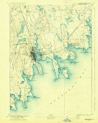
USGS Historical Quadrangle in GeoPDF.
This portion of the data release presents digital surface models (DSMs) and hillshade images of the intertidal zone at Post Point, Bellingham Bay, WA. The DSMs were derived from structure-from-motion (SfM) processing of aerial imagery collected with an unmanned aerial system (UAS) on 2019-06-06. Unlike a digital elevation model (DEM), the DSMs represent the elevation of the highest object within the bounds of a cell. Vegetation, buildings and other objects have not been removed from the data. In addition, data artifacts resulting from noise in the original imagery have not been removed. The DSMs are presented with two resolutions: one DSM, covering the entire survey area, has a resolution of 4 centimeters per pixel;...
This data set contains imagery from the National Agriculture Imagery Program (NAIP). The NAIP program is administered by USDA FSA and has been established to support two main FSA strategic goals centered on agricultural production. These are increase stewardship of America's natural resources while enhancing the environment, and to ensure commodities are procured and distributed effectively and efficiently to increase food security. The NAIP program supports these goals by acquiring and providing ortho imagery that has been collected during the agricultural growing season in the U.S. The NAIP ortho imagery is tailored to meet FSA requirements and is a fundamental tool used to support FSA farm and conservation programs....
This portion of the data release presents topographic point clouds of the intertidal zone at Post Point, Bellingham Bay, WA. The point clouds were derived from structure-from-motion (SfM) processing of aerial imagery collected with an unmanned aerial system (UAS) on 2019-06-06. Two point clouds are presented with different resolutions: one point cloud (PostPoint_2019-06-06_pointcloud.zip) covers the entire survey area and has 145,653,2221 points with an average point density of 1,057 points per-square meter; the other point cloud (PostPointHighRes_2019-06-06_pointcloud.zip) has 139,427,055 points with an average point density of 3,487 points per-square meter and was derived from a lower-altitude flight covering...
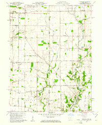
USGS Historical Quadrangle in GeoPDF.
The Massachusetts Office of Coastal Zone Management (CZM) launched the Shoreline Change Project in 1989 to identify erosion-prone areas of the Massachusetts coast. Seventy-six maps were produced in 1997 depicting a statistical analysis of shoreline change on ocean-facing shorelines from the mid-1800s to 1978 using multiple data sources. In 2001, a 1994 shoreline was added. More recently, in cooperation with CZM, the U.S. Geological Survey (USGS) delineated a new shoreline for Massachusetts using color aerial ortho-imagery from 2008 to 2009 and topographic lidar data collected in 2007. This update included a marsh shoreline, which was defined to be the tonal difference between low- and high-marsh seen in ortho-photos....
Categories: Data;
Types: Downloadable,
Map Service,
OGC WFS Layer,
OGC WMS Layer,
Shapefile;
Tags: Bourne,
CMGP,
Chatham,
Coastal and Marine Geology Program,
Duxbury,
This portion of the data release presents the locations of the temporary ground control points (GCPs) used for the structure-from-motion (SfM) processing of the imagery collected during an unmanned aerial system (UAS) survey of the intertidal zone at Post Point, Bellingham Bay, WA on 2019-06-06. Nineteen temporary ground control points (GCPs) were distributed throughout each survey area to establish survey control. The GCPs consisted of a combination of small square tarps with black-and-white cross patterns and "X" marks placed on the ground using temporary chalk. The GCP positions were measured using post-processed kinematic (PPK) GPS, using corrections from a GPS base station located approximately 5 kilometers...
Categories: Data;
Tags: Bathymetry and Elevation,
Bellingham,
Bellingham Bay,
CHMRP,
Coastal and Marine Hazards and Resources Program,
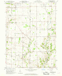
USGS Historical Quadrangle in GeoPDF.
This data set contains imagery from the National Agriculture Imagery Program (NAIP). The NAIP program is administered by USDA FSA and has been established to support two main FSA strategic goals centered on agricultural production. These are increase stewardship of America's natural resources while enhancing the environment, and to ensure commodities are procured and distributed effectively and efficiently to increase food security. The NAIP program supports these goals by acquiring and providing ortho imagery that has been collected during the agricultural growing season in the U.S. The NAIP ortho imagery is tailored to meet FSA requirements and is a fundamental tool used to support FSA farm and conservation programs....
This data set contains imagery from the National Agriculture Imagery Program (NAIP). The NAIP program is administered by USDA FSA and has been established to support two main FSA strategic goals centered on agricultural production. These are, increase stewardship of America's natural resources while enhancing the environment, and to ensure commodities are procured and distributed effectively and efficiently to increase food security. The NAIP program supports these goals by acquiring and providing ortho imagery that has been collected during the agricultural growing season in the U.S. The NAIP ortho imagery is tailored to meet FSA requirements and is a fundamental tool used to support FSA farm and conservation programs....
This portion of the data release presents the raw aerial imagery collected during an Unmanned Aerial System (UAS) survey of the intertidal zone at Post Point, Bellingham Bay, WA, on 2019-06-06. The imagery was acquired using a Department of Interior-owned 3DR Solo quadcopter fitted with a Ricoh GR II digital camera featuring a global shutter. The camera was mounted using a fixed mount on the bottom of the UAS and oriented in an approximately nadir orientation. The UAS was flown on pre-programmed autonomous flight lines which were oriented roughly shore-parallel and were spaced to provide approximately 70 percent overlap between images from adjacent lines. Three flights (F01, F02, F03) covering the survey area were...
USGS Historical Quadrangle in GeoPDF.
|

|
