Filters: Tags: Fall Creek Lake (X)
27 results (7ms)|
Filters
Contacts
(Less)
|
The Middle Fork Willamette River basin encompasses 3,548 square kilometers of western Oregon and drains to the mainstem Willamette River. Fall Creek basin encompasses 653 square kilometers and drains to the Middle Fork Willamette River. In cooperation with the U.S. Army Corps of Engineers, the U.S. Geological Survey evaluated geomorphic responses of downstream river corridors to annual drawdowns to streambed at Fall Creek Lake. This study of geomorphic change is focused on the major alluvial channel segments downstream of the U.S. Army Corps of Engineers’ dams on Fall Creek and the Middle Fork Willamette River, as well as the 736 hectare Fall Creek Lake. Reservoir erosion during streambed drawdown results in sediment...
Categories: Data;
Types: Downloadable,
GeoTIFF,
Map Service,
Raster;
Tags: Fall Creek,
Fall Creek Lake,
Jasper, Oregon,
Lane County,
Middle Fork Willamette River,
The Middle Fork Willamette River basin encompasses 3,548 square kilometers of western Oregon and drains to the mainstem Willamette River. Fall Creek basin encompasses 653 square kilometers and drains to the Middle Fork Willamette River. In cooperation with the U.S. Army Corps of Engineers, the U.S. Geological Survey evaluated geomorphic responses of downstream river corridors to annual drawdowns to streambed at Fall Creek Lake. This study of geomorphic change is focused on the major alluvial channel segments downstream of the U.S. Army Corps of Engineers’ dams on Fall Creek and the Middle Fork Willamette River, as well as the 736 hectare Fall Creek Lake. Reservoir erosion during streambed drawdown results in sediment...
The Middle Fork Willamette River basin encompasses 3,548 square kilometers of western Oregon and drains to the mainstem Willamette River. Fall Creek basin encompasses 653 square kilometers and drains to the Middle Fork Willamette River. In cooperation with the U.S. Army Corps of Engineers, the U.S. Geological Survey evaluated geomorphic responses of downstream river corridors to annual drawdowns to streambed at Fall Creek Lake. This study of geomorphic change is focused on the major alluvial channel segments downstream of the U.S. Army Corps of Engineers’ dams on Fall Creek and the Middle Fork Willamette River, as well as the 736 hectare Fall Creek Lake. Reservoir erosion during streambed drawdown results in sediment...
The Middle Fork Willamette River basin encompasses 3,548 square kilometers of western Oregon and drains to the mainstem Willamette River. Fall Creek basin encompasses 653 square kilometers and drains to the Middle Fork Willamette River. In cooperation with the U.S. Army Corps of Engineers, the U.S. Geological Survey evaluated geomorphic responses of downstream river corridors to annual drawdowns to streambed at Fall Creek Lake. This study of geomorphic change is focused on the major alluvial channel segments downstream of the U.S. Army Corps of Engineers’ dams on Fall Creek and the Middle Fork Willamette River, as well as the 736 hectare Fall Creek Lake. Reservoir erosion during streambed drawdown results in sediment...
The Middle Fork Willamette River basin encompasses 3,548 square kilometers of western Oregon and drains to the mainstem Willamette River. Fall Creek basin encompasses 653 square kilometers and drains to the Middle Fork Willamette River. In cooperation with the U.S. Army Corps of Engineers, the U.S. Geological Survey evaluated geomorphic responses of downstream river corridors to annual drawdowns to streambed at Fall Creek Lake. This study of geomorphic change is focused on the major alluvial channel segments downstream of the U.S. Army Corps of Engineers’ dams on Fall Creek and the Middle Fork Willamette River, as well as the 736 hectare Fall Creek Lake. Reservoir erosion during streambed drawdown results in sediment...
This data set contains imagery from the National Agriculture Imagery Program (NAIP). The NAIP program is administered by USDA FSA and has been established to support two main FSA strategic goals centered on agricultural production. These are, increase stewardship of America's natural resources while enhancing the environment, and to ensure commodities are procured and distributed effectively and efficiently to increase food security. The NAIP program supports these goals by acquiring and providing ortho imagery that has been collected during the agricultural growing season in the U.S. The NAIP ortho imagery is tailored to meet FSA requirements and is a fundamental tool used to support FSA farm and conservation programs....
The Middle Fork Willamette River basin encompasses 3,548 square kilometers of western Oregon and drains to the mainstem Willamette River. Fall Creek basin encompasses 653 square kilometers and drains to the Middle Fork Willamette River. In cooperation with the U.S. Army Corps of Engineers, the U.S. Geological Survey evaluated geomorphic responses of downstream river corridors to annual drawdowns to streambed at Fall Creek Lake. This study of geomorphic change is focused on the major alluvial channel segments downstream of the U.S. Army Corps of Engineers’ dams on Fall Creek and the Middle Fork Willamette River, as well as the 736 hectare Fall Creek Lake. Reservoir erosion during streambed drawdown results in sediment...
The Middle Fork Willamette River basin encompasses 3,548 square kilometers of western Oregon and drains to the mainstem Willamette River. Fall Creek basin encompasses 653 square kilometers and drains to the Middle Fork Willamette River. In cooperation with the U.S. Army Corps of Engineers, the U.S. Geological Survey evaluated geomorphic responses of downstream river corridors to annual drawdowns to streambed at Fall Creek Lake. This study of geomorphic change is focused on the major alluvial channel segments downstream of the U.S. Army Corps of Engineers’ dams on Fall Creek and the Middle Fork Willamette River, as well as the 736 hectare Fall Creek Lake. Reservoir erosion during streambed drawdown results in sediment...
The Middle Fork Willamette River basin encompasses 3,548 square kilometers of western Oregon and drains to the mainstem Willamette River. Fall Creek basin encompasses 653 square kilometers and drains to the Middle Fork Willamette River. In cooperation with the U.S. Army Corps of Engineers, the U.S. Geological Survey evaluated geomorphic responses of downstream river corridors to annual drawdowns to streambed at Fall Creek Lake. This study of geomorphic change is focused on the major alluvial channel segments downstream of the U.S. Army Corps of Engineers’ dams on Fall Creek and the Middle Fork Willamette River, as well as the 736 hectare Fall Creek Lake. Reservoir erosion during streambed drawdown results in sediment...
Categories: Data;
Types: Downloadable,
GeoTIFF,
Map Service,
Raster;
Tags: Fall Creek,
Fall Creek Lake,
Jasper, Oregon,
Lane County,
Middle Fork Willamette River,
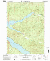
USGS Historical Quadrangle in GeoPDF.
The Middle Fork Willamette River Basin encompasses 3,548 square kilometers of western Oregon and drains to the mainstem Willamette River. Fall Creek Basin encompasses 653 square kilometers and drains to the Middle Fork Willamette River. In cooperation with the U.S. Army Corps of Engineers, the U.S. Geological Survey evaluated geomorphic responses of downstream river corridors to annual drawdowns to streambed at Fall Creek Lake. This study of geomorphic change is focused on the major alluvial channel segments downstream of the U.S. Army Corps of Engineers dams including the lowermost 11.5 km of Fall Creek and 27.3 km of the Middle Fork Willamette River, as well as Fall Creek Lake. GIS layers defining the landforms,...
The Middle Fork Willamette River Basin encompasses 3,548 square kilometers of western Oregon and drains to the mainstem Willamette River. Fall Creek Basin encompasses 653 square kilometers and drains to the Middle Fork Willamette River. In cooperation with the U.S. Army Corps of Engineers, the U.S. Geological Survey evaluated geomorphic responses of downstream river corridors to annual drawdowns to streambed at Fall Creek Lake. This study of geomorphic change is focused on the major alluvial channel segments downstream of the U.S. Army Corps of Engineers dams including the lowermost 11.5 km of Fall Creek and 27.3 km of the Middle Fork Willamette River, as well as Fall Creek Lake. This dataset is delivered as one...
The Middle Fork Willamette River basin encompasses 3,548 square kilometers of western Oregon and drains to the mainstem Willamette River. Fall Creek basin encompasses 653 square kilometers and drains to the Middle Fork Willamette River. In cooperation with the U.S. Army Corps of Engineers, the U.S. Geological Survey evaluated geomorphic responses of downstream river corridors to annual drawdowns to streambed at Fall Creek Lake. This study of geomorphic change is focused on the major alluvial channel segments downstream of the U.S. Army Corps of Engineers’ dams on Fall Creek and the Middle Fork Willamette River, as well as the 736 hectare Fall Creek Lake. Reservoir erosion during streambed drawdown results in sediment...
The Middle Fork Willamette River basin encompasses 3,548 square kilometers of western Oregon and drains to the mainstem Willamette River. Fall Creek basin encompasses 653 square kilometers and drains to the Middle Fork Willamette River. In cooperation with the U.S. Army Corps of Engineers, the U.S. Geological Survey evaluated geomorphic responses of downstream river corridors to annual drawdowns to streambed at Fall Creek Lake. This study of geomorphic change is focused on the major alluvial channel segments downstream of the U.S. Army Corps of Engineers’ dams on Fall Creek and the Middle Fork Willamette River, as well as the 736 hectare Fall Creek Lake. Reservoir erosion during streambed drawdown results in sediment...
The Middle Fork Willamette River basin encompasses 3,548 square kilometers of western Oregon and drains to the mainstem Willamette River. Fall Creek basin encompasses 653 square kilometers and drains to the Middle Fork Willamette River. In cooperation with the U.S. Army Corps of Engineers, the U.S. Geological Survey evaluated geomorphic responses of downstream river corridors to annual drawdowns to streambed at Fall Creek Lake. This study of geomorphic change is focused on the major alluvial channel segments downstream of the U.S. Army Corps of Engineers’ dams on Fall Creek and the Middle Fork Willamette River, as well as the 736 hectare Fall Creek Lake. Reservoir erosion during streambed drawdown results in sediment...
The Middle Fork Willamette River basin encompasses 3,548 square kilometers of western Oregon and drains to the mainstem Willamette River. Fall Creek basin encompasses 653 square kilometers and drains to the Middle Fork Willamette River. In cooperation with the U.S. Army Corps of Engineers, the U.S. Geological Survey evaluated geomorphic responses of downstream river corridors to annual drawdowns to streambed at Fall Creek Lake. This study of geomorphic change is focused on the major alluvial channel segments downstream of the U.S. Army Corps of Engineers’ dams on Fall Creek and the Middle Fork Willamette River, as well as the 736 hectare Fall Creek Lake. Reservoir erosion during streambed drawdown results in sediment...
This data set contains imagery from the National Agriculture Imagery Program (NAIP). The NAIP program is administered by USDA FSA and has been established to support two main FSA strategic goals centered on agricultural production. These are, increase stewardship of America's natural resources while enhancing the environment, and to ensure commodities are procured and distributed effectively and efficiently to increase food security. The NAIP program supports these goals by acquiring and providing ortho imagery that has been collected during the agricultural growing season in the U.S. The NAIP ortho imagery is tailored to meet FSA requirements and is a fundamental tool used to support FSA farm and conservation programs....
This data set contains imagery from the National Agriculture Imagery Program (NAIP). The NAIP program is administered by USDA FSA and has been established to support two main FSA strategic goals centered on agricultural production. These are, increase stewardship of America's natural resources while enhancing the environment, and to ensure commodities are procured and distributed effectively and efficiently to increase food security. The NAIP program supports these goals by acquiring and providing ortho imagery that has been collected during the agricultural growing season in the U.S. The NAIP ortho imagery is tailored to meet FSA requirements and is a fundamental tool used to support FSA farm and conservation programs....
|

|
