Filters: Tags: Federal land (X)
100 results (15ms)|
Filters
Date Range
Extensions Types Contacts
Categories Tag Types Tag Schemes |

These data are an extraction of state, local and private conservation lands from PAD-US (CBI Edition) Version 2. PAD-US (CBI Edition) Version 2 is a national database of protected fee lands in the United States. PAD-US (CBI Edition) Version 2 has been redesigned to be used along with the National Conservation Easement Database (NCED), to visualize the entire terrestrial conservation estate of the United States. PAD-US (CBI Edition) Version 2 is limited to the continental U.S., Alaska, and Hawaii. It does not include protected areas data for U.S. territories at this time. Protected areas are cornerstones of national and international conservation strategies. By way of these designations, lands and waters are set...

These data area an extraction from PAD-US (CBI Edition) Version 2 of National Wildlife Refuge. PAD-US (CBI Edition) Version 2 is a national database of protected fee lands in the United States. PAD-US (CBI Edition) Version 2 has been redesigned to be used along with the National Conservation Easement Database (NCED), to visualize the entire terrestrial conservation estate of the United States. PAD-US (CBI Edition) Version 2 is limited to the continental U.S., Alaska, and Hawaii. It does not include protected areas data for U.S. territories at this time. Protected areas are cornerstones of national and international conservation strategies. By way of these designations, lands and waters are set aside in-perpetuity...

This dataset is an extract of the full PAD-US (CBI Edition) Version 2 for New Jersey. For more information about this dataset, and to download the full US dataset, please go to: http://consbio.org/products/projects/pad-us-cbi-edition PAD-US (CBI Edition) Version 2 is a national database of protected fee lands in the United States. PAD-US (CBI Edition) Version 2 has been redesigned to be used along with the National Conservation Easement Database (NCED) , to visualize the entire terrestrial conservation estate of the United States. PAD-US (CBI Edition) Version 2 is limited to the continental U.S., Alaska, and Hawaii. It does not include protected areas data for U.S. territories at this time. Protected areas are...

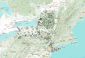
This dataset is an extract of the full PAD-US (CBI Edition) Version 2 for Massachusetts. For more information about this dataset, and to download the full US dataset, please go to: http://consbio.org/products/projects/pad-us-cbi-edition PAD-US (CBI Edition) Version 2 is a national database of protected fee lands in the United States. PAD-US (CBI Edition) Version 2 has been redesigned to be used along with the National Conservation Easement Database (NCED) , to visualize the entire terrestrial conservation estate of the United States. PAD-US (CBI Edition) Version 2 is limited to the continental U.S., Alaska, and Hawaii. It does not include protected areas data for U.S. territories at this time. Protected areas...

This dataset is an extract of the full PAD-US (CBI Edition) Version 2 for Kansas. For more information about this dataset, and to download the full US dataset, please go to: http://consbio.org/products/projects/pad-us-cbi-edition PAD-US (CBI Edition) Version 2 is a national database of protected fee lands in the United States. PAD-US (CBI Edition) Version 2 has been redesigned to be used along with the National Conservation Easement Database (NCED) , to visualize the entire terrestrial conservation estate of the United States. PAD-US (CBI Edition) Version 2 is limited to the continental U.S., Alaska, and Hawaii. It does not include protected areas data for U.S. territories at this time. Protected areas are cornerstones...

This dataset is an extract of the full PAD-US (CBI Edition) Version 2 for Colorado. For more information about this dataset, and to download the full US dataset, please go to: http://consbio.org/products/projects/pad-us-cbi-edition PAD-US (CBI Edition) Version 2 is a national database of protected fee lands in the United States. PAD-US (CBI Edition) Version 2 has been redesigned to be used along with the National Conservation Easement Database (NCED) , to visualize the entire terrestrial conservation estate of the United States. PAD-US (CBI Edition) Version 2 is limited to the continental U.S., Alaska, and Hawaii. It does not include protected areas data for U.S. territories at this time. Protected areas are cornerstones...

This dataset is an extract of the full PAD-US (CBI Edition) Version 2 for Arizona. For more information about this dataset, and to download the full US dataset, please go to: http://consbio.org/products/projects/pad-us-cbi-edition PAD-US (CBI Edition) Version 2 is a national database of protected fee lands in the United States. PAD-US (CBI Edition) Version 2 has been redesigned to be used along with the National Conservation Easement Database (NCED) , to visualize the entire terrestrial conservation estate of the United States. PAD-US (CBI Edition) Version 2 is limited to the continental U.S., Alaska, and Hawaii. It does not include protected areas data for U.S. territories at this time. Protected areas are cornerstones...
Federal protected areas such as national parks and preserves and wildlife refuges cover large areas of the study area. Because of its remote location, few people visit the region for recreational use, and except for the Iditarod, activities are concentrated in the summer. Recreation in the region includes sport hunting, sport fishing, and general outdoor hiking and camping activities.
BLM Surface Management Agency Layer
Types: Downloadable;
Tags: BLM,
Bankhead-Jones,
Bureau of Land Management,
Bureau of Reclamation,
DOI,

These data are the extraction from PAD-US (CBI Edition) Version 2 of National Historic Park & Sites. PAD-US (CBI Edition) Version 2 is a national database of protected fee lands in the United States. PAD-US (CBI Edition) Version 2 has been redesigned to be used along with the National Conservation Easement Database (NCED), to visualize the entire terrestrial conservation estate of the United States. PAD-US (CBI Edition) Version 2 is limited to the continental U.S., Alaska, and Hawaii. It does not include protected areas data for U.S. territories at this time. Protected areas are cornerstones of national and international conservation strategies. By way of these designations, lands and waters are set aside in-perpetuity...

This dataset is an extract of the full PAD-US (CBI Edition) Version 2 for Rhode Island. For more information about this dataset, and to download the full US dataset, please go to: http://consbio.org/products/projects/pad-us-cbi-edition PAD-US (CBI Edition) Version 2 is a national database of protected fee lands in the United States. PAD-US (CBI Edition) Version 2 has been redesigned to be used along with the National Conservation Easement Database (NCED) , to visualize the entire terrestrial conservation estate of the United States. PAD-US (CBI Edition) Version 2 is limited to the continental U.S., Alaska, and Hawaii. It does not include protected areas data for U.S. territories at this time. Protected areas are...

This dataset is an extract of the full PAD-US (CBI Edition) Version 2 for California. For more information about this dataset, and to download the full US dataset, please go to: http://consbio.org/products/projects/pad-us-cbi-edition PAD-US (CBI Edition) Version 2 is a national database of protected fee lands in the United States. PAD-US (CBI Edition) Version 2 has been redesigned to be used along with the National Conservation Easement Database (NCED) , to visualize the entire terrestrial conservation estate of the United States. PAD-US (CBI Edition) Version 2 is limited to the continental U.S., Alaska, and Hawaii. It does not include protected areas data for U.S. territories at this time. Protected areas are...
This "Surface Management Agency" data layer portrays tracts of federal land for the United States and classifies these holdings by administrative agency. Multiple federal agencies have contributed to the contents of this layer and it is in a continuous state of update. Source and date of feature updates are tracked to the feature level.
Types: Downloadable;
Tags: BLM,
Bankhead-Jones,
Bureau of Land Management,
Bureau of Reclamation,
DOI,
This "Surface Management Agency" data layer portrays tracts of federal land for the United States and classifies these holdings by administrative agency. Multiple federal agencies have contributed to the contents of this layer and it is in a continuous state of update. Source and date of feature updates are tracked to the feature level.
Types: Downloadable;
Tags: Authorization,
BLM,
Bankhead-Jones,
Bureau of Land Management,
Bureau of Reclamation,
This "Surface Management Agency" data layer portrays tracts of federal land for the United States and classifies these holdings by administrative agency. Multiple federal agencies have contributed to the contents of this layer and it is in a continuous state of update. Source and date of feature updates are tracked to the feature level.
Types: Downloadable;
Tags: BLM,
Bankhead-Jones,
Bureau of Land Management,
Bureau of Reclamation,
CBR,
This "Surface Management Agency" data layer portrays tracts of federal land for the United States and classifies these holdings by administrative agency. Multiple federal agencies have contributed to the contents of this layer and it is in a continuous state of update. Source and date of feature updates are tracked to the feature level. The dataset was clipped to the ecoregion boundary and queried for National parks, National Preserves, and National Wildlife Refuges.
Types: Downloadable;
Tags: BLM,
Bankhead-Jones,
Bureau of Land Management,
Bureau of Reclamation,
DOI,
This "Surface Management Agency" data layer portrays tracts of federal land for the United States and classifies these holdings by administrative agency. Multiple federal agencies have contributed to the contents of this layer and it is in a continuous state of update. Source and date of feature updates are tracked to the feature level.
Types: Downloadable;
Tags: BLM,
Bankhead-Jones,
Bureau of Land Management,
Bureau of Reclamation,
DOI,

This dataset is an extract of the full PAD-US (CBI Edition) Version 2 for Virginia. For more information about this dataset, and to download the full US dataset, please go to: http://consbio.org/products/projects/pad-us-cbi-edition PAD-US (CBI Edition) Version 2 is a national database of protected fee lands in the United States. PAD-US (CBI Edition) Version 2 has been redesigned to be used along with the National Conservation Easement Database (NCED) , to visualize the entire terrestrial conservation estate of the United States. PAD-US (CBI Edition) Version 2 is limited to the continental U.S., Alaska, and Hawaii. It does not include protected areas data for U.S. territories at this time. Protected areas are...
This dataset is an extract of the full PAD-US (CBI Edition) Version 2 for New York. For more information about this dataset, and to download the full US dataset, please go to: http://consbio.org/products/projects/pad-us-cbi-edition PAD-US (CBI Edition) Version 2 is a national database of protected fee lands in the United States. PAD-US (CBI Edition) Version 2 has been redesigned to be used along with the National Conservation Easement Database (NCED) , to visualize the entire terrestrial conservation estate of the United States. PAD-US (CBI Edition) Version 2 is limited to the continental U.S., Alaska, and Hawaii. It does not include protected areas data for U.S. territories at this time. Protected areas are cornerstones...
|

|
