Filters: Tags: Fields (X)
19 results (28ms)|
Filters
Date Range
Extensions Types Contacts
Categories Tag Types Tag Schemes |
The Trout Creek mule deer herd is composed of residents and migrants that make short-range elevational migrations. Mule deer mainly winter at lower elevations surrounding Blue Mountain and the slopes of the Oregon Canyon Mountains. In spring, some of these mule deer migrate to higher elevations in the Oregon Canyon Mountains. Other members of the herd winter in the southwestern portion of the herd’s range, inhabiting areas near Hawks Mountain, the Pueblo Mountains, and the foothills of the Trout Creek Mountains. These mule deer migrate to summer ranges on the crests of Holloway Mountain and the Trout Creek Mountains. Notably, one mule deer formerly wintering on the Trout Creek Mountains migrated south from a summer...
Categories: Data;
Types: Downloadable,
Map Service,
OGC WFS Layer,
OGC WMS Layer,
Shapefile;
Tags: Fields,
Oregon,
United States,
animal behavior,
biota,
A pool, or group of pools, within a specified geographic area that contain oil or natural gas. Fields are not specific to producing geological formation(s). Fields are used for well naming purposes relative to the well site surface coordinates and the objective formation of the well.
Digital files of basement structure in Colorado, including structure contours on top of Precambrian basement rock, selected wells drilled to Precambrian and Lower Paleozoic rocks, sedimentary basins, major oil and gas fields, Precambrian and Upper Cretaceous to Tertiary volcanic and intrusive rock outcrops. Major sedimentary basins and arches, as well as Precambrian mountain ranges and volcanic fields are included. Also included are 73 gas fields and 129 oil fields.
This data set contains imagery from the National Agriculture Imagery Program (NAIP). The NAIP program is administered by USDA FSA and has been established to support two main FSA strategic goals centered on agricultural production. These are, increase stewardship of America's natural resources while enhancing the environment, and to ensure commodities are procured and distributed effectively and efficiently to increase food security. The NAIP program supports these goals by acquiring and providing ortho imagery that has been collected during the agricultural growing season in the U.S. The NAIP ortho imagery is tailored to meet FSA requirements and is a fundamental tool used to support FSA farm and conservation programs....
This data set contains imagery from the National Agriculture Imagery Program (NAIP). The NAIP program is administered by USDA FSA and has been established to support two main FSA strategic goals centered on agricultural production. These are, increase stewardship of America's natural resources while enhancing the environment, and to ensure commodities are procured and distributed effectively and efficiently to increase food security. The NAIP program supports these goals by acquiring and providing ortho imagery that has been collected during the agricultural growing season in the U.S. The NAIP ortho imagery is tailored to meet FSA requirements and is a fundamental tool used to support FSA farm and conservation programs....

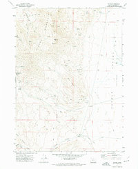
USGS Historical Quadrangle in GeoPDF.
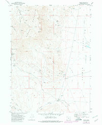
USGS Historical Quadrangle in GeoPDF.
This data set contains imagery from the National Agriculture Imagery Program (NAIP). The NAIP program is administered by USDA FSA and has been established to support two main FSA strategic goals centered on agricultural production. These are, increase stewardship of America's natural resources while enhancing the environment, and to ensure commodities are procured and distributed effectively and efficiently to increase food security. The NAIP program supports these goals by acquiring and providing ortho imagery that has been collected during the agricultural growing season in the U.S. The NAIP ortho imagery is tailored to meet FSA requirements and is a fundamental tool used to support FSA farm and conservation programs....

OFFLINE DATA: CONTACT SAREC PERSONNEL TO AQUIRE - GIS data for Sustainable Agriculture Research and Extension Center (SAREC). Includes Infrastructure, Base Data, Fields, Study, Soil, and Yield Data. Data collected by GPS, and then cleaned using GIS.
Mandatory targets for biofuels have led to their rapid global adoption, but ethical problems with their large-scale production are widely reported. Research is underway to find new biofuel technologies that mitigate climate change and can be produced sustainably and economically. Following an 18-month inquiry, the Nuffield Council on Bioethics has developed an ethical framework for biofuels policy-making. Based on a number of widely held ethical values, six ethical principles are introduced that should be considered in biofuels policy-making. Many current biofuels policies fail this ethical ‘test’. An overarching ethical standard for biofuels is proposed that includes the protection of human rights and the environment,...
Categories: Publication;
Types: Citation;
Tags: Biological,
electric,
experimental,
fields,
frequency,
This data set contains imagery from the National Agriculture Imagery Program (NAIP). The NAIP program is administered by USDA FSA and has been established to support two main FSA strategic goals centered on agricultural production. These are, increase stewardship of America's natural resources while enhancing the environment, and to ensure commodities are procured and distributed effectively and efficiently to increase food security. The NAIP program supports these goals by acquiring and providing ortho imagery that has been collected during the agricultural growing season in the U.S. The NAIP ortho imagery is tailored to meet FSA requirements and is a fundamental tool used to support FSA farm and conservation programs....
Types: Citation;
Tags: 22011,
3.75 x 3.75 minute,
3009328,
Aerial Compliance,
BEAUREGARD PARISH LA FSA,
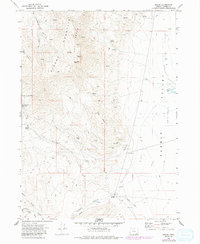
USGS Historical Quadrangle in GeoPDF.
This data set contains imagery from the National Agriculture Imagery Program (NAIP). The NAIP program is administered by USDA FSA and has been established to support two main FSA strategic goals centered on agricultural production. These are, increase stewardship of America's natural resources while enhancing the environment, and to ensure commodities are procured and distributed effectively and efficiently to increase food security. The NAIP program supports these goals by acquiring and providing ortho imagery that has been collected during the agricultural growing season in the U.S. The NAIP ortho imagery is tailored to meet FSA requirements and is a fundamental tool used to support FSA farm and conservation programs....
Types: Citation;
Tags: 22011,
3.75 x 3.75 minute,
3009328,
Aerial Compliance,
BEAUREGARD PARISH LA FSA,
The Trout Creek mule deer herd is composed of residents and migrants that make short-range elevational migrations. Mule deer mainly winter at lower elevations surrounding Blue Mountain and the slopes of the Oregon Canyon Mountains. In spring, some of these mule deer migrate to higher elevations in the Oregon Canyon Mountains. Other members of the herd winter in the southwestern portion of the herd’s range, inhabiting areas near Hawks Mountain, the Pueblo Mountains, and the foothills of the Trout Creek Mountains. These mule deer migrate to summer ranges on the crests of Holloway Mountain and the Trout Creek Mountains. Notably, one mule deer formerly wintering on the Trout Creek Mountains migrated south from a summer...
Categories: Data;
Types: Downloadable,
Map Service,
OGC WFS Layer,
OGC WMS Layer,
Shapefile;
Tags: Fields,
Oregon,
United States,
animal behavior,
biota,
USGS Historical Quadrangle in GeoPDF.
This data set contains imagery from the National Agriculture Imagery Program (NAIP). The NAIP program is administered by USDA FSA and has been established to support two main FSA strategic goals centered on agricultural production. These are, increase stewardship of America's natural resources while enhancing the environment, and to ensure commodities are procured and distributed effectively and efficiently to increase food security. The NAIP program supports these goals by acquiring and providing ortho imagery that has been collected during the agricultural growing season in the U.S. The NAIP ortho imagery is tailored to meet FSA requirements and is a fundamental tool used to support FSA farm and conservation programs....
Types: Citation;
Tags: 22011,
3.75 x 3.75 minute,
3009328,
Aerial Compliance,
BEAUREGARD PARISH LA FSA,
This data set contains imagery from the National Agriculture Imagery Program (NAIP). The NAIP program is administered by USDA FSA and has been established to support two main FSA strategic goals centered on agricultural production. These are, increase stewardship of America's natural resources while enhancing the environment, and to ensure commodities are procured and distributed effectively and efficiently to increase food security. The NAIP program supports these goals by acquiring and providing ortho imagery that has been collected during the agricultural growing season in the U.S. The NAIP ortho imagery is tailored to meet FSA requirements and is a fundamental tool used to support FSA farm and conservation programs....
|

|
