Filters: Tags: Final Rule (X)
17 results (100ms)|
Filters
Date Range
Extensions Types
Contacts
Categories Tag Types
|

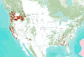
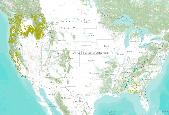
These data identify, in general, the areas where final critical habitat exist for species listed as endangered or threatened.
From USFWS service description: "This data service identifies, in general, the areas where final critical habitat exist for species that are endangered or threatened. Special protections and/or restrictions are possible in areas where federal funding, permits, licenses, authorizations or actions occur or are required. Critical habitat are areas considered essential for the conservation of a listed species. These areas provide notice to the public and land managers the importance of these areas to the conservation of the species." The data can be downloaded in a shapefile, viewed on the Fish and Wildlife Service's map viewer, or accessed through a web service. It's also possible to view the data through the ScienceBase...
Categories: Data,
Web Site;
Types: ArcGIS REST Map Service,
Map Service,
OGC WMS Layer,
OGC WMS Service;
Tags: Critical Habitat,
Final Rule,
U.S. Fish and Wildlife Service,
USFWS
These data identify, in general, the areas where final critical habitat exist for species listed as endangered or threatened.
Categories: Data;
Types: Map Service,
OGC WFS Layer,
OGC WMS Layer,
OGC WMS Service;
Tags: Academics & scientific researchers,
Alabama,
BIOSPHERE,
BIOSPHERE,
Conservation NGOs,

These data identify the areas (in general) where final critical habitat for the species listed under the ESA occur
This USFWS data set has been modified by NatureServe to include critical habitat only within the Central Basin and Range, and Mojave Basin and Range ecoregions, and further modified to include only the desert tortoise (Gopherus agassizii). These data identify, in general, the areas where final critical habitat exist for species listed as endangered or threatened.
Types: Downloadable;
Tags: BLM,
Bureau of Land Management,
CBR 2010,
Central Basin and Range,
Critical Habitat,
These data identify, in general, the areas where final critical habitat exist for species listed as endangered or threatened.
These data identify, in general, the areas where final critical habitat exist for species listed as endangered or threatened.
Types: Downloadable;
Tags: BLM,
Bureau of Land Management,
CBR 2010,
Central Basin and Range,
Critical Habitat,
The Great Plains Landscape Conservation Cooperative (GPLCC, https://www.fws.gov/science/catalog) is a partnership that provides applied science and decision support tools to assist natural resource managers conserve plants, fish and wildlife in the mid- and short-grass prairie of the southern Great Plains. It is part of a national network of public-private partnerships — known as Landscape Conservation Cooperatives (LCCs, http://www.fws.gov/science/shc/lcc.html) — that work collaboratively across jurisdictions and political boundaries to leverage resources and share science capacity. The Great Plains LCC identifies science priorities for the region and helps foster science that addresses these priorities to support...
Categories: Data;
Types: Downloadable,
Map Service,
OGC WFS Layer,
OGC WMS Layer,
Shapefile;
Tags: Colorado,
Critical Habitat,
Final Rule,
GPLCC,
Great Plains Landscape Conservation Cooperative,
These data identify, in general, the areas where final critical habitat exist for species listed as endangered or threatened.

These data identify, in general, the areas where final critical habitat exist for species listed as endangered or threatened. This dataset was updated with new data from the USFWS Critical Habitat Portal on 9/8/2011. This includes fixes to incorrect attribution of species names to polygons evident in previous versions of this dataset.
These data identify, in general, the areas where final critical habitat exist for species listed as endangered or threatened.
Types: Downloadable;
Tags: BLM,
Bureau of Land Management,
CBR 2010,
Central Basin and Range,
Critical Habitat,
This USFWS data set has been clipped by NatureServe to include critical habitat only within the Central Basin and Range, and Mojave Basin and Range ecoregions, and extracted to include only the desert tortoise (Gopherus agassizii) critical habitat areas. These data identify, in general, the areas where final critical habitat exist for species listed as endangered or threatened.
These data identify, in general, the areas where final critical habitat for the Fender's blue butterfly (Icaricia icarioides fenderi) occur within the WOPR (Western Oregon Plan Revision) boundary.BLM: (Bureau of Land Management) USFWS: (US Fish and Wildlife Service) WOPR: (Western Oregon Plan Revision) PRMP: (Proposed Resource Management Plan) CHU: (Critical Habitat Unit) These data are intended to be used as a guide to identify the general areas where final critical habitat for the Fender's blue butterfly occur. Specific identity of critical habitat should be obtained from the text of the final designation of critical habitat for the Fender's blue butterfly published in: Federal Register, October 31, 2006, vol....
These data identify, in general, the areas where final critical habitat for the Desert yellowhead (Yermo xanthocephalus) occur. The geographic extent includes Laramie and Platte Counties, Wyoming.
Categories: Data;
Types: Downloadable;
Tags: Colorado Butterfly Plant,
Critical habitat,
Final Rule,
Flora,
Flower,
These data identify, in general, the areas where final critical habitat for the Desert yellowhead (Yermo xanthocephalus) occur. The geographic extent includes Fremont County, Wyoming.
Categories: Data;
Types: Downloadable;
Tags: Critical habitat,
Desert yellowhead,
Final Rule,
Flora,
Flower,
To provide the user with a general idea of areas where final critical habitat for Southwestern willow flycatcher (Empidonax traillii extimus). The geographic extent includes counties in Arizona, California, Colorado, New Mexico, Nevada and Utah.
Types: Downloadable;
Tags: BLM,
Bureau of Land Management,
Critical Habitat,
DOI,
Empidonax traillii extimus,
The Great Plains Landscape Conservation Cooperative (GPLCC, https://www.fws.gov/science/catalog) is a partnership that provides applied science and decision support tools to assist natural resource managers conserve plants, fish and wildlife in the mid- and short-grass prairie of the southern Great Plains. It is part of a national network of public-private partnerships — known as Landscape Conservation Cooperatives (LCCs, http://www.fws.gov/science/shc/lcc.html) — that work collaboratively across jurisdictions and political boundaries to leverage resources and share science capacity. The Great Plains LCC identifies science priorities for the region and helps foster science that addresses these priorities to support...
Categories: Data;
Types: Downloadable,
Map Service,
OGC WFS Layer,
OGC WMS Layer,
Shapefile;
Tags: Colorado,
Critical Habitat,
Final Rule,
GPLCC,
Great Plains Landscape Conservation Cooperative,
|

|
