|
|
This data set contains imagery from the National Agriculture Imagery Program (NAIP). The NAIP program is administered by USDA FSA and has been established to support two main FSA strategic goals centered on agricultural production. These are, increase stewardship of America's natural resources while enhancing the environment, and to ensure commodities are procured and distributed effectively and efficiently to increase food security. The NAIP program supports these goals by acquiring and providing ortho imagery that has been collected during the agricultural growing season in the U.S. The NAIP ortho imagery is tailored to meet FSA requirements and is a fundamental tool used to support FSA farm and conservation programs....
Types: Citation;
Tags: 27075,
3.75 x 3.75 minute,
4709139,
Aerial Compliance,
Compliance, All tags...
Digital Ortho rectified Image,
Downloadable Data,
FINLAND,
FINLAND, SW,
JPEG2000,
LAKE CO MN FSA,
Lake,
MN,
MN075,
NAIP,
Ortho Rectification,
Orthoimagery,
Quarter Quadrangle,
USDA National Agriculture Imagery Program (NAIP),
farming, Fewer tags

The Critical Minerals in Archived Mine Samples Database (CMDB) contains chemistry and geologic information for historic ore and ore-related rock samples from mineral deposits in the United States. In addition, the database contains samples from archetypal deposits from 27 other countries in North America, South America, Asia, Africa and Europe. Samples were obtained from archived ore collections under the U.S. Geological Survey's project titled "Quick Assessment of Rare and Critical Metals in Ore Deposits: A National Assessment" (2008 to 2013) in an effort to begin an assessment of the Nations' previously mined ore deposits for critical minerals. Mineralized and altered rock samples were provided by the Colorado...
Categories: Data;
Types: ArcGIS REST Map Service,
ArcGIS Service Definition,
Downloadable,
Map Service,
OGC WFS Layer,
OGC WMS Layer,
Shapefile;
Tags: Alaska,
Argentina,
Arizona,
Arkansas,
Australia, All tags...
Brazil,
Burma,
California,
Canada,
Chile,
China,
Colorado,
Cuba,
Democratic Republic of Congo,
Economic Geology,
Finland,
Geochemistry,
Germany,
Honduras,
Idaho,
India,
Indonesia,
Japan,
Kansas,
Kentucky,
Maine,
Mauritania,
Mexico,
Michigan,
Mineral Resources,
Minnesota,
Missouri,
Montana,
NGDB,
Namibia,
National Geochemical Database,
Nevada,
New Jersey,
New Mexico,
New York,
North Carolina,
Norway,
Oklahoma,
Oregon,
Papua New Guinea,
Pennsylvania,
Peru,
Philippines,
Poland,
Portugal,
Russia,
South Africa,
South Carolina,
South Dakota,
Sweden,
Tennessee,
Texas,
USGS Science Data Catalog (SDC),
United States,
Utah,
Vietnam,
Virginia,
Washington,
Wisconsin,
Wyoming,
Zambia,
aluminum,
antimony,
arsenic,
atomic emission spectroscopy,
barium,
beryllium,
bismuth,
boron,
cadmium,
calcium,
cerium,
chemical analysis,
chromium,
cobalt,
copper,
critical minerals,
dysprosium,
economic geology,
erbium,
europium,
fluorine,
gadolinium,
gallium,
geochemical data,
geochemistry,
geoscientific information,
germanium,
gold,
hafnium,
historic ores,
holmium,
indium,
iron,
lanthanum,
lead,
lithium,
lutetium,
magnesium,
manganese,
metallic mineral resources,
mineral deposit type,
mineral deposits,
mineralogy,
molybdenum,
neodymium,
nickel,
niobium,
nonmetallic mineral resources,
palladium,
phosphorus,
platinum,
potassium,
praseodymium,
rhenium,
rock geochemistry,
rocks and deposits,
samarium,
scandium,
silicon,
silver,
strontium,
sulfur,
tantalum,
tellurium,
terbium,
thallium,
thorium,
thulium,
tin,
titanium,
tungsten,
uranium,
vanadium,
ytterbium,
yttrium,
zinc,
zirconium, Fewer tags

This coverage includes arcs, polygons and polygon labels that describe U.S. Geological Survey defined geologic provinces of Europe including Turkey. (Albania, Andorra, Austria, Belgium, Bosnia and Herzegovina, Bulgaria, Croatia, Cyprus, Czech Republic, Denmark, Finland, France, Germany, Greece, Hungary, Iceland, Ireland, Italy, Liechtenstein, Luxembourg, The Former Yugoslav Republic of Macedonia, Malta, Monaco, Netherlands, Norway, Poland, Portugal, Romania, San Marino, Serbia and Montenegro, Slovakia, Slovenia, Spain, Sweden, Switzerland, Turkey, United Kingdom and Vatican City.) Each province has a set of geologic characteristics distinguishing it from surrounding provinces. These characteristics may include the...
Categories: Data,
pre-SM502.8;
Types: Downloadable,
Map Service,
OGC WFS Layer,
OGC WMS Layer,
Shapefile;
Tags: AL,
AN,
AU,
Adana/Sivas, Province 2079,
Adriatic Basin, Province 4058, All tags...
Aegean, Province 4075,
Albania,
Alentejo-Guadalquivir Basin, Province 4077,
Alps, Province 4051,
Andalucia, Province 4088,
Andorra,
Anglo-Dutch Basin, Province 4036,
Anglo-Paris Basin, Province 4040,
Apulia Platform, Province 4059,
Aquitaine Basin, Province 4045,
Araks, Province 2080,
Armoricia, Province 4041,
Austria,
BE,
BK,
BU,
Baltic Depression, Province 4021,
Baltic Shield-Norwegian Caledonides, Province 4016,
Barents Continental Slope, Province 4013,
Belgium,
Belorussian-Voronezh High, Province 1004,
Betic Zone, Province 4078,
Black Sea Continental Slope, Province 1107,
Bohemia, Province 4046,
Bosnia and Herzegovina,
Bresse Depression, Province 4054,
Bulgaria,
CY,
Carpathian-Balkanian Basin, Province 4061,
Corsican-Sardinian Basins, Province 4067,
Crete, Province 4076,
Croatia,
Cyprus,
Czech Republic,
DA,
Denmark,
Dinaric Alps, Province 4071,
Dobrogea Foreland, Province 1103,
Dobrogean Orogen, Province 4063,
EI,
EZ,
Earth Science,
Economic geology,
Euphrates/Mardin, Province 2075,
Europe,
FI,
FO,
FR,
Faeroes-Shetland-Orkney Basin, Province 4019,
Faroe Islands,
Fennoscandian Border-Danish-Polish Margin, Province 4022,
Finland,
France,
GI,
GK,
GM,
GR,
Galician Basin, Province 4073,
Gas,
Geologic province,
Geology,
German-Polish Basin, Province 4033,
Germany,
Gibraltar,
Greece,
Guernsey,
HR,
HU,
Haleb, Province 2076,
Hammerfest-Varanger Basin, Province 4015,
Hatton-Rockall Basin, Province 4020,
Horda-Norwegian-Danish Basin, Province 4023,
Hungary,
IC,
IM,
IT,
Iberian Massif, Province 4072,
Iberic Cordillera, Province 4083,
Iceland,
Ireland,
Ireland-Scotland Platform, Province 4026,
Irish Sea, Province 4030,
Isle of Man,
Italy,
JE,
Jersey,
Jura, Province 4052,
Kardiff/Menders Massif, Province 2084,
Kola Monocline-Finnmark Platform, Province 1051,
LO,
LS,
LU,
Lesser Caucasus, Province 2081,
Liechtenstein,
Lion-Camargue, Province 4056,
London-Brabant Platform, Province 4037,
Lusitanian Basin, Province 4074,
Luxembourg,
MK,
MN,
MW,
Malta,
Massif Central, Province 4043,
Mediterranean Basin, Province 2070,
Mid-North Sea High, Province 4028,
Midland Valley-Forth Approaches Basin, Province 4027,
Molasse Basin, Province 4049,
Monaco,
Munsterland Basin, Province 4038,
NL,
NO,
Natural Gas,
Natural Resources,
Natural gas resources,
Netherlands,
North Carpathian Basin, Province 4047,
North Sea Graben, Province 4025,
Northwest German Basin, Province 4035,
Norway,
Oil,
Oil,
Oil sand resources,
Oil shale resources,
PL,
PO,
Pannonian Basin, Province 4048,
Pelagian Basin, Province 2048,
Petroleum,
Po Basin, Province 4060,
Poland,
Portugal,
Provence Basin, Province 4068,
Pyrenean Foothills-Ebro Basin, Province 4044,
RO,
Resource Assessment,
Rhine Graben, Province 4055,
Rif Basin, Province 2072,
Romania,
Russian Craton Margin, Province 1011,
SI,
SM,
SP,
SR,
SV,
SW,
SZ,
San Marino,
Serbia and Montenegro,
Sicily, Province 4066,
Slovakia,
Slovenia,
Southwest German Basin, Province 4039,
Spain,
Spanish Trough-Cantabrian Zone, Province 4070,
Svalbard,
Sweden,
Switzerland,
TU,
Tajo-Duero Basin, Province 4082,
The Former Yugoslav Republic of Macedonia,
Thrace/Samsun, Province 2085,
Trans-Graben, Province 4053,
Transylvanian Basin, Province 4057,
Troms-Bjornoya, Province 4014,
Turkey,
Tuscany-Latium-Paola, Province 4062,
Tuz/Corum, Province 2083,
Tyrrhenian Basin, Province 4069,
U.S. Geological Survey,
UK,
USGS,
USGS Science Data Catalog (SDC),
Ukrainian Shield, Province 1013,
United Kingdom,
VT,
Vatican City,
Vestford-Helgeland, Province 4017,
West Black Sea Basin, Province 4064,
Zagros Fold Belt, Province 2030,
Zagros Thrust Zone, Province 2031,
environment,
europe,
geoscientificInformation,
oilgas,
wep,
worldgeologicmaps, Fewer tags
This data set contains imagery from the National Agriculture Imagery Program (NAIP). The NAIP program is administered by USDA FSA and has been established to support two main FSA strategic goals centered on agricultural production. These are, increase stewardship of America's natural resources while enhancing the environment, and to ensure commodities are procured and distributed effectively and efficiently to increase food security. The NAIP program supports these goals by acquiring and providing ortho imagery that has been collected during the agricultural growing season in the U.S. The NAIP ortho imagery is tailored to meet FSA requirements and is a fundamental tool used to support FSA farm and conservation programs....
Types: Citation;
Tags: 27075,
3.75 x 3.75 minute,
4709139,
Aerial Compliance,
Compliance, All tags...
Digital Ortho rectified Image,
Downloadable Data,
FINLAND,
FINLAND, NW,
JPEG2000,
LAKE CO MN FSA,
Lake,
MN,
MN075,
NAIP,
Ortho Rectification,
Orthoimagery,
Quarter Quadrangle,
USDA National Agriculture Imagery Program (NAIP),
farming, Fewer tags

This dataset is comprised of water quality data and benthic macroinvertebrate data collected from basins in Colorado, USA, and Finland. The data includes ancillary water quality characteristics but also a suite of trace metals observed at each site. Also included are modeled outputs that characterize the bioavailability of each trace metal to a biotic ligand. These data were used to explore the importance of metal toxicity and pH as stressors on benthic macroinvertebrates characterized as the number of unique Ephemeroptera + Plecoptera + Trichoptera genera observed at each site. An interpretive summary of the work follows. One of the primary goals of biological assessment of rivers is to identify whether contaminants...
Categories: Data;
Types: Citation,
Map Service,
OGC WFS Layer,
OGC WMS Layer,
OGC WMS Service;
Tags: Benthic Macroinvertebrates,
Bioavailability,
Colorado,
Europe,
Finland, All tags...
Forestry,
Metals,
Mining,
Mixtures,
National Water Quality Program,
USGS Science Data Catalog (SDC),
United States,
biota,
environment,
inlandWaters,
pH, Fewer tags
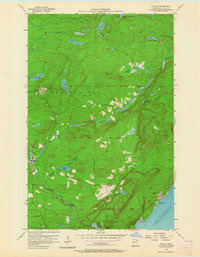
USGS Historical Quadrangle in GeoPDF.
Tags: 7.5 x 7.5 minute,
Downloadable Data,
Finland,
GeoPDF,
GeoTIFF, All tags...
Historical Topographic Maps,
Historical Topographic Maps 7.5 x 7.5 Minute Map Series,
MN,
Map,
imageryBaseMapsEarthCover, Fewer tags
This data set contains imagery from the National Agriculture Imagery Program (NAIP). The NAIP program is administered by USDA FSA and has been established to support two main FSA strategic goals centered on agricultural production. These are, increase stewardship of America's natural resources while enhancing the environment, and to ensure commodities are procured and distributed effectively and efficiently to increase food security. The NAIP program supports these goals by acquiring and providing ortho imagery that has been collected during the agricultural growing season in the U.S. The NAIP ortho imagery is tailored to meet FSA requirements and is a fundamental tool used to support FSA farm and conservation programs....
Types: Citation;
Tags: 27075,
3.75 x 3.75 minute,
4709139,
Aerial Compliance,
Compliance, All tags...
Digital Ortho rectified Image,
Downloadable Data,
FINLAND,
FINLAND, SE,
JPEG2000,
LAKE CO MN FSA,
Lake,
MN,
MN075,
NAIP,
Ortho Rectification,
Orthoimagery,
Quarter Quadrangle,
USDA National Agriculture Imagery Program (NAIP),
farming, Fewer tags
USGS Historical Quadrangle in GeoPDF.
Tags: 15 x 15 minute,
Downloadable Data,
Finland,
GeoPDF,
GeoTIFF, All tags...
Historical Topographic Maps,
Historical Topographic Maps 15 x 15 Minute Map Series,
MN,
Map,
imageryBaseMapsEarthCover, Fewer tags
USGS Historical Quadrangle in GeoPDF.
Tags: 7.5 x 7.5 minute,
Downloadable Data,
Finland,
GeoPDF,
GeoTIFF, All tags...
Historical Topographic Maps,
Historical Topographic Maps 7.5 x 7.5 Minute Map Series,
MN,
Map,
imageryBaseMapsEarthCover, Fewer tags
USGS Historical Quadrangle in GeoPDF.
Tags: 15 x 15 minute,
Downloadable Data,
Finland,
GeoPDF,
GeoTIFF, All tags...
Historical Topographic Maps,
Historical Topographic Maps 15 x 15 Minute Map Series,
MN,
Map,
imageryBaseMapsEarthCover, Fewer tags

These worksheets contain data from geochemical analyses of solid mill tailings and other ore processing materials from worldwide localities, and leachates from those samples.
Categories: Data;
Tags: Alaska,
California,
Canada,
China,
Colorado, All tags...
Finland,
Idaho,
Illinois,
Maine,
Mineral Resources,
Minnesota,
Missouri,
New Zealand,
Peru,
Slovakia,
Sweden,
Tennessee,
USGS Science Data Catalog (SDC),
Utah,
Vermont,
Virginia,
mine waste, Fewer tags

This coverage includes arcs that describe faults found in the surface outcrops of bedrock of Europe including Turkey (Albania, Andorra, Austria, Belgium, Bosnia and Herzegovina, Bulgaria, Croatia, Cyprus, Czech Republic, Denmark, Finland, France, Germany, Greece, Hungary, Iceland, Ireland, Italy, Liechtenstein, Luxembourg, The Former Yugoslav Republic of Macedonia, Malta, Monaco, Netherlands, Norway, Poland, Portugal, Romania, San Marino, Serbia and Montenegro, Slovakia, Slovenia, Spain, Sweden, Switzerland, Turkey, United Kingdom and Vatican City.)
Categories: Data;
Types: Downloadable,
Map Service,
OGC WFS Layer,
OGC WMS Layer,
Shapefile;
Tags: AL,
AN,
AU,
Adana/Sivas, Province 2079,
Adriatic Basin, Province 4058, All tags...
Aegean, Province 4075,
Age,
Albania,
Alentejo-Guadalquivir Basin, Province 4077,
Alps, Province 4051,
Andalucia, Province 4088,
Andorra,
Anglo-Dutch Basin, Province 4036,
Anglo-Paris Basin, Province 4040,
Apulia Platform, Province 4059,
Aquitaine Basin, Province 4045,
Araks, Province 2080,
Armoricia, Province 4041,
Austria,
BE,
BK,
BU,
Baltic Depression, Province 4021,
Baltic Shield-Norwegian Caledonides, Province 4016,
Barents Continental Slope, Province 4013,
Belgium,
Belorussian-Voronezh High, Province 1004,
Betic Zone, Province 4078,
Black Sea Continental Slope, Province 1107,
Bohemia, Province 4046,
Bosnia and Herzegovina,
Bresse Depression, Province 4054,
Bulgaria,
CY,
Carpathian-Balkanian Basin, Province 4061,
Corsican-Sardinian Basins, Province 4067,
Crete, Province 4076,
Croatia,
Cyprus,
Czech Republic,
DA,
Denmark,
Dinaric Alps, Province 4071,
Dobrogea Foreland, Province 1103,
Dobrogean Orogen, Province 4063,
EI,
EZ,
Earth Science,
Economic geology,
Euphrates/Mardin, Province 2075,
Europe,
FI,
FO,
FR,
Faeroes-Shetland-Orkney Basin, Province 4019,
Faroe Islands,
Fault,
Fennoscandian Border-Danish-Polish Margin, Province 4022,
Finland,
France,
GI,
GK,
GM,
GR,
Galician Basin, Province 4073,
Gas,
Generalized geology,
Geologic Province,
Geologic age,
Geologic map,
Geology,
Geology,
German-Polish Basin, Province 4033,
Germany,
Gibraltar,
Greece,
Guernsey,
HR,
HU,
Haleb, Province 2076,
Hammerfest-Varanger Basin, Province 4015,
Hatton-Rockall Basin, Province 4020,
Horda-Norwegian-Danish Basin, Province 4023,
Hungary,
IC,
IM,
IT,
Iberian Massif, Province 4072,
Iberic Cordillera, Province 4083,
Iceland,
Ireland,
Ireland-Scotland Platform, Province 4026,
Irish Sea, Province 4030,
Isle of Man,
Italy,
JE,
Jersey,
Jura, Province 4052,
Kardiff/Menders Massif, Province 2084,
Kola Monocline-Finnmark Platform, Province 1051,
LO,
LS,
LU,
Lesser Caucasus, Province 2081,
Liechtenstein,
Lion-Camargue, Province 4056,
London-Brabant Platform, Province 4037,
Lusitanian Basin, Province 4074,
Luxembourg,
MK,
MN,
MW,
Malta,
Massif Central, Province 4043,
Mediterranean Basin, Province 2070,
Mid-North Sea High, Province 4028,
Midland Valley-Forth Approaches Basin, Province 4027,
Molasse Basin, Province 4049,
Monaco,
Munsterland Basin, Province 4038,
NL,
NO,
Natural Gas,
Natural Resources,
Natural gas resources,
Netherlands,
North Carpathian Basin, Province 4047,
North Sea Graben, Province 4025,
Northwest German Basin, Province 4035,
Norway,
Oil,
Oil,
Oil sand resources,
Oil shale resources,
PL,
PO,
Pannonian Basin, Province 4048,
Pelagian Basin, Province 2048,
Petroleum,
Po Basin, Province 4060,
Poland,
Portugal,
Provence Basin, Province 4068,
Pyrenean Foothills-Ebro Basin, Province 4044,
RO,
Resource Assessment,
Rhine Graben, Province 4055,
Rif Basin, Province 2072,
Romania,
Russian Craton Margin, Province 1011,
SI,
SM,
SP,
SR,
SV,
SW,
SZ,
San Marino,
Serbia and Montenegro,
Sicily, Province 4066,
Slovakia,
Slovenia,
Southwest German Basin, Province 4039,
Spain,
Spanish Trough-Cantabrian Zone, Province 4070,
Svalbard,
Sweden,
Switzerland,
TU,
Tajo-Duero Basin, Province 4082,
The Former Yugoslav Republic of Macedonia,
Thrace/Samsun, Province 2085,
Thrust fault,
Trans-Graben, Province 4053,
Transylvanian Basin, Province 4057,
Troms-Bjornoya, Province 4014,
Turkey,
Tuscany-Latium-Paola, Province 4062,
Tuz/Corum, Province 2083,
Tyrrhenian Basin, Province 4069,
U.S. Geological Survey,
UK,
USGS,
USGS Science Data Catalog (SDC),
Ukrainian Shield, Province 1013,
United Kingdom,
VT,
Vatican City,
Vestford-Helgeland, Province 4017,
West Black Sea Basin, Province 4064,
Zagros Fold Belt, Province 2030,
Zagros Thrust Zone, Province 2031,
environment,
europe,
geoscientificInformation,
oilgas,
wep,
worldgeologicmaps, Fewer tags
This data set contains imagery from the National Agriculture Imagery Program (NAIP). The NAIP program is administered by USDA FSA and has been established to support two main FSA strategic goals centered on agricultural production. These are, increase stewardship of America's natural resources while enhancing the environment, and to ensure commodities are procured and distributed effectively and efficiently to increase food security. The NAIP program supports these goals by acquiring and providing ortho imagery that has been collected during the agricultural growing season in the U.S. The NAIP ortho imagery is tailored to meet FSA requirements and is a fundamental tool used to support FSA farm and conservation programs....
Types: Citation;
Tags: 27075,
3.75 x 3.75 minute,
4709139,
Aerial Compliance,
Compliance, All tags...
Digital Ortho rectified Image,
Downloadable Data,
FINLAND,
FINLAND, NE,
JPEG2000,
LAKE CO MN FSA,
Lake,
MN,
MN075,
NAIP,
Ortho Rectification,
Orthoimagery,
Quarter Quadrangle,
USDA National Agriculture Imagery Program (NAIP),
farming, Fewer tags

This dataset includes monthly dissolved silicon (DSi) concentration data from 198 rivers across the Northern Hemisphere. Concentration and discharge data were sourced from public and/or published datasets and the Weighted Regressions on Time, Discharge, and Season model (Hirsch et al. 2010) was used to estimate monthly concentrations and flow-normalized concentrations for all sites over their period of record. Sites span eight climate zones, ranged from 18 degrees N to 70 degrees N, and vary in drainage area from < 1 km2 to nearly 3 million km2. These monthly concentration data were then used to cluster sites into average (i.e., average of all years) and annual (i.e., each year individually) seasonal regimes using...
Categories: Data;
Tags: Canada,
Finland,
Norway,
Russia,
Sweden, All tags...
USGS Science Data Catalog (SDC),
United States,
Water Quality,
Water Resources,
biogeochemistry,
phenology,
river,
silicon, Fewer tags

This worksheet displays the results of mineral abundance estimates based on Rietveld refinement of X-ray diffraction (XRD) analyses of mill tailings and other ore processing materials from worldwide localities. Data are also provided to show variation in mineral abundance estimates for subsplits in individual samples. Samples were analyzed using a PANalytical X'Pert Pro diffractometer using Cu radiation and the results interpreted using Highscore Plus v.4.7.
Categories: Data;
Tags: Alaska,
California,
Canada,
China,
Colorado, All tags...
Finland,
Idaho,
Illinois,
Maine,
Mineral Resources,
Minnesota,
Missouri,
New Zealand,
Peru,
Slovakia,
Sweden,
Tenneessee,
USGS Science Data Catalog (SDC),
Utah,
Vermont,
Virginia,
mine waste, Fewer tags

This coverage includes arcs, polygons, and polygon labels that describe the generalized geologic age of surface outcrops of bedrock of Europe including Turkey (Albania, Andorra, Austria, Belgium, Bosnia and Herzegovina, Bulgaria, Croatia, Cyprus, Czech Republic, Denmark, Finland, France, Germany, Greece, Hungary, Iceland, Ireland, Italy, Liechtenstein, Luxembourg, The Former Yugoslav Republic of Macedonia, Malta, Monaco, Netherlands, Norway, Poland, Portugal, Romania, San Marino, Serbia and Montenegro, Slovakia, Slovenia, Spain, Sweden, Switzerland, Turkey, United Kingdom and Vatican City.) It also includes shorelines and inland water bodies.
Categories: Data,
pre-SM502.8;
Types: Downloadable,
Map Service,
OGC WFS Layer,
OGC WMS Layer,
Shapefile;
Tags: AL,
AN,
AU,
Adana/Sivas, Province 2079,
Adriatic Basin, Province 4058, All tags...
Aegean, Province 4075,
Age,
Albania,
Alentejo-Guadalquivir Basin, Province 4077,
Alps, Province 4051,
Andalucia, Province 4088,
Andorra,
Anglo-Dutch Basin, Province 4036,
Anglo-Paris Basin, Province 4040,
Apulia Platform, Province 4059,
Aquitaine Basin, Province 4045,
Araks, Province 2080,
Armoricia, Province 4041,
Austria,
BE,
BK,
BU,
Baltic Depression, Province 4021,
Baltic Shield-Norwegian Caledonides, Province 4016,
Barents Continental Slope, Province 4013,
Belgium,
Belorussian-Voronezh High, Province 1004,
Betic Zone, Province 4078,
Black Sea Continental Slope, Province 1107,
Bohemia, Province 4046,
Bosnia and Herzegovina,
Bresse Depression, Province 4054,
Bulgaria,
CY,
Carpathian-Balkanian Basin, Province 4061,
Corsican-Sardinian Basins, Province 4067,
Crete, Province 4076,
Croatia,
Cyprus,
Czech Republic,
DA,
Denmark,
Dinaric Alps, Province 4071,
Dobrogea Foreland, Province 1103,
Dobrogean Orogen, Province 4063,
EI,
EZ,
Earth Science,
Economic geology,
Euphrates/Mardin, Province 2075,
Europe,
FI,
FO,
FR,
Faeroes-Shetland-Orkney Basin, Province 4019,
Faroe Islands,
Fennoscandian Border-Danish-Polish Margin, Province 4022,
Finland,
France,
GI,
GK,
GM,
GR,
Galician Basin, Province 4073,
Gas,
Generalized geology,
Geologic Province,
Geologic age,
Geologic map,
Geology,
Geology,
German-Polish Basin, Province 4033,
Germany,
Gibraltar,
Greece,
Guernsey,
HR,
HU,
Haleb, Province 2076,
Hammerfest-Varanger Basin, Province 4015,
Hatton-Rockall Basin, Province 4020,
Horda-Norwegian-Danish Basin, Province 4023,
Hungary,
IC,
IM,
IT,
Iberian Massif, Province 4072,
Iberic Cordillera, Province 4083,
Iceland,
Ireland,
Ireland-Scotland Platform, Province 4026,
Irish Sea, Province 4030,
Isle of Man,
Italy,
JE,
Jersey,
Jura, Province 4052,
Kardiff/Menders Massif, Province 2084,
Kola Monocline-Finnmark Platform, Province 1051,
LO,
LS,
LU,
Lesser Caucasus, Province 2081,
Liechtenstein,
Lion-Camargue, Province 4056,
London-Brabant Platform, Province 4037,
Lusitanian Basin, Province 4074,
Luxembourg,
MK,
MN,
MW,
Malta,
Massif Central, Province 4043,
Mediterranean Basin, Province 2070,
Mid-North Sea High, Province 4028,
Midland Valley-Forth Approaches Basin, Province 4027,
Molasse Basin, Province 4049,
Monaco,
Munsterland Basin, Province 4038,
NL,
NO,
Natural Gas,
Natural Resources,
Natural gas resources,
Netherlands,
North Carpathian Basin, Province 4047,
North Sea Graben, Province 4025,
Northwest German Basin, Province 4035,
Norway,
Oil,
Oil,
Oil sand resources,
Oil shale resources,
PL,
PO,
Pannonian Basin, Province 4048,
Pelagian Basin, Province 2048,
Petroleum,
Po Basin, Province 4060,
Poland,
Portugal,
Provence Basin, Province 4068,
Pyrenean Foothills-Ebro Basin, Province 4044,
RO,
Resource Assessment,
Rhine Graben, Province 4055,
Rif Basin, Province 2072,
Romania,
Russian Craton Margin, Province 1011,
SI,
SM,
SP,
SR,
SV,
SW,
SZ,
San Marino,
Serbia and Montenegro,
Sicily, Province 4066,
Slovakia,
Slovenia,
Southwest German Basin, Province 4039,
Spain,
Spanish Trough-Cantabrian Zone, Province 4070,
Svalbard,
Sweden,
Switzerland,
TU,
Tajo-Duero Basin, Province 4082,
The Former Yugoslav Republic of Macedonia,
Thrace/Samsun, Province 2085,
Trans-Graben, Province 4053,
Transylvanian Basin, Province 4057,
Troms-Bjornoya, Province 4014,
Turkey,
Tuscany-Latium-Paola, Province 4062,
Tuz/Corum, Province 2083,
Tyrrhenian Basin, Province 4069,
U.S. Geological Survey,
UK,
USGS,
USGS Science Data Catalog (SDC),
Ukrainian Shield, Province 1013,
United Kingdom,
VT,
Vatican City,
Vestford-Helgeland, Province 4017,
West Black Sea Basin, Province 4064,
Zagros Fold Belt, Province 2030,
Zagros Thrust Zone, Province 2031,
europe,
oilgas,
wep,
worldgeologicmaps, Fewer tags

This data release presents the Yale stocks and flows database (YSTAFDB). Its data describe the use of 102 materials from the early 1800s to circa 2013 through anthropogenic cycles, their recycling and criticality properties, and on spatial scales ranging from suburbs to global. This data collection was previously scattered across multiple non-uniformly formatted files such as journal papers, reports, and unpublished spreadsheets. These data have been synthesized into YSTAFDB, which is presented as individual comma-separated text files and also in MySQL and PostgreSQL database formats. Consolidation of these data into a single database can increase their accessibility and reusability, which is relevant to diverse...
Categories: Data;
Tags: AFGHANISTAN,
ALBANIA,
ALGERIA,
ANDORRA,
ANGOLA, All tags...
ANGUILLA,
ANTIGUA AND BARBUDA,
ARGENTINA,
ARMENIA,
ARUBA,
AUSTRALIA,
AUSTRIA,
AZERBAIJAN,
Africa,
Asia,
BAHAMAS, THE,
BAHRAIN,
BANGLADESH,
BARBADOS,
BELARUS,
BELGIUM,
BELIZE,
BENIN,
BHUTAN,
BOLIVIA,
BOSNIA AND HERZEGOVINA,
BOTSWANA,
BRAZIL,
BRUNEI,
BULGARIA,
BURKINA FASO,
BURMA,
BURUNDI,
CAMBODIA,
CAMEROON,
CANADA,
CENTRAL AFRICAN REPUBLIC,
CHAD,
CHILE,
CHINA,
COLOMBIA,
COMOROS,
COSTA RICA,
CROATIA,
CUBA,
CURACAO,
CYPRUS,
CZECH REPUBLIC,
Cape Verde,
Caribbean,
Central America,
Central Europe,
Commonwealth of Independent States,
Congo (Democratic Republic of the),
Congo (Republic of the),
DENMARK,
DJIBOUTI,
DOMINICA,
DOMINICAN REPUBLIC,
ECUADOR,
EGYPT,
EL SALVADOR,
EQUATORIAL GUINEA,
ERITREA,
ESTONIA,
ETHIOPIA,
East Asia,
Eastern Europe,
Energy Resources,
Environmental Health,
Europe,
European Union,
FIJI,
FINLAND,
FRANCE,
FRENCH GUIANA,
FRENCH POLYNESIA,
GABON,
GAMBIA, THE,
GEORGIA,
GERMANY,
GHANA,
GIBRALTAR,
GREECE,
GREENLAND,
GRENADA,
GUADELOUPE,
GUAM,
GUATEMALA,
GUINEA,
GUINEA-BISSAU,
GUYANA,
HAITI,
HONDURAS,
HONG KONG,
HUNGARY,
ICELAND,
INDIA,
INDONESIA,
IRAN,
IRAQ,
IRELAND,
ISRAEL,
ITALY,
IVORY COAST (COTE D’IVOIRE),
JAMAICA,
JAPAN,
JORDAN,
KAZAKHSTAN,
KENYA,
KOREA, NORTH,
KOREA, SOUTH,
KUWAIT,
KYRGYZSTAN,
LAOS,
LATVIA,
LEBANON,
LESOTHO,
LIBERIA,
LIBYA,
LITHUANIA,
LUXEMBOURG,
Latin America,
MACEDONIA,
MADAGASCAR,
MALAWI,
MALAYSIA,
MALI,
MARTINIQUE,
MAURITANIA,
MAURITIUS,
MEXICO,
MOLDOVA,
MONGOLIA,
MONTENEGRO,
MOROCCO,
MOZAMBIQUE,
Middle East,
Mineralogy,
NAMIBIA,
NEPAL,
NETHERLANDS,
NEW CALEDONIA,
NEW ZEALAND,
NICARAGUA,
NIGER,
NIGERIA,
NORWAY,
North America,
Northern Europe,
OMAN,
Oceania,
PAKISTAN,
PANAMA,
PAPUA NEW GUINEA,
PARAGUAY,
PERU,
PHILIPPINES,
POLAND,
PORTUGAL,
PUERTO RICO,
QATAR,
REUNION,
ROMANIA,
RUSSIA,
RWANDA,
SAO TOME AND PRINCIPE,
SAUDI ARABIA,
SENEGAL,
SERBIA,
SEYCHELLES,
SIERRA LEONE,
SINGAPORE,
SLOVAKIA,
SLOVENIA,
SOMALIA,
SOUTH AFRICA,
SOUTH SUDAN,
SPAIN,
SRI LANKA,
SUDAN,
SURINAME,
SWAZILAND,
SWEDEN,
SWITZERLAND,
SYRIA,
South America,
TAIWAN,
TAJIKISTAN,
TANZANIA,
THAILAND,
TIMOR-LESTE,
TOGO,
TONGA,
TRINIDAD AND TOBAGO,
TUNISIA,
TURKEY,
TURKMENISTAN,
UGANDA,
UKRAINE,
UNITED ARAB EMIRATES,
UNITED KINGDOM,
UNITED STATES,
URUGUAY,
USGS Science Data Catalog (SDC),
UZBEKISTAN,
VENEZUELA,
VIETNAM,
WESTERN SAHARA,
Western Europe,
YEMEN,
ZAMBIA,
ZIMBABWE,
circular economy,
economy,
environment,
geoscientificInformation,
industrial ecology,
location,
material flows,
material life cycles,
materials flow (commodities),
metallic mineral resources,
mineral deposits,
nonmetallic mineral resources,
society, Fewer tags
USGS Historical Quadrangle in GeoPDF.
Tags: 7.5 x 7.5 minute,
Downloadable Data,
Finland,
GeoPDF,
GeoTIFF, All tags...
Historical Topographic Maps,
Historical Topographic Maps 7.5 x 7.5 Minute Map Series,
MN,
Map,
imageryBaseMapsEarthCover, Fewer tags
|
|

