Filters: Tags: Fishhook (X)
7 results (7ms)|
Filters
Contacts
(Less)
|
From June 12-21, 2017, the Alaska Division of Geological & Geophysical Surveys (DGGS) geologists carried out geologic mapping and geochemical sampling in the northeastern Tanacross D-1, and parts of the C-1, and D-2 quadrangles. The project area lies within the Yukon-Tanana Uplands, and encompasses the boundary between Fortymile and Lake George assemblages. It includes porphyry copper-molybdenum-gold deposits and prospects including: Taurus, Fishhook (also known as SW Pika), and Pika Canyon, and is adjacent to the Fortymile Mining District to the north. Highlights of this geochemical report include sampling and characterization of the Pika Canyon, Fishhook, and Taurus prospects. This dataset contains four samples...
This data set contains imagery from the National Agriculture Imagery Program (NAIP). The NAIP program is administered by USDA FSA and has been established to support two main FSA strategic goals centered on agricultural production. These are, increase stewardship of America's natural resources while enhancing the environment, and to ensure commodities are procured and distributed effectively and efficiently to increase food security. The NAIP program supports these goals by acquiring and providing ortho imagery that has been collected during the agricultural growing season in the U.S. The NAIP ortho imagery is tailored to meet FSA requirements and is a fundamental tool used to support FSA farm and conservation programs....
This data set contains imagery from the National Agriculture Imagery Program (NAIP). The NAIP program is administered by USDA FSA and has been established to support two main FSA strategic goals centered on agricultural production. These are, increase stewardship of America's natural resources while enhancing the environment, and to ensure commodities are procured and distributed effectively and efficiently to increase food security. The NAIP program supports these goals by acquiring and providing ortho imagery that has been collected during the agricultural growing season in the U.S. The NAIP ortho imagery is tailored to meet FSA requirements and is a fundamental tool used to support FSA farm and conservation programs....
This data set contains imagery from the National Agriculture Imagery Program (NAIP). The NAIP program is administered by USDA FSA and has been established to support two main FSA strategic goals centered on agricultural production. These are, increase stewardship of America's natural resources while enhancing the environment, and to ensure commodities are procured and distributed effectively and efficiently to increase food security. The NAIP program supports these goals by acquiring and providing ortho imagery that has been collected during the agricultural growing season in the U.S. The NAIP ortho imagery is tailored to meet FSA requirements and is a fundamental tool used to support FSA farm and conservation programs....
This data set contains imagery from the National Agriculture Imagery Program (NAIP). The NAIP program is administered by USDA FSA and has been established to support two main FSA strategic goals centered on agricultural production. These are, increase stewardship of America's natural resources while enhancing the environment, and to ensure commodities are procured and distributed effectively and efficiently to increase food security. The NAIP program supports these goals by acquiring and providing ortho imagery that has been collected during the agricultural growing season in the U.S. The NAIP ortho imagery is tailored to meet FSA requirements and is a fundamental tool used to support FSA farm and conservation programs....
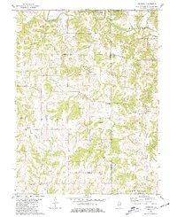
USGS Historical Quadrangle in GeoPDF.
This data release is part of a study designed to test geochemical methods that best delineate known mineral deposits in the northeast part of the Tanacross 1° x 3° quadrangle, within the Yukon-Tanana Upland region, Alaska. The total area sampled is about 3,200 km2. Extensive tundra cover and patchy spruce/alder vegetation and very limited outcrop exposure characterize the area. Soils and stream sediments contain mixtures of weathered bedrock, sand derived from dunes developed during the Pleistocene, and volcanic ash deposits from the 1.2 Ky eruption of the nearby Mount Churchill volcano. Several mineral deposits are known in the area, including the Late Cretaceous to earliest Tertiary porphyry Cu (+/-Mo-Au) deposits...
Categories: Data;
Types: Downloadable,
Map Service,
OGC WFS Layer,
OGC WMS Layer,
Shapefile;
Tags: Alaska,
Bluff,
Economic Geology,
Economic geology,
Fishhook,
|

|
