Filters: Tags: Flagstaff (X) > partyWithName: U.S. Geological Survey (X)
41 results (51ms)|
Filters
Date Range
Extensions Types Contacts
Categories Tag Types Tag Schemes |
South of Interstate 40 elk reside primarily in Arizona’s Game Management Unit (GMU) 8. Upon completing population surveys in 2021, approximately 4,000 elk were estimated to inhabit GMU 8. Their summer range is primarily characterized by high-elevation ponderosa pine forests and grasslands. The elk radiate out from various origin points within their summer range to their winter range, comprised of rims of canyons in the area, including Sycamore Canyon, Tule Canyon, and Government Canyon. This series of canyons creates an impermeable southern boundary for this herd. Their winter range along the rim country is primarily characterized by pinyon-juniper, manzanita, and scrub oak. Interstate 40 is the primary threat to...
Categories: Data;
Types: Downloadable,
Map Service,
OGC WFS Layer,
OGC WMS Layer,
Shapefile;
Tags: Arizona,
Flagstaff,
United States,
animal behavior,
biota,
USGS Historical Quadrangle in GeoPDF.
South of Interstate 40 mule deer reside in Game Management Units (GMU) 8 and 6B in Arizona. The herd summers in high-elevation open meadows and ponderosa pine habitat southwest of Flagstaff, Arizona. In late October, the herd migrates west to lower elevation pinyon-juniper and shrub habitats near the junction of Interstate 40 and U.S. Highway 89. With funding support by the U.S. Department of the Interior (USDI) through Secretarial Order 3362, research on this herd’s migration began in February 2020. Additional GPS collars were deployed in January 2022 with support from the U.S. Forest Service, Mule Deer Foundation, and other partners. Primary threats to the herd’s migration involve high volume roads including Interstate...
Categories: Data;
Types: Downloadable,
Map Service,
OGC WFS Layer,
OGC WMS Layer,
Shapefile;
Tags: Arizona,
Ash Fork,
Bellemont,
Flagstaff,
Parks,
The National Aeronautics and Space Administration, working with members of the scientific community, has determined that early manned lunar exploration will be oriented primarily to investigations in the geosciences. Exploration by man on the lunar surface will, therefore be geological, geophysical, geochemical, geochemical, and surveying in nature, and will be directed to the physical and chemical characteristics of the lunar crust, and to measurements that will furnish data pertinent to understanding the physics of the Moon. Scientific exploration of the Moon will provide information fundamental to understanding the origin and composition of the Solar System, and engineering data important to the design of specific...
These data were used to examine the effectiveness of a non-lethal tool (Bioelectrical Impedance Analysis, "BIA") to estimate the physiological condition of endangered and threatened fishes in the Colorado River Basin. We conducted laboratory trials using hatchery-raised Humpback Chub and Bonytail and wild-captured Roundtail Chub, where fish were subjected to different feeding trials to elucidate a response in physiological condition and different temperature treatments to approximate field conditions. At the end of each 6-week trial fish were removed from tanks, lateral and dorsal measurements of BIA were taken, and fish were sacrificed for proximate composition analysis (lipid, protein, water, ash, dry mass, energy...
Types: Citation;
Tags: Arizona,
Bioelectrical Impedance Analysis,
Bonytail,
Colorado River Basin,
Dorsal measurements,
USGS Historical Quadrangle in GeoPDF.
USGS Historical Quadrangle in GeoPDF.
South of Interstate 40 mule deer reside in Game Management Units (GMU) 8 and 6B in Arizona. The herd summers in high-elevation open meadows and ponderosa pine habitat southwest of Flagstaff, Arizona. In late October, the herd migrates west to lower elevation pinyon-juniper and shrub habitats near the junction of Interstate 40 and U.S. Highway 89. With funding support by the U.S. Department of the Interior (USDI) through Secretarial Order 3362, research on this herd’s migration began in February 2020. Additional GPS collars were deployed in January 2022 with support from the U.S. Forest Service, Mule Deer Foundation, and other partners. Primary threats to the herd’s migration involve high volume roads including Interstate...
Categories: Data;
Types: Downloadable,
Map Service,
OGC WFS Layer,
OGC WMS Layer,
Shapefile;
Tags: Arizona,
Ash Fork,
Bellemont,
Flagstaff,
Parks,

USGS Historical Quadrangle in GeoPDF.

USGS Historical Quadrangle in GeoPDF.
When the Apollo astronauts land on the Moon, their precise location will not be known. The real-time geologic mapping planned for the first mission could best be done if the exact position of the landing site were determined. The astronauts may have to find their position, with or without assistance from the Earth-based scientific mission center, before leaving the Lunar Module (LM), and the less time this takes, the more time will be available for exploring the lunar surface.
USGS Historical Quadrangle in GeoPDF.
USGS Historical Quadrangle in GeoPDF.
USGS Historical Quadrangle in GeoPDF.

USGS Historical Quadrangle in GeoPDF.
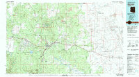
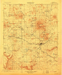
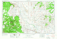
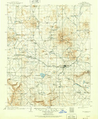
Incorporated into USGS OpenFile Report #1094, "The Geologic Classification of the Meteorites", these materials were written by Donald Elston and contain figures, photos, and charts to help astronauts (who were not trained geologists) be able to identify and articulately describe the geologic observations they made on the lunar surface.
Mule deer of the Kaibab North herd on the Kaibab Plateau are treasured for their historic and contemporary significance in North America. They are the densest population of mule deer in Arizona, with an estimate of 10,200 individuals in 2019. This report compiles two research efforts, the first completed by Arizona Game and Fish Department in 2014, and the second from Utah Division of Wildlife’s ongoing research started in 2017. The Kaibab Plateau is bound on the east, south, and west by vertical canyon walls which run along the Colorado River and Kanab Creek. The Kaibab North Deer herd winters among pinyon-juniper, sagebrush, and cliffrose landscapes along the west, east, and northern extents of the plateau. Portions...
Categories: Data;
Types: Downloadable,
Map Service,
OGC WFS Layer,
OGC WMS Layer,
Shapefile;
Tags: Arizona,
Flagstaff,
United States,
animal behavior,
economy,
These are terrestrial laser scanner datasets collected in forested areas west of Flagstaff, Arizona in 2015 and 2016. For each of the two scanners, six treatment areas were scanned, with four of them overlapping one another (Figure 1). These data are composed of individual scans referenced to one another using reflective targets, and geolocated using differentially corrected GPS and RTK locations of scan locations (Figure 3). There were overall large differences in point density among the two scanners (Figure 2).
The National Aeronautics and Space Administration plans to land two astronauts on the Moon as a part of the Apollo Space Program. The questions arise: What should the astronauts do on the surface and what information should they gather? This report proposes answers to these questions by describing a possible series of scientific activities, or mission profiles, to be performed by the astronauts on the lunar surface during the first seven missions.
Details of field exercises to assess the readiness of astronauts to perform geologic investigations on the lunar surface. They include landscape description, geologic mapping, mobile traverse descriptions, impact crater description, depression description, and detailed mapping.
|

|
