Filters: Tags: Florida Land Cover Classification System (X)
6 results (24ms)|
Filters
Date Range
Extensions Types
Contacts Categories Tag Types Tag Schemes |
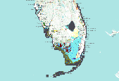
The Cooperative Land Cover Map is a project to develop an improved statewide land cover map from existing sources and expert review of aerial photography. The project is directly tied to a goal of Florida's State Wildlife Action Plan (SWAP) to represent Florida's diverse habitats in a spatially-explicit manner. The Cooperative Land Cover Map integrates 3 primary data types: 1) 6 million acres are derived from local or site-specific data sources, primarily on existing conservation lands. Most of these sources have a ground-truth or local knowledge component. We collected land cover and vegetation data from 37 existing sources. Each dataset was evaluated for consistency and quality and assigned a confidence category...
The Cooperative Land Cover Map is a project to develop an improved statewide land cover map from existing sources and expert review of aerial photography. The project is directly tied to a goal of Florida's State Wildlife Action Plan (SWAP) to represent Florida's diverse habitats in a spatially-explicit manner. The Cooperative Land Cover Map integrates 3 primary data types: 1) 6 million acres are derived from local or site-specific data sources, primarily on existing conservation lands. Most of these sources have a ground-truth or local knowledge component. We collected land cover and vegetation data from 37 existing sources. Each dataset was evaluated for consistency and quality and assigned a confidence category...
This is a land cover dataset developed by Florida Natural Areas Inventory for coastal conservation planning purposes. It is derived from two primary sources: 1) The Florida Cooperative Land Cover Map(CLC), v.2, a hybrid land cover that combines best available statewide and local land cover data sources; and 2) a revision of the CLC based on review of 2009 – 2011 high resolution aerial photography for a subset of remaining natural uplands that correspond to areas identified in the Assessment of Florida’s Remaining Coastal Upland Natural Communities (Johnson and Gulledge 2005). All data were clipped to a coastal analysis zone defined as 3 m elevation plus 1 kmbuffer. The classification scheme is a modified version...

This is a land cover dataset developed by Florida Natural Areas Inventory for coastal conservation planning purposes. It is derived from two primary sources: 1) The Florida Cooperative Land Cover Map(CLC), v.2, a hybrid land cover that combines best available statewide and local land cover data sources; and 2) a revision of the CLC based on review of 2009 – 2011 high resolution aerial photography for a subset of remaining natural uplands that correspond to areas identified in the Assessment of Florida’s Remaining Coastal Upland Natural Communities (Johnson and Gulledge 2005). All data were clipped to a coastal analysis zone defined as 3 m elevation plus 1 kmbuffer. The classification scheme is a modified version...
The Cooperative Land Cover Map is a project to develop an improved statewide land cover map from existing sources and expert review of aerial photography. The project is directly tied to a goal of Florida's State Wildlife Action Plan (SWAP) to represent Florida's diverse habitats in a spatially-explicit manner. The Cooperative Land Cover Map integrates 3 primary data types: 1) 6 million acres are derived from local or site-specific data sources, primarily on existing conservation lands. Most of these sources have a ground-truth or local knowledge component. We collected land cover and vegetation data from 37 existing sources. Each dataset was evaluated for consistency and quality and assigned a confidence category...
The Cooperative Land Cover Map is a project to develop an improved statewide land cover map from existing sources and expert review of aerial photography. The project is directly tied to a goal of Florida's State Wildlife Action Plan (SWAP) to represent Florida's diverse habitats in a spatially-explicit manner. The Cooperative Land Cover Map integrates 3 primary data types: 1) 6 million acres are derived from local or site-specific data sources, primarily on existing conservation lands. Most of these sources have a ground-truth or local knowledge component. We collected land cover and vegetation data from 37 existing sources. Each dataset was evaluated for consistency and quality and assigned a confidence category...
|

|
