Filters
Date Range
Types
Contacts
Tag Types
Tag Schemes
|
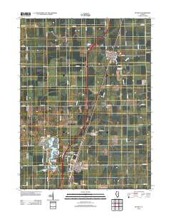
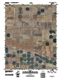
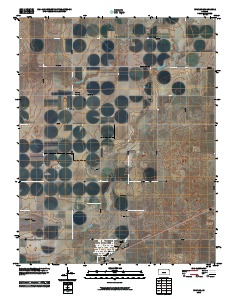
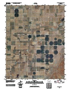
This data set contains imagery from the National Agriculture Imagery Program (NAIP). The NAIP program is administered by USDA FSA and has been established to support two main FSA strategic goals centered on agricultural production. These are, increase stewardship of America's natural resources while enhancing the environment, and to ensure commodities are procured and distributed effectively and efficiently to increase food security. The NAIP program supports these goals by acquiring and providing ortho imagery that has been collected during the agricultural growing season in the U.S. The NAIP ortho imagery is tailored to meet FSA requirements and is a fundamental tool used to support FSA farm and conservation programs....
Types: Citation;
Tags: 20057,
3.75 x 3.75 minute,
3709927,
Aerial Compliance,
BUCKLIN, All tags...
BUCKLIN, NW,
Compliance,
Digital Ortho rectified Image,
Downloadable Data,
FORD CO KS FSA,
Ford,
JPEG2000,
KS,
KS057,
NAIP,
Ortho Rectification,
Orthoimagery,
Quarter Quadrangle,
USDA National Agriculture Imagery Program (NAIP),
farming, Fewer tags

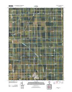
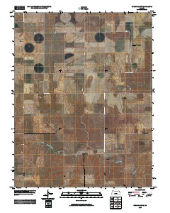
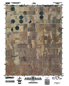
This data set contains imagery from the National Agriculture Imagery Program (NAIP). The NAIP program is administered by USDA FSA and has been established to support two main FSA strategic goals centered on agricultural production. These are, increase stewardship of America's natural resources while enhancing the environment, and to ensure commodities are procured and distributed effectively and efficiently to increase food security. The NAIP program supports these goals by acquiring and providing ortho imagery that has been collected during the agricultural growing season in the U.S. The NAIP ortho imagery is tailored to meet FSA requirements and is a fundamental tool used to support FSA farm and conservation programs....
Types: Citation;
Tags: 21151,
3.75 x 3.75 minute,
3708406,
Aerial Compliance,
Compliance, All tags...
Digital Ortho rectified Image,
Downloadable Data,
FORD,
FORD, SW,
JPEG2000,
KY,
KY151,
MADISON CO KY FSA,
Madison,
NAIP,
Ortho Rectification,
Orthoimagery,
Quarter Quadrangle,
USDA National Agriculture Imagery Program (NAIP),
farming, Fewer tags
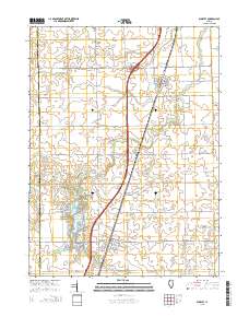
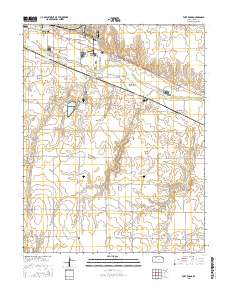
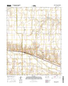
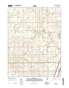
Layered GeoPDF 7.5 Minute Quadrangle Map. Layers of geospatial data include orthoimagery, roads, grids, geographic names, elevation contours, hydrography, and other selected map features.
Tags: 7.5 x 7.5 minute,
Buckley, IL,
Downloadable Data,
EarthCover,
Ford, All tags...
GeoPDF,
Illinois,
Imagery and Base Maps,
Iroquois,
Map,
U.S. National Grid,
US,
US Topo,
US Topo Historical,
United States,
contour,
geographic names,
hydrography,
imageryBaseMapsEarthCover,
orthoimage,
structures,
topographic,
transportation, Fewer tags
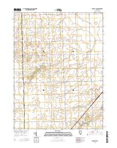
Layered GeoPDF 7.5 Minute Quadrangle Map. Layers of geospatial data include orthoimagery, roads, grids, geographic names, elevation contours, hydrography, and other selected map features.
Tags: 7.5 x 7.5 minute,
Buckley, IL,
Downloadable Data,
EarthCover,
Ford, All tags...
GeoPDF,
Illinois,
Imagery and Base Maps,
Iroquois,
Map,
Public Land Survey System,
U.S. National Grid,
US,
US Topo,
US Topo Historical,
United States,
boundary,
contour,
geographic names,
hydrography,
imageryBaseMapsEarthCover,
orthoimage,
structures,
topographic,
transportation,
woodland, Fewer tags
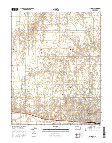
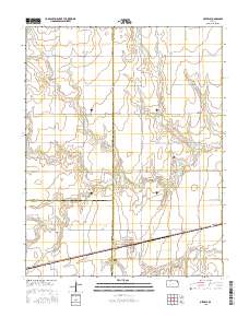
Layered GeoPDF 7.5 Minute Quadrangle Map. Layers of geospatial data include orthoimagery, roads, grids, geographic names, elevation contours, hydrography, and other selected map features.
Tags: 7.5 x 7.5 minute,
Downloadable Data,
EarthCover,
Ford,
GeoPDF, All tags...
Illinois,
Imagery and Base Maps,
Iroquois,
Livingston,
Map,
Piper City, IL,
U.S. National Grid,
US,
US Topo,
US Topo Historical,
United States,
contour,
geographic names,
hydrography,
imageryBaseMapsEarthCover,
orthoimage,
structures,
topographic,
transportation, Fewer tags
Layered GeoPDF 7.5 Minute Quadrangle Map. Layers of geospatial data include orthoimagery, roads, grids, geographic names, elevation contours, hydrography, and other selected map features.
Tags: 7.5 x 7.5 minute,
Downloadable Data,
EarthCover,
Ensign, KS,
Ford, All tags...
GeoPDF,
Gray,
Imagery and Base Maps,
Kansas,
Map,
Public Land Survey System,
U.S. National Grid,
US,
US Topo,
US Topo Historical,
United States,
boundary,
contour,
geographic names,
hydrography,
imageryBaseMapsEarthCover,
orthoimage,
structures,
topographic,
transportation,
woodland, Fewer tags
Layered GeoPFD 7.5 Minute Quadrangle Map. Layers of geospatial data include orthoimagery, roads, grids, geographic names, elevation contours, hydrography, and other selected map features.
Tags: 7.5 x 7.5 minute,
Dodge City SW, KS,
Downloadable Data,
EarthCover,
Ford, All tags...
GeoPDF,
Gray,
Imagery and Base Maps,
Kansas,
Map,
U.S. National Grid,
US,
US Topo,
US Topo Historical,
United States,
contour,
geographic names,
hydrography,
orthoimage,
topographic,
transportation, Fewer tags
Layered GeoPDF 7.5 Minute Quadrangle Map. Layers of geospatial data include orthoimagery, roads, grids, geographic names, elevation contours, hydrography, and other selected map features.
Tags: 7.5 x 7.5 minute,
Downloadable Data,
EarthCover,
Ford,
Fort Dodge, KS, All tags...
GeoPDF,
Imagery and Base Maps,
Kansas,
Map,
Public Land Survey System,
U.S. National Grid,
US,
US Topo,
US Topo Historical,
United States,
boundary,
contour,
geographic names,
hydrography,
imageryBaseMapsEarthCover,
orthoimage,
structures,
topographic,
transportation,
woodland, Fewer tags
Layered GeoPDF 7.5 Minute Quadrangle Map. Layers of geospatial data include orthoimagery, roads, grids, geographic names, elevation contours, hydrography, and other selected map features.
Tags: 7.5 x 7.5 minute,
Buckley NW, IL,
Downloadable Data,
EarthCover,
Ford, All tags...
GeoPDF,
Illinois,
Imagery and Base Maps,
Iroquois,
Livingston,
Map,
Public Land Survey System,
U.S. National Grid,
US,
US Topo,
US Topo Historical,
United States,
boundary,
contour,
geographic names,
hydrography,
imageryBaseMapsEarthCover,
orthoimage,
structures,
topographic,
transportation,
woodland, Fewer tags
Layered GeoPDF 7.5 Minute Quadrangle Map. Layers of geospatial data include orthoimagery, roads, grids, geographic names, elevation contours, hydrography, and other selected map features.
Tags: 7.5 x 7.5 minute,
Dodge City, KS,
Downloadable Data,
EarthCover,
Ford, All tags...
GeoPDF,
Imagery and Base Maps,
Kansas,
Map,
Public Land Survey System,
U.S. National Grid,
US,
US Topo,
US Topo Historical,
United States,
boundary,
contour,
geographic names,
hydrography,
imageryBaseMapsEarthCover,
orthoimage,
structures,
topographic,
transportation,
woodland, Fewer tags
Layered GeoPDF 7.5 Minute Quadrangle Map. Layers of geospatial data include orthoimagery, roads, grids, geographic names, elevation contours, hydrography, and other selected map features.
Tags: 7.5 x 7.5 minute,
Dodge City SW, KS,
Downloadable Data,
EarthCover,
Ford, All tags...
GeoPDF,
Gray,
Imagery and Base Maps,
Kansas,
Map,
Public Land Survey System,
U.S. National Grid,
US,
US Topo,
US Topo Historical,
United States,
boundary,
contour,
geographic names,
hydrography,
imageryBaseMapsEarthCover,
orthoimage,
structures,
topographic,
transportation,
woodland, Fewer tags
Layered GeoPFD 7.5 Minute Quadrangle Map. Layers of geospatial data include orthoimagery, roads, grids, geographic names, elevation contours, hydrography, and other selected map features.
Tags: 7.5 x 7.5 minute,
Downloadable Data,
EarthCover,
Ford,
Fowler, KS, All tags...
GeoPDF,
Imagery and Base Maps,
Kansas,
Map,
Meade,
U.S. National Grid,
US,
US Topo,
US Topo Historical,
United States,
contour,
geographic names,
hydrography,
orthoimage,
topographic,
transportation, Fewer tags
Layered GeoPFD 7.5 Minute Quadrangle Map. Layers of geospatial data include orthoimagery, roads, grids, geographic names, elevation contours, hydrography, and other selected map features.
Tags: 7.5 x 7.5 minute,
Downloadable Data,
EarthCover,
Ford,
GeoPDF, All tags...
Hodgeman,
Imagery and Base Maps,
Kansas,
Map,
Spearville NW, KS,
U.S. National Grid,
US,
US Topo,
US Topo Historical,
United States,
contour,
geographic names,
hydrography,
orthoimage,
topographic,
transportation, Fewer tags
Layered GeoPDF 7.5 Minute Quadrangle Map. Layers of geospatial data include orthoimagery, roads, grids, geographic names, elevation contours, hydrography, and other selected map features.
Tags: 7.5 x 7.5 minute,
Downloadable Data,
EarthCover,
Edwards,
Ford, All tags...
GeoPDF,
Hodgeman,
Imagery and Base Maps,
Kansas,
Map,
Offerle, KS,
Public Land Survey System,
U.S. National Grid,
US,
US Topo,
US Topo Historical,
United States,
boundary,
contour,
geographic names,
hydrography,
imageryBaseMapsEarthCover,
orthoimage,
structures,
topographic,
transportation,
woodland, Fewer tags
Layered GeoPFD 7.5 Minute Quadrangle Map. Layers of geospatial data include orthoimagery, roads, grids, geographic names, elevation contours, hydrography, and other selected map features.
Tags: 7.5 x 7.5 minute,
Downloadable Data,
EarthCover,
Edwards,
Ford, All tags...
GeoPDF,
Imagery and Base Maps,
Kansas,
Map,
Offerle SE, KS,
U.S. National Grid,
US,
US Topo,
US Topo Historical,
United States,
contour,
geographic names,
hydrography,
orthoimage,
topographic,
transportation, Fewer tags
Layered GeoPDF 7.5 Minute Quadrangle Map. Layers of geospatial data include orthoimagery, roads, grids, geographic names, elevation contours, hydrography, and other selected map features.
Tags: 7.5 x 7.5 minute,
Champaign,
Downloadable Data,
EarthCover,
Ford, All tags...
GeoPDF,
Illinois,
Imagery and Base Maps,
Map,
Perdueville, IL,
Public Land Survey System,
U.S. National Grid,
US,
US Topo,
US Topo Historical,
United States,
boundary,
contour,
geographic names,
hydrography,
imageryBaseMapsEarthCover,
orthoimage,
structures,
topographic,
transportation,
woodland, Fewer tags
Layered GeoPFD 7.5 Minute Quadrangle Map. Layers of geospatial data include orthoimagery, roads, grids, geographic names, elevation contours, hydrography, and other selected map features.
Tags: 7.5 x 7.5 minute,
Clark,
Downloadable Data,
EarthCover,
Ford, All tags...
GeoPDF,
Imagery and Base Maps,
Kansas,
Map,
Mount Jesus NW, KS,
U.S. National Grid,
US,
US Topo,
US Topo Historical,
United States,
contour,
geographic names,
hydrography,
orthoimage,
topographic,
transportation, Fewer tags

USGS Historical Quadrangle in GeoPDF.
Tags: 7.5 x 7.5 minute,
Downloadable Data,
Ford,
GeoPDF,
GeoTIFF, All tags...
Historical Topographic Maps,
Historical Topographic Maps 7.5 x 7.5 Minute Map Series,
Map,
WA,
imageryBaseMapsEarthCover, Fewer tags
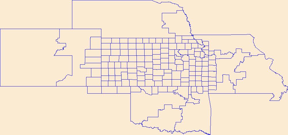
Geospatial data is comprised of government boundaries.
Tags: Allen,
Anderson,
Atchison,
Barber,
Barton, All tags...
Boundaries,
Bourbon,
Brown,
Butler,
Chase,
Chautauqua,
Cherokee,
Cheyenne,
Clark,
Clay,
Cloud,
Coffey,
Comanche,
County or Equivalent,
Cowley,
Crawford,
Decatur,
Dickinson,
Doniphan,
Douglas,
Downloadable Data,
Edwards,
Elk,
Ellis,
Ellsworth,
Esri Shapefile nan,
Finney,
Ford,
Franklin,
Geary,
Gove,
Graham,
Grant,
Gray,
Greeley,
Greenwood,
Hamilton,
Harper,
Harvey,
Haskell,
Hodgeman,
Incorporated Place,
Jackson,
Jefferson,
Jewell,
Johnson,
Jurisdictional,
KS,
Kansas,
Kearny,
Kingman,
Kiowa,
Labette,
Lane,
Leavenworth,
Lincoln,
Linn,
Logan,
Lyon,
Marion,
Marshall,
McPherson,
Meade,
Miami,
Minor Civil Division,
Mitchell,
Montgomery,
Morris,
Morton,
National Boundary Dataset (NBD),
National Boundary Dataset (NBD),
Native American Area,
Nemaha,
Neosho,
Ness,
Norton,
Osage,
Osborne,
Ottawa,
PLSS First Division,
PLSS Special Survey,
PLSS Township,
Pawnee,
Phillips,
Pottawatomie,
Pratt,
Public Land Survey System,
Rawlins,
Reno,
Republic,
Reserve,
Rice,
Riley,
Rooks,
Rush,
Russell,
Saline,
Scott,
Sedgwick,
Seward,
Shapefile,
Shawnee,
Sheridan,
Sherman,
Smith,
Stafford,
Stanton,
State,
State,
State or Territory,
Stevens,
Sumner,
Thomas,
Trego,
U.S. National Grid,
US,
Unincorporated Place,
United States,
Wabaunsee,
Wallace,
Washington,
Wichita,
Wilson,
Woodson,
Wyandotte,
boundaries,
boundary,
cadastral surveys,
geographic names,
land ownership,
land use maps,
legal land descriptions,
political and administrative boundaries,
zoning maps, Fewer tags
The National Hydrography Dataset (NHD) is a feature-based database that interconnects and uniquely identifies the stream segments or reaches that make up the nation's surface water drainage system. NHD data was originally developed at 1:100,000-scale and exists at that scale for the whole country. This high-resolution NHD, generally developed at 1:24,000/1:12,000 scale, adds detail to the original 1:100,000-scale NHD. (Data for Alaska, Puerto Rico and the Virgin Islands was developed at high-resolution, not 1:100,000 scale.) Local resolution NHD is being developed where partners and data exist. The NHD contains reach codes for networked features, flow direction, names, and centerline representations for areal water...
Tags: Administrative watershed units,
Administrative watershed units,
Area of Complex Channels,
Area to be submerged,
Barton, All tags...
Basin,
Basin,
Bay/Inlet,
Boundaries,
Boundary,
Bridge,
Canal/Ditch,
Coastline,
Connector,
Dam/Weir,
Downloadable Data,
Drainage areas for surface water,
Drainageway,
Edwards,
Esri File GeoDatabase 10,
Estuary,
FileGDB,
Flow direction network,
Flume,
Ford,
ForeShore,
Gaging Station,
Gate,
Gray,
HU-8,
HU-8 Subbasin,
HU10,
HU12,
HU14,
HU16,
HU2,
HU4,
HU6,
HU8,
HU8_11030004,
HUC,
Hazard Zone,
Hodgeman,
Hydrographic,
Hydrography,
Hydrography,
Hydrography,
Hydrologic Unit Code,
Hydrologic Units,
Ice mass,
Inundation Area,
KS,
Kansas,
Kiowa,
Levee,
Line,
Lock Chamber,
Marsh,
National Hydrography Dataset (NHD),
National Hydrography Dataset (NHD) Best Resolution,
National Hydrography Dataset (NHD) Best Resolution,
Nonearthen Shore,
Orthoimage,
Pawnee,
Playa,
Point,
PointEvent,
Pond,
Rapids,
Rapids,
Reach,
Reach code,
Reef,
Region,
Reservoir,
Rice,
Rock,
Rush,
Sea/Ocean,
Sink/Rise,
Sounding Datum Line,
Special Use Zone,
Special Use Zone Limit,
Spillway,
Stafford,
Stream,
Stream/River,
Sub-basin,
Sub-region,
Subbasin,
Submerged Stream,
Subregion,
Subwatershed,
Surface water systems,
Swamp,
Topographic,
Tunnel,
US,
Underground Conduit,
United States,
WBD,
WBD,
Wall,
Wash,
Water Intake Outflow,
Waterfall,
Watershed,
Watershed Boundaries,
Watershed Boundary Dataset,
Watershed Boundary Dataset,
Well,
artificial path,
boundaries,
dams,
drainage systems and characteristics,
inlandWaters,
lakes,
ngda,
rivers, Fewer tags
|
|

