Filters: Tags: Fort Collins (X)
31 results (14ms)|
Filters
Date Range
Types Contacts
Categories Tag Types Tag Schemes
|
To investigate the effects of imidacloprid on natural stream communities under controlled conditions, experimental streams were dosed with imidacloprid at concentrations ranging from 0.061 to 220 micrograms per liter (µg/L) for a period of 10 days. Natural stream macroinvertebrate communities were obtained from the Cache La Poudre River (Larimer County, CO) by colonizing trays full of large gravel for 75 days. The trays were added to laboratory experimental streams (mesocosms) at the USGS Fort Collins Science Center in Fort Collins, CO. At the end of 10 days, invertebrate abundance metrics were analyzed in relation to measured imidacloprid concentrations in water from the experimental streams. Declines in total...
These data were released prior to the October 1, 2016 effective date for the USGS’s policy dictating the review, approval, and release of scientific data as referenced in USGS Survey Manual Chapter 502.8 Fundamental Science Practices: Review and Approval of Scientific Data for Release. The U.S. Geological Survey developed this dataset as part of the Colorado Front Range Infrastructure Resources Project (FRIRP). One goal of the FRIRP was to provide information on the availability of those hydrogeologic resources that are either critical to maintaining infrastructure along the northern Front Range or that may become less available because of urban expansion in the northern Front Range. This dataset extends from the...
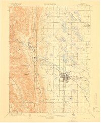
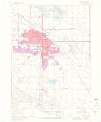
USGS Historical Quadrangle in GeoPDF.
USGS Historical Quadrangle in GeoPDF.
USGS Historical Quadrangle in GeoPDF.
These data were released prior to the October 1, 2016 effective date for the USGS’s policy dictating the review, approval, and release of scientific data as referenced in USGS Survey Manual Chapter 502.8 Fundamental Science Practices: Review and Approval of Scientific Data for Release. The U.S. Geological Survey developed this dataset as part of the Colorado Front Range Infrastructure Resources Project (FRIRP). One goal of the FRIRP was to provide information on the availability of those hydrogeologic resources that are either critical to maintaining infrastructure along the northern Front Range or that may become less available because of urban expansion in the northern Front Range. This dataset extends from the...
These data were released prior to the October 1, 2016 effective date for the USGS’s policy dictating the review, approval, and release of scientific data as referenced in USGS Survey Manual Chapter 502.8 Fundamental Science Practices: Review and Approval of Scientific Data for Release. The U.S. Geological Survey developed this dataset as part of the Colorado Front Range Infrastructure Resources Project (FRIRP). One goal of the FRIRP was to provide information on the availability of those hydrogeologic resources that are either critical to maintaining infrastructure along the northern Front Range or that may become less available because of urban expansion in the northern Front Range. This dataset extends from the...
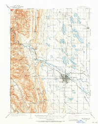
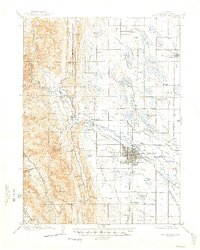
USGS Historical Quadrangle in GeoPDF.
USGS Historical Quadrangle in GeoPDF.
USGS Historical Quadrangle in GeoPDF.
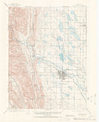
USGS Historical Quadrangle in GeoPDF.
USGS Historical Quadrangle in GeoPDF.
USGS Historical Quadrangle in GeoPDF.
We collected fecal pellets from six black-tailed prairie dogs in captivity. Prairie dogs were provided free access to non-treated grain (oat groats) or fipronil-treated grain for 5 days. Two prairie dogs received non-treated grain and four prairie dogs received fipronil grain. During each day of the feeding trial, prairie dog fecal pellets were collected, stored in sealable plastic bags, labeled by treatment, and frozen. Fecal pellets from days 2, 3, 4, and 5 were placed in 1.5 milliliter (mL) centrifuge tubes, ground into morsels and powder (fine particles for flea larvae to eat) with a disposable polypropylene pestle, separated as 0.50 milligram (mg) subsamples into pre-labeled centrifuge tubes, and frozen. Oropsylla...
These data were released prior to the October 1, 2016 effective date for the USGS’s policy dictating the review, approval, and release of scientific data as referenced in USGS Survey Manual Chapter 502.8 Fundamental Science Practices: Review and Approval of Scientific Data for Release. The U.S. Geological Survey developed this dataset as part of the Colorado Front Range Infrastructure Resources Project (FRIRP). One goal of the FRIRP was to provide information on the availability of those hydrogeologic resources that are either critical to maintaining infrastructure along the northern Front Range or that may become less available because of urban expansion in the northern Front Range. This dataset extends from the...
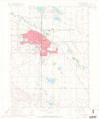
USGS Historical Quadrangle in GeoPDF.
This digital map shows the geographic extent of rock stratigraphic units (formations) as compiled by Colton in 1976 under the Front Range Urban Corridor Geology Program. Colton used his own geologic mapping and previously published geologic maps to compile one map having a single classification of geologic units. The resulting published color paper map (USGS Map I-855-G, Colton, 1978) was intended for land-use planning and to depict the regional geology. In 1997-1999, another USGS project designed to address urban growth issues was undertaken. This project, the USGS Front Range Infrastructure Resources Project, undertook to digitize Colton's map at 1:100,000 scale, making it useable in Geographical Information Systems...
These data were released prior to the October 1, 2016 effective date for the USGS’s policy dictating the review, approval, and release of scientific data as referenced in USGS Survey Manual Chapter 502.8 Fundamental Science Practices: Review and Approval of Scientific Data for Release. The U.S. Geological Survey developed this dataset as part of the Colorado Front Range Infrastructure Resources Project (FRIRP). One goal of the FRIRP was to provide information on the availability of those hydrogeologic resources that are either critical to maintaining infrastructure along the northern Front Range or that may become less available because of urban expansion in the northern Front Range. This dataset extends from the...
This data set contains imagery from the National Agriculture Imagery Program (NAIP). The NAIP program is administered by USDA FSA and has been established to support two main FSA strategic goals centered on agricultural production. These are, increase stewardship of America's natural resources while enhancing the environment, and to ensure commodities are procured and distributed effectively and efficiently to increase food security. The NAIP program supports these goals by acquiring and providing ortho imagery that has been collected during the agricultural growing season in the U.S. The NAIP ortho imagery is tailored to meet FSA requirements and is a fundamental tool used to support FSA farm and conservation programs....
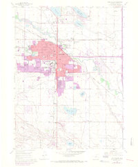
USGS Historical Quadrangle in GeoPDF.
|

|
