Filters: Tags: Four Corners (X)
49 results (46ms)|
Filters
|
This data set contains imagery from the National Agriculture Imagery Program (NAIP). The NAIP program is administered by USDA FSA and has been established to support two main FSA strategic goals centered on agricultural production. These are increase stewardship of America's natural resources while enhancing the environment, and to ensure commodities are procured and distributed effectively and efficiently to increase food security. The NAIP program supports these goals by acquiring and providing ortho imagery that has been collected during the agricultural growing season in the U.S. The NAIP ortho imagery is tailored to meet FSA requirements and is a fundamental tool used to support FSA farm and conservation programs....
The USGS Central Region Energy Team assesses oil and gas resources of the United States. The onshore and State water areas of the United States comprise 71 provinces. Within these provinces, Total Petroleum Systems are defined and Assessment Units are defined and assessed. Each of these provinces is defined geologically, and most province boundaries are defined by major geologic changes. The San Juan Basin Province is located in South Western Colorado and North Western New Mexico, encompassing all or parts of Montezuma, La Plata, and Archuletta Counties in Colorado and all or parts of San Juan, Rio Arriba, Sandoval, Mckinley, Bernalillo, and Cibola Counties in New Mexico. The main population centers within the study...
The SRLCC provided funds to the states of Arizona and New Mexico to support development of the states Crucial Habitat Assessment Tools (CHATs) which provide a decision support system to better incorporate wildlife values, sensitive animals and plants, and important ecosystem features into land use decision-making to reduce conflicts and surprises.Several states have released wildlife mapping tools that are the foundation for displaying crucial wildlife and corridor information. The state and regional CHATs are non-regulatory, and give project planners and the general public access to credible scientific data on a broad scale for use in project analysis, siting and planning. This includes large-scale development...
Categories: Data,
Project;
Types: ArcGIS REST Map Service,
ArcGIS Service Definition,
Downloadable,
Map Service,
OGC WFS Layer,
OGC WMS Layer,
OGC WMS Service;
Tags: AZ-01,
AZ-02,
AZ-03,
AZ-04,
AZ-05,

This dataset was developed using the STATSGO2, 1:250,000-scale US soils database with soil descriptions from the NRCS website (http://ortho.ftw.nrcs.usda.gov/cgi-bin/osd/osdname.cgi). The main soil characteristics described by this dataset are soil order, texture, climate regime and caliche (special diagnostic horizon).
This data set contains imagery from the National Agriculture Imagery Program (NAIP). The NAIP program is administered by USDA FSA and has been established to support two main FSA strategic goals centered on agricultural production. These are, increase stewardship of America's natural resources while enhancing the environment, and to ensure commodities are procured and distributed effectively and efficiently to increase food security. The NAIP program supports these goals by acquiring and providing ortho imagery that has been collected during the agricultural growing season in the U.S. The NAIP ortho imagery is tailored to meet FSA requirements and is a fundamental tool used to support FSA farm and conservation programs....
This data set contains imagery from the National Agriculture Imagery Program (NAIP). The NAIP program is administered by USDA FSA and has been established to support two main FSA strategic goals centered on agricultural production. These are, increase stewardship of America's natural resources while enhancing the environment, and to ensure commodities are procured and distributed effectively and efficiently to increase food security. The NAIP program supports these goals by acquiring and providing ortho imagery that has been collected during the agricultural growing season in the U.S. The NAIP ortho imagery is tailored to meet FSA requirements and is a fundamental tool used to support FSA farm and conservation programs....
The Total Petroleum System is used in the National Assessment Project and incorporates the Assessment Unit, which is the fundamental geologic unit used for the assessment of undiscovered oil and gas resources. The Total Petroleum System is shown here as a geographic boundary defined and mapped by the geologist responsible for the province and incorporates not only the set of known or postulated oil and (or) gas accumulations, but also the geologic interpretation of the essential elements and processes within the petroleum system that relate to source, generation, migration, accumulation, and trapping of the discovered and undiscovered petroleum resource(s).
This data set contains imagery from the National Agriculture Imagery Program (NAIP). The NAIP program is administered by USDA FSA and has been established to support two main FSA strategic goals centered on agricultural production. These are increase stewardship of America's natural resources while enhancing the environment, and to ensure commodities are procured and distributed effectively and efficiently to increase food security. The NAIP program supports these goals by acquiring and providing ortho imagery that has been collected during the agricultural growing season in the U.S. The NAIP ortho imagery is tailored to meet FSA requirements and is a fundamental tool used to support FSA farm and conservation programs....
This data set contains imagery from the National Agriculture Imagery Program (NAIP). The NAIP program is administered by USDA FSA and has been established to support two main FSA strategic goals centered on agricultural production. These are, increase stewardship of America's natural resources while enhancing the environment, and to ensure commodities are procured and distributed effectively and efficiently to increase food security. The NAIP program supports these goals by acquiring and providing ortho imagery that has been collected during the agricultural growing season in the U.S. The NAIP ortho imagery is tailored to meet FSA requirements and is a fundamental tool used to support FSA farm and conservation programs....
This data set contains imagery from the National Agriculture Imagery Program (NAIP). The NAIP program is administered by USDA FSA and has been established to support two main FSA strategic goals centered on agricultural production. These are, increase stewardship of America's natural resources while enhancing the environment, and to ensure commodities are procured and distributed effectively and efficiently to increase food security. The NAIP program supports these goals by acquiring and providing ortho imagery that has been collected during the agricultural growing season in the U.S. The NAIP ortho imagery is tailored to meet FSA requirements and is a fundamental tool used to support FSA farm and conservation programs....
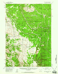
USGS Historical Quadrangle in GeoPDF.
The San Juan River is a major water source for communities in the Four Corners region of the United States (parts of Colorado, Arizona, New Mexico, Utah) and is a vital source of water for the Navajo Nation. The Navajo Nation Environmental Protection Agency (NNEPA) periodically samples surface water on the Navajo Nation and has found that some elements exceed NNEPA surface water standards (the upper limits of an element for consumption or other use of water). Constituents of concern are substances that could be harmful if present in sufficient quantities, and it is important to monitor the concentrations of these substances in the environment. In the San Juan River, constituents of concern include metals detected...
Categories: Data;
Types: Map Service,
OGC WFS Layer,
OGC WMS Layer,
OGC WMS Service;
Tags: Arizona,
Colorado,
Four Corners,
Geochemistry,
Mineral Resources,
In the drier, mid- and low-elevation portions of the Southern Rockies LCC, Fremont cottonwood represents the only native vegetation of tall stature, and cottonwood-dominated woodlands provide critical habitat for a large array of neotropical migratory birds and other animals. These woodlands likely dominated alluvial reaches of all streams where a snowmelt-driven spring flood was the major factor driving geomorphic and vegetation dynamics. These woodlands were also among the first habitats to undergo transformation as the regions land and water resources were developed.The PI coauthored a paper (Andersen et al. 2007) on assessing the amount of native Fremont cottonwood forest remaining on floodplains in 26 subbasins...
Categories: Data,
Project;
Types: GeoTIFF,
Map Service,
OGC WFS Layer,
OGC WMS Layer,
OGC WMS Service,
Raster;
Tags: AZ-01,
AZ-04,
Applications and Tools,
Arizona,
CO-02,
The Conservation Biology Institute is developing a tool that managers in all watersheds of the Southern Rockies Landscape Conservation Cooperative can use to project the effects of climate change on soil vulnerability conditions and help resource managers develop appropriate strategies to mitigate negative climate impacts.Specifically, they will develop a spatially-explicit soil vulnerability index for the Southern Rockies Landscape Conservation Cooperative that can be used to forecast short-term response of plants to current drought conditions and test a vegetation model of plant response to drought.Conservation Biology Institute will use the soil vulnerability index to compare historical and future simulations...
Categories: Data,
Project;
Types: Map Service,
OGC WFS Layer,
OGC WMS Layer,
OGC WMS Service;
Tags: AZ-01,
AZ-04,
Applications and Tools,
Arizona,
CO-02,
This dataset contains both the inputs and outputs generated as part of the Vulnerability assessment, including indicators of Exposure (the magnitude of climatic or ecological changes within the target landscape), Sensitivity (the response of targets to exposure), and Adaptive Capacity (the potential of the target to cope with exposure). These spatial datasets can be used to construct maps that classify areas according to the presence of vulnerable components.
Categories: Data;
Types: Downloadable,
Map Service,
OGC WFS Layer,
OGC WMS Layer,
Shapefile;
Tags: Arizona,
Colorado,
Colorado Plateau,
Four Corners,
New Mexico,
This data set contains imagery from the National Agriculture Imagery Program (NAIP). The NAIP program is administered by USDA FSA and has been established to support two main FSA strategic goals centered on agricultural production. These are increase stewardship of America's natural resources while enhancing the environment, and to ensure commodities are procured and distributed effectively and efficiently to increase food security. The NAIP program supports these goals by acquiring and providing ortho imagery that has been collected during the agricultural growing season in the U.S. The NAIP ortho imagery is tailored to meet FSA requirements and is a fundamental tool used to support FSA farm and conservation programs....
This data set contains imagery from the National Agriculture Imagery Program (NAIP). The NAIP program is administered by USDA FSA and has been established to support two main FSA strategic goals centered on agricultural production. These are increase stewardship of America's natural resources while enhancing the environment, and to ensure commodities are procured and distributed effectively and efficiently to increase food security. The NAIP program supports these goals by acquiring and providing ortho imagery that has been collected during the agricultural growing season in the U.S. The NAIP ortho imagery is tailored to meet FSA requirements and is a fundamental tool used to support FSA farm and conservation programs....
Sediment traps were deployed in thirty-three ephemeral and perennial tributaries to the San Juan River during 2021 and 2022. This dataset includes the chemical concentrations of the sediment samples collected in sediment traps during storm events. These traps collected sediment during storm events that typically occur as monsoonal convective storms from June to September. Because of the rural nature of the watershed, sediment traps were collected every 3 weeks so the sediment collected is a composite of that time period. The date listed is the date the trap was collected. Major ions are reported in weight percentage, while all other elements are reported in parts per million. Each sample was split and analyzed following...
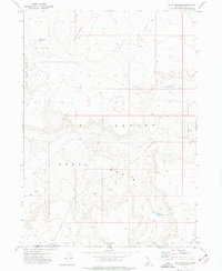
USGS Historical Quadrangle in GeoPDF.
This data set contains imagery from the National Agriculture Imagery Program (NAIP). The NAIP program is administered by USDA FSA and has been established to support two main FSA strategic goals centered on agricultural production. These are increase stewardship of America's natural resources while enhancing the environment, and to ensure commodities are procured and distributed effectively and efficiently to increase food security. The NAIP program supports these goals by acquiring and providing ortho imagery that has been collected during the agricultural growing season in the U.S. The NAIP ortho imagery is tailored to meet FSA requirements and is a fundamental tool used to support FSA farm and conservation programs....
|

|
