Filters: Tags: Four Corners (X)
41 results (300ms)|
Filters
Date Range
Extensions Types Contacts
Categories Tag Types
|
Sediment traps were deployed in tributaries to the San Juan River during 2021 and 2022. These traps collected sediment during storm events that typically occur as monsoonal convective storms from June to September. Because of the rural nature of the watershed, sediment traps were collected every 3 weeks so the sediment collected is a composite of that time period. The date listed is the date the trap was collected. This dataset includes the chemical concentrations of the sediment samples. Major ions are reported in weight percentage, while all other elements are reported in parts per million. Sediment samples in this dataset are digested using a mixture of hydrochloric, nitric, perchloric, and hydrofluoric acids...
This data set contains imagery from the National Agriculture Imagery Program (NAIP). The NAIP program is administered by USDA FSA and has been established to support two main FSA strategic goals centered on agricultural production. These are, increase stewardship of America's natural resources while enhancing the environment, and to ensure commodities are procured and distributed effectively and efficiently to increase food security. The NAIP program supports these goals by acquiring and providing ortho imagery that has been collected during the agricultural growing season in the U.S. The NAIP ortho imagery is tailored to meet FSA requirements and is a fundamental tool used to support FSA farm and conservation programs....
This data set contains imagery from the National Agriculture Imagery Program (NAIP). The NAIP program is administered by USDA FSA and has been established to support two main FSA strategic goals centered on agricultural production. These are, increase stewardship of America's natural resources while enhancing the environment, and to ensure commodities are procured and distributed effectively and efficiently to increase food security. The NAIP program supports these goals by acquiring and providing ortho imagery that has been collected during the agricultural growing season in the U.S. The NAIP ortho imagery is tailored to meet FSA requirements and is a fundamental tool used to support FSA farm and conservation programs....
Streamflows in late spring and summer have declined over the last century in the western U.S. and mean annual streamflow is projected to decrease by six to 25% over the next 100 years. In arid and semi-arid regions of the western US, it is likely that some perennial streams will shift to intermittent flow regimes in response to climate-driven changes in timing and magnitude of precipitation, runoff, and evaporation. The project will address the following two research question: how will small stream (1st-3rd order) low flow hydrology be impacted by predicted longer, drier summers in the Upper Colorado River Basin under climate change and in turn, what will be the resulting impacts on riparian plant communities?...
Categories: Data,
Project;
Types: ArcGIS REST Map Service,
ArcGIS Service Definition,
Downloadable,
Map Service,
OGC WFS Layer,
OGC WMS Layer,
OGC WMS Service;
Tags: AZ-01,
Applications and Tools,
Arizona,
CO-03,
Colorado,
Sediment traps were deployed in tributaries to the San Juan River during 2021 and 2022. These traps collected sediment during storm events that typically occur as monsoonal convective storms from June to September. Because of the rural nature of the watershed, sediment traps were collected every 3 weeks so the sediment collected is a composite of that time period. The date listed is the date the trap was collected. This dataset includes the chemical concentrations of the sediment samples. Major ions are reported in weight percentage, while all other elements are reported in parts per million. Samples were fused at 750°C with sodium peroxide and the fusion cake dissolved in a dilute nitric acid. The resulting solution...
This data set contains imagery from the National Agriculture Imagery Program (NAIP). The NAIP program is administered by USDA FSA and has been established to support two main FSA strategic goals centered on agricultural production. These are, increase stewardship of America's natural resources while enhancing the environment, and to ensure commodities are procured and distributed effectively and efficiently to increase food security. The NAIP program supports these goals by acquiring and providing ortho imagery that has been collected during the agricultural growing season in the U.S. The NAIP ortho imagery is tailored to meet FSA requirements and is a fundamental tool used to support FSA farm and conservation programs....

1 degree digital elevation model for Colorado, New Mexico, Utah and Arizona, USA
The University of California, Davis in partnership with the Navajo Nation is partnering with the Southern Rockies LCC to provide estimates of habitat connectivity for focal species on the Navajo Nation and adjacent lands that the tribe wishes to incorporate into planning and implementation of adaptive management. The project will derive habitat variables as inputs for connectivity models, and model outputs likely will include habitat quality and conductance. Species-specific models will be mathematically integrated to permit probabilistic statements about simultaneous connectivity for two or more species. The spatial data developed on wildlife distributions and habitat to model connectivity and, ultimately, viability...
Categories: Data,
Project;
Types: ArcGIS REST Map Service,
ArcGIS Service Definition,
Downloadable,
Map Service,
OGC WFS Layer,
OGC WMS Layer,
OGC WMS Service;
Tags: AZ-01,
Applications and Tools,
Arizona,
Arizona,
Cultural Resources,
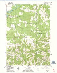
USGS Historical Quadrangle in GeoPDF.
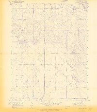
USGS Historical Quadrangle in GeoPDF.
Cell maps for each oil and gas assessment unit were created by the USGS as a method for illustrating the degree of exploration, type of production, and distribution of production in an assessment unit or province. A cell map was not created for the Menefee Coal-Bed Gas (50220381) assessment unit because it was considered a hypothetical assessment unit. The Mesaverde Updip oil had production wells associated with it but resource totals were below the minimum and wasn't quantitatively assessed. Each cell represents a quarter-mile square of the land surface, and the cells are coded to represent whether the wells included within the cell are predominantly oil-producing, gas-producing, both oil and gas-producing, dry,...
This data set contains imagery from the National Agriculture Imagery Program (NAIP). The NAIP program is administered by USDA FSA and has been established to support two main FSA strategic goals centered on agricultural production. These are, increase stewardship of America's natural resources while enhancing the environment, and to ensure commodities are procured and distributed effectively and efficiently to increase food security. The NAIP program supports these goals by acquiring and providing ortho imagery that has been collected during the agricultural growing season in the U.S. The NAIP ortho imagery is tailored to meet FSA requirements and is a fundamental tool used to support FSA farm and conservation programs....
This data set portrays the land ownership polygon features in the U.S. Geological Survey (USGS) Colorado Plateau coal assessment study area (Colorado, Utah, New Mexico and Arizona). The data set was created by clipping a national land ownership coverage of federal land polygon features that had been extracted from the individual USGS 1:2,000,000-scale state boundary Digital Line Graph (DLG) files and then paneled into a single coverage. The original national coverage metadata document is included here and modified slightly to indicate that the geographic areal extent is that of portions of Colorado, Utah, New Mexico and Arizona.
Categories: Data,
pre-SM502.8;
Types: Downloadable,
Map Service,
OGC WFS Layer,
OGC WMS Layer,
Shapefile;
Tags: Arizona,
Colorado,
Colorado Plateau,
Colorado Plateau,
Colorado Plateau Coal Assessment study area,
Without reliable spatial data for wetland and riparian areas, it is impossible for land managers to accurately assess the distribution of critical aquatic habitats and model potential impacts caused by climate change. Wetlands in the Southern Rockies are particularly important for wildlife habitat, as they are often far more productive than the surrounding uplands. In addition, wetlands are an integral component of regional hydrologic cycles through their role in flood abatement, storm water retention, groundwater recharge, and water quality improvement.Colorados wetlands were mapped by the FWS early 1980 and in late 1990, and though the maps exist, they were created for print and most are not useful as digital...
Categories: Data,
Project;
Types: ArcGIS REST Map Service,
ArcGIS Service Definition,
Downloadable,
Map Service,
OGC WFS Layer,
OGC WMS Layer,
OGC WMS Service;
Tags: Applications and Tools,
CO-03,
Colorado,
Colorado,
Conservation NGOs,
This dataset contains both the inputs and outputs generated as part of the Vulnerability assessment, including indicators of Exposure (the magnitude of climatic or ecological changes within the target landscape), Sensitivity (the response of targets to exposure), and Adaptive Capacity (the potential of the target to cope with exposure). These spatial datasets can be used to construct maps that classify areas according to the presence of vulnerable components.
Categories: Data;
Types: Downloadable,
Map Service,
OGC WFS Layer,
OGC WMS Layer,
Shapefile;
Tags: Arizona,
Colorado,
Colorado Plateau,
Four Corners,
New Mexico,
This data set contains imagery from the National Agriculture Imagery Program (NAIP). The NAIP program is administered by USDA FSA and has been established to support two main FSA strategic goals centered on agricultural production. These are increase stewardship of America's natural resources while enhancing the environment, and to ensure commodities are procured and distributed effectively and efficiently to increase food security. The NAIP program supports these goals by acquiring and providing ortho imagery that has been collected during the agricultural growing season in the U.S. The NAIP ortho imagery is tailored to meet FSA requirements and is a fundamental tool used to support FSA farm and conservation programs....
This data set contains imagery from the National Agriculture Imagery Program (NAIP). The NAIP program is administered by USDA FSA and has been established to support two main FSA strategic goals centered on agricultural production. These are, increase stewardship of America's natural resources while enhancing the environment, and to ensure commodities are procured and distributed effectively and efficiently to increase food security. The NAIP program supports these goals by acquiring and providing ortho imagery that has been collected during the agricultural growing season in the U.S. The NAIP ortho imagery is tailored to meet FSA requirements and is a fundamental tool used to support FSA farm and conservation programs....
This data set contains imagery from the National Agriculture Imagery Program (NAIP). The NAIP program is administered by USDA FSA and has been established to support two main FSA strategic goals centered on agricultural production. These are, increase stewardship of America's natural resources while enhancing the environment, and to ensure commodities are procured and distributed effectively and efficiently to increase food security. The NAIP program supports these goals by acquiring and providing ortho imagery that has been collected during the agricultural growing season in the U.S. The NAIP ortho imagery is tailored to meet FSA requirements and is a fundamental tool used to support FSA farm and conservation programs....
Land managers have incorporated threats to biodiversity for nearly two decades, but very few efforts have included threats from future conditions and fewer still have assessed vulnerability to climate change. This project will address two themes: 1) providing foundational information about habitat fragmentation and connectivity and 2) identifying the degree of vulnerability of key habitats to climate change.For development of understanding broadextent, a landscape-level pattern of climate change is an important complement to approaches to estimate rangeshifts for certain key focal species. Ecological system types (i.e. coarsefilters) are widely used in conservation planning because they contain valuable resources...
Categories: Data,
Project;
Types: ArcGIS REST Map Service,
ArcGIS Service Definition,
Downloadable,
Map Service,
OGC WFS Layer,
OGC WMS Layer,
OGC WMS Service;
Tags: AZ-01,
AZ-04,
Applications and Tools,
CO-02,
CO-03,
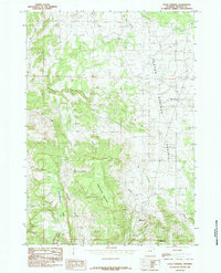
USGS Historical Quadrangle in GeoPDF.
|

|
