Filters: Tags: GAP (X)
69 results (26ms)|
Filters
Date Range
Extensions Types Contacts
Categories Tag Types
|
Some of the SNK rasters intentionally do not align or have the same extent. These rasters were not snapped to a common raster per the authors' discretion. Please review selected rasters prior to use. These varying alignments are a result of the use of differing source data sets and all products derived from them. We recommend that users snap or align rasters as best suits their own projects. - This dataset consists of raster distribution maps for terrestrial vertebrate species in Alaska. Individual species distribution maps were developed using the best available known occurrence points for each species and modeled using MaxEnt software and a series of environmental predictor variables. Output maps were clipped...
Some of the SNK rasters intentionally do not align or have the same extent. These rasters were not snapped to a common raster per the authors' discretion. Please review selected rasters prior to use. These varying alignments are a result of the use of differing source data sets and all products derived from them. We recommend that users snap or align rasters as best suits their own projects. - This dataset consists of raster distribution maps for terrestrial vertebrate species in Alaska. Individual species distribution maps were developed using the best available known occurrence points for each species and modeled using MaxEnt software and a series of environmental predictor variables. Output maps were clipped...
Some of the SNK rasters intentionally do not align or have the same extent. These rasters were not snapped to a common raster per the authors' discretion. Please review selected rasters prior to use. These varying alignments are a result of the use of differing source data sets and all products derived from them. We recommend that users snap or align rasters as best suits their own projects. - This dataset consists of raster distribution maps for terrestrial vertebrate species in Alaska. Individual species distribution maps were developed using the best available known occurrence points for each species and modeled using MaxEnt software and a series of environmental predictor variables. Output maps were clipped...
The Protected Areas Database of the United States (PAD-US) is a geodatabase that illustrates and describes public land ownership, management and conservation lands nationally, including voluntarily provided privately protected areas. The lands included in PAD-US are assigned conservation measures that qualify their intent to manage lands for the preservation of biological diversity and to other natural, recreational and cultural uses; managed for these purposes through legal or other effective means. The Protected Areas Database of the United States (PAD-US) is a geodatabase that illustrates and describes public land ownership, management and conservation lands nationally, including voluntarily provided privately...
Categories: Data;
Types: ArcGIS REST Map Service,
Map Service;
Tags: Conservation,
DOI,
GAP,
USGS,
land ownership,
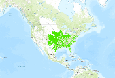
GAP distribution models represent the areas where species are predicted to occur based on habitat associations. GAP distribution models are the spatial arrangement of environments suitable for occupation by a species. In other words, a species distribution is created using a deductive model to predict areas suitable for occupation within a species range. To represent these suitable environments, GAP compiled existing GAP data, where available, and compiled additional data where needed. Existing data sources were the Southwest Regional Gap Analysis Project (SWReGAP) and the Southeast Gap Analysis Project (SEGAP) as well as a data compiled by Sanborn Solutions and Mason, Bruce and Girard. Habitat associations were...
Categories: Data;
Types: ArcGIS REST Map Service,
Map Service;
Tags: Biodiversity,
Conservation,
GAP,
Gap Analysis,
Species Distribution,
Relatively undeveloped terrestrial areas (Terrestrial Development Index scores less than 1 percent) in the Wyoming Basin Rapid Ecoregional Assessment project area. These data are provided by Bureau of Land Management (BLM) "as is" and may contain errors or omissions. The User assumes the entire risk associated with its use of these data and bears all responsibility in determining whether these data are fit for the User's intended use. These data may not have the accuracy, resolution, completeness, timeliness, or other characteristics appropriate for applications that potential users of the data may contemplate. The User is encouraged to carefully consider the content of the metadata file associated with these data....
This map summarizes information presented in the other chapters of the report, including background information on the Bureau of Land Management and Rapid Ecoregional Assessments (REAs), and the REA components that are addressed by the Wyoming Basin REA. In addition, we provide two-page summaries for each Change Agent (development, invasive species, fire, and climate change) and Conservation Element (species and communities) assessed by the Wyoming Basin REA. The REA?s provide an assessment of 1) baseline conditions for long-term monitoring of broad-scale conditions and trends; 2) landscape-level intactness of ecological communities, habitats for priority species, and the ecoregion overall; and 3) a predictive capacity...
This layer represents State Habitat and Species Mangement Areas in Wyoming from the Protected Areas Database of the US (PADUS). Part of the GAP Analysis, PADUS is a geodatabase that illustrates and describes public land ownership, managment and consercationlands nationally. The lands included are assigned conservation measures that qualify thier intent to mangae lands for the presercation of biological diversity and to other natural, recreational, and cultural uses.
Categories: Data;
Types: Downloadable,
Map Service,
OGC WFS Layer,
OGC WMS Layer,
Shapefile;
Tags: GAP,
LEAP,
PADUS,
marine protected areas,
usgs,
|

|