Filters: Tags: GAP codes (X)
115 results (12ms)|
Filters
Date Range
Extensions Types Contacts Categories Tag Types Tag Schemes |
The National Conservation Easement Database (NCED) is a collaborative venture to compile easement records (both spatial and tabular) from land trusts and public agencies throughout the United States in a single, up-to-date, sustainable, GIS compatible, online source. The goal of the NCED is to provide a comprehensive picture of the privately owned conservation easement lands, recognizing their contribution to America's natural heritage, a vibrant economy, and healthy communities. Conservation easements are legal agreements voluntarily entered into between landowners and conservation entities (agencies or land trusts) for the express purpose of protecting certain societal values such as open space or vital wildlife...
Types: Downloadable;
Tags: BLM,
Bureau of Land Management,
Conservation Easement,
Conservation Planning,
DOI,

This dataset is an extraction from PAD-US 1.1 (CBI Edition), by state. The PAD-US 1.1 (CBI Edition) data set portrays the nation's protected areas with a standardized spatial geometry and numerous valuable attributes on land ownership, management designations, and conservation status (using national GAP and international IUCN coding systems). The PAD-US 1.1 (CBI Edition) defines protected areas to include all lands dedicated to the preservation of biological diversity and to other natural, recreation and cultural uses, and managed for these purposes through legal or other effective means (adapted from IUCN definition). The database represents the full range of conservation designations that preserve these...

These protected areas were estimated by the Conservation Biology Institute as being secondarily threatened by the corresponding Deepwater Horizon oil spill trajectory forecast in the Gulf of Mexico. This dataset is extracted from PAD-US 1.1 (CBI Edition), and the original metadata has been included here, below. First, protected areas within 1 mile of the entire study area coastline (TX to NJ), or that intersect hydrological feature polygons from the NHDPlus National Hydrography Dataset within the 1-mile coastline buffer, were extracted from PAD-US 1.1 (CBI Edition). Then, protected areas were identified as being under primary, secondary, or tertiary threat from the oil spill. The probability of being affected...

This dataset is an extraction from PAD-US 1.1 (CBI Edition), by state. The PAD-US 1.1 (CBI Edition) data set portrays the nation's protected areas with a standardized spatial geometry and numerous valuable attributes on land ownership, management designations, and conservation status (using national GAP and international IUCN coding systems). The PAD-US 1.1 (CBI Edition) defines protected areas to include all lands dedicated to the preservation of biological diversity and to other natural, recreation and cultural uses, and managed for these purposes through legal or other effective means (adapted from IUCN definition). The database represents the full range of conservation designations that preserve these...

This dataset is an extraction from PAD-US 1.1 (CBI Edition), by Wilderness Area and Proposed Wilderness Area management designation. The PAD-US 1.1 (CBI Edition) data set portrays the nation's protected areas with a standardized spatial geometry and numerous valuable attributes on land ownership, management designations, and conservation status (using national GAP and international IUCN coding systems). The PAD-US 1.1 (CBI Edition) defines protected areas to include all lands dedicated to the preservation of biological diversity and to other natural, recreation and cultural uses, and managed for these purposes through legal or other effective means (adapted from IUCN definition). The database represents the full...

This dataset is an extraction from PAD-US 1.1 (CBI Edition), by the USDA Forest Service. This includes both land owned and managed by the USDA Forest Service. The PAD-US 1.1 (CBI Edition) data set portrays the nation's protected areas with a standardized spatial geometry and numerous valuable attributes on land ownership, management designations, and conservation status (using national GAP and international IUCN coding systems). The PAD-US 1.1 (CBI Edition) defines protected areas to include all lands dedicated to the preservation of biological diversity and to other natural, recreation and cultural uses, and managed for these purposes through legal or other effective means (adapted from IUCN definition). The database...

This dataset is an extraction from PAD-US 1.1 (CBI Edition), by the U.S. National Park Service. This includes both land owned and managed by the U.S. National Park Service. The PAD-US 1.1 (CBI Edition) data set portrays the nation's protected areas with a standardized spatial geometry and numerous valuable attributes on land ownership, management designations, and conservation status (using national GAP and international IUCN coding systems). The PAD-US 1.1 (CBI Edition) defines protected areas to include all lands dedicated to the preservation of biological diversity and to other natural, recreation and cultural uses, and managed for these purposes through legal or other effective means (adapted from IUCN definition)....

(A newer version of these data is now available, Protected Areas - (Rhode Island), October 2012 ) This dataset is an extraction from PAD-US 1.1 (CBI Edition), by state. The PAD-US 1.1 (CBI Edition) data set portrays the nation's protected areas with a standardized spatial geometry and numerous valuable attributes on land ownership, management designations, and conservation status (using national GAP and international IUCN coding systems). The PAD-US 1.1 (CBI Edition) defines protected areas to include all lands dedicated to the preservation of biological diversity and to other natural, recreation and cultural uses, and managed for these purposes through legal or other effective means (adapted from IUCN definition)....

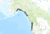
This polygon data set includes the protected areas of Alaska (USA) that are managed by national, state, provincial, or territorial authorities. As defined by the International Union for the Conservation of Nature (IUCN), a protected area is an area of land and/or sea especially dedicated to the protection and maintenance of biological diversity, and of natural and associated cultural resources, and managed through legal or other effective means. The data set was assembled for the Commission for Environmental Cooperation (CEC) from other public data sets containing data on protected areas in Canada, Mexico, and the United States. Protected area data was obtained from Natural Resources Canada for areas in Canada;...

This polygon data set includes the protected areas of the Pacific States, United States of America that are managed by national, state, provincial, or territorial authorities. As defined by the International Union for the Conservation of Nature (IUCN), a protected area is an area of land and/or sea especially dedicated to the protection and maintenance of biological diversity, and of natural and associated cultural resources, and managed through legal or other effective means. The data set was assembled for the Commission for Environmental Cooperation (CEC) from other public data sets containing data on protected areas in Canada, Mexico, and the United States. Protected area data was obtained from Natural Resources...

(A newer version of these data is now available, Protected Areas - Illinois, October 2012 ) This dataset is an extraction from PAD-US 1.1 (CBI Edition), by state. The PAD-US 1.1 (CBI Edition) data set portrays the nation's protected areas with a standardized spatial geometry and numerous valuable attributes on land ownership, management designations, and conservation status (using national GAP and international IUCN coding systems). The PAD-US 1.1 (CBI Edition) defines protected areas to include all lands dedicated to the preservation of biological diversity and to other natural, recreation and cultural uses, and managed for these purposes through legal or other effective means (adapted from IUCN definition). The...

(A newer version of these data is now available, Protected Areas - Oklahoma, October 2012 ) This dataset is an extraction from PAD-US 1.1 (CBI Edition), by state. The PAD-US 1.1 (CBI Edition) data set portrays the nation's protected areas with a standardized spatial geometry and numerous valuable attributes on land ownership, management designations, and conservation status (using national GAP and international IUCN coding systems). The PAD-US 1.1 (CBI Edition) defines protected areas to include all lands dedicated to the preservation of biological diversity and to other natural, recreation and cultural uses, and managed for these purposes through legal or other effective means (adapted from IUCN definition). The...

A newer version of these data is now available, Protected Areas - Pennsylvania, October 2012 This dataset is an extraction from PAD-US 1.1 (CBI Edition), by state. The PAD-US 1.1 (CBI Edition) data set portrays the nation's protected areas with a standardized spatial geometry and numerous valuable attributes on land ownership, management designations, and conservation status (using national GAP and international IUCN coding systems). The PAD-US 1.1 (CBI Edition) defines protected areas to include all lands dedicated to the preservation of biological diversity and to other natural, recreation and cultural uses, and managed for these purposes through legal or other effective means (adapted from IUCN definition)....

(A newer version of these data is now available, Protected Areas - California, October 2012 ) This dataset is an extraction from PAD-US 1.1 (CBI Edition), by state. The PAD-US 1.1 (CBI Edition) data set portrays the nation's protected areas with a standardized spatial geometry and numerous valuable attributes on land ownership, management designations, and conservation status (using national GAP and international IUCN coding systems). The PAD-US 1.1 (CBI Edition) defines protected areas to include all lands dedicated to the preservation of biological diversity and to other natural, recreation and cultural uses, and managed for these purposes through legal or other effective means (adapted from IUCN definition)....

This dataset is an extraction from PAD-US 1.1 (CBI Edition) of lands owned by the Bureau of Indian Affairs, Native American Tribes and Native Alaskan Corporations. The PAD-US 1.1 (CBI Edition) data set portrays the nation's protected areas with a standardized spatial geometry and numerous valuable attributes on land ownership, management designations, and conservation status (using national GAP and international IUCN coding systems). The PAD-US 1.1 (CBI Edition) defines protected areas to include all lands dedicated to the preservation of biological diversity and to other natural, recreation and cultural uses, and managed for these purposes through legal or other effective means (adapted from IUCN definition). The...
(A newer version of these data is now available, Protected Areas - Iowa, October 2012 ) This dataset is an extraction from PAD-US 1.1 (CBI Edition), by state. The PAD-US 1.1 (CBI Edition) data set portrays the nation's protected areas with a standardized spatial geometry and numerous valuable attributes on land ownership, management designations, and conservation status (using national GAP and international IUCN coding systems). The PAD-US 1.1 (CBI Edition) defines protected areas to include all lands dedicated to the preservation of biological diversity and to other natural, recreation and cultural uses, and managed for these purposes through legal or other effective means (adapted from IUCN definition). The database...

(A newer version of these data is now available, Protected Areas - Idaho, October 2012 ) This dataset is an extraction from PAD-US 1.1 (CBI Edition), by state. The PAD-US 1.1 (CBI Edition) data set portrays the nation's protected areas with a standardized spatial geometry and numerous valuable attributes on land ownership, management designations, and conservation status (using national GAP and international IUCN coding systems). The PAD-US 1.1 (CBI Edition) defines protected areas to include all lands dedicated to the preservation of biological diversity and to other natural, recreation and cultural uses, and managed for these purposes through legal or other effective means (adapted from IUCN definition). The...

(A newer version of these data is now available, Protected Areas - Maryland, October 2012 ) This dataset is an extraction from PAD-US 1.1 (CBI Edition), by state. The PAD-US 1.1 (CBI Edition) data set portrays the nation's protected areas with a standardized spatial geometry and numerous valuable attributes on land ownership, management designations, and conservation status (using national GAP and international IUCN coding systems). The PAD-US 1.1 (CBI Edition) defines protected areas to include all lands dedicated to the preservation of biological diversity and to other natural, recreation and cultural uses, and managed for these purposes through legal or other effective means (adapted from IUCN definition). The...
Protected areas are cornerstones of national and international conservation strategies. By way of these designations, lands and waters are set-aside in-perpetuity to preserve functioning natural ecosystems, act as refuges for species, and maintain ecological processes. Complementary conservation strategies preserve land for the sustainable use of natural resources, or for the protection of significant geologic and cultural features or open space. PAD-US 1.1 (CBI Edition) attempts to include all available spatial data on these places. It is our goal to publish the most comprehensive geospatial data set of U. S. protected areas to date. PAD-US 1.1 (CBI Edition) is limited to the continental U.S., Alaska, and Hawaii....

These data are an extraction of federal land ownership from PAD-US 1.1 (CBI Edition). Protected areas are cornerstones of national and international conservation strategies. By way of these designations, lands and waters are set-aside in-perpetuity to preserve functioning natural ecosystems, act as refuges for species, and maintain ecological processes. Complementary conservation strategies preserve land for the sustainable use of natural resources, or for the protection of significant geologic and cultural features or open space. PAD-US 1.1 (CBI Edition) attempts to include all available spatial data on these places. It is our goal to publish the most comprehensive geospatial data set of U. S. protected areas...
|

|
