Filters: Tags: GEOGRAPHIC INFORMATION SYSTEMS (X)
946 results (16ms)|
Filters
Date Range
Extensions Types Contacts
Categories Tag Types
|

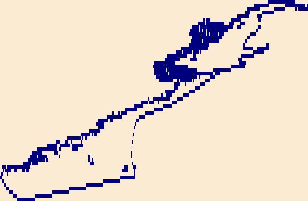
The High Resolution National Hydrography Dataset Plus (NHDPlus HR) is an integrated set of geospatial data layers, including the best available National Hydrography Dataset (NHD), the 10-meter 3D Elevation Program Digital Elevation Model (3DEP DEM), and the National Watershed Boundary Dataset (WBD). The NHDPlus HR combines the NHD, 3DEP DEMs, and WBD to create a stream network with linear referencing, feature naming, "value added attributes" (VAAs), elevation-derived catchments, and other features for hydrologic data analysis. The stream network with linear referencing is a system of data relationships applied to hydrographic systems so that one stream reach "flows" into another and "events" can be tied to and traced...

The High Resolution National Hydrography Dataset Plus (NHDPlus HR) is an integrated set of geospatial data layers, including the best available National Hydrography Dataset (NHD), the 10-meter 3D Elevation Program Digital Elevation Model (3DEP DEM), and the National Watershed Boundary Dataset (WBD). The NHDPlus HR combines the NHD, 3DEP DEMs, and WBD to create a stream network with linear referencing, feature naming, "value added attributes" (VAAs), elevation-derived catchments, and other features for hydrologic data analysis. The stream network with linear referencing is a system of data relationships applied to hydrographic systems so that one stream reach "flows" into another and "events" can be tied to and traced...

The High Resolution National Hydrography Dataset Plus (NHDPlus HR) is an integrated set of geospatial data layers, including the best available National Hydrography Dataset (NHD), the 10-meter 3D Elevation Program Digital Elevation Model (3DEP DEM), and the National Watershed Boundary Dataset (WBD). The NHDPlus HR combines the NHD, 3DEP DEMs, and WBD to create a stream network with linear referencing, feature naming, "value added attributes" (VAAs), elevation-derived catchments, and other features for hydrologic data analysis. The stream network with linear referencing is a system of data relationships applied to hydrographic systems so that one stream reach "flows" into another and "events" can be tied to and traced...

The High Resolution National Hydrography Dataset Plus (NHDPlus HR) is an integrated set of geospatial data layers, including the best available National Hydrography Dataset (NHD), the 10-meter 3D Elevation Program Digital Elevation Model (3DEP DEM), and the National Watershed Boundary Dataset (WBD). The NHDPlus HR combines the NHD, 3DEP DEMs, and WBD to create a stream network with linear referencing, feature naming, "value added attributes" (VAAs), elevation-derived catchments, and other features for hydrologic data analysis. The stream network with linear referencing is a system of data relationships applied to hydrographic systems so that one stream reach "flows" into another and "events" can be tied to and traced...

The High Resolution National Hydrography Dataset Plus (NHDPlus HR) is an integrated set of geospatial data layers, including the best available National Hydrography Dataset (NHD), the 10-meter 3D Elevation Program Digital Elevation Model (3DEP DEM), and the National Watershed Boundary Dataset (WBD). The NHDPlus HR combines the NHD, 3DEP DEMs, and WBD to create a stream network with linear referencing, feature naming, "value added attributes" (VAAs), elevation-derived catchments, and other features for hydrologic data analysis. The stream network with linear referencing is a system of data relationships applied to hydrographic systems so that one stream reach "flows" into another and "events" can be tied to and traced...

The High Resolution National Hydrography Dataset Plus (NHDPlus HR) is an integrated set of geospatial data layers, including the best available National Hydrography Dataset (NHD), the 10-meter 3D Elevation Program Digital Elevation Model (3DEP DEM), and the National Watershed Boundary Dataset (WBD). The NHDPlus HR combines the NHD, 3DEP DEMs, and WBD to create a stream network with linear referencing, feature naming, "value added attributes" (VAAs), elevation-derived catchments, and other features for hydrologic data analysis. The stream network with linear referencing is a system of data relationships applied to hydrographic systems so that one stream reach "flows" into another and "events" can be tied to and traced...
The U.S. Geological Survey (USGS) developed a regression model for estimating mean August baseflow per square mile of drainage area in cooperation with National Oceanic and Atmospheric Administration (NOAA) to help resource managers assess relative amounts of baseflow in streams with Maine Atlantic Salmon habitat (Lombard and others, 2021). The model was applied to each reach of a stream network derived from select National Hydrography Dataset Plus High-Resolution (NHDPlusHR) data in the State of Maine south of 46º 21′55″ N latitude. The spatial coverage developed from the stream network contains model-estimated mean August baseflow per square mile of drainage area as an attribute of each NHDPlusHR reach. Please...
Categories: Data,
Data Release - Revised;
Types: ArcGIS REST Map Service,
ArcGIS Service Definition,
Downloadable,
Map Service,
OGC WFS Layer,
OGC WMS Layer,
OGC WMS Service;
Tags: Atlantic,
Atlantic Salmon,
August,
Distinct Population Segment,
Hydrology,
This product consists of time-series calculations of anthropogenic characteristics derived for 16 data themes for multiple scales covering the conterminous United States. The characteristics are those which (a) have consistent data sources, and (b) have the potential to affect the water quality of streams and rivers. All 16 data themes are provided for Hydrologic Unit Code level-10 (HUC-10) boundaries (n = 15,458). Additionally, measures of land use and imperviousness are provided for U.S. Environmental Protection Agency (USEPA) Level 4 ecoregions (n = 967) and for U.S. counties (n = 3,109). The data may be scaled up to broader areas; that is, HUC-10 data may be scaled up to HUC-8, 6, 4, or HUC-2 areas, Level 4...
Categories: Data;
Tags: Atmospheric Deposition,
Census of Agriculture,
Conservation Practices,
Conterminous US,
Crop Reserve Program,
This part of the Data Release contains the raster representation of the water-level altitude and water-level change maps developed every 5 years from 1980-2015 for the upper Rio Grande Focus Area Study. The input point data used to generate the water-level altitude maps can be found in the "Groundwater level measurement data used to develop water-level altitude maps in the upper Rio Grande Alluvial Basins" child item of this data release. These digital data accompany Houston, N.A., Thomas, J.V., Foster, L.K., Pedraza, D.E., and Welborn, T.L., 2020, Hydrogeologic framework, groundwater-level altitudes, groundwater-level changes, and groundwater-storage changes in selected alluvial basins of the upper Rio Grande...
Types: Map Service,
OGC WFS Layer,
OGC WMS Layer,
OGC WMS Service;
Tags: Abiquiu Reservoir,
Ahumada,
Alamosa,
Alamosa County,
Alamosa Creek,
Understanding how sea-level rise will affect coastal landforms and the species and habitats they support is critical for developing approaches that balance the needs of humans and native species. Given the magnitude of the threat posed by sea-level rise, and the urgency to better understand it, there is an increasing need to forecast sea-level rise effects on barrier islands. To address this problem, scientists in the U.S. Geological Survey (USGS) Coastal and Marine Geology program are developing Bayesian networks as a tool to evaluate and to forecast the effects of sea-level rise on shoreline change, barrier island geomorphology, and habitat availability for species such as the piping plover (Charadrius melodus)...
Understanding how sea-level rise will affect coastal landforms and the species and habitats they support is critical for developing approaches that balance the needs of humans and native species. Given the magnitude of the threat posed by sea-level rise, and the urgency to better understand it, there is an increasing need to forecast sea-level rise effects on barrier islands. To address this problem, scientists in the U.S. Geological Survey (USGS) Coastal and Marine Geology program are developing Bayesian networks as a tool to evaluate and to forecast the effects of sea-level rise on shoreline change, barrier island geomorphology, and habitat availability for species such as the piping plover (Charadrius melodus)...
Categories: Data;
Types: Downloadable,
Map Service,
OGC WFS Layer,
OGC WMS Layer,
Shapefile;
Tags: Assateague Island,
Assateague Island,
Assateague Island National Seashore,
Assateague Island National Seashore,
Atlantic Ocean,
DLCC’s Vegetation Map Pilot is a project envisioned initially as a supervised classification of two or three small areas of the DLCC. DLCC technical stakeholders advised changing from a supervised classification to an object oriented classification (OOC) method.This report presents the findings, feasibility, and lessons-learned during the exploration and object oriented classification process and results of the two sites on the United States-Mexico border, this is needed information before considering a full-scale, Vegetation Mapping Project, to include bigger areas or the totality of the Desert LCC region.
Categories: Data;
Tags: Academics & scientific researchers,
Aquascalientes,
Aquascalientes,
Arizona,
Arizona,
We used the United States National Grid to develop a sampling grid for monitoring programs in the Great Plains Landscape Conservation Cooperative, delineated by Bird Conservation Regions 18 and 19. Landscape Conservation Cooperatives are science based partnerships with the goal to inform and guide conservation at regional landscape levels. Developing a standardized sampling grid for a LCC is a new endeavor and is designed to reduce program costs, avoid repetition in sampling, and increase efficiency in monitoring programs. This is possible because the grid’s nationwide coverage, uniform starting point, and scalability allow researchers to expand their monitoring programs from a small, local level to a regional or...
Categories: Data,
Publication;
Types: Citation,
Map Service,
OGC WFS Layer,
OGC WMS Layer,
OGC WMS Service;
Tags: BIRDS,
Colorado,
Colorado,
Federal resource managers,
Final Report,

The High Resolution National Hydrography Dataset Plus (NHDPlus HR) is an integrated set of geospatial data layers, including the National Hydrography Dataset (NHD), National Watershed Boundary Dataset (WBD), and 3D Elevation Program Digital Elevation Model (3DEP DEM). The NHDPlus HR combines the NHD, 3DEP DEMs, and WBD to a data suite that includes the NHD stream network with linear referencing functionality, the WBD hydrologic units, elevation-derived catchment areas for each stream segment, "value added attributes" (VAAs), and other features that enhance hydrologic data analysis and routing.

The High Resolution National Hydrography Dataset Plus (NHDPlus HR) is an integrated set of geospatial data layers, including the National Hydrography Dataset (NHD), National Watershed Boundary Dataset (WBD), and 3D Elevation Program Digital Elevation Model (3DEP DEM). The NHDPlus HR combines the NHD, 3DEP DEMs, and WBD to a data suite that includes the NHD stream network with linear referencing functionality, the WBD hydrologic units, elevation-derived catchment areas for each stream segment, "value added attributes" (VAAs), and other features that enhance hydrologic data analysis and routing.
The State Geologic Map Compilation (SGMC) geodatabase of the conterminous United States (https://doi.org/10.5066/F7WH2N65) represents a seamless, spatial database of 48 State geologic maps that range from 1:50,000 to 1:1,000,000 scale. A national digital geologic map database is essential in interpreting other datasets that support numerous types of national-scale studies and assessments, such as those that provide geochemistry, remote sensing, or geophysical data. The SGMC is a compilation of the individual U.S. Geological Survey releases of the Preliminary Integrated Geologic Map Databases for the United States. The SGMC geodatabase also contains updated data for seven States and seven entirely new State geologic...
Categories: Data,
Data Release - Revised;
Types: ArcGIS REST Map Service,
ArcGIS Service Definition,
Downloadable,
Map Service;
Tags: Alabama,
Arizona,
Arkansas,
California,
Colorado,
The High Resolution National Hydrography Dataset Plus (NHDPlus HR) is an integrated set of geospatial data layers, including the best available National Hydrography Dataset (NHD), the 10-meter 3D Elevation Program Digital Elevation Model (3DEP DEM), and the National Watershed Boundary Dataset (WBD). The NHDPlus HR combines the NHD, 3DEP DEMs, and WBD to create a stream network with linear referencing, feature naming, "value added attributes" (VAAs), elevation-derived catchments, and other features for hydrologic data analysis. The stream network with linear referencing is a system of data relationships applied to hydrographic systems so that one stream reach "flows" into another and "events" can be tied to and traced...
Understanding how sea-level rise will affect coastal landforms and the species and habitats they support is critical for crafting approaches that balance the needs of humans and native species. Given this increasing need to forecast sea-level rise effects on barrier islands in the near and long terms, we are developing Bayesian networks to evaluate and to forecast the cascading effects of sea-level rise on shoreline change, barrier island state, and piping plover habitat availability. We use publicly available data products, such as lidar, orthophotography, and geomorphic feature sets derived from those, to extract metrics of barrier island characteristics at consistent sampling distances. The metrics are then incorporated...
Categories: Data;
Types: Downloadable,
Map Service,
OGC WFS Layer,
OGC WMS Layer,
Shapefile;
Tags: Atlantic Ocean,
Barrier Island,
CMGP,
Coastal Hazards,
Coastal and Marine Geology Program,
Understanding how sea-level rise will affect coastal landforms and the species and habitats they support is critical for crafting approaches that balance the needs of humans and native species. Given this increasing need to forecast sea-level rise effects on barrier islands in the near and long terms, we are developing Bayesian networks to evaluate and to forecast the cascading effects of sea-level rise on shoreline change, barrier island state, and piping plover habitat availability. We use publicly available data products, such as lidar, orthophotography, and geomorphic feature sets derived from those, to extract metrics of barrier island characteristics at consistent sampling distances. The metrics are then incorporated...
Categories: Data;
Types: Downloadable,
GeoTIFF,
Map Service,
OGC WFS Layer,
OGC WMS Layer,
Raster,
Shapefile;
Tags: Atlantic Ocean,
Barrier Island,
Bayesian Network,
CMHRP,
Coastal Erosion,
Understanding how sea-level rise will affect coastal landforms and the species and habitats they support is critical for crafting approaches that balance the needs of humans and native species. Given this increasing need to forecast sea-level rise effects on barrier islands in the near and long terms, we are developing Bayesian networks to evaluate and to forecast the cascading effects of sea-level rise on shoreline change, barrier island state, and piping plover habitat availability. We use publicly available data products, such as lidar, orthophotography, and geomorphic feature sets derived from those, to extract metrics of barrier island characteristics at consistent sampling distances. The metrics are then incorporated...
Categories: Data;
Types: Downloadable,
GeoTIFF,
Map Service,
Raster;
Tags: Atlantic Ocean,
Barrier Island,
Bayesian Network,
CMGP,
Charadrius melodus,
|

|
