Filters: Tags: Geothermal (X)
184 results (55ms)|
Filters
Date Range
Extensions
Types Contacts
Categories Tag Types
|
Outside view of the Castle Hot Springs Hotel.
A walkway on the grounds of the Castle Hot Springs Hotel.
View of the outside of the Castle Hot Springs Hotel.
Stakeholder analysis allows analysts to identify how parties might be affected by government projects. This process involves identifying the likely impacts of a proposed action and stakeholder groups affected by that action. Additionally, the process involves assessing how these groups might be affected and suggesting measures to mitigate any adverse effects. Evidence suggests that the efficiency and effectiveness of government actions can be increased and adverse social impacts mitigated when officials understand how a proposed action might affect stakeholders. This report discusses how to conduct useful stakeholder analyses for government officials making decisions on energy-efficiency and renewable-energy technologies...
Categories: Publication;
Types: Citation;
Tags: Bioenergy,
Emission,
Germany,
Renewable energy,
Solar energy,
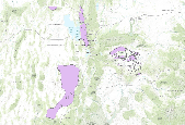
This dataset depicts renewable geothermal resources identified by the Utah Renewable Energy Zone (UREZ) task force.
Long Valley Caldera in eastern California formed 0.76 Ma ago in a cataclysmic eruption that resulted in the deposition of 600 km3 of Bishop Tuff. The total current heat flow from the caldera floor is estimated to be ~ 290 MW, and a geothermal power plant in Casa Diablo on the flanks of the resurgent dome (RD) generates ~40 MWe. The RD in the center of the caldera was uplifted by ~ 80 cm between 1980 and 1999 and was explained by most models as a response to magma intrusion into the shallow crust. This unrest has led to extensive research on geothermal resources and volcanic hazards in the caldera. Here we present results from precise, high-resolution, temperature–depth profiles in five deep boreholes (327–1,158...
Categories: Publication;
Types: Citation;
Tags: Caldera,
Heat flow,
Hydrothermal,
Long Val,
geothermal
Boiling River at Mammoth (YBOI), Yellowstone National Park Sample Collection: Samples were collected near the USGS stream gage 06190540 (Latitude 44°59'05.83", Longitude 110°41'18.20" NAD83). At the time of collection, all waters samples were filtered through a syringe filter (0.45-micrometer). Two splits of the filtered water were retained for chemical analyses, including an unacidified (FU) sample for determination of anion concentrations and a nitric acid preserved (FA; 1% volume-to-volume concentrated trace-metal grade nitric acid) sample for cation and trace metal analyses. During sample collection, the water temperature, specific conductance, and pH were often measured. Sample Analyses: Concentrations...
Categories: Data;
Types: Citation,
Map Service,
OGC WFS Layer,
OGC WMS Layer,
OGC WMS Service;
Tags: Boiling River,
Geothermal,
Yellowstone National Park,
chloride flux
Falls River near Squirrel, Idaho (YFAL) Sample Collection: Samples were collected near the USGS stream gage 13046995 (Latitude 44°03'43", Longitude 111°09'07" NAD83). At the time of collection, all waters samples were filtered through a syringe filter (0.45-micrometer). Two splits of the filtered water were retained for chemical analyses, including an unacidified (FU) sample for determination of anion concentrations and a nitric acid preserved (FA; 1% volume-to-volume concentrated trace-metal grade nitric acid) sample for cation and trace metal analyses. During sample collection, the water temperature, specific conductance, and pH were often measured. Sample Analyses: Concentrations of chloride, fluoride,...
Categories: Data;
Types: Citation,
Map Service,
OGC WFS Layer,
OGC WMS Layer,
OGC WMS Service;
Tags: Geothermal,
Yellowstone National Park,
chloride flux
This dataset consists of 42 magnetotelluric (MT) stations collected in 2017 in the Northwest Geysers, CA. The U.S. Geological Survey acquired these data as part of a project to image the heat source in the Northwest Geysers. Support was from the U.S. Geological Survey's Volcano Hazards Program.
This dataset consists of 42 magnetotelluric (MT) stations collected in 2017 in the Northwest Geysers, CA. The U.S. Geological Survey acquired these data as part of a project to image the heat source in the Northwest Geysers. Support was from the U.S. Geological Survey's Volcano Hazards Program.
This dataset consists of 42 magnetotelluric (MT) stations collected in 2017 in the Northwest Geysers, CA. The U.S. Geological Survey acquired these data as part of a project to image the heat source in the Northwest Geysers. Support was from the U.S. Geological Survey's Volcano Hazards Program.
This dataset consists of 42 magnetotelluric (MT) stations collected in 2017 in the Northwest Geysers, CA. The U.S. Geological Survey acquired these data as part of a project to image the heat source in the Northwest Geysers. Support was from the U.S. Geological Survey's Volcano Hazards Program.
This shapefile displays geothermal systems in nevada that are either currently producing electrical power, or have produced at least some high-temperature fluids (>150 C) from geothermal wells.
This dataset consists of 24 magnetotelluric (MT) stations collected in 2017 in Gabbs Valley, Nevada. The U.S. Geological Survey acquired these data as part of Phase 2 of the Nevada Play Fairway Analysis Project led by the University of Nevada at Reno and funded by the Department of Energy (grant number DE-EE0006731) with support from the U.S. Geological Survey's Energy Program.
Interest in renewable energy has never been greater, but much uncertainty remains as to the role the various technologies will play in the transition to a low-carbon future. This book sets out the facts - how the technologies work, where and to what extent they are currently employed, and where the greatest potential lies. Covering all the major fields - solar electricity, solar thermal, solar architecture, bioenergy, wind, geothermal, hydropower, as well as new energy technologies - it also includes sections on how best to promote the uptake of renewables and answers to common questions and opposition. The authors provide a number of German-sourced yet internationally relevant examples and strategies which have...
Categories: Publication;
Types: Citation;
Tags: Bioenergy,
Emission,
Germany,
Renewable energy,
Solar energy,
This paper approximates the emissions rebound effects' associated with substituting expensive and GHG emitting natural gas (LNG) power plants, with apparently cheaper and lower emitting nuclear plant. It then evaluates the effect this has on economy wide electricity use as well as net GHG emissions changes. The analysis is undertaken by combining aspects of an input-output model with an optimizing energy systems model. The scope of the case study is limited to the effects of the electricity sector (and its emissions) on the Korean economy from 2005 to 2030. Its primary basis (in terms of data and assumptions) is the recent national Basic Plan for Long-Term Electricity Supply and Demand (KPX, 2006).(2) The cases...
Yellowstone River at Corwin Springs, MT (YYCR) Sample Collection: Samples were collected near the USGS stream gage 06191500 (Latitude 45°06'43.63", Longitude 110°47'37.20" NAD83). At the time of collection, all waters samples were filtered through a syringe filter (0.45-micrometer). Two splits of the filtered water were retained for chemical analyses, including an unacidified (FU) sample for determination of anion concentrations and a nitric acid preserved (FA; 1% volume-to-volume concentrated trace-metal grade nitric acid) sample for cation and trace metal analyses. During sample collection, the water temperature, specific conductance, and pH were often measured. Sample Analyses: Concentrations of chloride,...
Categories: Data;
Types: Citation,
Map Service,
OGC WFS Layer,
OGC WMS Layer,
OGC WMS Service;
Tags: Boiling River,
Geothermal,
Yellowstone National Park,
chloride flux

This dataset is composed of 6th-field Hydrologic Units (HUC6 watersheds) in Washington State. Attributes describe the presence of a potential threat to groundwater thermal quality (specifically, geothermal resources) and existing biodiversity value (hot springs) in each HUC6. More detailed information is available in the report cited below. This dataset is part of a larger groundwater project across the Pacific NW (Brown et al. 2009) region which has two primary goals: (1) develop tools to identify where and how groundwater is important to biodiversity conservation and (2) assess the pressing threats to the quantity and quality of that groundwater and develop strategies to abate those threats. Data and analyses...
|

|
