Filters: Tags: Grand River (X)
25 results (61ms)|
Filters
Date Range
Extensions Types
Contacts
Categories Tag Types
|
This dataset documents locations of and water temperature recorded by Hobo Water Temp Pro series loggers (Onset Computer Corp., Bourne, MA) deployed by the USGS Comprehensive Sturgeon Research Project at up to 24 locations in the Lower Missouri River (from the Gavins Point Dam near Yankton, South Dakota to its confluence with the Mississippi River near St. Louis, Missouri) and 13 selected tributaries (James River, Big Sioux River, Little Sioux River, Platte River (in Nebraska), Nishnabotna River, Nodaway River, Platte River (in Missouri), Kansas River, Grand River, Chariton River, Lamine River, Osage River, and Gasconade River) since 2005. Data document the site name, spatial location, temporal extent of water temperature...
USGS Historical Quadrangle in GeoPDF.
USGS Historical Quadrangle in GeoPDF.
This dataset includes pesticides and pesticide transformation products in 15 tributaries of the Great Lakes. Pesticides were monitored using polar organic chemical integrative samplers (POCIS) to estimate concentrations in water following standard protocols (Alvarez, 2010) in June and July 2016. POCIS extracts were analyzed for 225 chemicals (USGS National Water Quality Laboratory schedule 5437, Sandstrom and others, 2016), for which 129 chemicals also have POCIS uptake rates, allowing calculations of time-weighted mean concentration over the approximately 30 day deployment (Alvarez and others, 2008). Collectively, there were 97 chemicals detected, and time-weighted mean concentrations could be calculated for 95...
These data are supplemental rip-rap gradation data (Wolman Pebble Count) in text (.txt) format, collected during 2014-2018 field seasons for select bridges in the United States. These data were collected using a measuring tape to determine riprap gradation (D15, D50, D85, and D100) on in-place riprap at bridge piers and/or abutments at various locations in each study reach. They supplement the Geospatial Data for Bridge Scour Countermeasure Assessments at Select Bridges in the United States, 2016–18. For high-resolution sites, traditional multibeam surveys were conducted using methods described in Huizinga (2015).
This data set contains imagery from the National Agriculture Imagery Program (NAIP). The NAIP program is administered by USDA FSA and has been established to support two main FSA strategic goals centered on agricultural production. These are, increase stewardship of America's natural resources while enhancing the environment, and to ensure commodities are procured and distributed effectively and efficiently to increase food security. The NAIP program supports these goals by acquiring and providing ortho imagery that has been collected during the agricultural growing season in the U.S. The NAIP ortho imagery is tailored to meet FSA requirements and is a fundamental tool used to support FSA farm and conservation programs....
USGS Historical Quadrangle in GeoPDF.
This dataset consists of select contaminants of emerging concern (CEC) including pesticides and transformation products, pharmaceuticals and transformation products, and wastewater indicator compound results measured in 131 surface water, 129 bottom sediment, 7 field replicate, and 6 field blank samples collected from 131 sites located on 27 tributaries of the Great Lakes during the summer of 2019. Samples were analyzed at the U.S. Geological Survey National Water Quality Laboratory (NWQL). Surface water samples were collected and analyzed for 238 pesticides, pesticide transformation products, and surrogate compounds (NWQL laboratory schedule 2437; Sandstrom and others, 2015), 152 pharmaceuticals, pharmaceutical...
Categories: Data;
Types: Map Service,
OGC WFS Layer,
OGC WMS Layer,
OGC WMS Service;
Tags: Au Gres River,
Buffalo River,
Cattaraugus River,
Chippewa River,
East Twin River,
This data set contains imagery from the National Agriculture Imagery Program (NAIP). The NAIP program is administered by USDA FSA and has been established to support two main FSA strategic goals centered on agricultural production. These are, increase stewardship of America's natural resources while enhancing the environment, and to ensure commodities are procured and distributed effectively and efficiently to increase food security. The NAIP program supports these goals by acquiring and providing ortho imagery that has been collected during the agricultural growing season in the U.S. The NAIP ortho imagery is tailored to meet FSA requirements and is a fundamental tool used to support FSA farm and conservation programs....
This data set is a compilation of data from two sampling efforts (2010 and 2014), focused on determining the presence and distribution of organic contaminants throughout the United States portion of the Great Lakes watershed. Water-borne contaminants were monitored in 69 tributaries of the Great Lakes using semipermeable membrane devices (SPMDs), and polar organic chemical integrative samplers (POCIS). Analyses included 185 chemicals (143 detected) including polycyclic aromatic hydrocarbons (PAHs), legacy and current-use pesticides, polychlorinated biphenyls (PCBs), polybrominated diphenyl ether (PBDE) and organophosphate fire retardants, pharmaceuticals, fragrances, industrial chemicals, surfactants, and others.
These data are supplemental site information in portable document format (.pdf) collected during 2016-2018 field seasons for select bridges in the United States (Dudunake and others, 2018). These files describe building plans for countermeasures, a field from to describe conditions during site assessment, and a photo summary of the study area.
USGS Historical Quadrangle in GeoPDF.
This data set contains imagery from the National Agriculture Imagery Program (NAIP). The NAIP program is administered by USDA FSA and has been established to support two main FSA strategic goals centered on agricultural production. These are, increase stewardship of America's natural resources while enhancing the environment, and to ensure commodities are procured and distributed effectively and efficiently to increase food security. The NAIP program supports these goals by acquiring and providing ortho imagery that has been collected during the agricultural growing season in the U.S. The NAIP ortho imagery is tailored to meet FSA requirements and is a fundamental tool used to support FSA farm and conservation programs....
This data set contains imagery from the National Agriculture Imagery Program (NAIP). The NAIP program is administered by USDA FSA and has been established to support two main FSA strategic goals centered on agricultural production. These are, increase stewardship of America's natural resources while enhancing the environment, and to ensure commodities are procured and distributed effectively and efficiently to increase food security. The NAIP program supports these goals by acquiring and providing ortho imagery that has been collected during the agricultural growing season in the U.S. The NAIP ortho imagery is tailored to meet FSA requirements and is a fundamental tool used to support FSA farm and conservation programs....
Scouring of streambed material surrounding bridge structures is a leading cause of bridge failure in the United States. Damages resulting from bridge failure oftentimes lead to financial burdens and loss of life. To date, there has been no comprehensive evaluation of the current (2016) effectiveness of the guidance or overall long-term performance of bridge-scour countermeasures provided in the Federal Highway Administration, Hydraulic Engineering Circular No. 23, Bridge Scour and Stream Instability Countermeasures. To that end, the U.S. Geological Survey, in cooperation with the Federal Highway Administration, obtained bathymetric, topographical, and other data at 20 of the surveyed sites across the United States...
Types: Citation,
Map Service,
OGC WFS Layer,
OGC WMS Layer,
OGC WMS Service;
Tags: ADCP,
ASCII,
Acoustic,
Bathymetry,
Beaverhead River,
This data set contains imagery from the National Agriculture Imagery Program (NAIP). The NAIP program is administered by USDA FSA and has been established to support two main FSA strategic goals centered on agricultural production. These are, increase stewardship of America's natural resources while enhancing the environment, and to ensure commodities are procured and distributed effectively and efficiently to increase food security. The NAIP program supports these goals by acquiring and providing ortho imagery that has been collected during the agricultural growing season in the U.S. The NAIP ortho imagery is tailored to meet FSA requirements and is a fundamental tool used to support FSA farm and conservation programs....
This is a combined shapefile of all Greater Widland Ecosystems. We first created shapefiles for each GWE using hydrological units, contiguous habitat, human influence (25 km buffer) taking into account of federal, private, and tribal lands. We then combined them.
Categories: Data;
Types: Downloadable,
Map Service,
OGC WFS Layer,
OGC WMS Layer,
Shapefile;
Tags: Badland,
Bighorn,
Fort Peck,
Grand River,
Grandsand Dunes,
This data set contains imagery from the National Agriculture Imagery Program (NAIP). The NAIP program is administered by USDA FSA and has been established to support two main FSA strategic goals centered on agricultural production. These are, increase stewardship of America's natural resources while enhancing the environment, and to ensure commodities are procured and distributed effectively and efficiently to increase food security. The NAIP program supports these goals by acquiring and providing ortho imagery that has been collected during the agricultural growing season in the U.S. The NAIP ortho imagery is tailored to meet FSA requirements and is a fundamental tool used to support FSA farm and conservation programs....
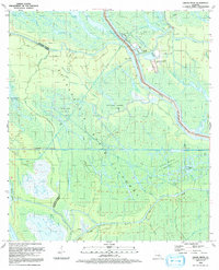
USGS Historical Quadrangle in GeoPDF.
Hydrologic and hydraulic analyses were done for selected reaches of the Grand River, Red Cedar River and Sycamore Creek near Lansing, Michigan. To update and expand a portion of the Federal Emergency Management Agency detailed Flood Insurance Study, the U.S. Geological Survey (USGS) and the City of Lansing initiated a cooperative study. The study comprised a 3.2-mile reach of the Grand River, a 30.2-mile reach of the Red Cedar River, and a 12.0-mile reach of Sycamore Creek. Historical streamflow data from multiple streamgages, Grand River at Lansing, MI. (USGS station number 04113000), Red Cedar River at East Lansing, MI. (USGS station number 04112500), Red Cedar River near Williamston, MI. (USGS station number...
|

|
