Filters: Tags: Grand Valley (X)
15 results (53ms)|
Filters
Date Range
Types Contacts
Categories Tag Types Tag Schemes |
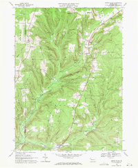
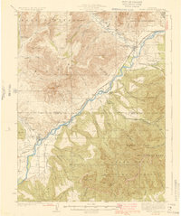
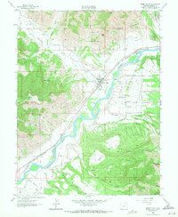
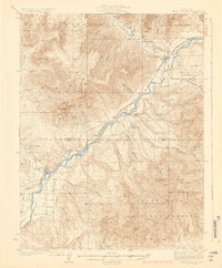
USGS Historical Quadrangle in GeoPDF.
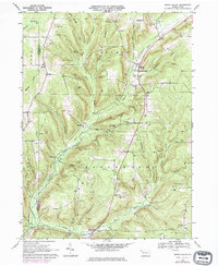
USGS Historical Quadrangle in GeoPDF.
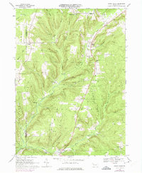
USGS Historical Quadrangle in GeoPDF.
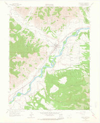
USGS Historical Quadrangle in GeoPDF.
This data set contains imagery from the National Agriculture Imagery Program (NAIP). The NAIP program is administered by USDA FSA and has been established to support two main FSA strategic goals centered on agricultural production. These are, increase stewardship of America's natural resources while enhancing the environment, and to ensure commodities are procured and distributed effectively and efficiently to increase food security. The NAIP program supports these goals by acquiring and providing ortho imagery that has been collected during the agricultural growing season in the U.S. The NAIP ortho imagery is tailored to meet FSA requirements and is a fundamental tool used to support FSA farm and conservation programs....
The U.S. Geological Survey (USGS), in cooperation with the Grand Valley Drainage District and the Colorado Water Conservation Board, conducted a loading analysis for selected constituents and tributaries to the Colorado River in the Grand Valley, western Colorado, using data from 1991 to 2018, to characterize concentrations, stream loading, and load reductions for Escherichia coli, total recoverable iron, and dissolved selenium for stream segments on the State of Colorado 303(d) list of impaired waters. Escherichia coli, total recoverable iron, and dissolved selenium concentrations and streamflow data were compiled from the Water Quality Portal (WQP). The data were submitted to the WQP by the USGS, Colorado Department...
Categories: Data Release - Revised;
Tags: Colorado,
Colorado River,
E. coli,
Grand Valley,
Mesa County,

USGS Historical Quadrangle in GeoPDF.
USGS Historical Quadrangle in GeoPDF.
This data set contains imagery from the National Agriculture Imagery Program (NAIP). The NAIP program is administered by USDA FSA and has been established to support two main FSA strategic goals centered on agricultural production. These are, increase stewardship of America's natural resources while enhancing the environment, and to ensure commodities are procured and distributed effectively and efficiently to increase food security. The NAIP program supports these goals by acquiring and providing ortho imagery that has been collected during the agricultural growing season in the U.S. The NAIP ortho imagery is tailored to meet FSA requirements and is a fundamental tool used to support FSA farm and conservation programs....
In 2004 U.S. Geological Survey biologists recorded vegetation and biological soil crust (BSC) cover by species as well as measured soil stability and compaction data along 85 transects at the Badger Wash study area in western Colorado. Soil samples were collected and processed for chemistry and texture. Using analysis of variance and nonmetric multidimensional scaling (NMDS) we assessed the cover of vegetation and BSC both grouped by plant physiognomy and dynamic soil properties (soil chemistry/nutrients and stability and compaction) as influenced by the effects of grazing history and soil group (which varied by slope, topographic wetness index and soil properties). Vegetation and BSC cover data were also compared...
This data release has been superseded by version 2.0, available here: https://doi.org/10.5066/P9P6WI44 The U.S. Geological Survey, in cooperation with Grand Valley Drainage District, Colorado Water Conservation Board, Colorado Department of Public Health and Environment, and Colorado River Water Conservation District, conducted a loading analysis for selected constituents and tributaries in the Grand Valley, Colorado, to support the development of total maximum daily loads (TMDL) at monitoring locations on U.S. Environmental Protection Agency 303(d) listed segments. The data tables include Escherichia coli, total recoverable iron, and dissolved selenium concentrations, streamflow data, and computed loads as...
This data set contains imagery from the National Agriculture Imagery Program (NAIP). The NAIP program is administered by USDA FSA and has been established to support two main FSA strategic goals centered on agricultural production. These are, increase stewardship of America's natural resources while enhancing the environment, and to ensure commodities are procured and distributed effectively and efficiently to increase food security. The NAIP program supports these goals by acquiring and providing ortho imagery that has been collected during the agricultural growing season in the U.S. The NAIP ortho imagery is tailored to meet FSA requirements and is a fundamental tool used to support FSA farm and conservation programs....
USGS Historical Quadrangle in GeoPDF.
This data set contains imagery from the National Agriculture Imagery Program (NAIP). The NAIP program is administered by USDA FSA and has been established to support two main FSA strategic goals centered on agricultural production. These are, increase stewardship of America's natural resources while enhancing the environment, and to ensure commodities are procured and distributed effectively and efficiently to increase food security. The NAIP program supports these goals by acquiring and providing ortho imagery that has been collected during the agricultural growing season in the U.S. The NAIP ortho imagery is tailored to meet FSA requirements and is a fundamental tool used to support FSA farm and conservation programs....
USGS Historical Quadrangle in GeoPDF.
|

|
